
Distance: 4.5km
Time: five and a half hours, I could have probably reduced the time if I was setting the pace but it’s more enjoyable if you admire the views. Also, if we went up the ridge (at about 1.3km into the hike) instead of taking the lower road it would have added another 30 minutes or more.
Difficulty (regular Taiwan hiker): 4-5/10 – lots of steep scrambles, ropes, it’s tiring.
Difficulty (new Taiwan hiker): 9/10 – actually this is the most physically challenging hike I’ve done, it hasn’t got 10/10 just because it can be completed in a day. This is a tough, full-body hike, you need strength in your arms and your legs to scale the ropes.
Water: 2L – we did this on a warm winter day (27 degrees), and we needed to drink a lot, in summer I would definitely want more.
Shade: mostly shaded, but with some totally exposed portions, if you’re doing this hike in strong sun you should take hands-free sun protection.
Mobile network: on and off.
Enjoyment: I absolutely love this type of hiking, it is taxing mentally and physically, it challenges your whole body and requires you always to be thinking of where you’re going to put your hands and feet next. I’m sure this hiking trail is not everyone’s cup of tea but I think it’s great.
Other: I would strongly advise that you take time to make sure you’re prepared for this hike; long sleeves and trousers would be a good idea, (especially if the mosquitoes like you) and gloves are a must. You will be getting up and personal with nature so you don’t want too much exposed skin and you don’t want to take your best white t-shirt. You should start early enough to complete it safely and you shouldn’t attempt it in bad weather or if it’s rained within the past two days, it would be dangerous and miserable. You also ought to take some energy-replacing foods to keep you going. It’s a lot more enjoyable if you’re prepared and not worrying about if you’ve got enough time/water/food.
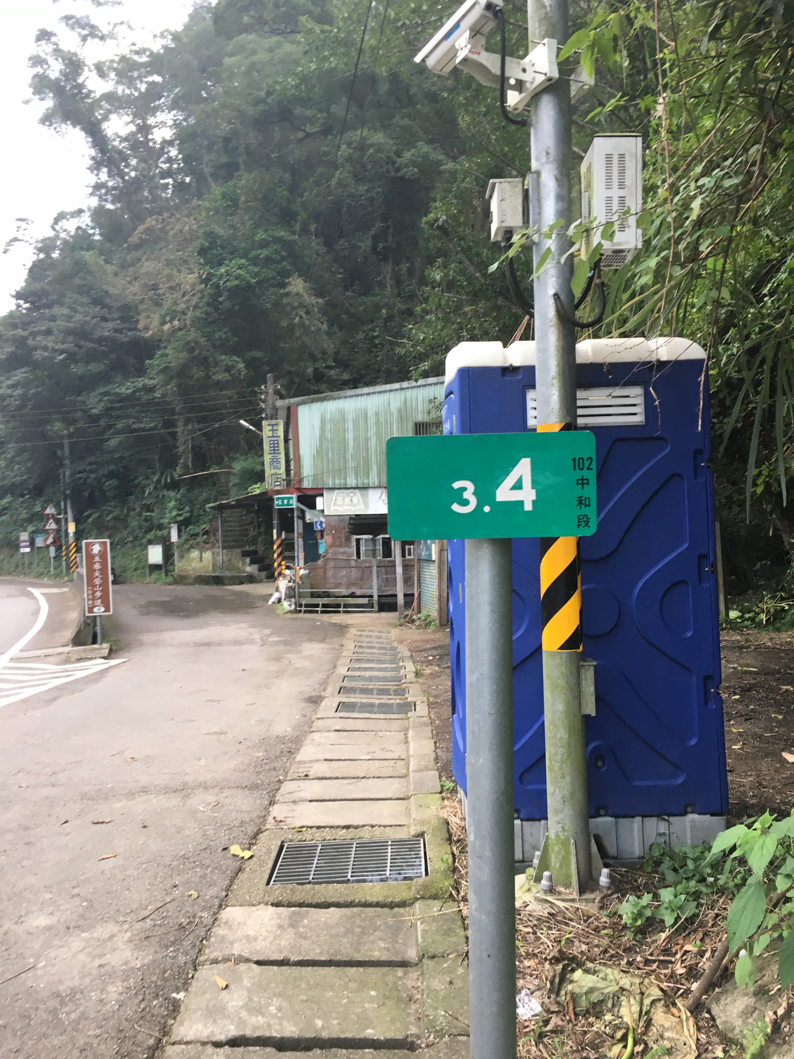
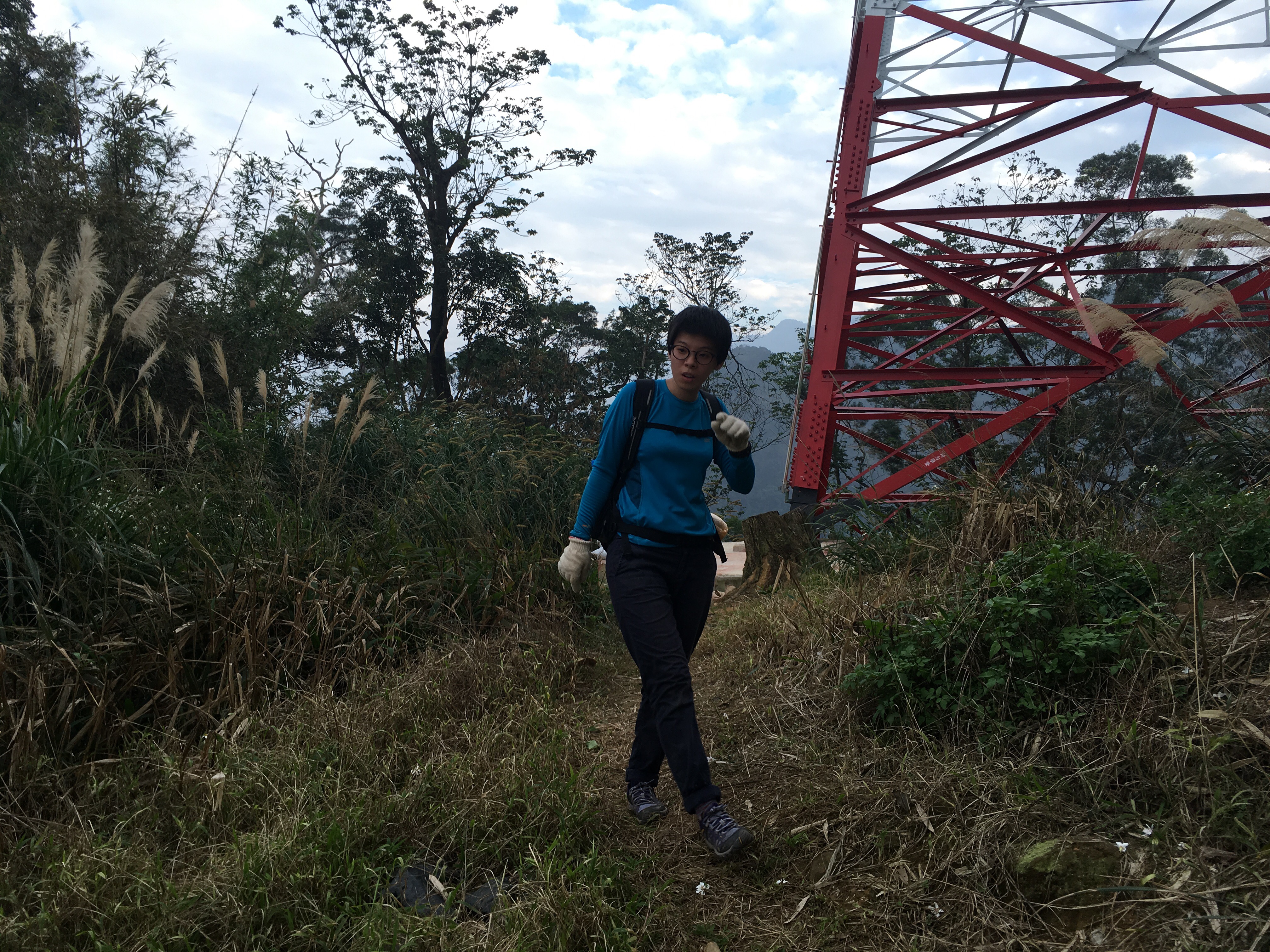
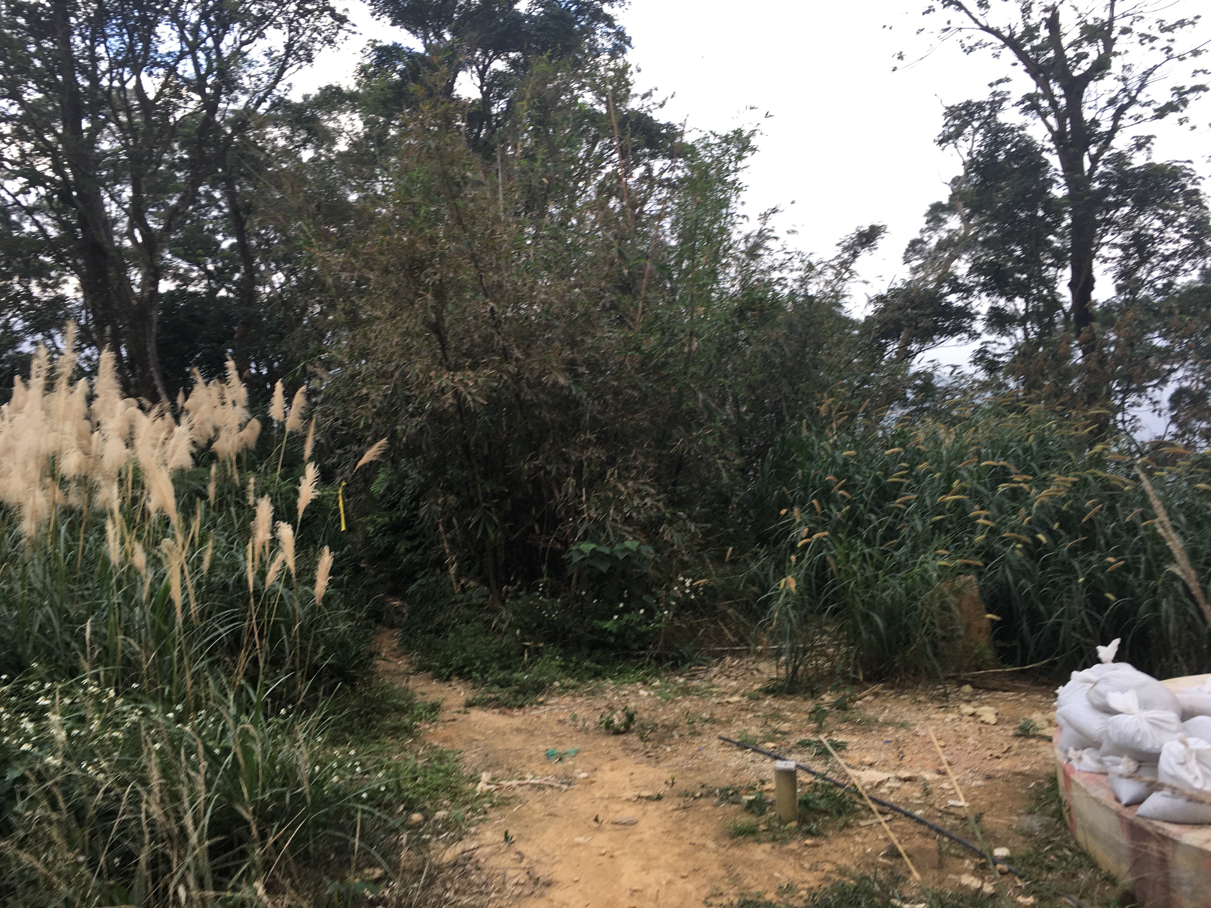
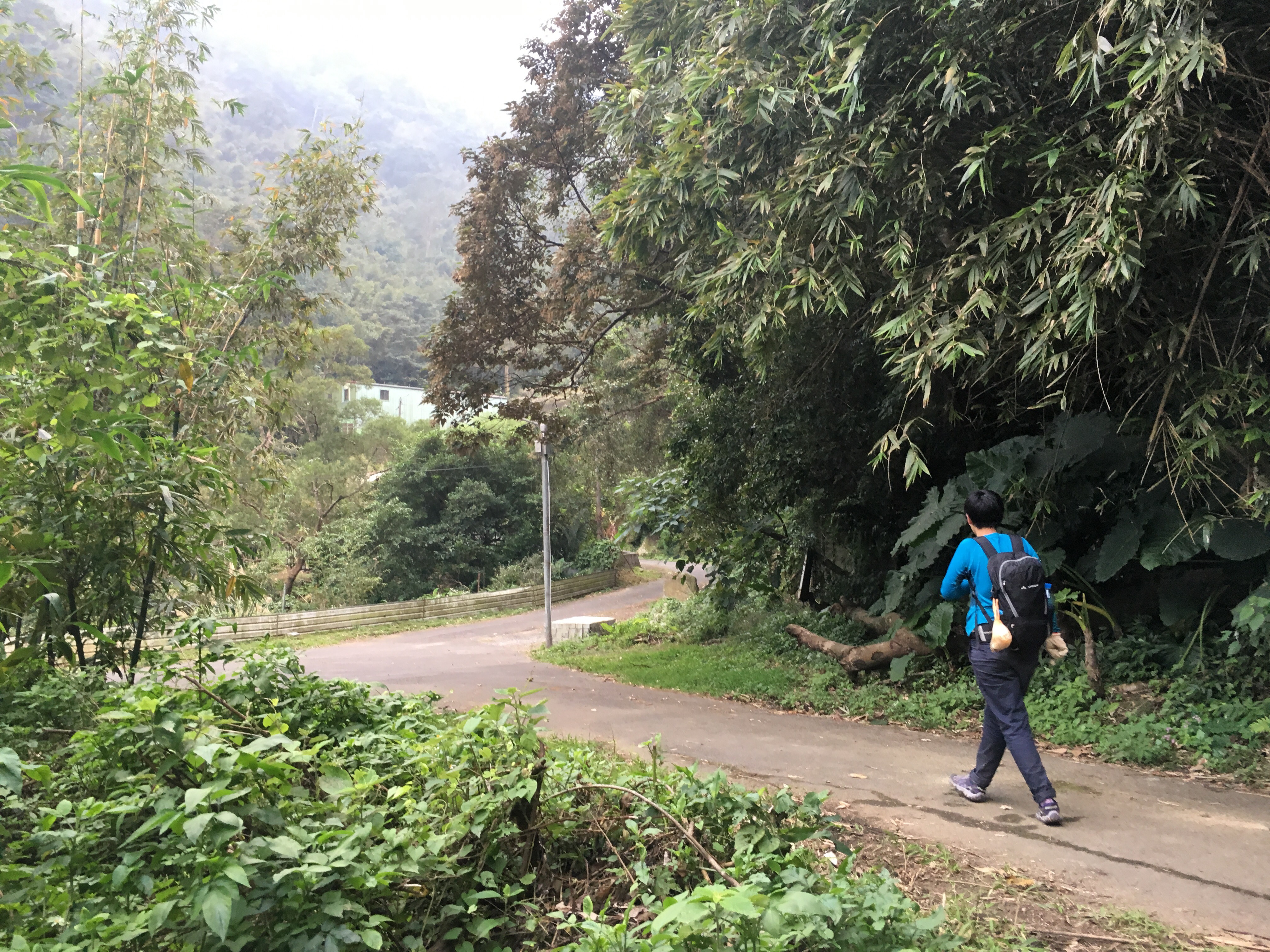
Driving east along Dapu road from Sanxia you will arrive at marker 3.4. Here you’ll find a porter-loo and a small shop. If you go on the weekend you might find the shop open but I’ve only been here on weekdays and it’s always been closed so I wouldn’t rely on getting your supplies here.

The path goes steeply up and you’ll very quickly know if you’re up to the task or not.
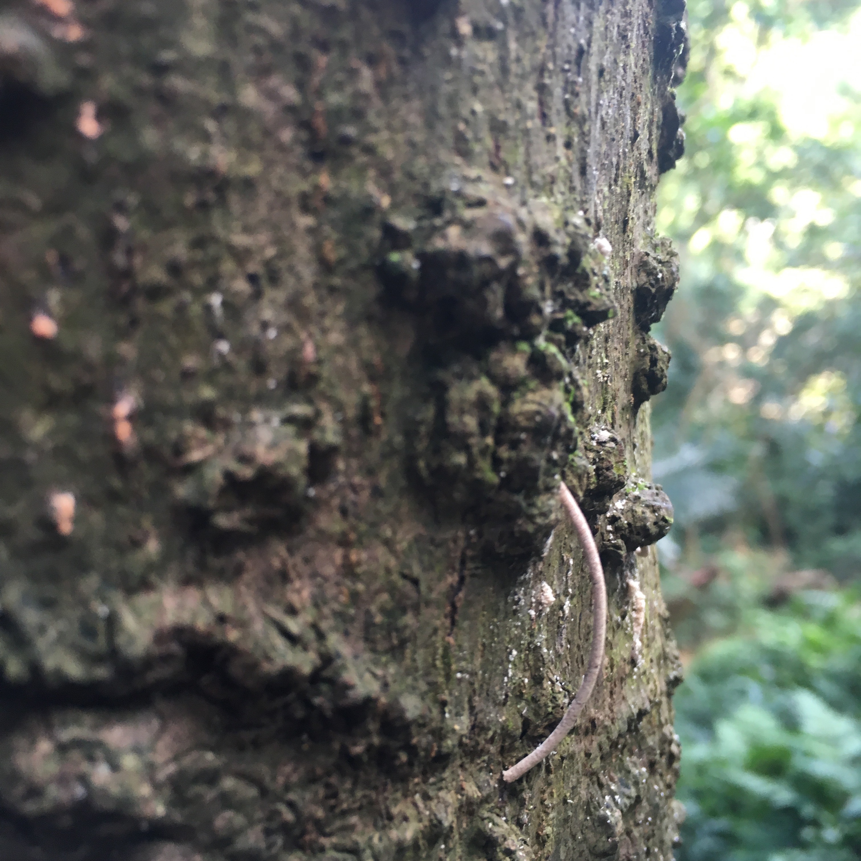
One of the trees near the start of the trail seemed to be extruding small cylinders of sawdust from all over its trunk.

Around the base of the tree was evidence of more of these extruded cylinders. I asked a passing older couple if they knew what it was but they didn’t. After returning home I googled this strange sight and found out that it was most likely the work of Asian ambrosia beetles which bore into the tree.
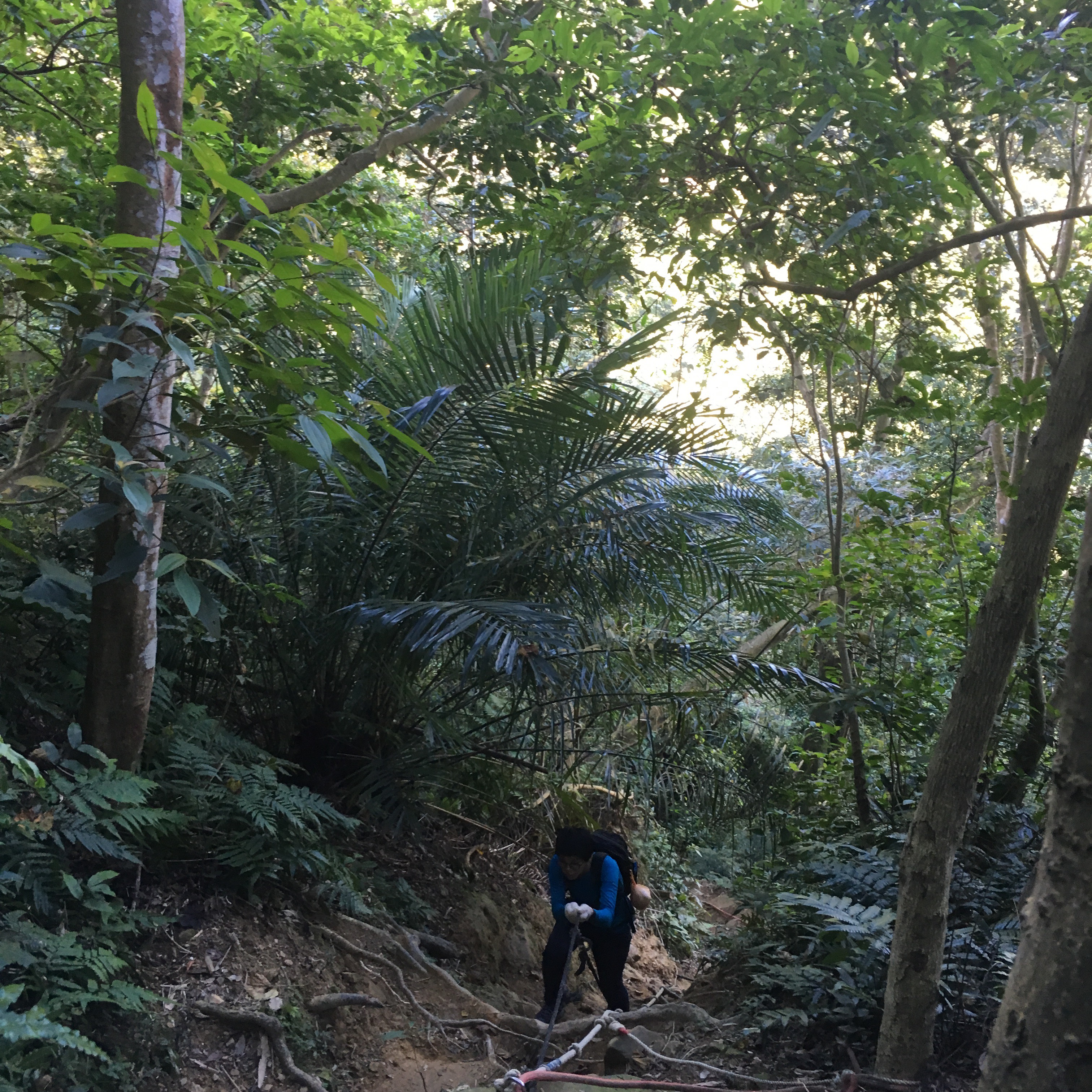
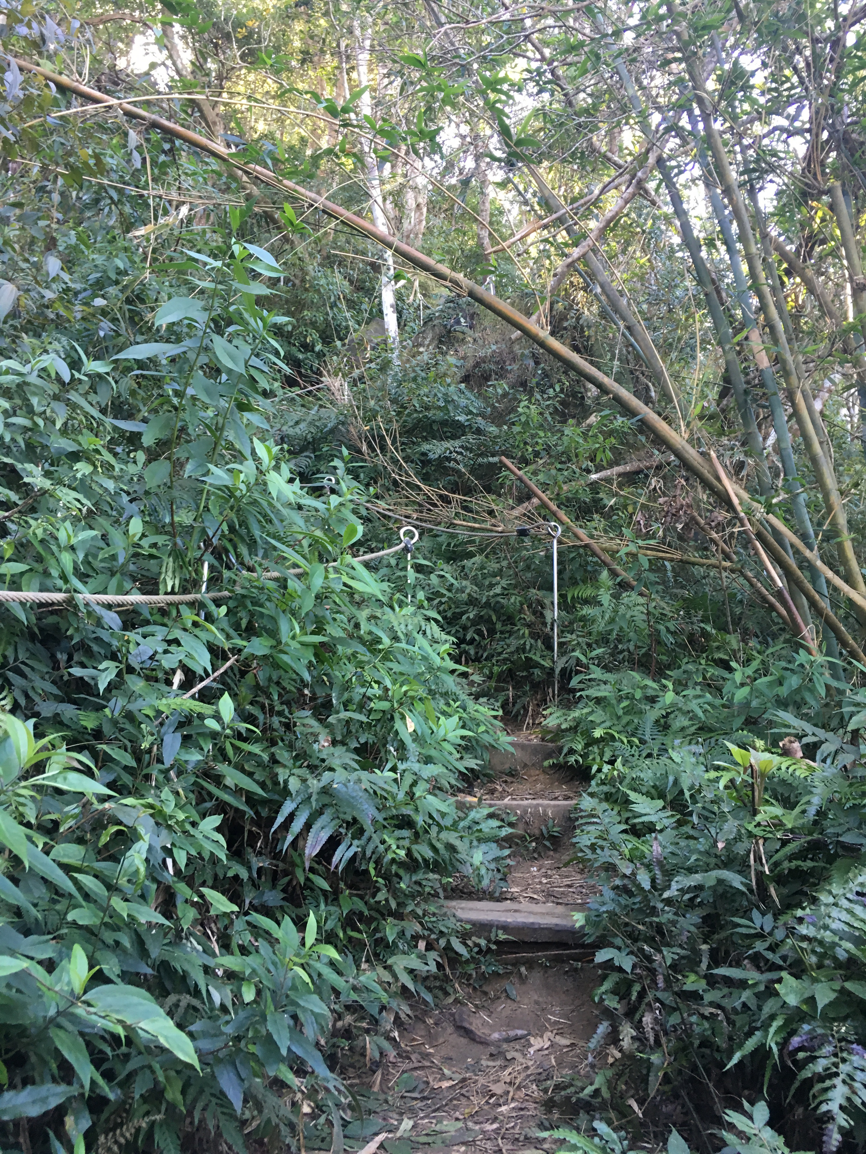
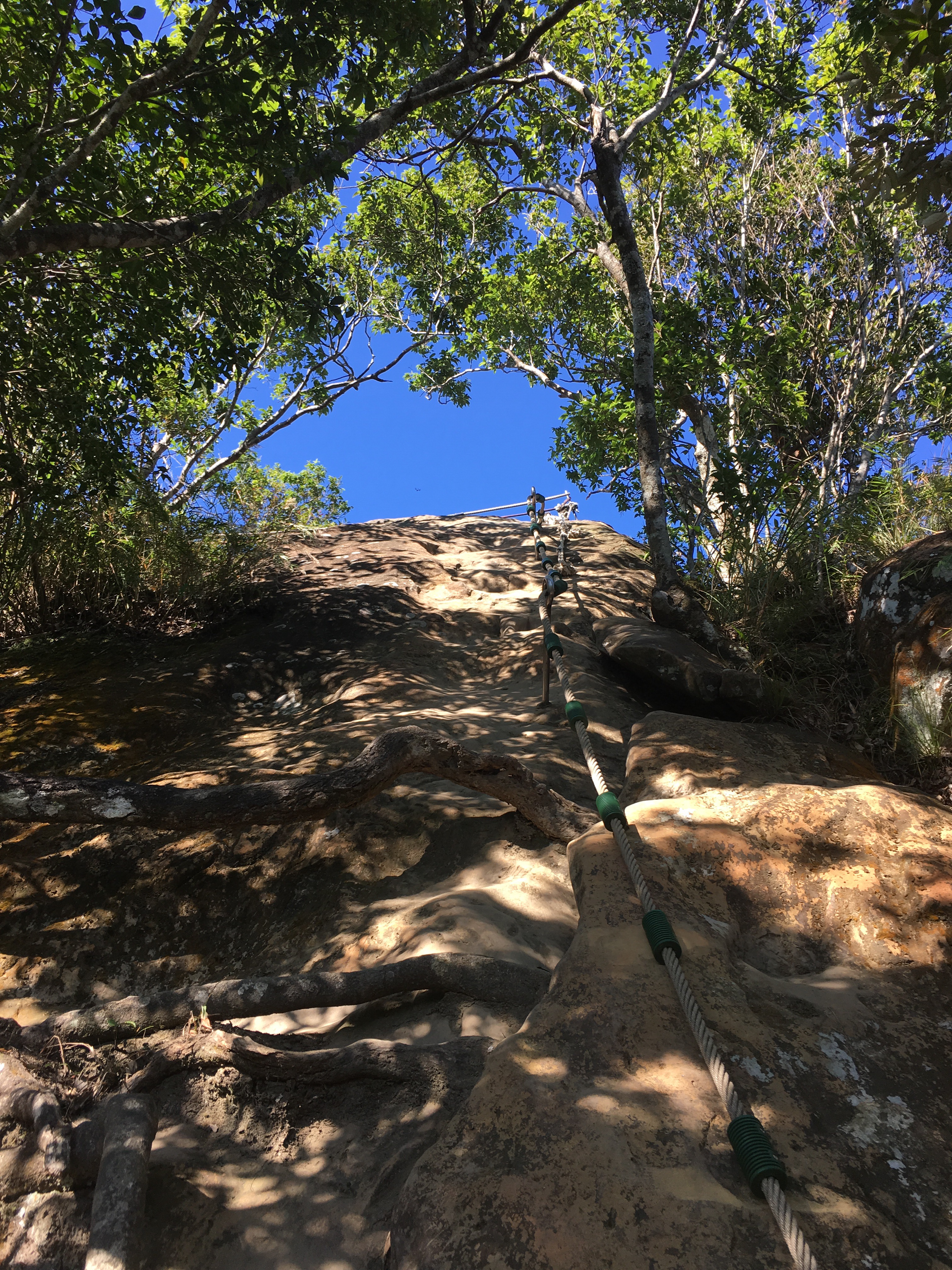
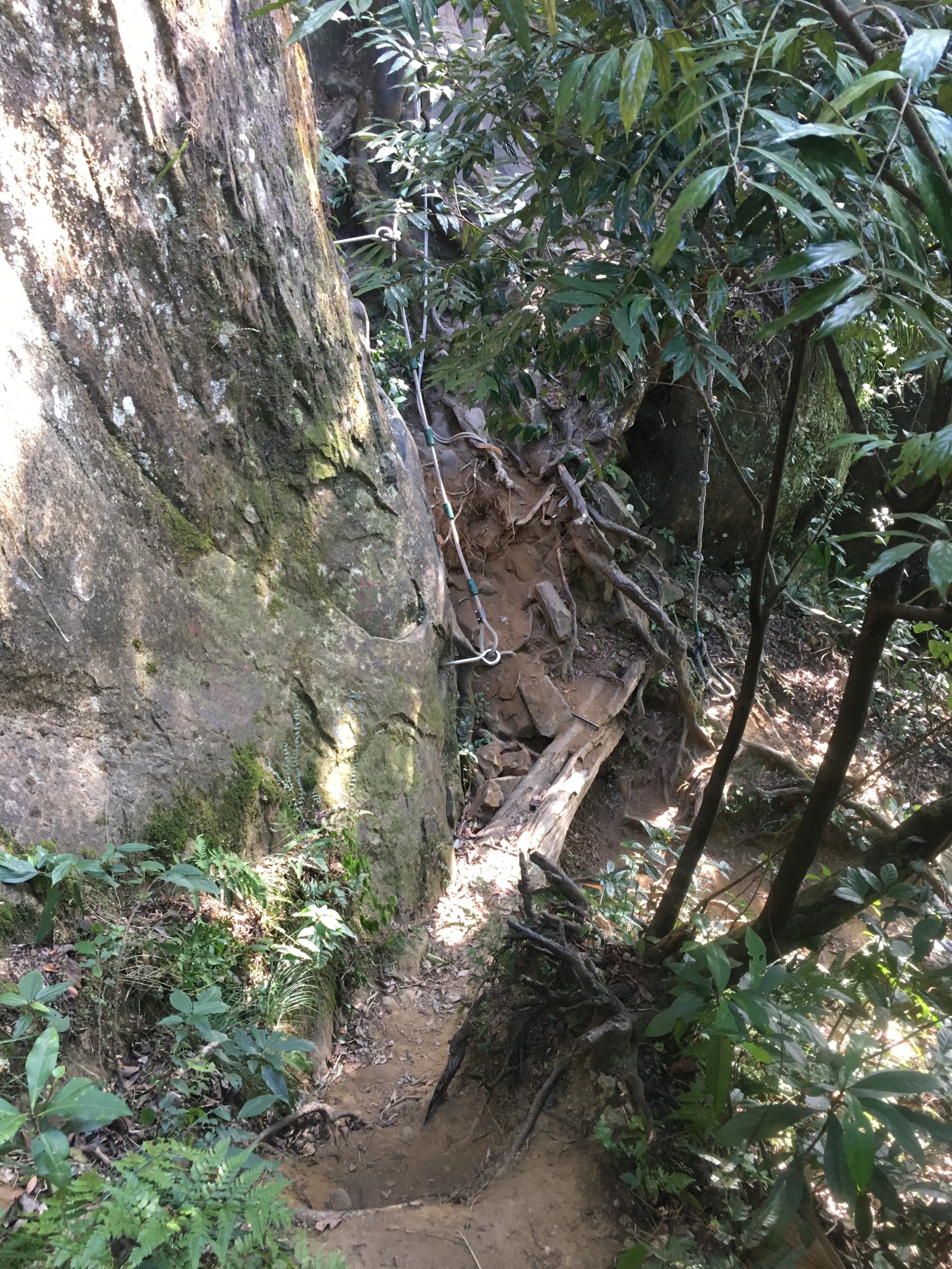
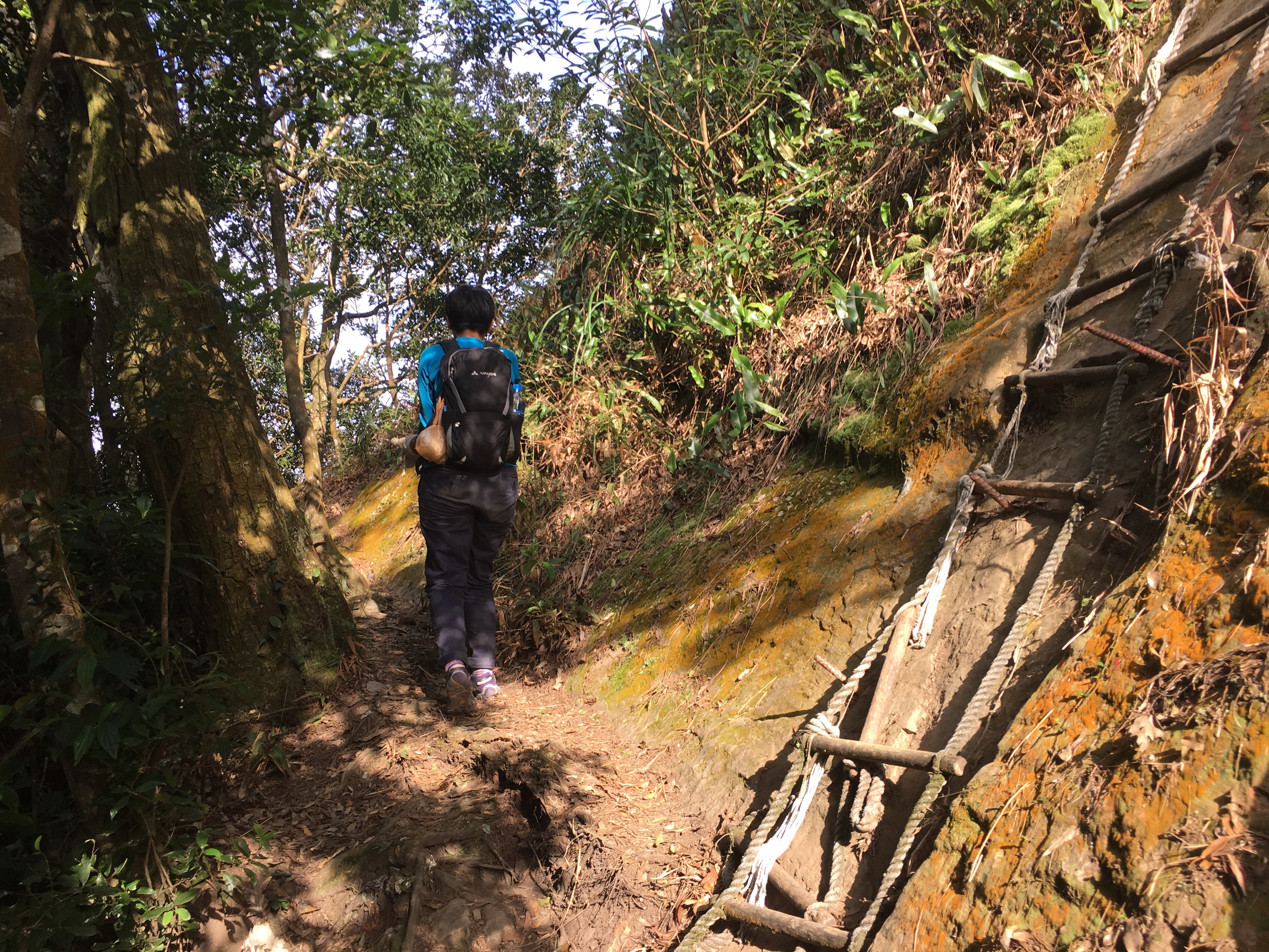
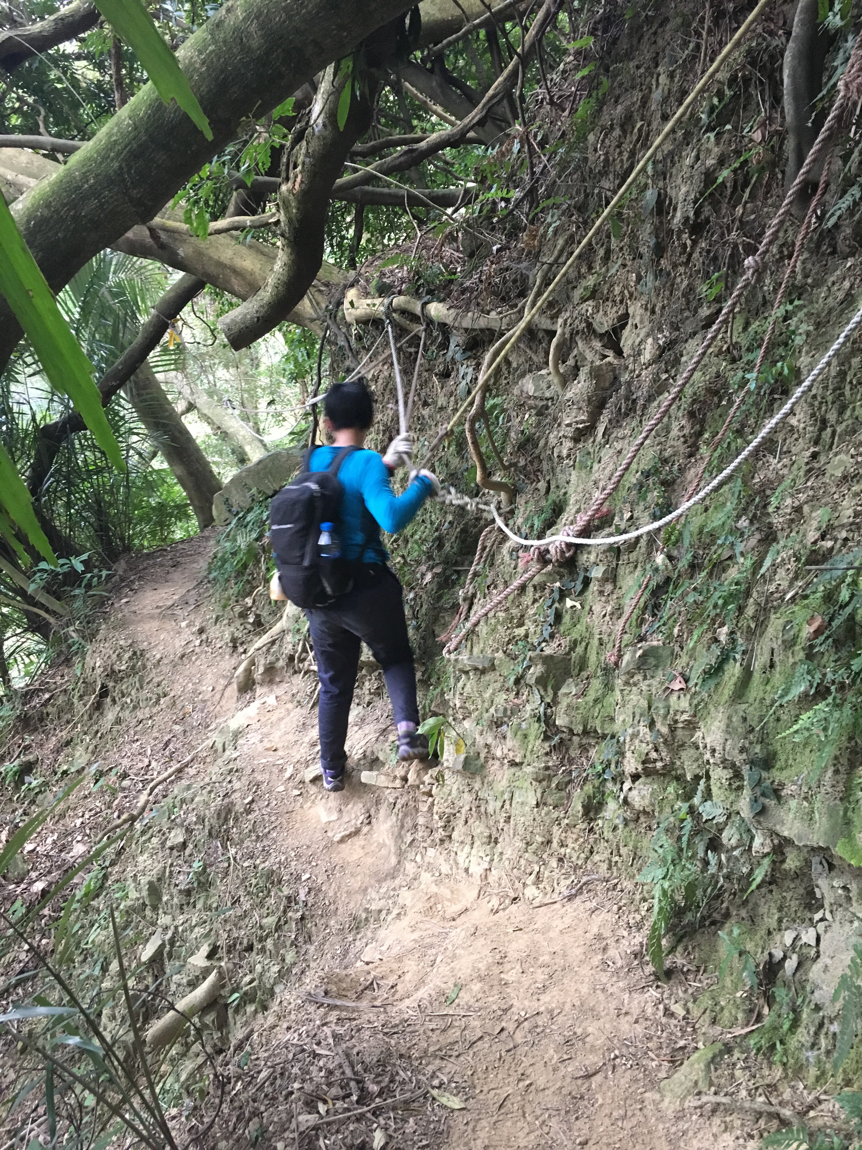
The path starts as a scramble using ropes, tree roots and rock formations to make your way up.
There is a series of peaks and small flat areas followed by more climbing. This is Teresa 30 minutes into the hike.
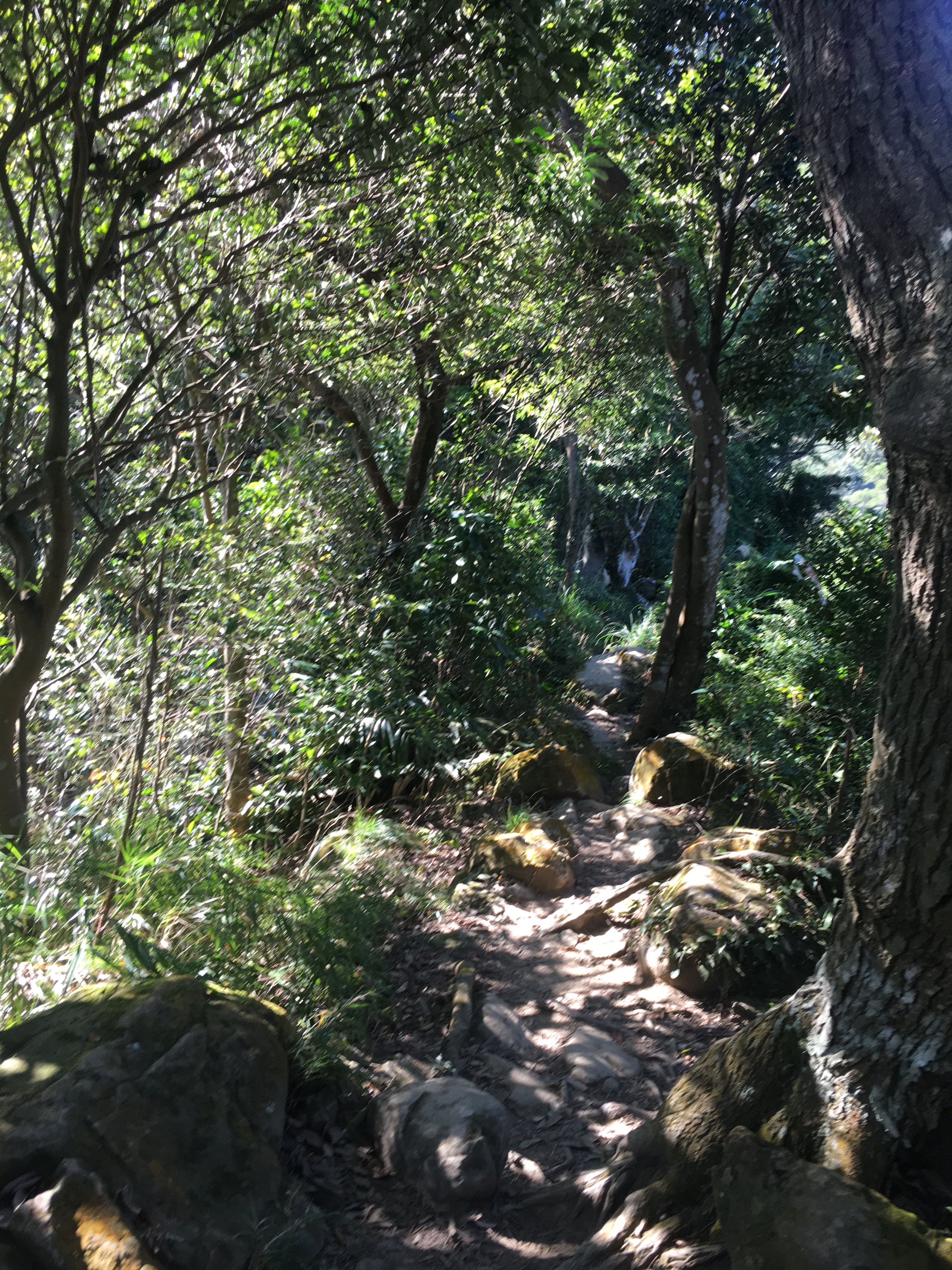
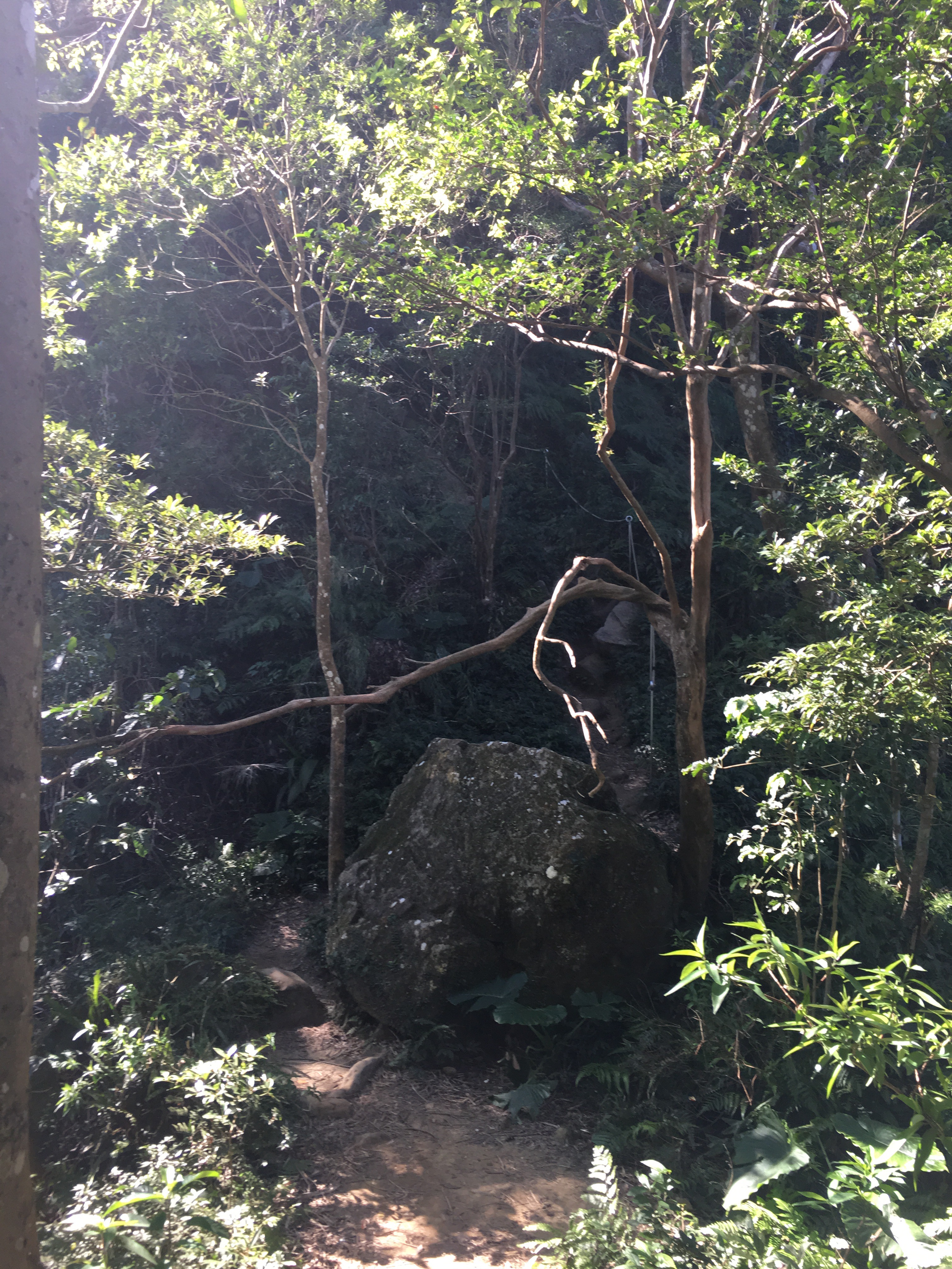
The flatter parts still require caution as the floor is made up of the same tree roots and boulders that make climbing easier.
0.28km and 40 minutes in, (yes, we averaged 100m in nearly fifteen minutes on this part of the ascent…although part of that was due to a return to the car to make sure it was locked), I arrived first and made use of a well-placed rock to wait for Teresa.
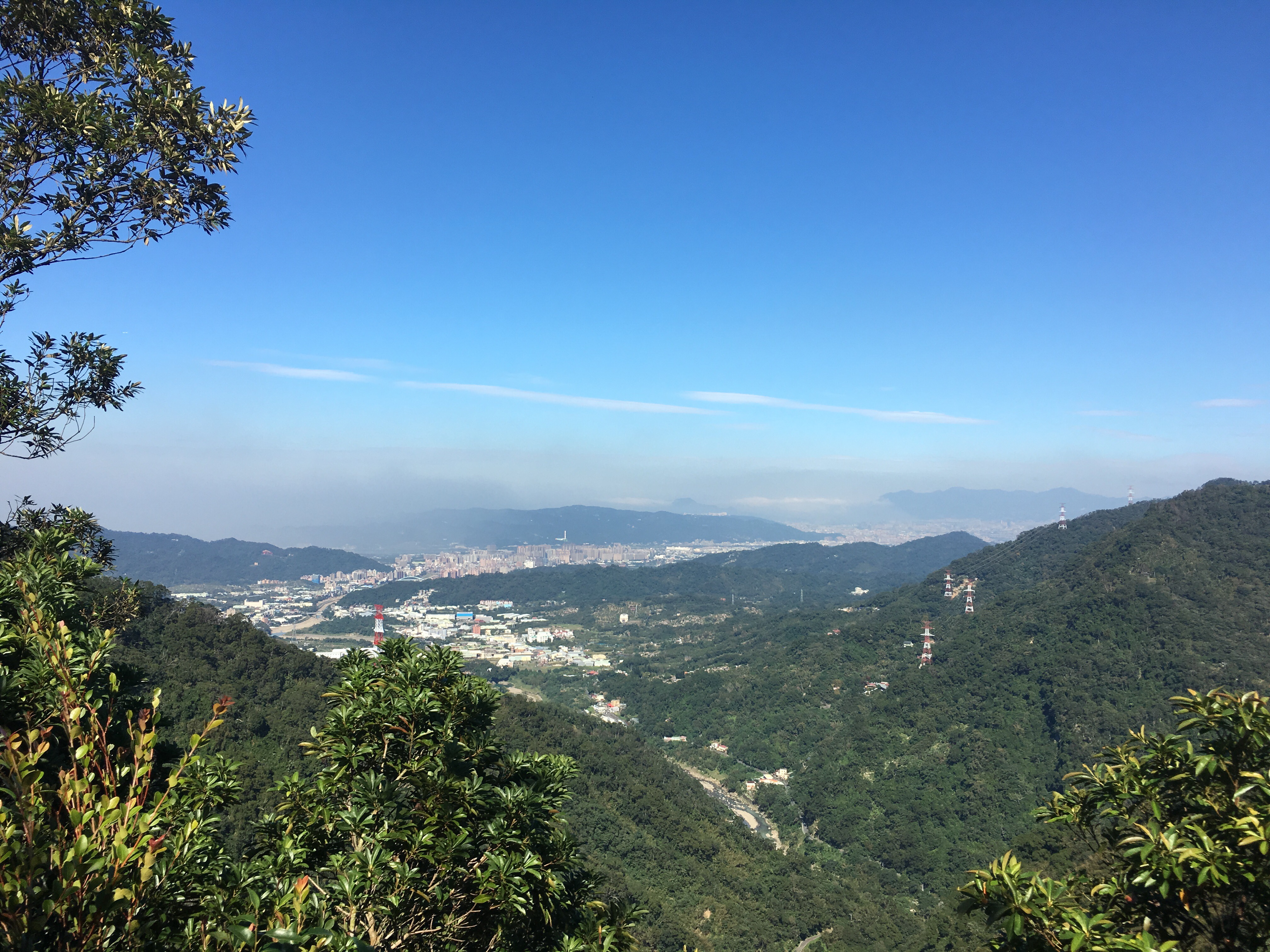
Here we could look back at the valley we’d just climbed up from but the challenges ahead were totally shrouded by forest.
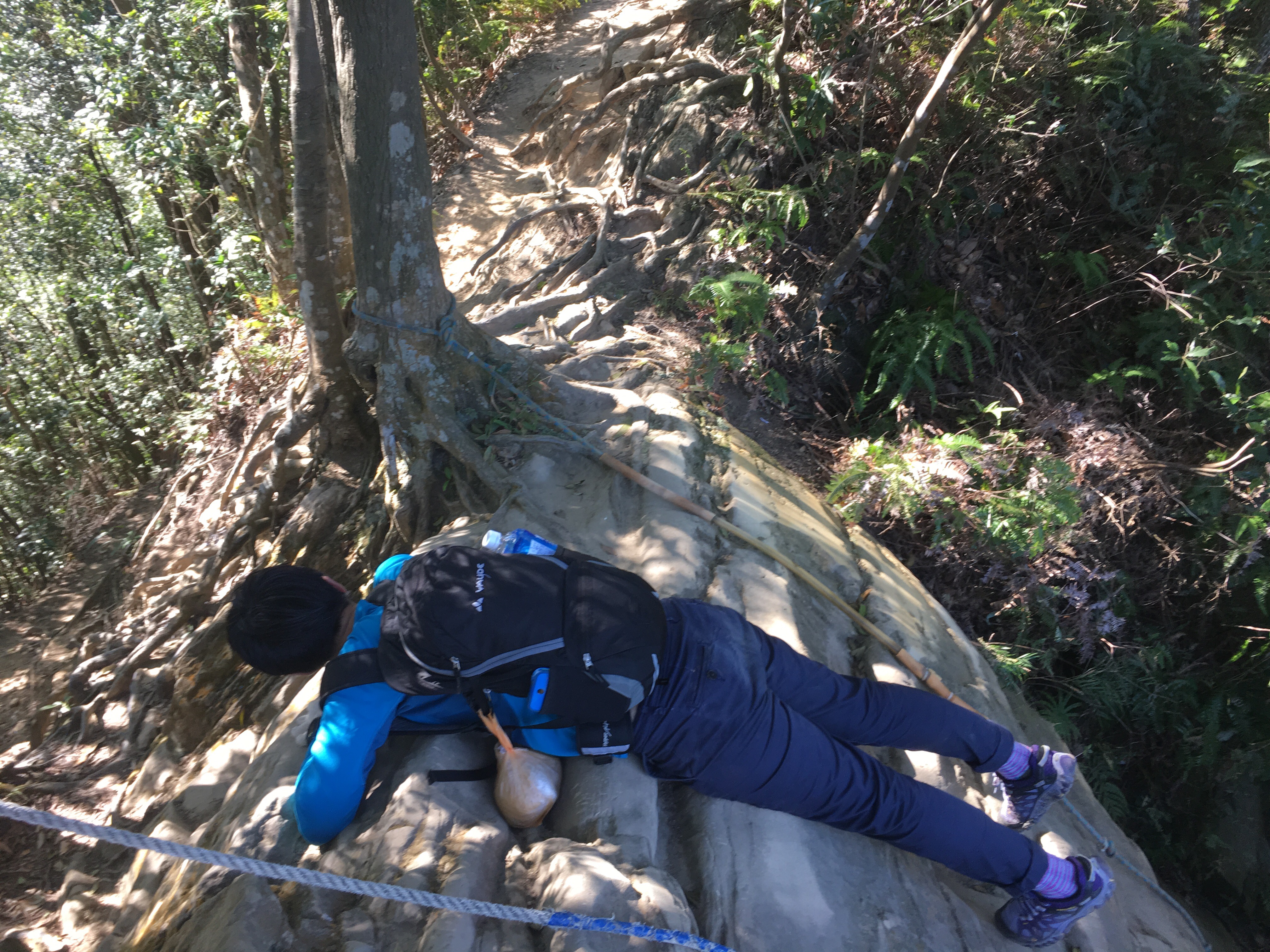
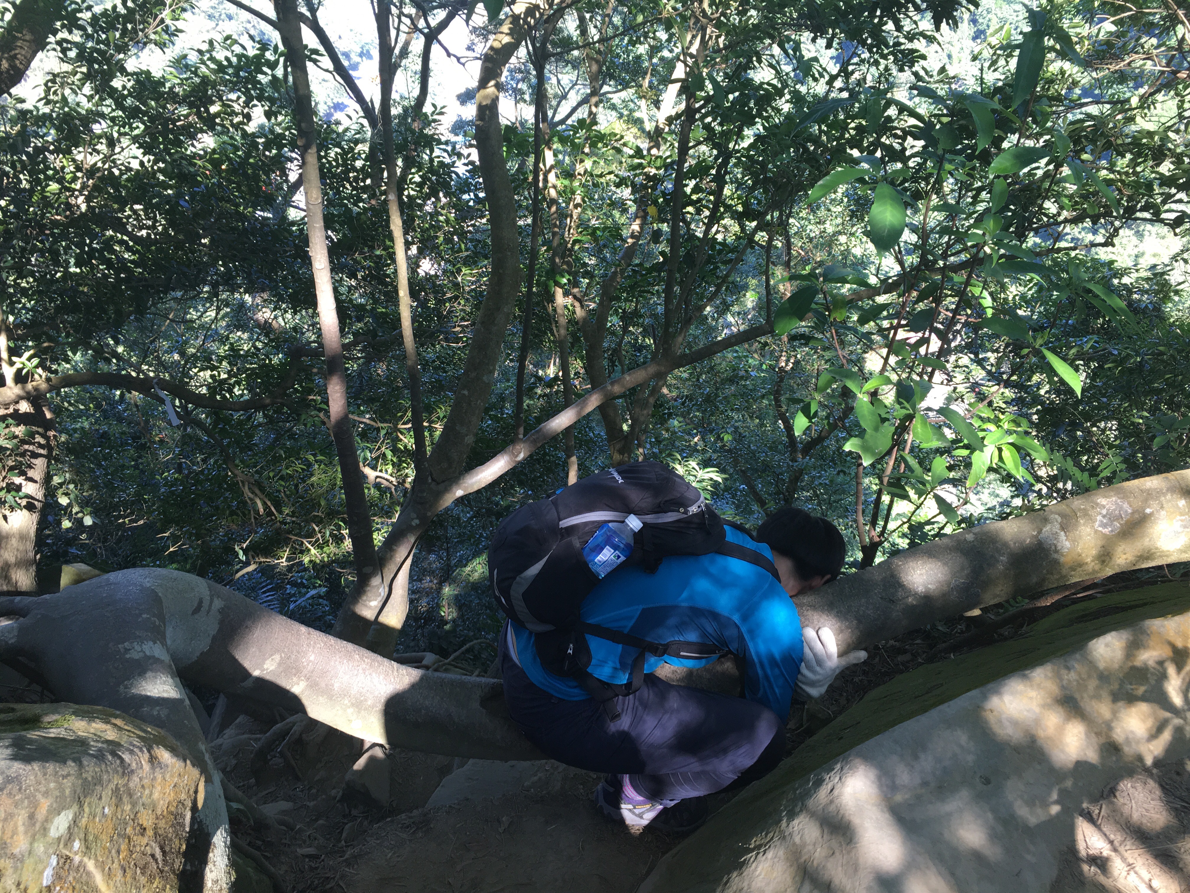
Still only 0.42km (and 56 minutes) into the hike Teresa stopped to commune with nature again. Actually I think I could have walked this part in about half an hour by myself as I do a lot more cardio exercise than Teresa, (she will always win if we compete on strength though).
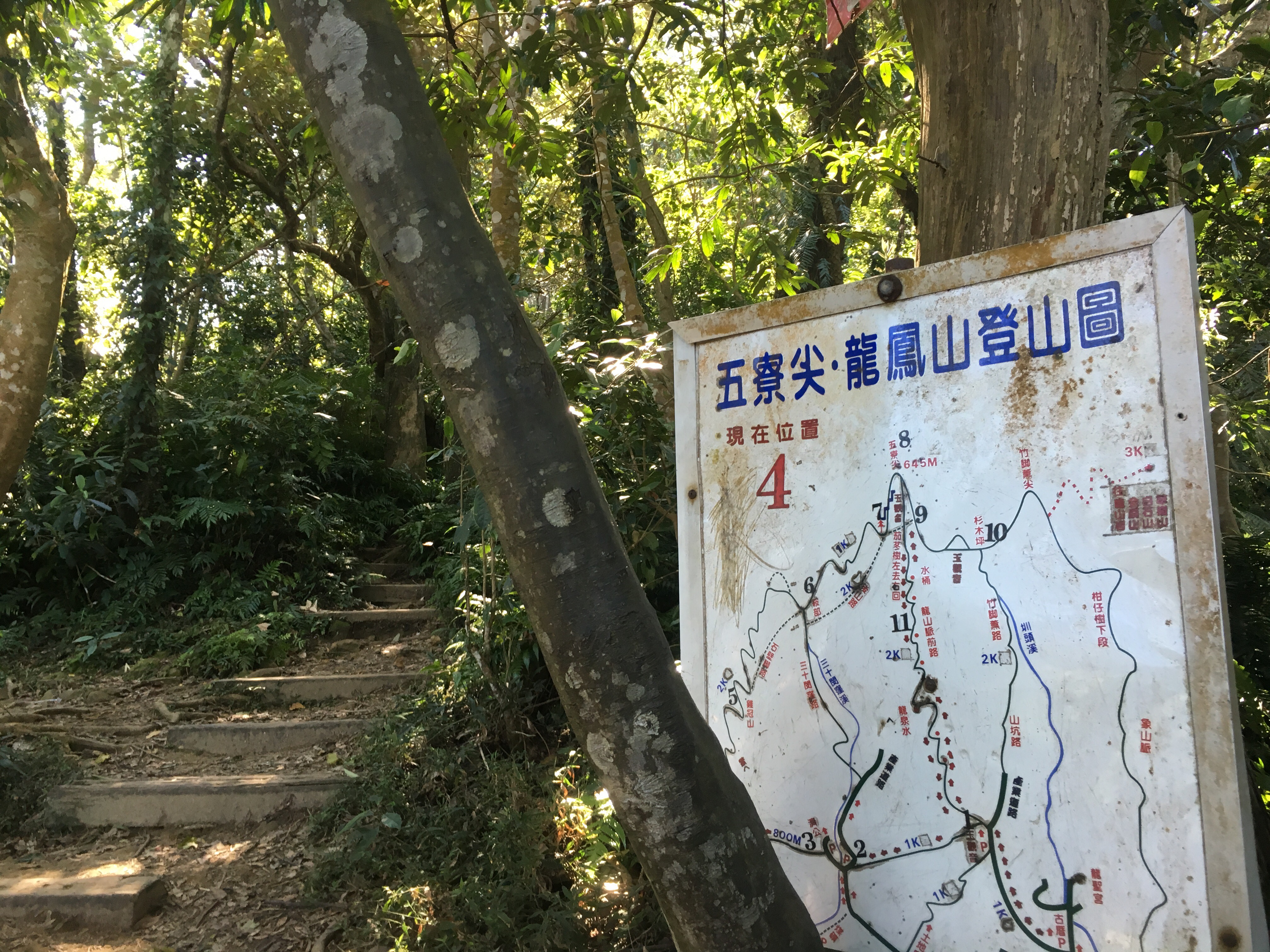
At 0.8km (1 hour and 20 minutes) in we reached point 4 on the map. These maps are generally useful in that they do somewhat represent reality but they make more sense in hindsight than as an aid to finding your way. When we did this last time we started too late so we took a shorter path back but this time we continued straight up beyond the sign in the direction of point 5.
The path continues in a deceptively easy manner for a short time before becoming a scramble once more. About ten minutes after point four there is a large rock with a path going up it and a path going around. The path going up it is a dead end. People just like to climb things. As you pass the rock check out the wonderful honeycomb weathering in its face.

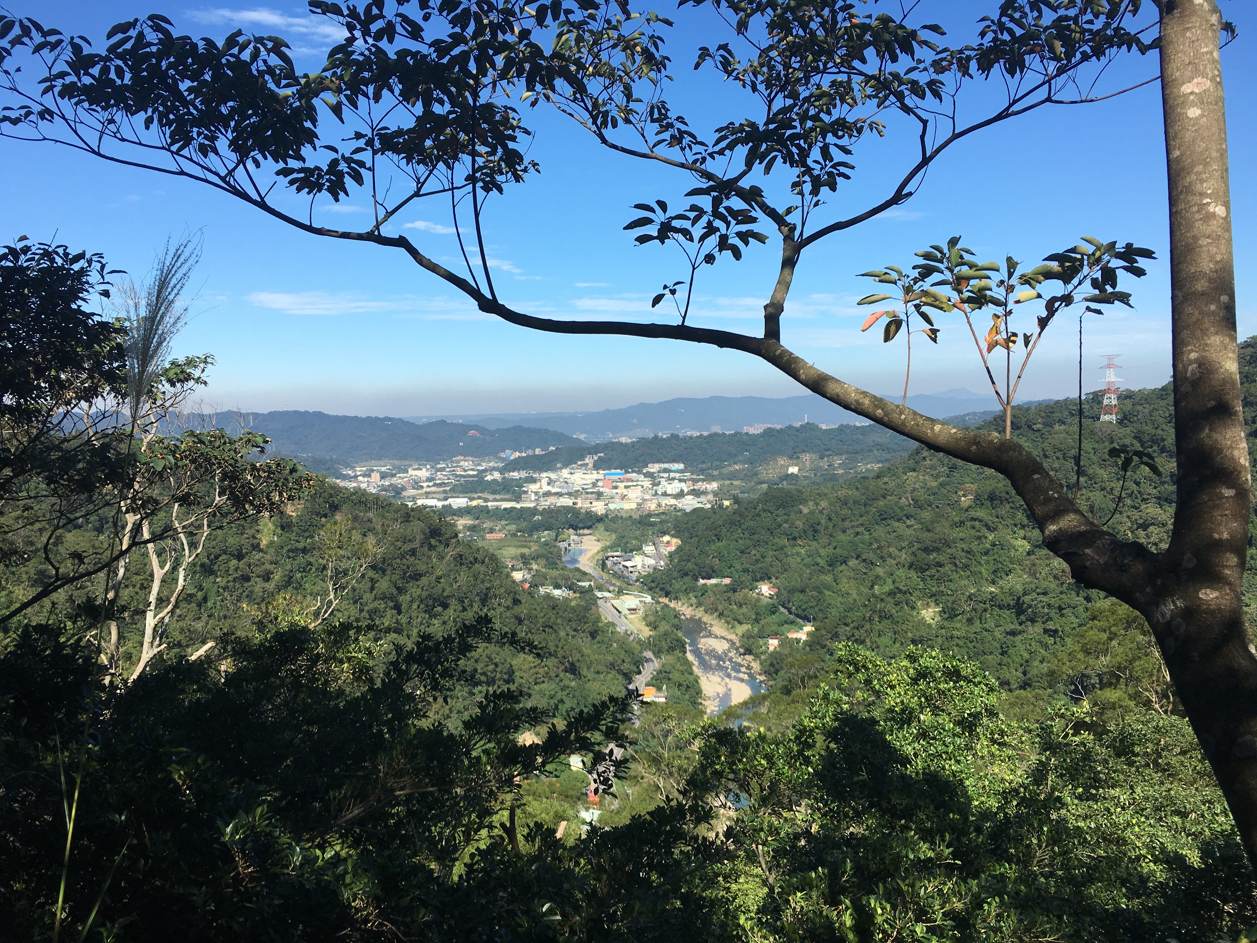
Just beyond the big rock we got a glimpse of the mountains to the left of us. The beautiful blue sky didn’t stay all day, haze settled across the landscape not long after I’d taken this.
The path starts to go more up and down around this point (previously it was up, flat, up).
There are a few particularly challenging portions for those with short legs around here.
At the 1km mark (1 hour and 48 minutes), we reached a suitable spot for quick refuelling (I’d brought nuts, I love nuts as a hiking snack, small and nutrient dense).
Less than five minutes walk from the resting place we got our first taste of ridge walking.

The path here dips in and out of the canopy and for the first time you can see the path snaking up the hill in the distance. Actually there are a couple of parallel paths here, one slightly lower down and to the right so you can keep out of the sun on a hot day. Where the upper and lower paths merge there is a cave-like geological feature which has been hollowed out of the softer stone.
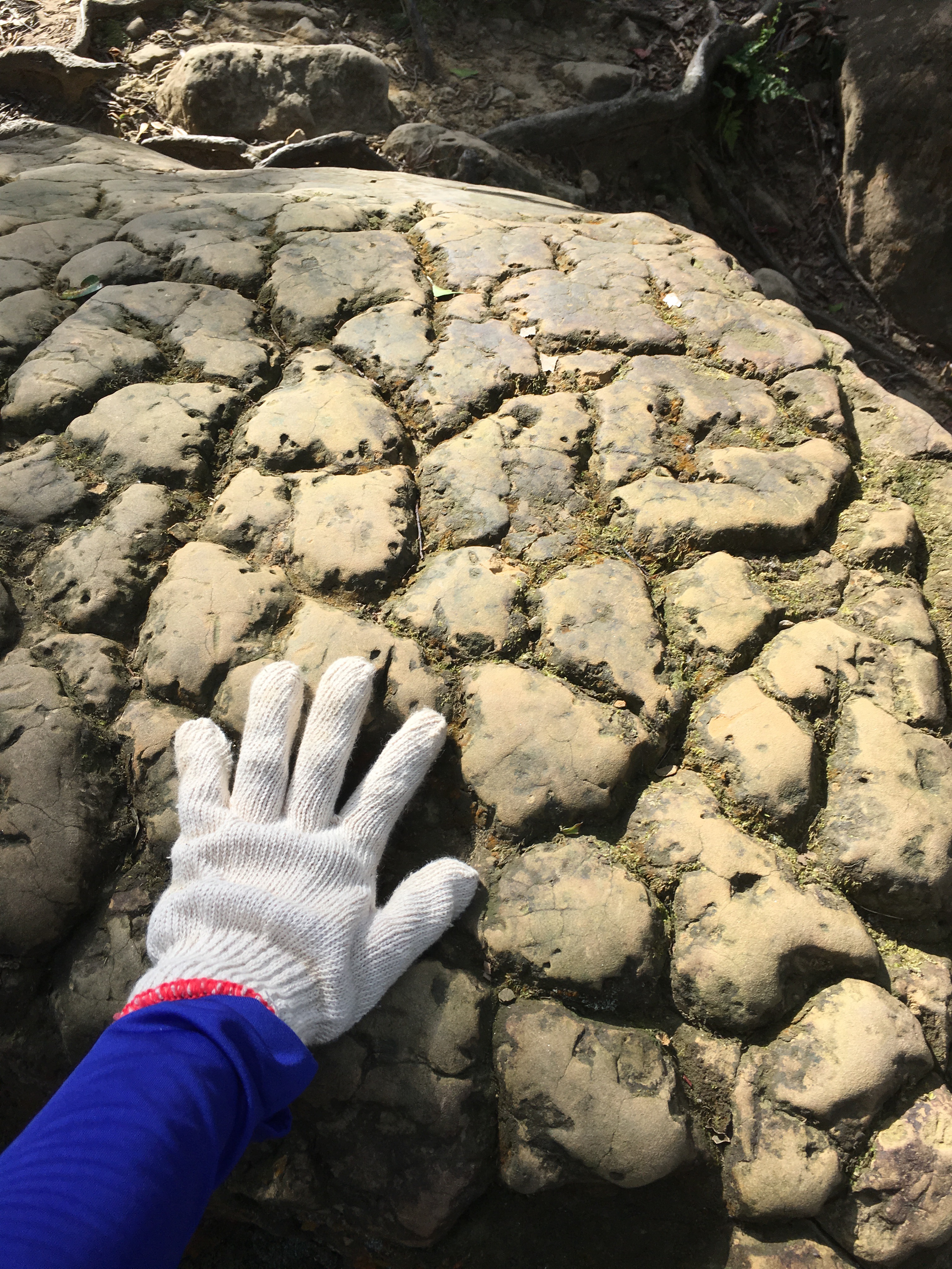
A little further beyond the cave I came across this lovely example of sea/estuary floor. It’s fascinating to imagine the forces that resulted in this piece of rock coming to rest so high up a mountain.
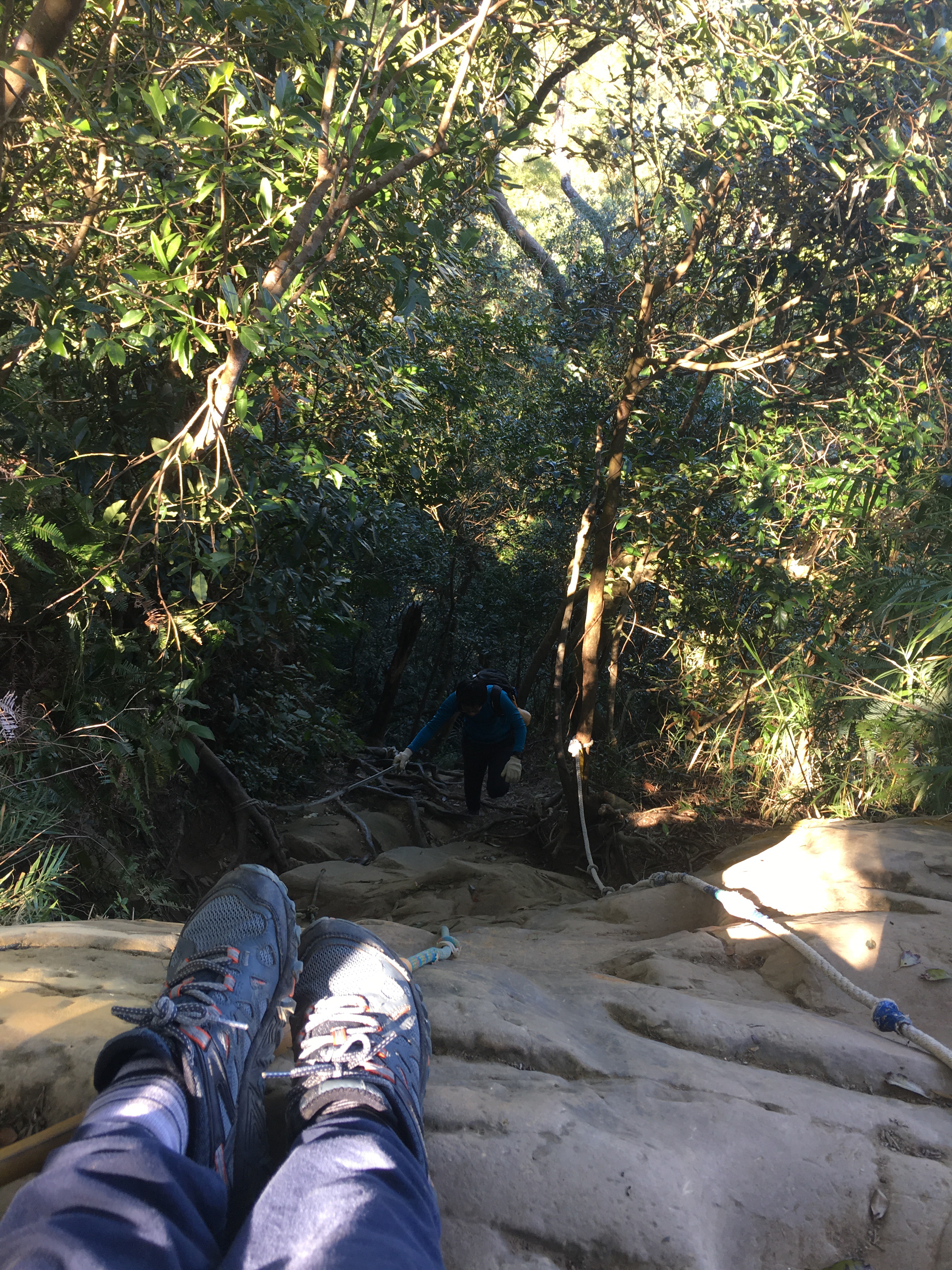
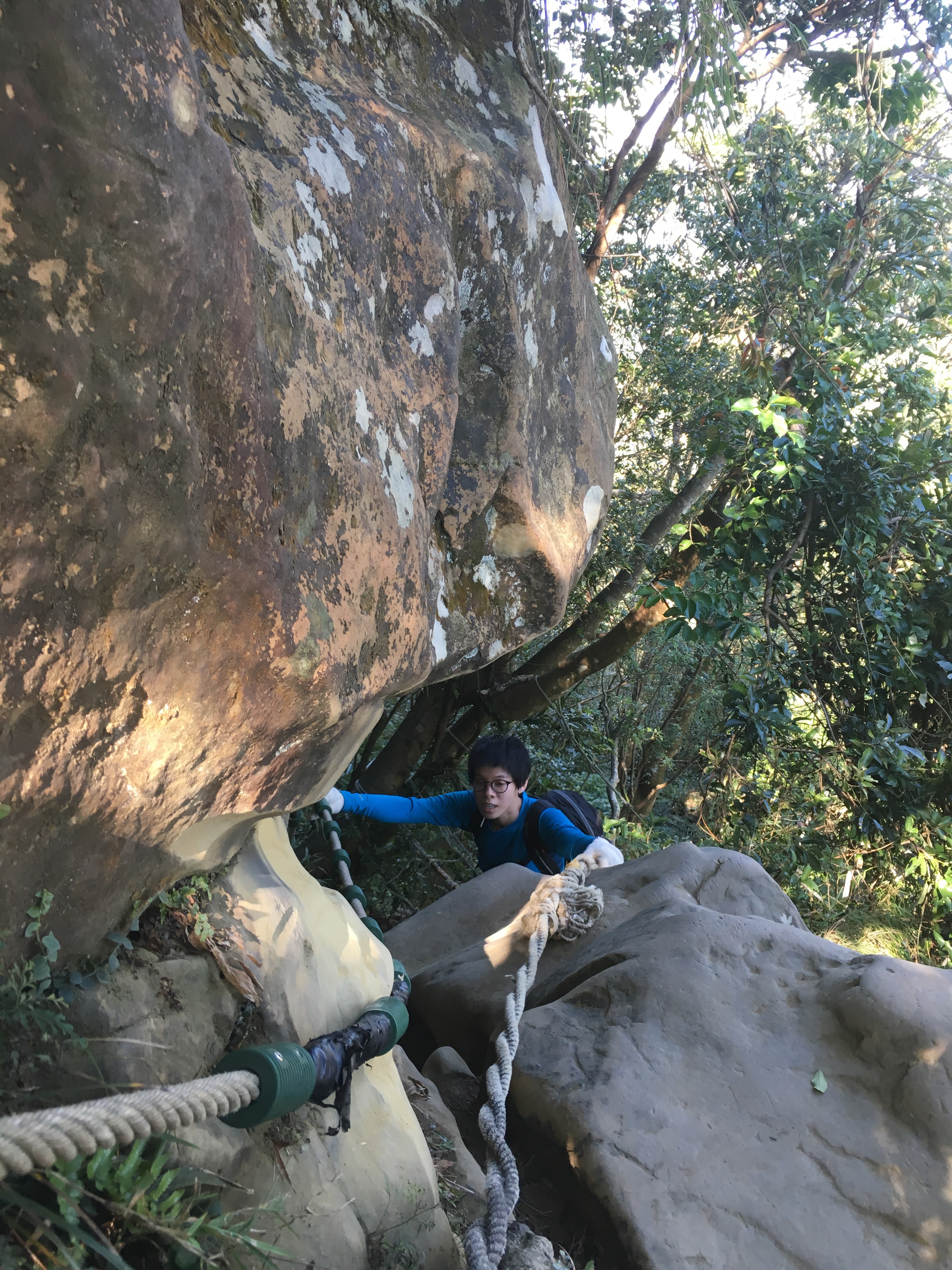
The next part was the scariest part of the hike for me. I don’t especially like heights, it’s not that I can’t do it, just that I really need to focus on just putting one foot in front of the other until I get somewhere more secure. I think I basically crawled up and never moved my feet and hands at the same time, always keeping one point of contact fixed.
The daunting bit for me is where the rope switches over from left to right, it feels so scary!

Teresa had no such qualms and was able to staunter up like a mountain goat despite having broken her leg less than a year ago.

This is 1.2km (2 hours and twenty minutes) into the hike. At the far end of the exposed part a sign tells you that you’ve reached point 5.

Walking away from the sign post we came across this lovely little lily pond which had flowering lilies despite being half way up a mountain.

This small sign is the one which leads you to the spectacular vistas seen in other blogs on this subject. Go left and up and you’ll walk along the ridge top, go right and down and you’ll skirt along the base of the cliff. As we wanted to climb wuliaojian proper (the whole hiking trail complex is known as wuliaojian but it seems that many blogs on the subject take the higher route and then head back before the mountain itself), we took the right hand path. I’m really cautious with timings when hiking as I would seriously hate to find myself halfway up a path like this with the night coming down around me, so we took the short cut to make sure we could get round the rest of the trail. I would love to come back and start a little earlier in order to do the complete walk.
About ten minutes later the short route merges with the longer ridge route, I’m not sure how much longer the ridge top part would have taken. The climb down looked pretty tough.

The path goes steeply down a little way before arriving at the marker board for point 6.
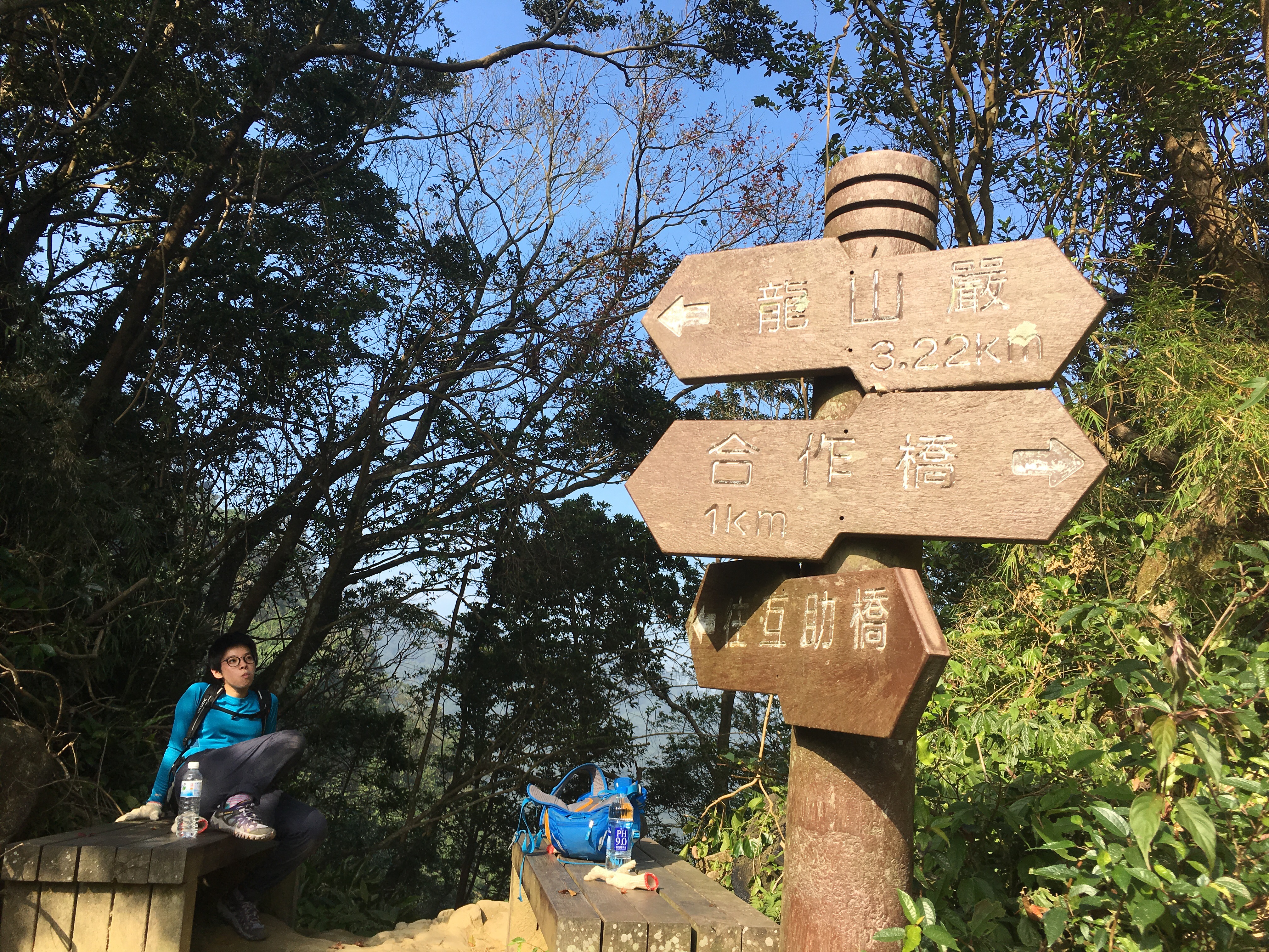
Marker board 6 six has probably the most detailed map of the hike but if you’ve got this far you probably don’t need it. There’s also two benches to rest on. A path goes down between the benches (this seems to be where a lot of people head down after completing the ridge part between 5 and 6).

As we wanted to climb Wuliaojian proper and do the full loop of the valley we continued up past the maps. (There also happens to be a geocache hidden here.)

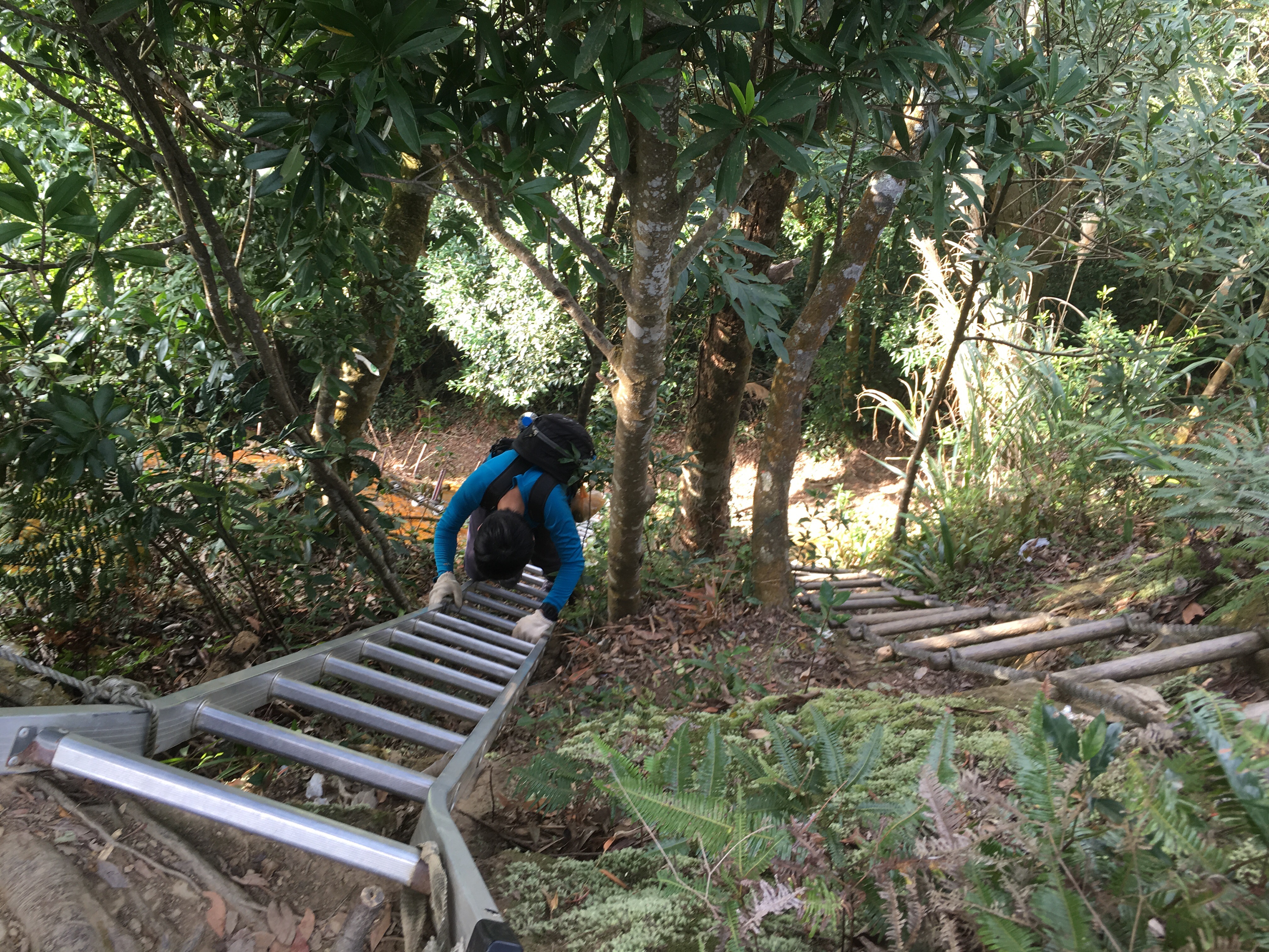
From marker six forward the climbs aren’t nearly as challenging as they were earlier on, they’re mostly straightforward with obvious places to put hands and feet.

There’s even a couple of ladders. Just beyond this ladder the path continues diagonally across the rock face but there’s also a rope going up so that you can can a look at the view over the valley.

The haze had started to settle by this time and the landscape seemed like a découpaged image with each receding peak having a slightly paler shade than the one in front of it.

About 45 minutes after leaving marker board 6 we made the steep descent to point 7. This was 1.85km and 3 hours, 20 minutes into the hike – as a runner as well as a hiker those times seem ridiculous but it really is a tough hike.
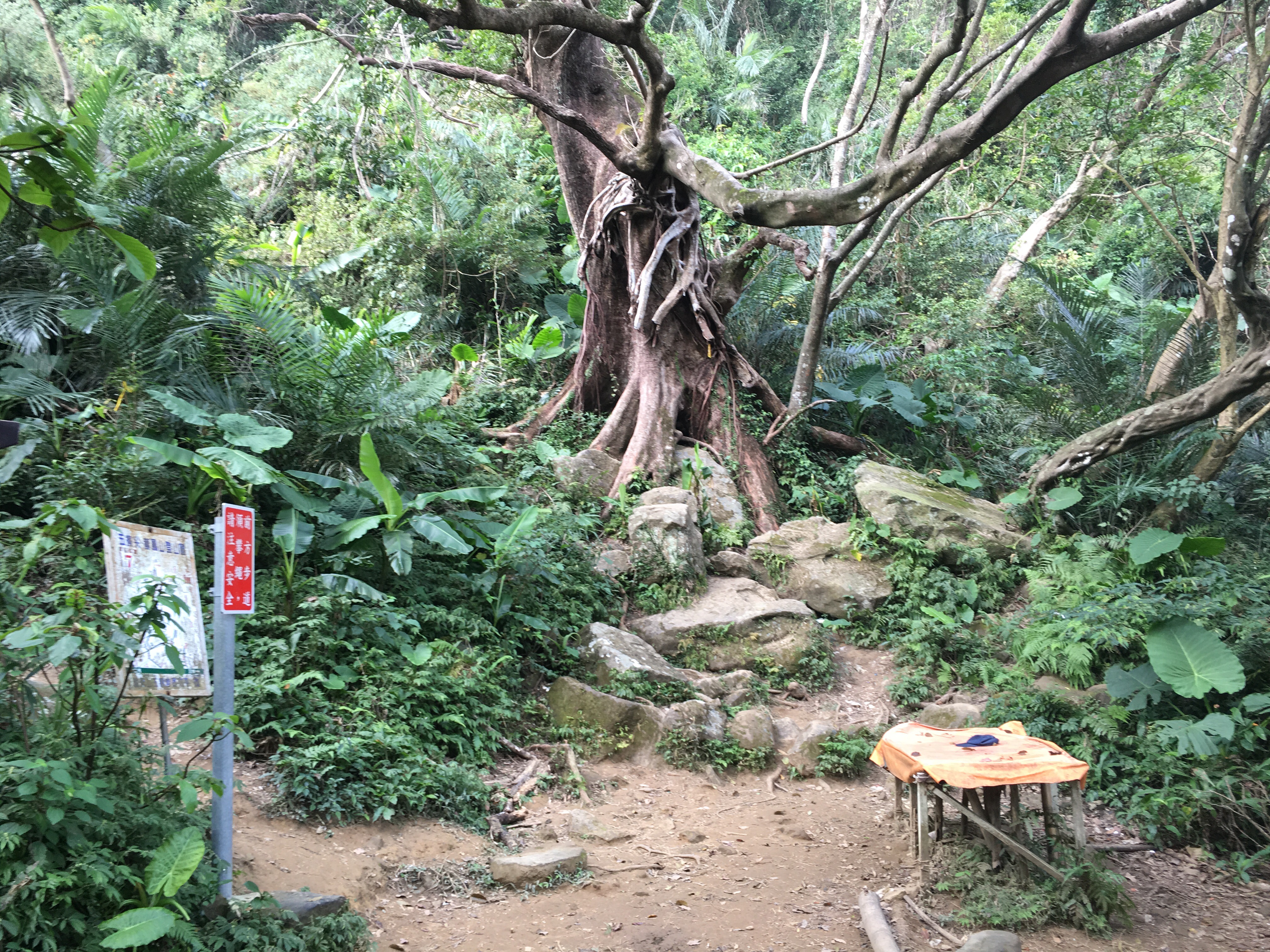
Point 7 is marked on the map by a picture of a tree, and the old couple I’d spoken to at the start of the hike had said they were going to walk to the big tree before heading back. When we arrived there or was obvious why the tree was such a marker point. It’s not that it’s much larger than other trees in the area (although it is very large), it’s just more impressive. Sitting atop a castle of rocks it seems to preside over its clearing like a village elder. All the trees around it seem insignificant in comparison. We took a while here to consider whether we should go on or take the path back. We decided to push on, (up and left beyond the signs), as we still had a little more than three hours of daylight and we reasoned that a lot of the rest of the walk would be going downhill.

Fifteen minutes later we arrived (somewhat confusingly) at marker board 9. I’ve looked at the map several times and cannot work out how it happened, we didn’t cross over our path at any point, the tracker app I use can show me that – we chalked it up to being just another one of the idiosyncrasies of Taiwanese map design. The maps for this specific trail are consistent which is a lot better than a lot of maps manage to be however they consistently mark the distance in kg instead of km. Anyway, we decided to continue to the right-ish and upwards, (there was a second path going left), and if it didn’t get us to Wuliaojian we would head back and take a route we knew could get us back before dark.

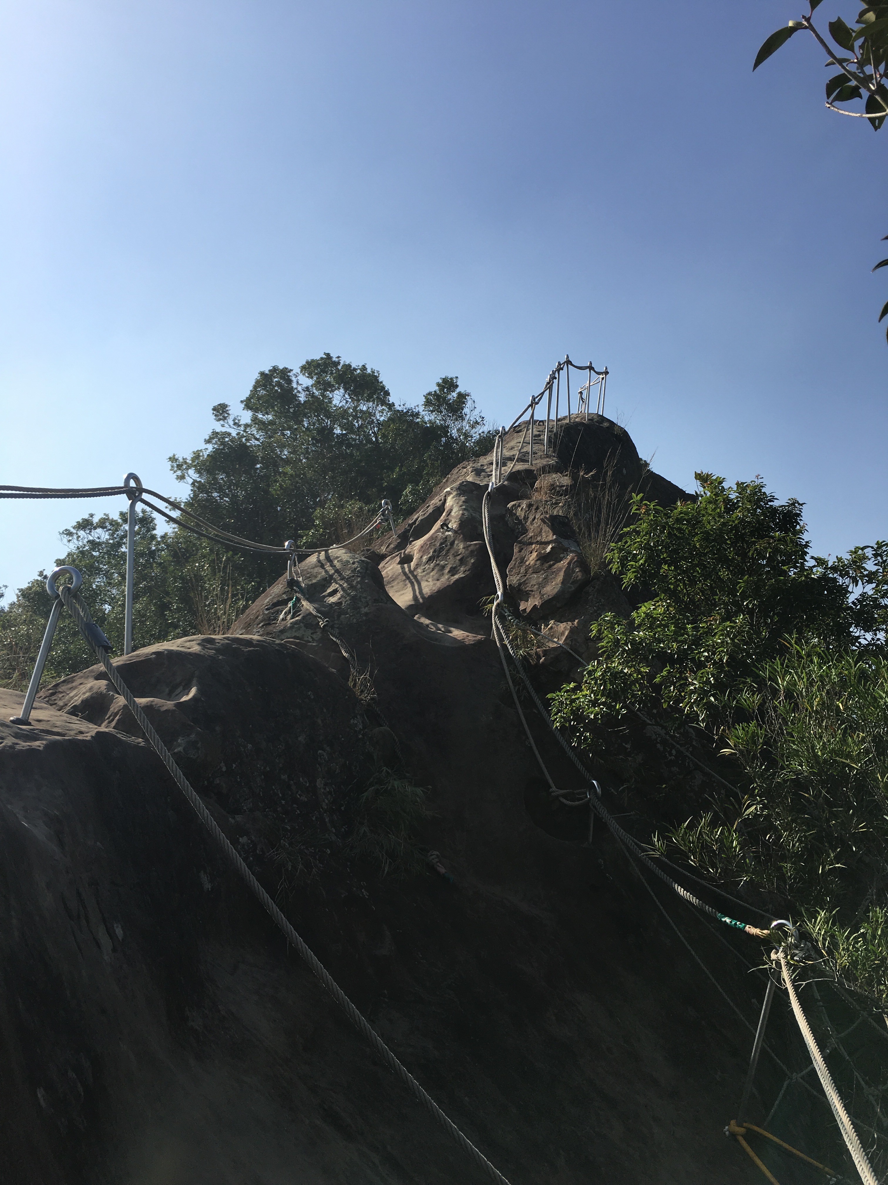
Luckily we didn’t need to turn back because a little over five minutes later we finally reached the highest peak of the walk, Wuliaolian.
The route down from the peak is a daunting ladder going straight down the side.
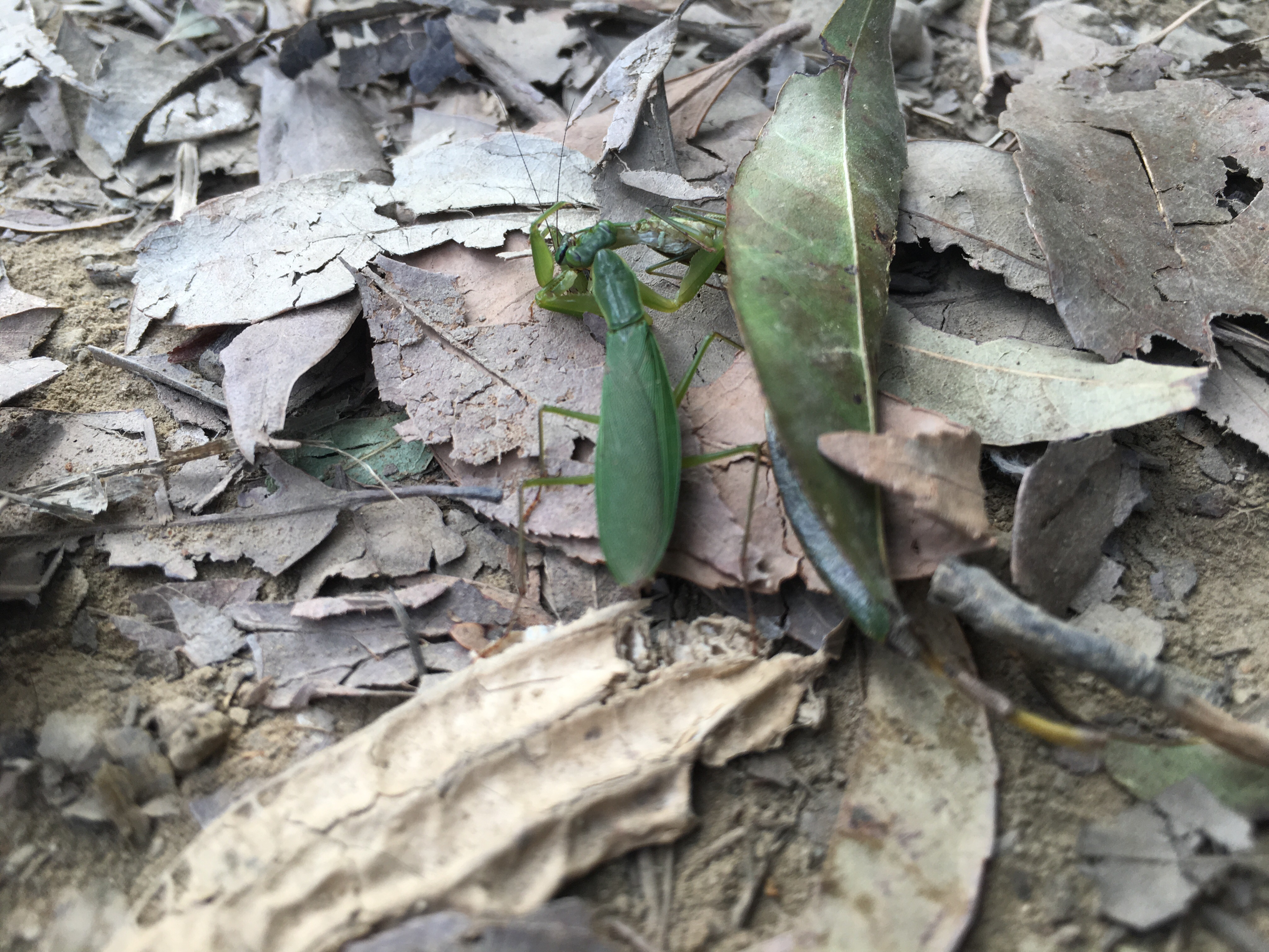
Whilst I was waiting for my turn to climb down I encountered these two minibeasts engaged in either insect love or insect war. It was hard to tell which.
At the foot of the ladders the path goes both ways. We took the path on the right (with our backs to the ladders). I think the other path leads back to a little way before the peak, so you can probably avoid climbing it if you want to.
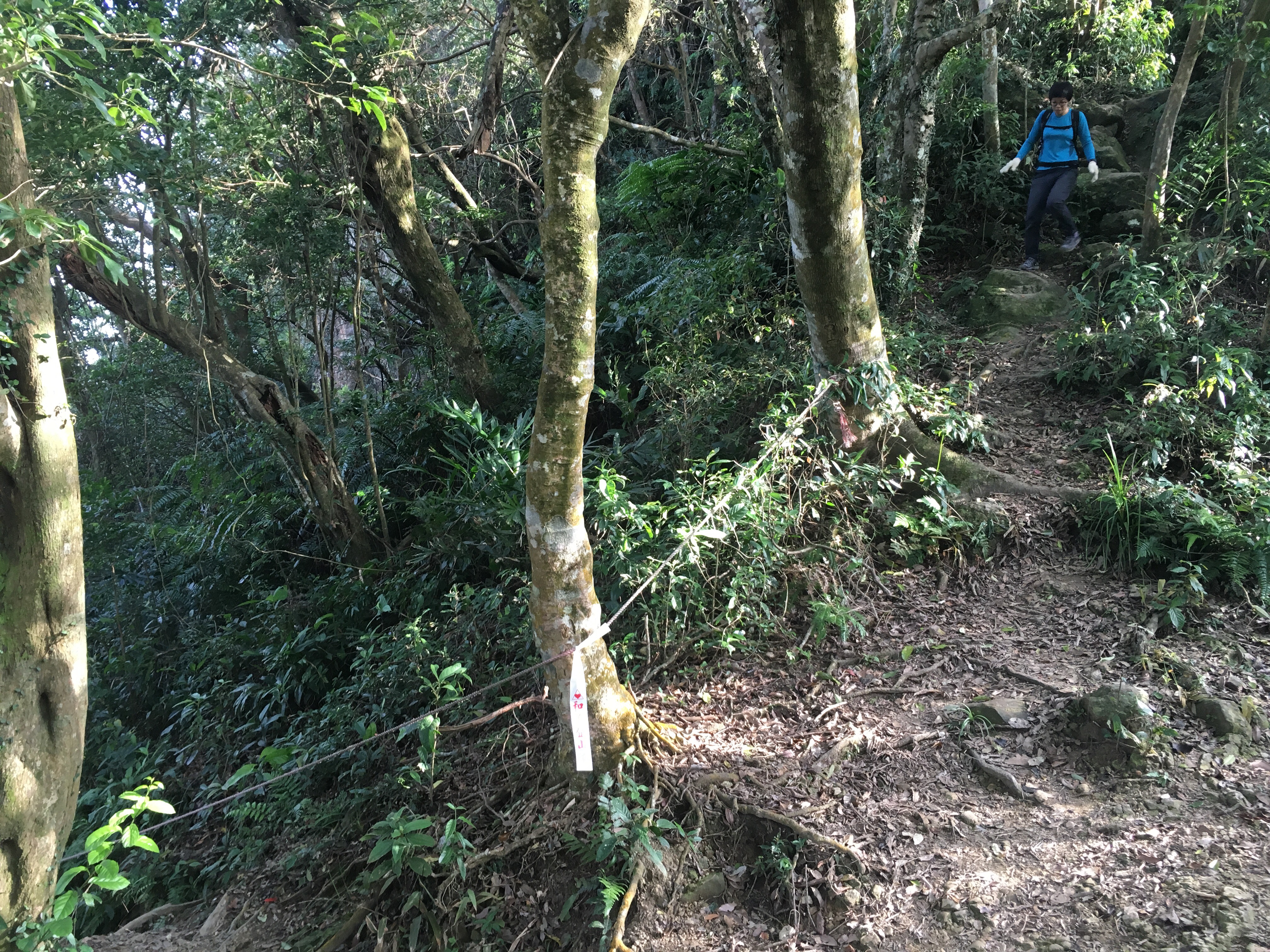
After this point we started making good time as the path was almost entirely downwards. A lot of it was also in the shadow of the hill which meant that it was a lot more slippery underfoot.
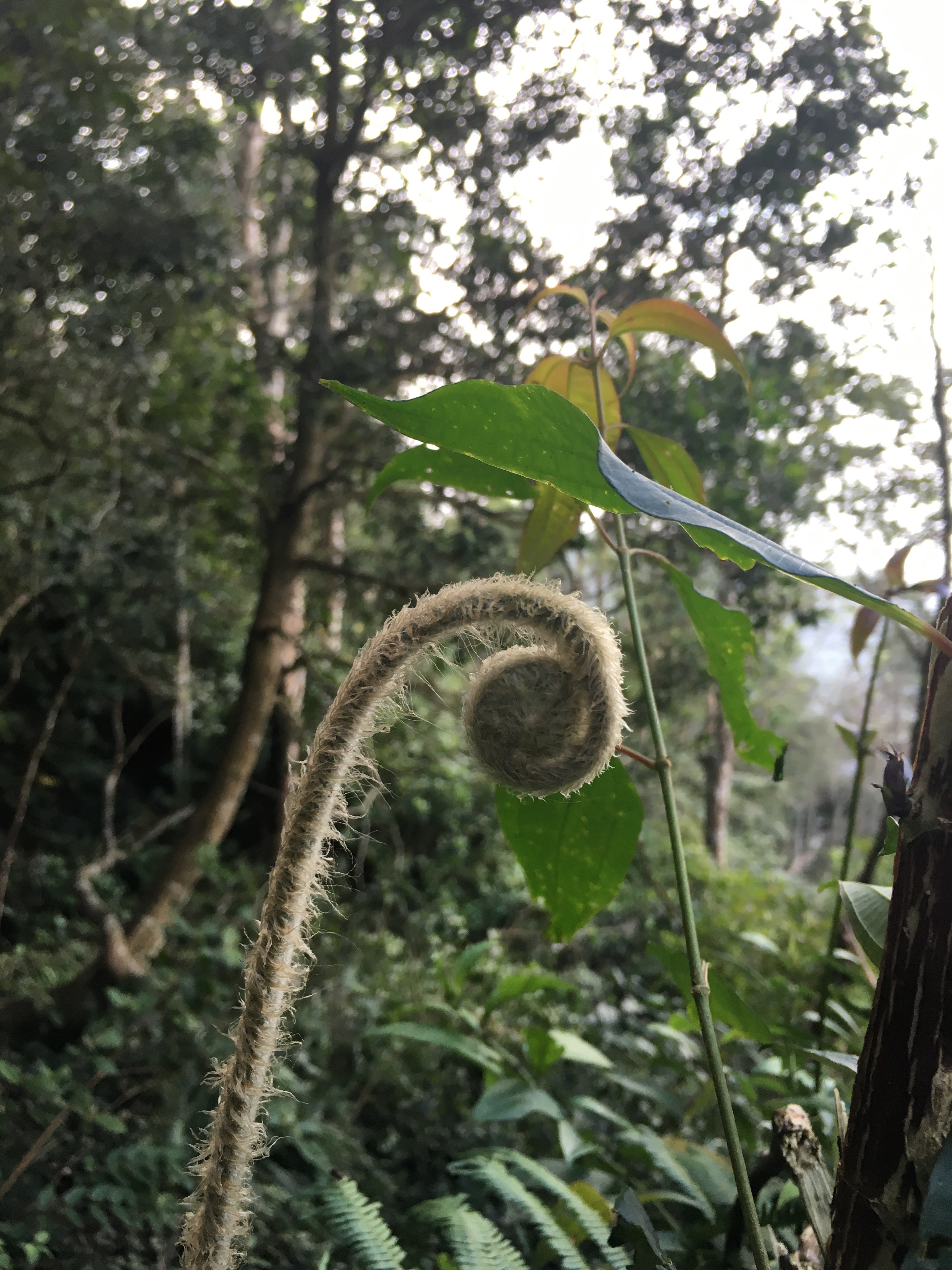
One of the good things about being in the shady part of the valley is that they’re often filled with ferns. Here was no exception, tall, proud, hairy spirals pushed upwards. Some areas were full of them, standing tall and pale and strange looking.
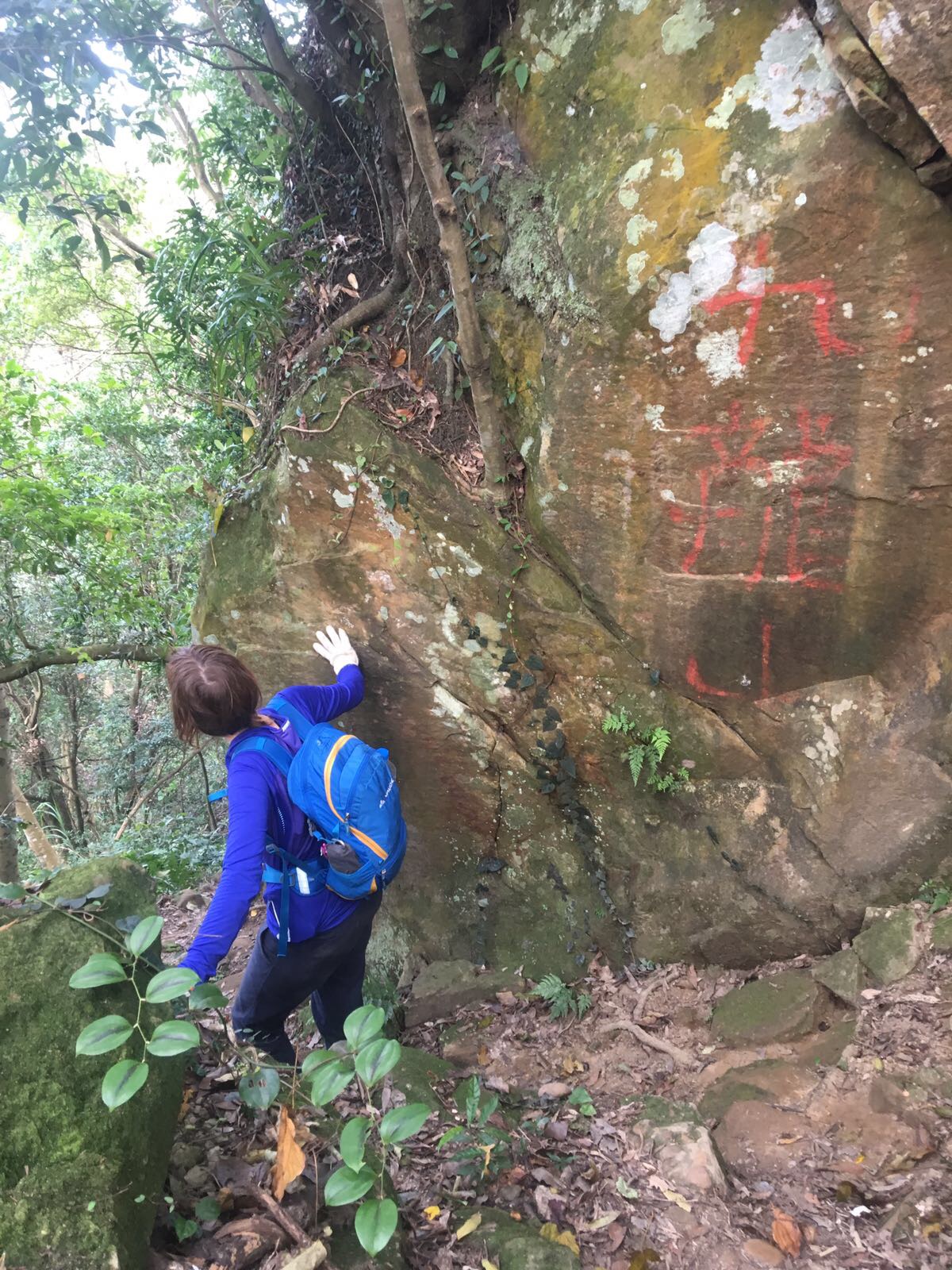
Although we felt like we must be going in the right general direction given the lay of the land we were thrown off by this marker for 九龍山/jiulong mountain which didn’t seem to correlate to any of the maps. We continued anyway.
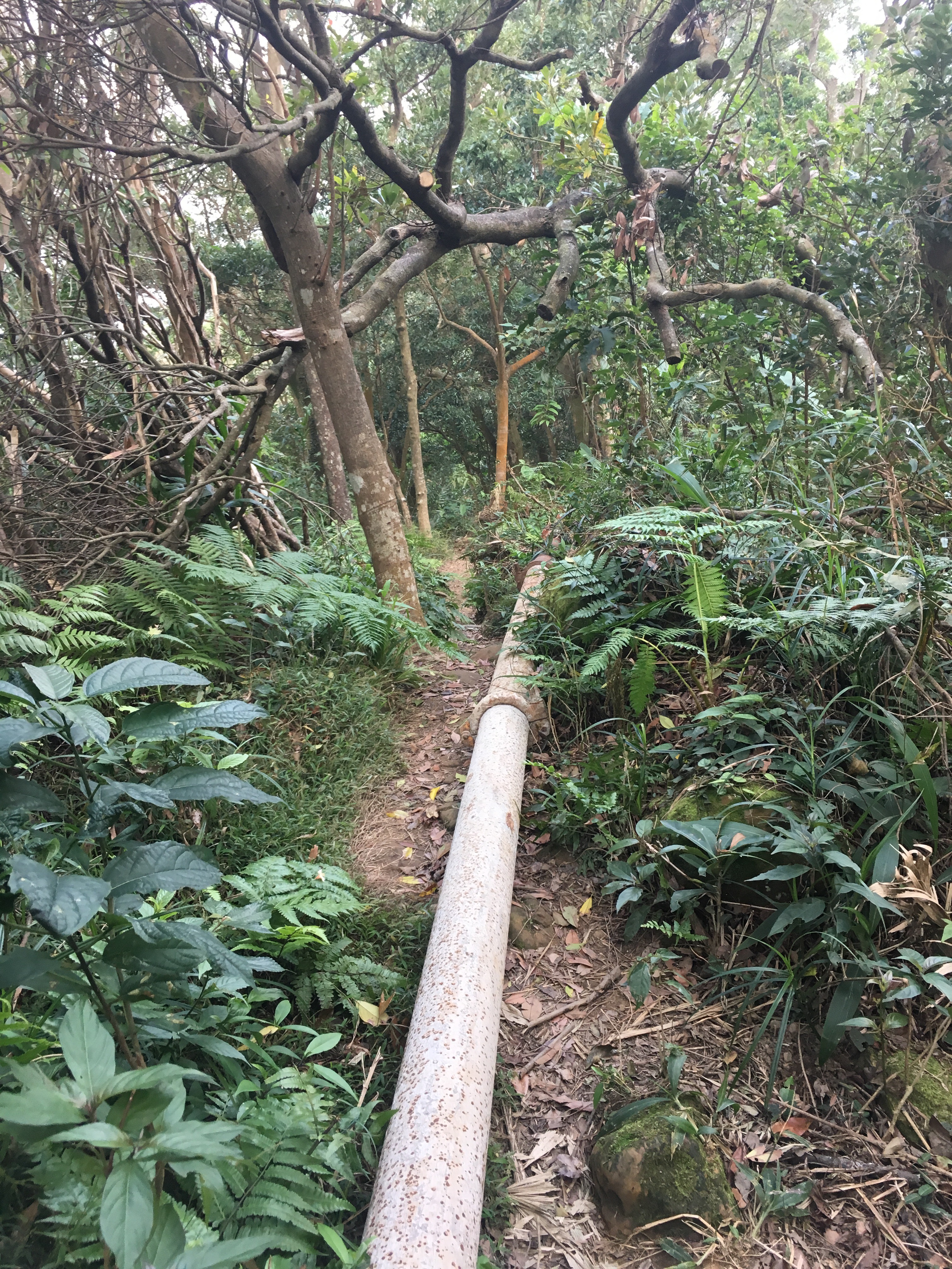
Not far beyond the Jiulong marker the path is joined by this pipe which runs parallel to/over the path for a lot of the way down.
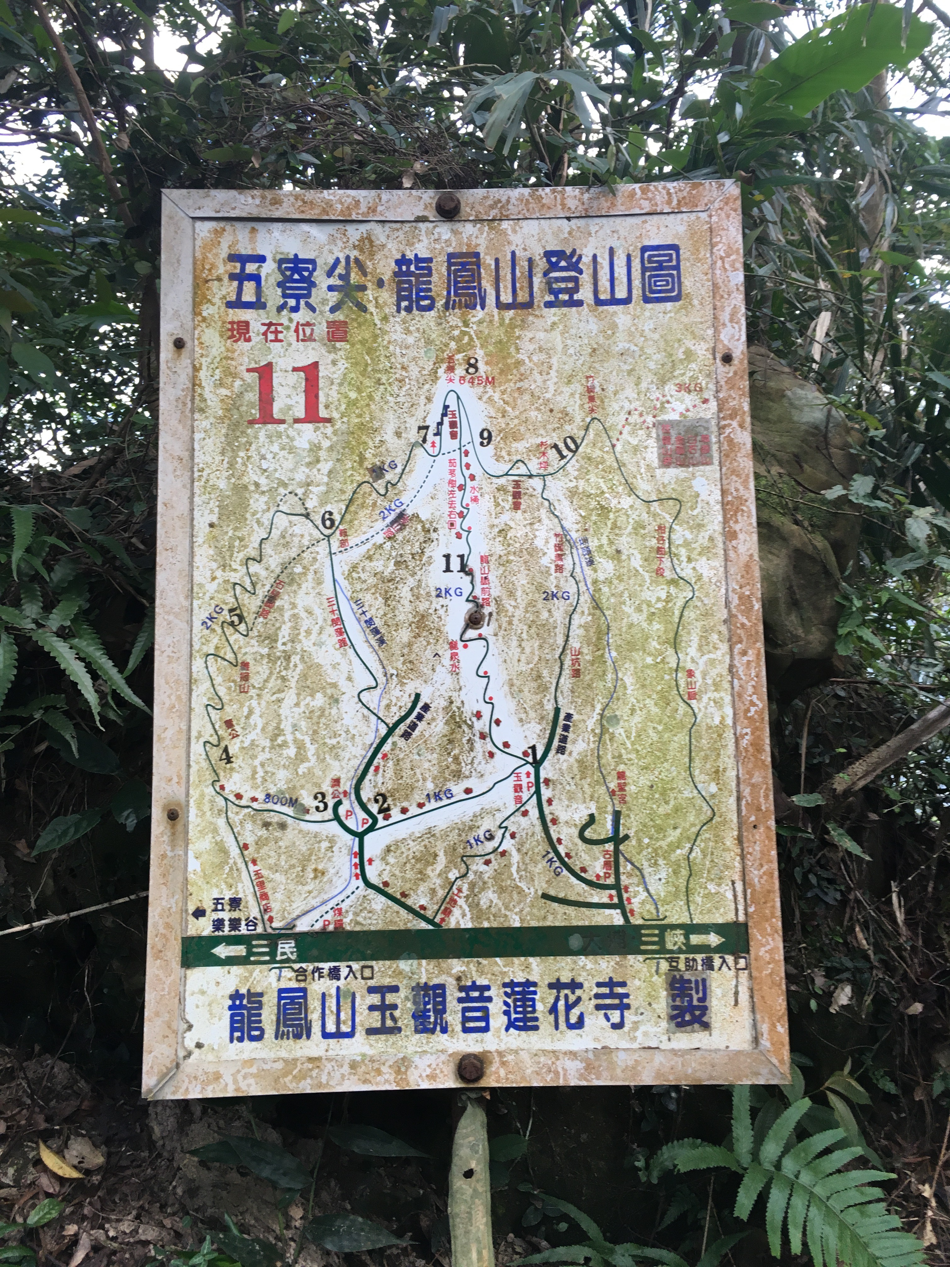
Luckily it wasn’t long before we reached the marker board at point 11. It still didn’t really explain how we’d done 7, 9, 8, 11 but at least it meant we were on track.

The path continues down with signs of construction on both sides. It was hard to tell if the projects we still being worked on or had been abandoned.
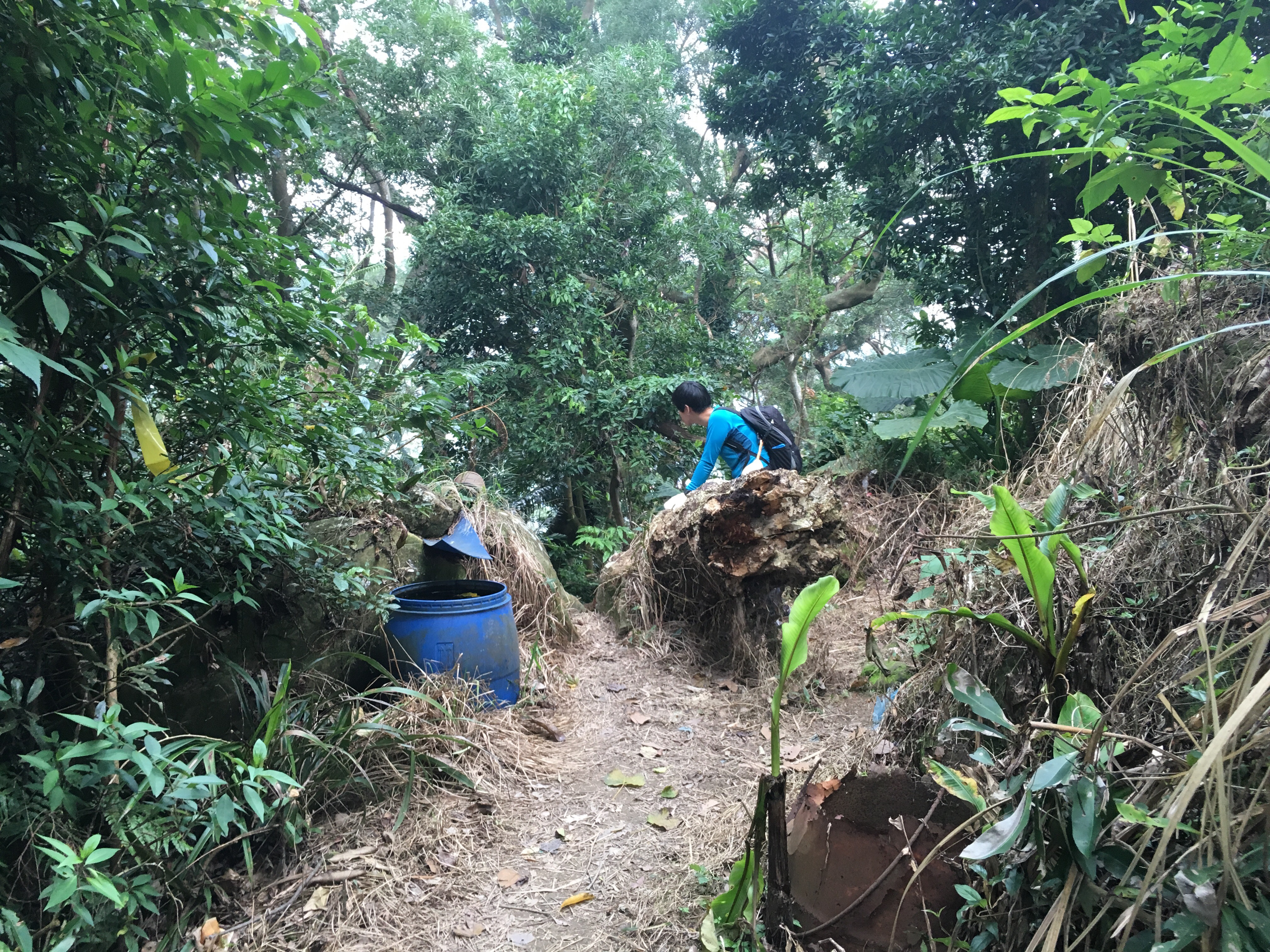
A little below the construction project on the right there’s a point where it seems you can go two ways. We went right-ish between the rusted barrel on the right and the blue one on the left.

There are signs of life on the way down, the cables overhead which were presumably used to pull up construction materials, cups left out by a tap.
The path is a little confusing when it gets to the pylon.
There are two paths, the right-hand one runs right past the pylon and into the trees, the left hand one goes down a little way before turning right, (there’s an offshoot on the left which we ignored). Anyway, they both join up after a short way.
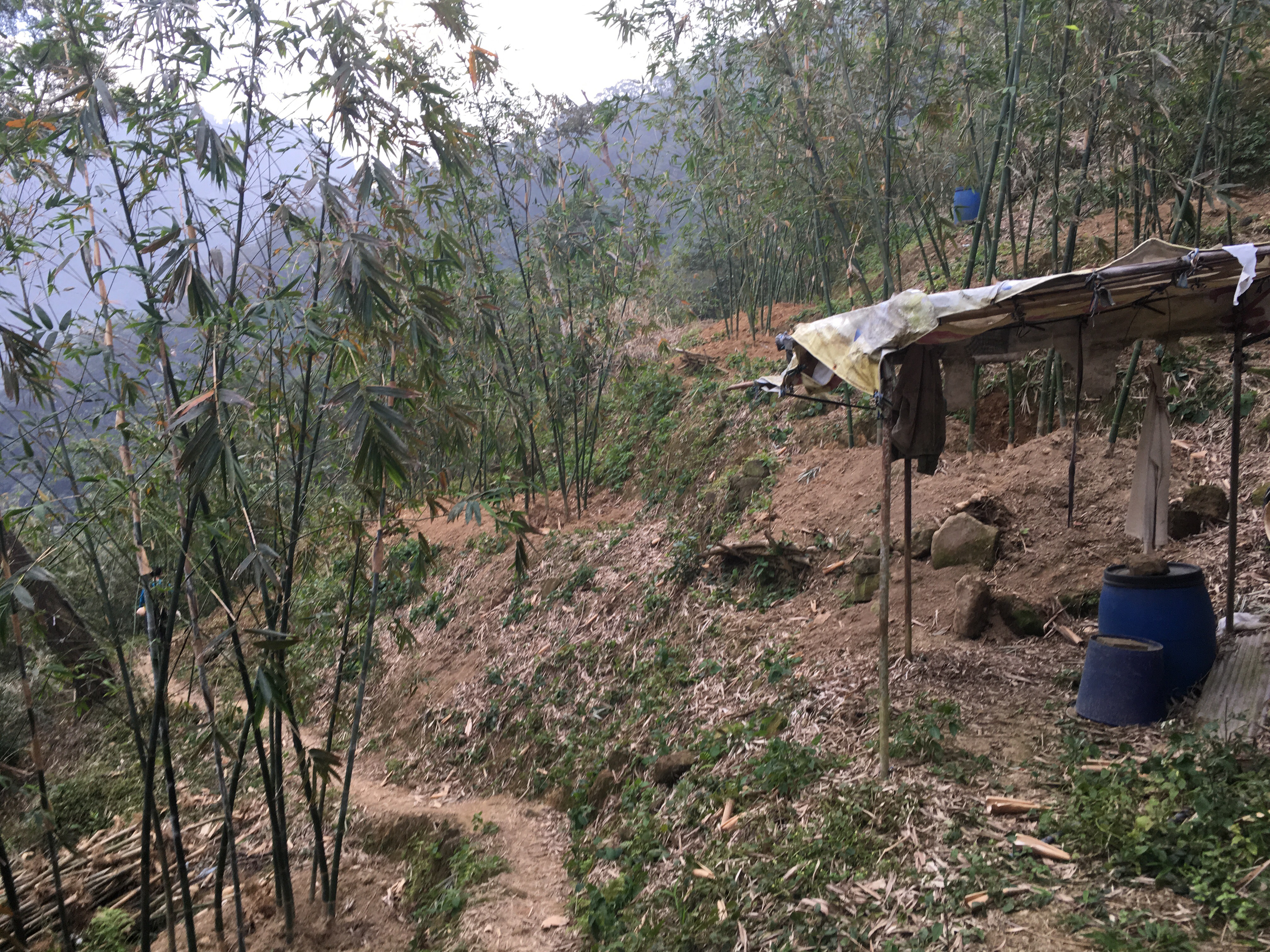
As the path got closer to civilisation we passed through bamboo farms and could hear the noise of the traffic on the road.
Strangely the paths here seemed to be a lot less maintained than the ones we’d been walking all day and there were places where you could that bad weather had damaged the path.
About 40 minutes after leaving point 11 we broke out onto the road. At the junction we headed left and down. The road passes small farms as it makes its way back to the main river.
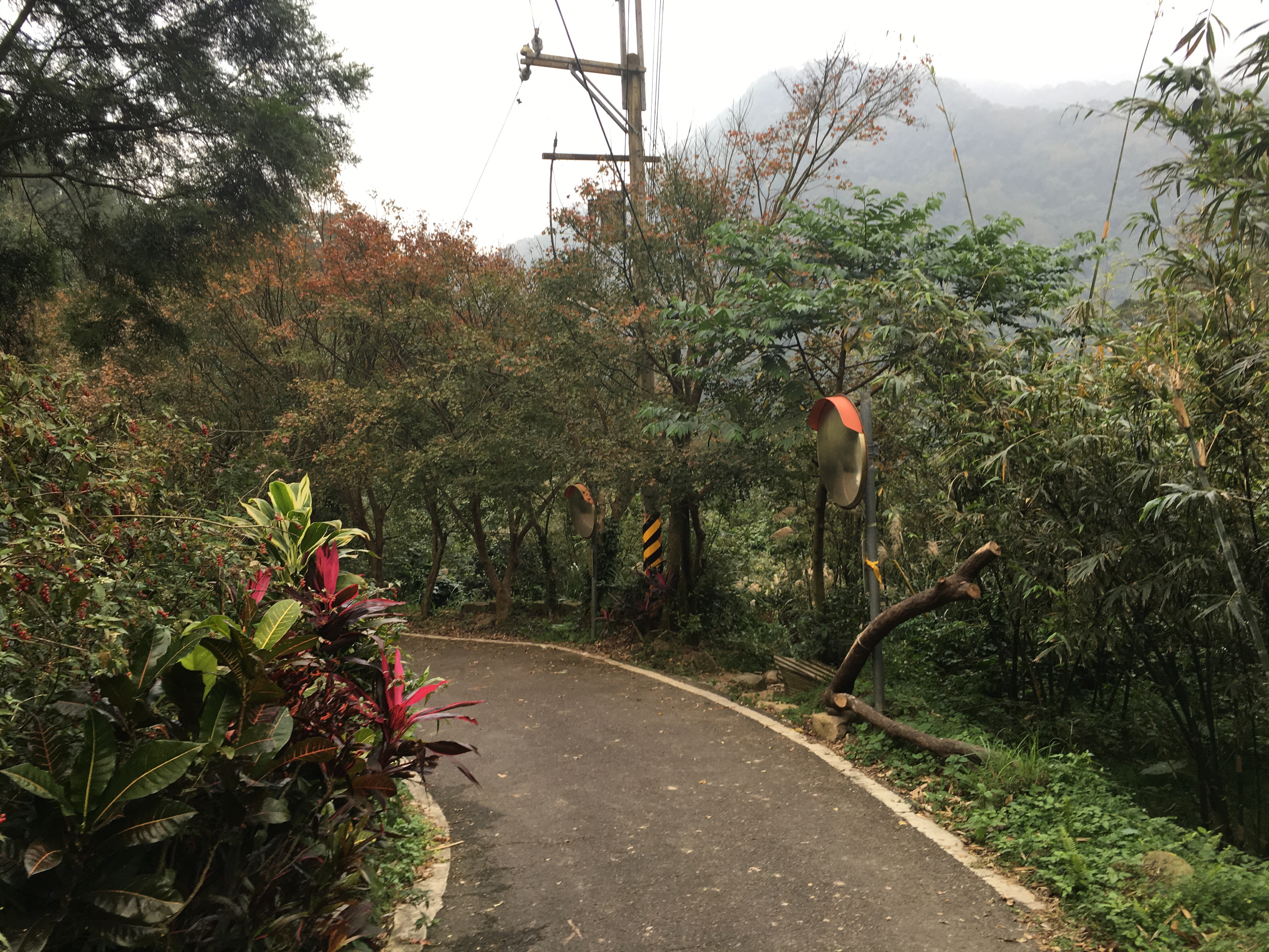
We took the path on the right between these two mirrors, it’s a shortcut which passes abandoned buildings to come out right next to where we parked the car.
How to get to Wuliaoijian
Google maps address: 237, New Taipei City, Sanxia District, Dabu Rd, 51號
GPS address: N24 53.065 E121 22.590
Public transport: there is an extremely infrequent bus service running from Da Ren La Da Yong Intersection in Sanxia District so you’d be better off getting there under your own steam or at least making sure you’ve got someone to pick you up at the end.
My new words learnt on this hike:
- 湯圓 / tāng yuán / rice balls, the small sweet things that are traditionally eaten on Winter Equinox
- 嶺 / lǐng / ridge
- 手套 / shǒu tào / gloves

Pingback: gao taishan, xiao-zhong-da dao tianshan (高台山 / 小中大島田山) | taiwan trails and tales
This is truly awesome!! My kudos to you and Theresa. Your blog should be a book!!
LikeLike
Thank you so much! It makes me really happy to think that someone has enjoyed reading this. There is already a guy who has made a book out of this kind of stuff, Richard Saunders of Off the Beaten Track, (his site is one of the ones I’ve linked on the reference page.) I hope one day that I get to visit half the places he’s been to but it seems that he’s always got somewhere new and exciting to explore.
How about you? Do you have any recommendations for good hikes around Taiwan?
LikeLike
Just completed this hike today after looking at this post!! Great pics and the hike was amazing!! Really enjoyed it!!
LikeLike
I’m really glad to hear that you enjoyed it. You must have had great weather for it yesterday. I wish I’d been there to enjoy it too.
LikeLike
Any permits to climb to have?
LikeLike
Nope, this one doesn’t require any permit. So far there is only one permit walk listed on this site.
LikeLike
Thanks
LikeLike
No problem. Let me know how it goes.
LikeLike
I loved this hike. Have you ever hiked with the Taipei Hikers group before? My fiance and I hike with them all the time to find new and interesting places around.
LikeLiked by 1 person
No, I can’t say I have ever hiked with that group. Actually, I’ve only ever done one hike in a group, (八唐縱走), I was somewhat unsure of how I felt about the experience. I would love the added security of being in part of a group, but as an introvert who deals with many people in my day job, I found it kind of stressful to spend my day off with other people. I know that I am making myself sound extremely antisocial, I promise I’m not really, I’m just worried that I would feel tired by needing to be sociable.
LikeLike
Thanks for the great review of the trail. I have a long layover in Taipei and I plan to make my way to the trail but have to be back in time for my flight… Thanks to your detailed notes and photos I feel confident that I can do it 😊
LikeLike
I’m really happy to hear it’s been of use to you. This would be an interesting way to make use of a layover.
LikeLike
Pingback: The Ultimate Guide to Hiking in Taiwan – Parkbus Taiwan
Pingback: The 2021 Ultimate Guide to Hiking in Taiwan – Taiwan Outdoors
Pingback: The top 5 things to do in Taipei | The Daily Navigator
Thank you Theresa’s friend (because I don’t think you have ever mentioned your name in all your posts)! I have been using your hiking posts for 6 hikes now and want to share my gratitude for your guides in making it possible to understand what kind of hike it’s going to be.
I must say (for other readers) that your hiking pace is not average haha so do plan in more time when you follow the guides or don’t expect rest breaks that are longer than 10mins.
Best advice from these guides: Start as early in the day as you can so you are not stressed by fading daylight and bring more than enough water and food, again so that you are not stressed when supplies are low. I once got lost and a 3hours detour depleted my water supply completely. Wasn’t fun.
LikeLike