(UPDATED SEPTEMBER 2023)
This was one of the very first walks on this site. It was published in 2016, meaning I must have walked it and written about it within a few months (or weeks) of immigrating to Taiwan. It feels like another lifetime ago! Since we found ourselves with a spare afternoon and a need to visit family in Taoyuan in the evening, it seemed like a good opportunity to pay a return visit and update some photos. (Well, quite frankly, this is an entirely new post, that old one was not particularly useful or well-written.)
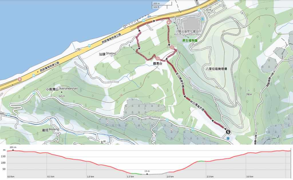
Distance: 3.6km.
Time: A very leisurely 1½ hours.
Difficulty 1/10 (regular Taiwan hiker): The only challenging factor were all the steps in the heat.
Difficulty 2-3/10 (new Taiwan hiker): It’s pretty easy. It is well-paved, there are not many places to go wrong, and there are adequate signs. The only difficult point is the steps.
Total ascent: About 180m.
Water: A single 0.5L bottle was enough, but there aren’t any places to buy water or fill up.
Shade: Some shade—OK for a mid-afternoon hike with sun cream.
Mobile network: Clear mobile coverage.
Enjoyment: This is more suitable for families or early morning health walks. There are a couple of nice views but compared to what else Taiwan has to offer it’s not hugely exciting.
Route type: Lollipop loop
Permit: None needed
Jump to the bottom of this post for a trail map and GPX file.

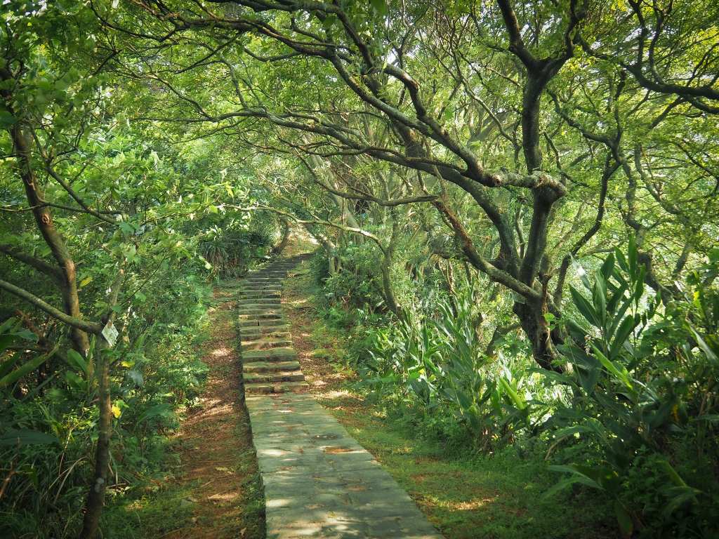
The walk starts from a muddy carpark on the industrial edge of Linkou. The start is marked by a map, a portaloo and two trail names. Characters on the wall call it Taiping Binhai Trail (太平濱海步道, also translated as Taiping Coastal Trail) and a mock stone stele says Huaijiu Historic Trail (懷舊古道). In the past, the path was used to connect villagers living in the coastal communities with those living up on the hill.

The first part of the walk runs alongside the edge of some factories as it winds its way slowly downwards.

But before long, we found ourselves walking through the forest with the sound of noisy grey treepies and cicadas making it necessary to shout a little to hear each other.

It seemed that we were visiting at peak cicada emerging season because everywhere we looked, there were piles of the dry exoskeletons littering the ground beneath each tree trunk.

Part-way down, the trail has to skirt around an old military bunker.

Then, not far beyond that, you get the first mostly unimpeded look at the ocean. The descent also becomes somewhat steeper around this point. On the coast is the unmissable sprawl of Taipei Harbour, and just inland is Bali Refuse Incineration Plant (the big tower).

The trail slopes gently again until it reaches some tall stands of bamboo, then cuts down some steps to a junction.

We took the left here, but you could just as equally go right. The route later loops back to this spot.

From a viewing platform a little lower down we got a closer look at the incinerator’s tower. Teresa found a selfie showing a much younger version of her and her mum at this very spot.


There are three more junctions. At all three, keep to the right (the side trails are all marked as not being exits).

When the steps reach a lane, turn right once more, then right again once you hit the main road. This is the main road running along the coast and it’s pretty busy, so you’ll want to make sure you pass carefully.


There are three more junctions. At all three, keep to the right (the side trails are all marked as not being exits).

There’s a toilet block beside a junction just a little way up the steps. At the junction, take the left-hand trail heading uphill.

While steep, the path here is quite pretty. There’s also another viewing platform (although the view is a little overgrown now).

Keep heading up following the signs uphill for Taipingling until you read the track.

If you’ve had enough of steps, you can follow the track all the way back up to the car park. As a shade seeker, I would rather walk up the steps than an exposed lane, so we turned right and cut across in front of some old mud-brick houses until we rejoined the path we’d been on earlier.

From there, it was just another 20 minutes up to where we’d started.

How to get to Linkou Taiping Trail
Google Maps address: If you’re coming by car or scooter, you can park here at the trailhead carpark.
GPS location: N25 07.483 E121 22.282
Public transport: This trail is accessible by public transport, but honestly, unless you’re living in Linkou, it probably is not worth the effort. It is only served by the F235 bus, which runs from Linkou, stops close to the top of the trail, then again at the bottom end of the trail before turning back around and returning to Linkou.
Nearby trails:
Linkou Taiping Coastal Trail Map
GPX file available here on Outdoor Active. (Account needed, but the free one works just fine.)
If you enjoy what I write and would like to help me pay for the cost of running this site or train tickets to the next trailhead, then feel free to throw a few dollars my way. You can find me on either PayPal or Buy Me a Coffee.
