
Distance: 2km to the waterfall and back, 4km if you do the round trip to the top of the mountain.
Time: An hour to the waterfall and back, two hours if you continue up to the top. Add extra time if you plan to enjoy a paddle in the water.
Difficulty (regular Taiwan hiker): 2/10 – Not difficult, just a little awkward to get to.
Difficulty (new Taiwan hiker): 6/10 – Up to the waterfall the path is a mixture of paved and large boulders, beyond the waterfall there’s a little bit of a steep scramble and lots of steps. Having said that it really is very short.
Water: 0.8L
Shade: The first third is a little exposed but after that there are plenty of trees to shade you.
Mobile network: Poor, unavailable for most of the walk, the only time I had good signal was at the very top.
Enjoyment: A great mix of slightly challenging walking and rewarding scenery.
Trail map and GPX file available here.
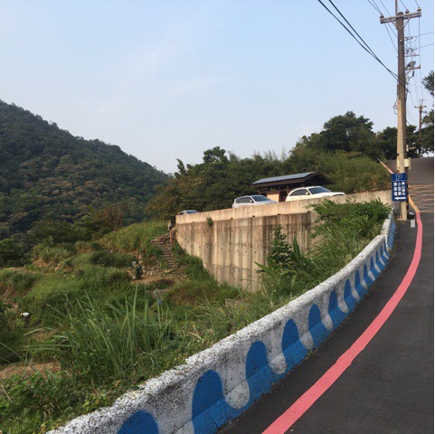
At the car parking area you’ll find toilets, best to make use of the facilities before you start walking as there’s nothing else on the trail.
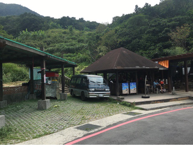
At the trail-head you’ll find a few small huts, we went on a weekday so there weren’t many people, just an old man selling his produce but the bottom half of the trail is dotted with small shelters so if you go at the weekend you’ll probably find lots of farmers selling their wares.
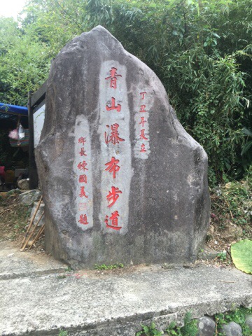
There’s a big trail marker just the to the right of the huts and behind it you’ll find a map.
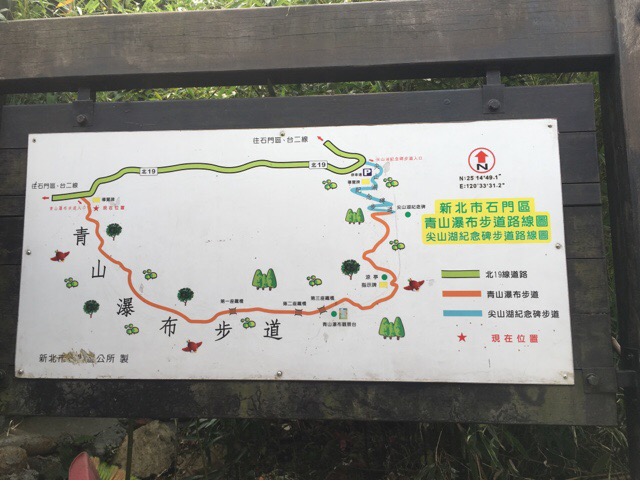
The map doesn’t have any English but you’ll find it pretty easy to see where you’re going, there are a few smaller paths detouring off the main trail but just stick to the main path and you’ll be fine.
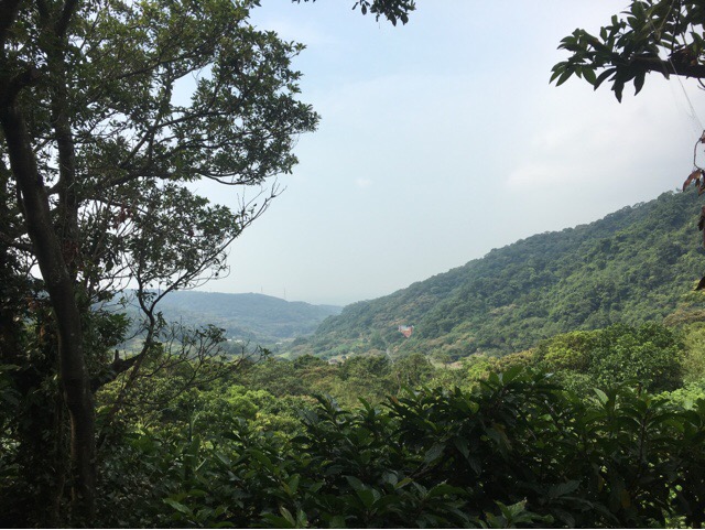
If you look to your right as you climb you can catch a glimpse of the lower valley before the forest swallows you up.
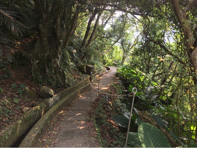
The first section of the path is easy underfoot and the small water channel on the left burbles enticingly leading on to its source.
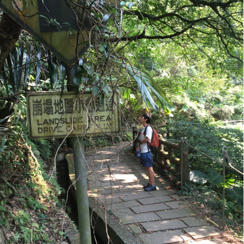
You’ll see a few signs of recently fallen rocks as you meander along the path, although I was more concerned by the idea that anyone might try to drive up here.
This is the first point at which you get close to the river, the real path goes up off to the left of this photo but it is hard to ignore the call of the water.
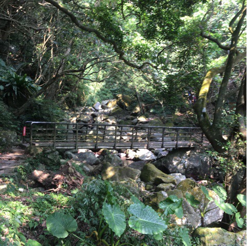
This is the first of three bridges you’ll encounter before getting to the waterfall.
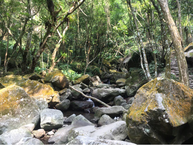
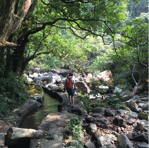
From here to the fall you’ll follow the boulder-strewn path along the edge of the riverbed. The landscape here truly is breathtaking, this large, glacial valley gives you a real sense of nature’s power and the huge, moss and lichen covered rocks speak of the vast amounts of time that has passed since they were deposited there. I truly love walking in this kind of ancient environment, it lets me feel connected to history in a way that looking at artefacts in a museum never can.
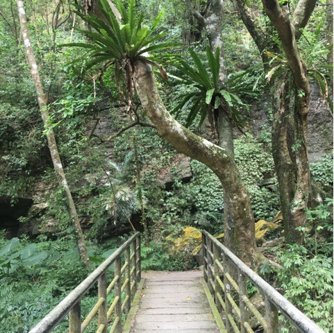
The next bridge, there’s one more just a little further up.
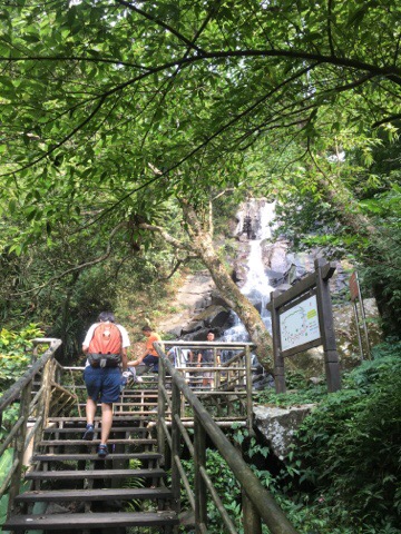
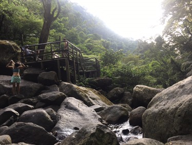
Scaling the viewing platform at Qing Shan waterfall.
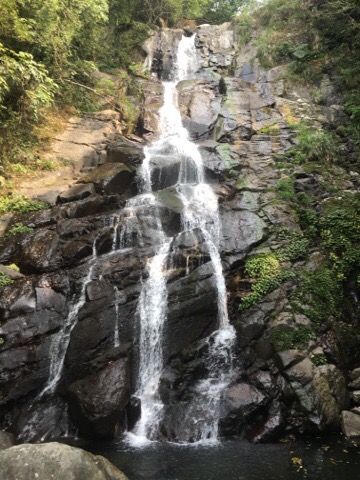
We only stopped briefly to enjoy the sights and sounds before heading on up. As can be seen from the first picture on this post there were quite a few people enjoying the water but as soon as we continued the climb we had the trail all to ourselves.
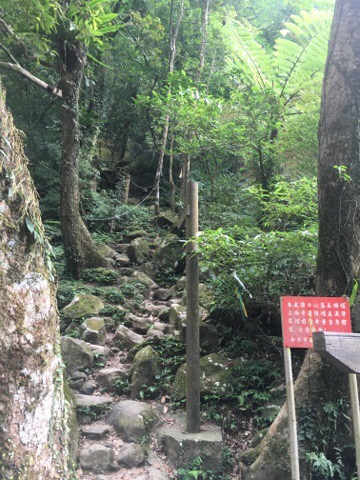
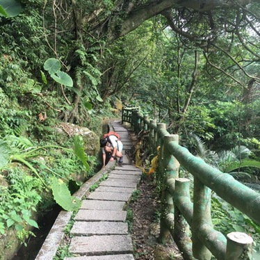
The path leading up from the waterfall starts as a bit of a scramble. It’s not too tough but you need to be a little more careful.
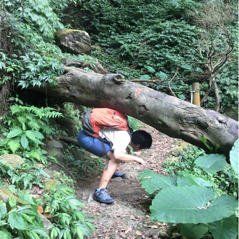
At one point there is a tree which seems to have fallen and then continued growing across the path.
From here on up the path is roped most of the way.

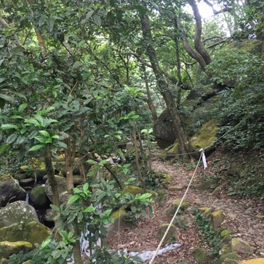
The landscape here is truly beautiful and with less people walking this section of the trail we were free to enjoy the tranquility.
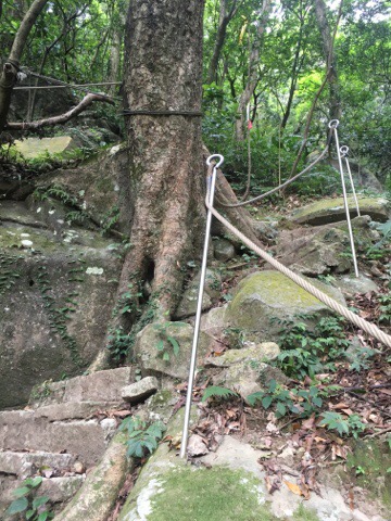
The steps get a little steep at points, take it slow and use the rope to help if necessary.
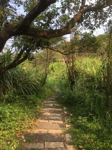
As you reach the top the path flattens out some and the ground is covered with lush grasses. This is also pretty much the first time that I had cell reception since leaving the car park.
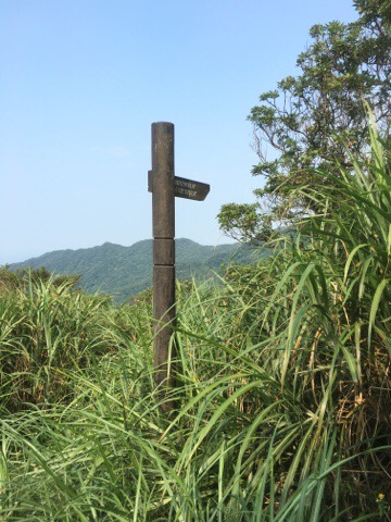
At the top there’s a sign directing you to Qing Shan lake, it’s really close, only a couple of minutes walk but the path was really over grown and as one of us was only wearing short trousers we decided to call it a day and head back down. The steeper bits required a little more care on the way down but it was pretty easy given that most of it was just steps.
When we arrived back at the main waterfall there were fewer people around and we decided to cool off by dipping our feet in.
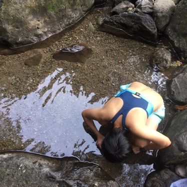
After sitting on the rocks with our feet in the water for a short while we became aware that the small pool was teeming with life, two types of tiny fish and lots of freshwater fish were eating the algae which was growing on the stones. This led to a fun half hour spent catching shrimp with our hands and transferring them (gently) to a finished water bottle.
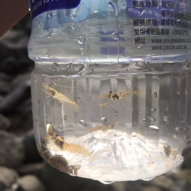
Some of the shrimp we caught before we let them go again.
Walking back towards the car we discovered yet another use for an empty water bottle, we played a one-stick version of pooh sticks and let our mini bottle/boat sail down the water channel next to us. I am certain that any child would find this as thrilling as we did, just remember to pick up your bottle and take it home with you to recycle.
How to get there
Car or scooter: google maps address:青山瀑布步道 北19, Shihmen District, New Taipei City 253, Taiwan
It’s about a 20 minute drive from Tamshui so you could get a taxi to take you but getting back would be harder.
Public transport: Take the MRT to Tamshui (淡水) station and from there take bus 867 towards Sanzhi/Shimen/Jianshan (三芝/石門/尖山). The bus stops at Laomei (老梅), and from there you can walk up the road for about 5km to the trailhead. If you do this you need to count the road signs telling you the distance, shortly after 4.5 there’s a light blue bridge going off to the left and the trail starts a little way up that road – there’s a sign there telling you which way to go.
My new words learnt on this hike were:
- 螞蟻 / mǎ yǐ / ant
- 農地 / nóng dì / farm, farmland
- 山谷 / shān gǔ / valley
- 山頂 / shān dǐng / mountain top
- 湖 / hú / lake
- 蝦子 / xiā zi / shrimp
- 抓 / zhuā / catch (with your hands, like we caught the shrimp), grab
