Distance: 6.8km
Time: 3-4 hours, fast walking without breaks will be doable in three hours, four hours is a little more leisurely but start early and allow extra time if you plan to check out the museum at the bottom.
Difficulty (regular Taiwan hiker): 1/10 – just quite a lot of steps, this is tiring on a hot day, but otherwise ok.
Difficulty (new Taiwan hiker): 4/10 the route is almost entirely paved which means that it’s easy underfoot but it’s also almost entirely uphill or downhill without much flat walking to catch your breath.
Water: 1.5L on a hot day.
Shade: 50/50 the upper portion is quite exposed but the lower down you go the more forested the route is.
Mobile network: mostly ok, patchy in a few areas.
Enjoyment: I don’t mind steps so it was fine for me but not everyone feels the same. Also better if you time your return to the top to coincide with sunset.
A map and GPX file can be downloaded here on Outdoor Active. (Account needed, but a free one works just fine.)
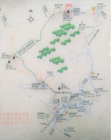
Mount Wu Fen hiking trail follows the green line on the above map, (the map can be found at both ends of the trail). We started our hike from the top of the mountain, walked down to the coal mine museum and then up again but it would probably be easier to do it the other way round or even stop halfway as long as you have someone to pick you up at either end.
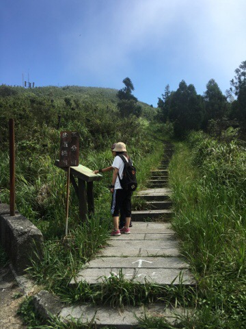
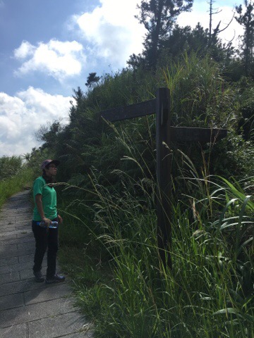
There’s a sign board at the trail head.
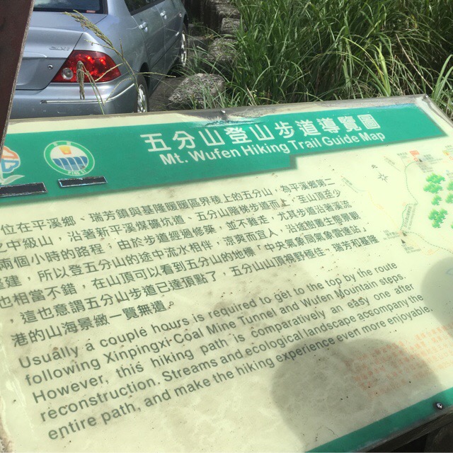
It gives a little detail about the walk your about to do. You can see the same information at several points along the route.
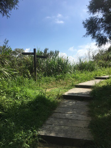
Going left will take you up to the weather station, follow the path to the right to keep going.
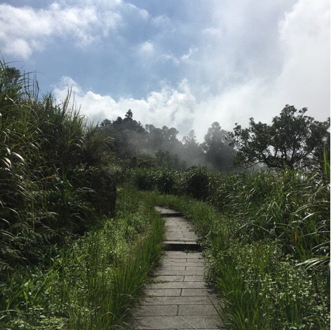
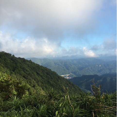
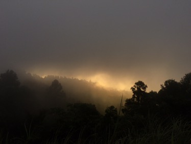
I love hiking where the clouds brush over the ridge you’re walking on, it’s wonderfully refreshing on a hot day.
This is about the only time when the view opens up to show you where you’re headed next.
Another potential diversion, stick to the paved path.
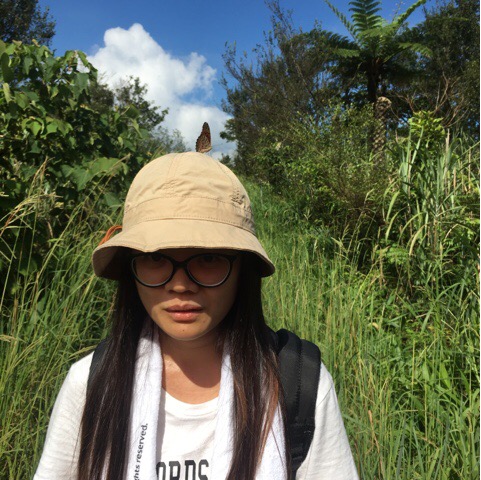
We encountered lots of small wildlife on this route including this especially friendly butterfly.
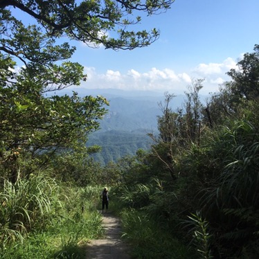
From here it’s steadily down all the way.
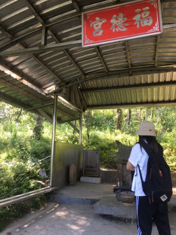
A little over halfway, (sign to the bottom says 1000m and the sign to the top says 1700m), there is a shelter and small shrine to Tudigong.
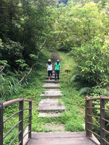
Continuing down we started to cross small streams.
We also came across evidence of the lanterns released from nearby Shifen and Pinxi.
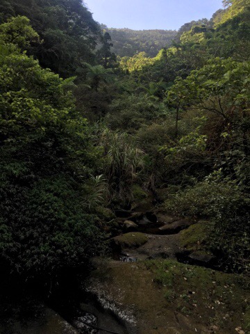
Towards the bottom there was beautiful, rich, lush forest. The variety of greens to enjoy is amazing.
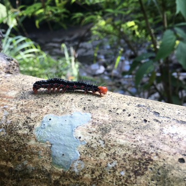
We also saw quite a lot of different caterpillars.
This was the half-way point for us but it would be the start of the trail if you were parking at the coal mining museum and going up.
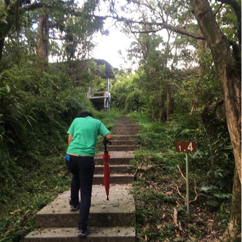
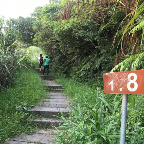
Going up the distance markers suddenly seem more important! At 1.4km is the first place to sit and take a break.
Back in Tudigong’s temple.
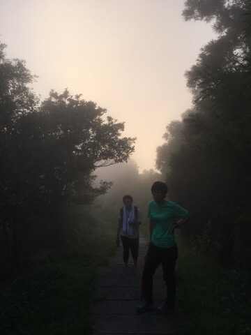
Walking the same route in both directions means that you get an opportunity to see things you missed first time.
Just around the bend from here there is another shelter on the left. By this point we really needed to keep going as we were aware that time was getting a bit short and we wanted to reach the top before sunset.
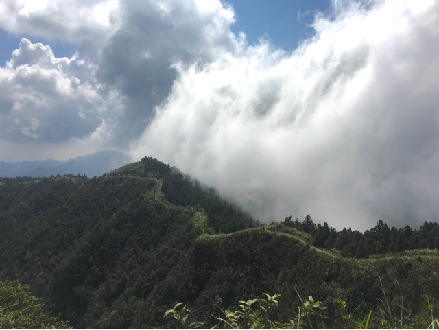
Just as we neared the final shelter the clouds surrounded the mountain tops and the sun started to go down. It was absolutely beautiful.
The last leg of the ascent, the clouds provided much welcomed cooling after a steady 560m climb.
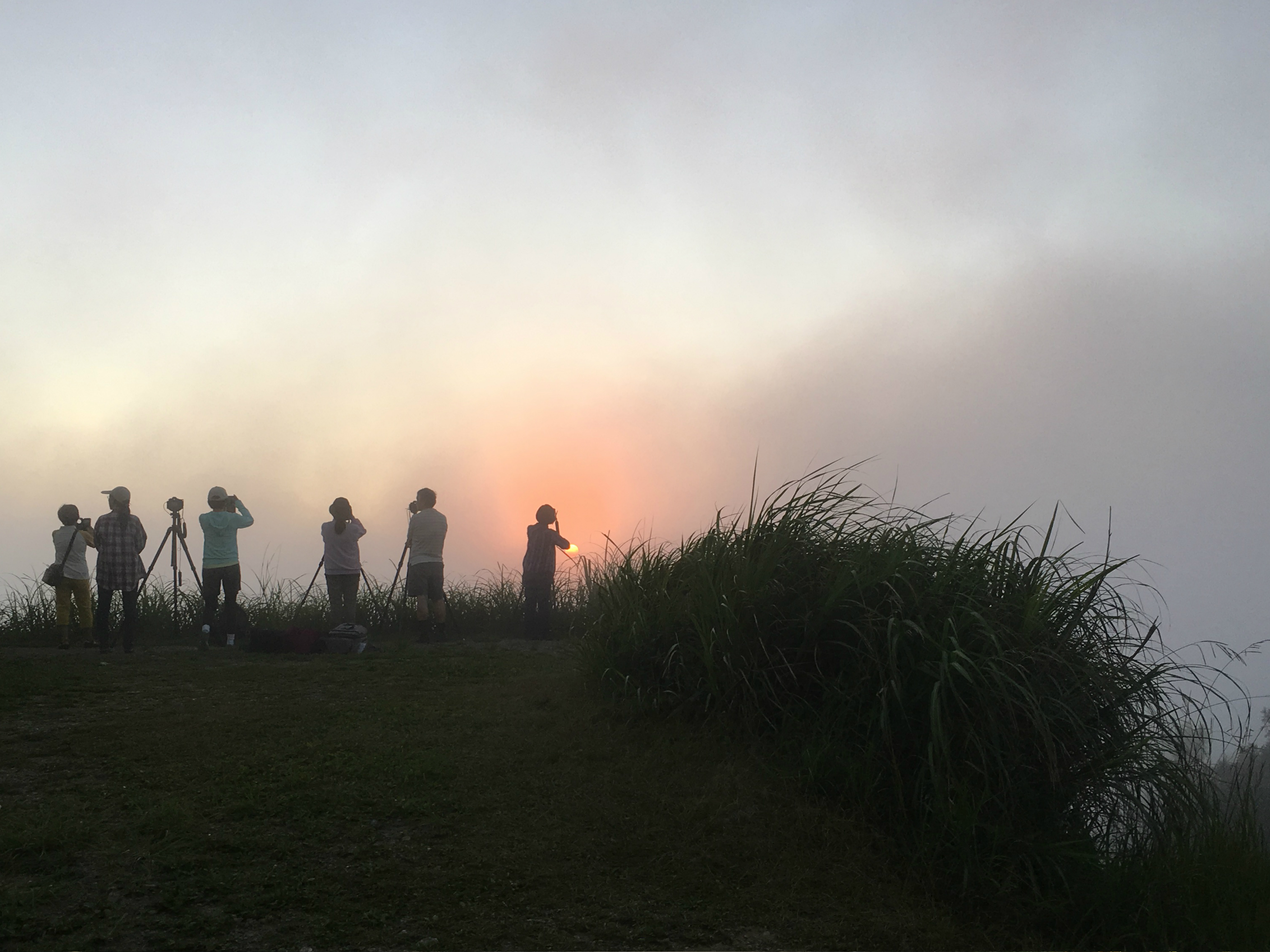
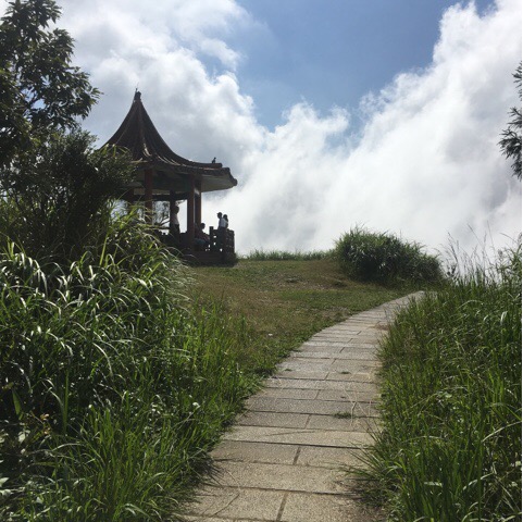
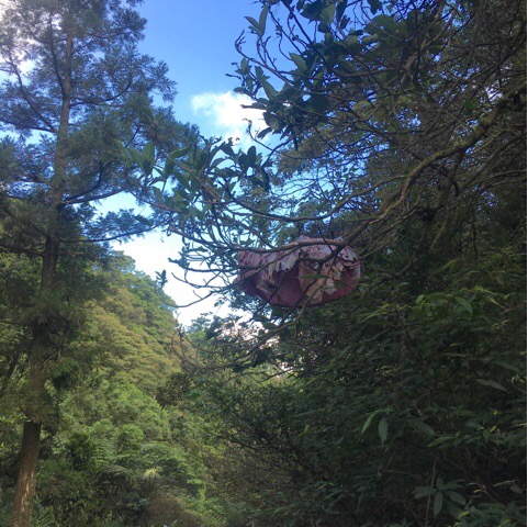
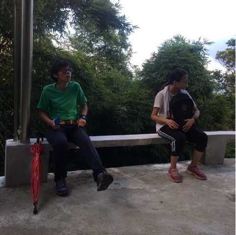
To the left of these photographers is the shelter/pavilion seen in the first photo of this blog and just a little further along the trail is the road where we parked. By the time we returned to the top many people had gathered to watch and photograph the sunset.
How to get to Mount Wufen
Car or taxi:Wufenshan Weather Radar Station, No. 1, Lane 1, Section 4, Jing’an Rd, Ruifang District, New Taipei City, 224 / 新北市瑞芳區靜安路四段1巷1號(五分山氣象雷達站)
You should be able to get a taxi to the top or the bottom from nearby Shifen.
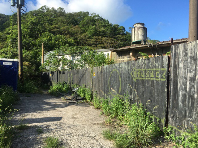
Alternatively, you can start from the bottom next to the museum and walk up and then down. If you’re coming from Taipei (via Freeway 1) Shifen Coal Mining Museum is the first left turn off Provincial Highway 2. The car park at the bottom looks like nothing and you can’t drive your car to the start of the trail, you have to park it first then walk towards the museum and trail.
Public Transport: Getting here by train is a little bit more complicated and you would have to make multiple changes. Coming from Taipei you would need to first catch a train to Ruifang (瑞芳), then get out of the paid ticket area to buy another ticket. In Ruifang buy a ticket to Shifen (十分). You can either buy a return to Shifen or a day pass for the Pinxi (平溪) line, the day pass would be better if you plan to visit other places but if you plan to tour the area you’ll need to leave Taipei early to get it all done within the day. You’d also have to do the walk in reverse, walking up from Shifen and then back down.
My new words learnt on this hike were:
- 蚱蜢 / zhà měng / grasshopper
- 蝴蝶 / hú dié / butterfly
- 毛毛蟲 / máo mao chóng / caterpillar
- 天燈 / tiān dēng / lantern (the giant kind like you can see in Pingxi, the Chinese actually means sky light but apparently that’s what they’re called)
- 蛇 / shé / snake
- 蜻蜓 / qīng tíng / dragonfly
