RAKNUS SELU TRAIL – SECTIONS RSA52, RSA48, and RSA49
There are two options for walking day 11 and 12 on the RST. One of those cuts through the strawberry-field-filled valley around Nanhu and follows Laoguanlu—the region’s old military and trading route. This is part of the alternative option which takes the high road and goes over the hill instead. Since I’m the type of person who feels like I have cheated myself if I don’t do anything to completion, I walked both versions. However, if you only plan to walk one, I would suggest doing this version. Both this day and the next had long and pleasant stretches of trail that were quiet, peaceful and easy to follow, and the overnight stop at Ginger Garden was a really lovely pause along the way.
RAKNUS SELU STAMPS: There are two RST stamps along this section.
- RSA49: This one is kept in the covered decking area of a leisure farm just above Shifendong Tea Pavillion. The farm wasn’t open when I passed through, but the stamp is just kept out in the open.
- RSA50: This one is located inside the shop/visitor centre at Ginger Garden. This place is open 8am-5pm daily.
DISTANCE: About 19km.
TIME: 8-9 hours – It took me a little over eight hours with lots of pauses to look at interesting things.
TOTAL ASCENT: Around 1,200 metres, although since plenty of that was done on roads, so it wasn’t as tiring as it might sound.
DIFFICULTY (REGULAR TAIWAN HIKERS): 4/10 – For someone familiar with Taiwan’s trails, this walk does not have any particularly difficult sections. In fact, aside from one or two brief slippery spots with ropes, the walking is pretty easy. However, the length, risk of running into dogs, and fact that this walk either has to be done as an overnight trip or with your own transportation at both ends makes it a little harder. In light of this, I’d say this walk belongs either at the harder end of easy or the easy end of moderate.
DIFFICULTY (NEW HIKERS): 7-8/10 – For new hikers new to Taiwan, all the above makes this a moderate to difficult walk.
FOOD, DRINKS & PIT STOPS: There are no places to pick up refreshments aside from at the start and the end of this walk. Make sure you have everything you need before you leave the FamilyMart at the start of this day’s walking.
TRAIL SURFACES: Two-thirds dirt trail, one-third road.
SHADE: The road section would be very exposed on a sunny day. In fact, even in very overcast weather, I got a little bit of a burn from the UV, but my skin is irritatingly sensitive to sun.
MOBILE NETWORK: Mostly ok with a couple of weak spots.
SOLO HIKE-ABILITY: The walking on this section is perfectly suitable for solo hikers. The biggest risk is running into territorial dogs.
OTHER: Softer-soled shoes will help keep you comfortable on the long road kilometres.
SECTIONS COVERED:
- RSA52: Chuyun Historic Trail → Fayun Temple → Old Provincial Highway 3 → Nanhu (出雲古道→法雲寺→舊台三→南湖)
- RSA48: Chuguan Historic Trail, Yundong Section (出關古道-雲崠段)
- RSA49: Chuguan Historic Trail, Shifendong Section (出關古道-十分崠段)
Jump to the bottom of this post for a trail map, GPX file and all the other practicalities.
DETAILS & DIRECTIONS:
07:30 – I left the bus at Fayun Temple stop about 40 minutes after leaving Miaoli, and headed into FamilyMart to get breakfast and provisions.


07:45 – Suitably fuelled, I set off. From the FamilyMart, you’ll need to cross over Provincial Highway 3 and walk over Bi’an Bridge. The lane takes you through a couple of strawberry farms, and even at this early hour, they were getting ready to open. At the next junction, turn right and head uphill towards Fayun Temple. At this point, I was recovering ground that I’d walked on an earlier part of the RST. On that occasion, I’d walked over from Chuhuangkeng to Fayun Temple and then on to Nanhu.


08:01 – I had somehow forgotten just how long the road up to the temple is. I swear it just took me five minutes to walk down, but walking up took nearly fifteen. Turn left off the road and climb up the steps through a couple of archways leading to the temple.

A couple of nuns were pottering around doing their morning stuff.

On this second visit, the scenery was cool and gloomy with a low-hanging ceiling of cloud beheading the mountains that had been visible beyond the farm scenery on my last visit.


And over towards the Dahu Land Reclamation Memorial Stele (大湖開闢紀念碑), there were both monkeys and cats staking out their claims to different spots.

The Dahu Land Reclamation Memorial Stele (as I found out while writing about the alternative day 11 route), was erected in 1917 to commemorate brothers Wu Dingxin (吳定新) and Wu Dinglian’s (吳定連) role in “opening” the Dahu region.
It’s probably a good idea to make use of the temple’s toilet facilities before you go any further because there aren’t any more toilets for quite a while. When I was in there, another hiker came in and told me how terrifying all the monkeys were.


08:15 – Head beyond the memorial stele, then through an arch. Beyond that, the way is a little unclear. You need to head up this road past an old shower block that’s been converted into a storehouse, then you should see this row of toilets leading away into the woods.

Soon, I found myself back at the junction that had brought me to Fayuan Temple a week earlier. The paths to both left and right are part of the RST. Right heads over to Chuhuangkeng, but to end up at Ginger Garden, you’ll need to head left.


Almost straight away, the trail feels peaceful and relaxing. The greenery is mixed, but with lots of bamboo, and for a while, there are partially obscured views to the left. There was also a lot of fresh monkey poo on the ground.

Someone has carved several tortoises on trees along the trail.


08:30 – Turn right at this first junction, away from the majority of the hiking tags, they’re directing people to Yunu Shan (玉女山). Then, after a short distance, take a left.

Beyond that junction, the trail passes through bamboo forests filled with slender stems—scenery that would be repeated at several points throughout the day.

08:41 – A sharp left turn up a bank and a ropey scramble mark the start of the next phase of this walk. It’s not exactly that it gets much harder, but it’s clear that this trail isn’t as frequently traversed as what I’d been walking on minutes earlier.

08:45 – I found myself skirting round an electricity pylon that was humming slightly in the damp air.

08:56 – The path passes under and straight through the second pylon (no.151).


Tung tree seed pods and deer poo. I had already passed several muntjacs, so it wasn’t a surprise to see this.

Where there isn’t so much bamboo, the path is this type of pretty and mixed forest scenery.


09:13 – By a boundary marker, the trail crosses straight over another path that doesn’t show up on my map. As I crossed over, the sound of firecrackers erupted far off in the valley below.

09:16 – Beyond the boundary marker junction, the trail becomes broader, and slopes down to a T-junction where the RST veers to the left.

09:26 – The trail crests a hill around the 2k+600 marker and heads straight over past another unmarked trail on the left.


09:34 – The path veers just left of a clearing full of cypress trees that were either a different variety to what I’m used to or else had been treated in some way that made them split into multiple trunks. A dozy muntjac ambled away without noticing me…until it did and let out a startled squawk. A short while later, the path turns left onto an old farm track and begins to head downhill.


Stay on the main track the whole way down. It in doubt, just keep an eye open for the RST trail signage and other hiking tags. While walking this section, I learnt that wind grazing the tops of betel nut trees (aka areca palms) sounds uncannily like rain in most other types of forest.

A clutch of the fallen nuts – I don’t think these are being harvested by anyone anymore.


09:53 – After passing through some open gates, the track winds past some abandoned buildings.

And just a short distance further, you get a clear view over towards Nanhu.
As the trail drew close to the road, I disturbed a hawk from its roost on a dead tree, which in turn caused a chorus of alarm calls to erupt the beaks of many small birds in the vicinity.


10:03 – The track passes a cluster of small houses with rows of near strawberry and dragonfruit plants. Then after crossing Qiongjiaokeng Creek, you need to turn right onto the road and head uphill again. There’s a coffee shop here that I would have paused in had I been a little further along with the day’s walking.

The road switchbacks its way up past a handful of farmsteads, and my passage set off a chain reaction of guard dogs barking their loud protest.


10:38 – An exploratory oil and gas extraction site in the middle of nowhere. This one is marked as being CHK 137/138 W. This was the first of several such sites I’d pass along the road.


10:55 – Take a sharp turn to the left here and double back on yourself.

11:02 – There was a lot going on at this junction. First I noticed another gas and oil extraction site, then seconds later, a pair of territorial dogs started barking at me. I could tell by the way the hair on the ringleader’s hackles were raised that he meant business. The black and tan one got a little too close for comfort, but stuck to barking without rushing me at all. Thankfully, the RST signage makes it easy to see that the trail follows the road left around the oil and/or gas field so I didn’t need to faff around figuring out where to go. Without turning my back to the dogs, I edged around the bend. They followed me for another 50 metres before deciding I’d gone far enough to no longer be a threat.


An interesting formation of shale (or mudrock) and something that is probably related to the region’s gas and oil extraction past.

11:25 – Take the left fork at the junction, signposted as going to Fuyang Temple (福勇祠).

11:29 – The dogs from the farm opposite Fuyang Temple loudly expressed their displeasure at my presence but didn’t come close.


11:31 – Head left uphill at this junction. The road climbs up past a tiny wayside shrine where I met a man eating an orange, then it climbs further to another gas site. I would have paused to photograph the shrine but his scooter was parked in front of it and I got slightly sketchy vibes from him so I didn’t want to give him any reason to engage me in conversation (he’d ridden past me twice already and that never feels good as a lone female hiker, even when people are probably just out there minding their own business).


11:40 – The track climbs to a three-way junction. As I was looking at the view, a farmer in a blue truck rocked up. He WOULD NOT accept that I wasn’t lost despite my pointing out the bright RST signage literally right beside the trail. He seemed highly skeptical of my plan to arrive at Shifendong Tea Pavillion, so thank god I didn’t tell him that my actual destination was quite a way further over at Ginger Garden. He insisted on giving me directions but then didn’t move until I moved, which was awkward because we both needed to head up the same narrow road. The RST heads up to the right here.
Pass two homesteads. The second one was the destination of my unwished-for knight-in-a-blue truck. It transpired that either he or his brother lived here with a whole pack of guard dogs, so I guess he probably has encountered a fair amount of bemused hikers. His friend/brother also came out and expressed distress at my plan to keep walking despite obviously being lost (“there are so many unmarked junctions!”). In the end, I told them I’d walked to this point from Taoyuan without getting lost (true, although not all in one go), and had downloaded a GPX route, and these two facts seemed to pacify them somewhat.

They did, however insist on gifting me a bamboo stick, telling me, “There’s a fierce dog ahead. Take this.” I didn’t encounter the dog, but if you pass their house without them being there, you might want to be wary. There were at least four dogs, one of which came at me noisily, but not aggressively.

11:46 – Take a sharp right downhill. There’s no RST signage here at present, so I had to refer to my map.


11:54 – At the next junction, the RST ploughs straight ahead and into the trees. Then, after about five minutes, keep right at the fork and follow the track past another small patch of farmland before looping back around to climb again.

12:15 – After cresting a hill, I found myself descending through more strawberry farms and one of the horrible motion-sensitive bird scares startled me when it emitted the tinny sound of a car horn. Turn right when the path hits the flat, then go with it as it curves to the left.


12:22 – The stamp for RSA59 Is kept in the covered decking area of a leisure farm just above Shifendong Tea Pavillion.

The stamp shows a Taiwan whistling thrush, although it doesn’t capture this bird’s full charm. If you ever get to see this endemic species, you’ll notice it’s a stunning, iridescent blue. However, they are more commonly found lurking in dark streambeds where the gloom doesn’t show them at their finest. (Stamp on paper because this muppet here forgot to take the RST trail passport.)


I also met a quartet of hikers sheltering from the cold and the wind inside Shifendong Tea Pavillion. They’d paused for lunch and got tea after walking over from Ginger Garden and intended to walk back the same way they’d come. They invited me in to share some tea with them, but I was in a solo mood, so I thanked them and kept moving. This building was constructed in 1923, but the location had been an important one for cross-township trade for even longer.

During the Xingfeng and Tongzhi eras of the Qing dynasty (so around 1850-1875), this saddle became the primary resting point for travellers crossing from the coastal regions into Dahu Township. Salt from the coast and agricultural products live pickled bamboo passed through here (and the three other pavilions that used to exist along the way).A mural on one of the walls beside the road depicts travellers carrying their produce, and the structure is now preserved as a grade 3 national monument.

12:32 – The RST continues more or less straight over and on from where it joins the road. It’s well-marked with signs and a big map.


12:36 – Take a left turn up a track next to this really cute fingerpost replica of the tea pavilion. (Keep to the track, ignoring a turn-off to the right.


12:42 – Just past a holiday house, take a right turn. Then a couple of minutes later, I took a brief detour to visit this relatively new-looking land god temple. (A plaque on the side told me it had been rebuilt in 2004.) From this point on, the weather took a turn for the cooler, damper, and gloomier.


13:02 – Look out for these steps on the left side of the trail. The RST heads to them and around the edge of some cleared terraced farmland.

Judging by the moss-and-lichen-patinaed quality of the plants, trees and fence posts, blankets of clouds are a common feature of this region’s micro-climate.


13:09 – An information board beside a rock face says that locals call it Dongpo Pork Cliff (東坡肉岩壁). Dongpo Pork is a way of serving pork belly in braised cubes with layered gelatinous skin, fat and tender meat. The square holes seemingly cut from the rock face show layers of shale and sandstone and look like a giant has taken two huge portions to stew in braising spices. A more mundane explanation seems to exist in the fault line that zigzags through the rock.


13:16 – The trail briefly joins an old farm track. Turn right onto the track heading up to Luzaiwangfeng Viewing Platform (鹿仔望峰觀音台). There was absolutely no view.

Despite the gloom, the forest felt lively and still welcoming. Sometimes woods like these have a heavy atmosphere, but this one was light and lively with lots of chirruping birds.

13:27 – The summit of Mount Luzaiwangfeng (鹿仔望峰) is a small clearing which may or may not have views in clear weather. However, as with the viewing platform of earlier, by this point, the cloud had really settled on the hills and all I could see was a wall of white.


There are two peaks and one more high point along this ridge line, so the path does a lot of dipping and climbing. Luckily for me, the cool weather was perfect for this type of walking, I was able to stay comfortably warm as long as I kept moving. Details like this narrow cutting and nest of a thousand baby spiders also gave me plenty to look at.

13:44 – A grand camper tree presides over the next junction. Here, a farmers’ track that doesn’t appear on my map intersects with RST. Keep going straight.
The forest was mixed, with patches of almost exclusively bamboo, and if I paused to look up in those sections, the trees were swaying so vigorously that I felt dizzy, almost as if I was on board a boat in tumultuous seas.

13:54 – The trail cuts out into an exposed off for the briefest of stretches and I found that it wasn’t even drizzling. The ground was entirely dry and the “rain” I’d been walking in was just the trees catching moisture from the clouds.


14:00 – For about 100m, the trail joins an old farm track. I passed an abandoned building with a sofa in it, then, not far beyond that, a signpost directs you off the track and up some steps to the right.

14:09 – Pass straight over the top of this farm track.


14:14 – After a few more minutes, I reached the summit of Xinbaierfen Shan or Caishoutu Shan (新百二分山/菜壽凸山). The summit is marked by an octagonal pavilion that I sheltered in for a few minutes before heading off on the final stretch.

Knowing I was close to my destination and wouldn’t get stuck on the mountain at night meant I was able to really revel in the gathering gloom.


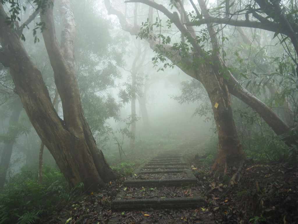
Just look how beautiful this scenery is!

14:37 – The RST heads straight over at this clearing. The trail on the left is signposted as heading towards Shengheng Temple (聖衡宮).

I’d been walking for so long and so quietly by myself that the voices I started to hear coming through the mist sounded more like a dream than reality.

14:43 – The appearance of this huge white shape indicates that you’re off the trail and almost back in civilisation.

A few paces further and I found myself at the base of the 25m-high Cloud Viewing Tower (觀雲樓). On this occasion, there was no need to climb to the summit to appreciate the clouds because they were literally all around me. Despite that, I climbed up anyway, peering in through the moisture-obscured glass to see the gods stationed at altars on three levels. The top was not only just one huge wall of white, but it was also blowing a damn cold breeze, so after glancing hastily at the information boards explaining what I might see on a clear day, I beat a hasty retreat.


14:55 – Ginger and other local produce decorate the fencing on the way down, and just beyond where the view terminates in white here, there was a vendor selling hot ginger tea.


14:56 – Turn left at the junction in the first picture, then right in the second.

15:01 – The trail arrives at the road and you’ll find a gathering of vendors selling hot food and other souvenirs from a platform that has a great view when there are no clouds. Turn left to cross over and find the visitor centre.


The stamp for the next section of the RST is kept inside the visitor centre and it shows a stylised image of the sun rising over a sea of clouds.

Outside the visitor centre, you can find a big vat of ginger tea that is free for visitors to drink—almost everyone was clutching steaming paper cups. If I had been allowed to use my own cup, I would have tried some, but the sign explicitly states that people can’t use their own flasks (I guess they had problems with people taking the piss in the past).


Teresa arrived a short while after me, and (after I first checked in), I met her a few minutes further down the road at a vegetarian restaurant called Ginger Lily (穗花の山奈). I couldn’t quite believe my luck that there was a vegetarian restaurant up here in the middle of nowhere, so I decided we had to eat there even if the prices were a little on the high side given how much we’d spent so far on this trip ($380 per person). However, I would happily go back and pay the same again.


The owners, who only recently converted their place to a vegetarian establishment, don’t have a fixed menu, instead, they a seasonal menu based on what is growing in their garden at any given time. In winter, this turned out to be a hotpot with a choice of three soup-based and an unlimited quantity of freshly harvested vegetables. He also served us steaming ginger tea that was as spicy as it was sweet. If you plan to visit this place, it’s advisable to call ahead and make a reservation because it closes early and everything is made to order.


Very full, we made our way back to the hotel in soup-thick mist and turned in for the night. Thankfully, our small room was exceedingly cosy and kept us warm against the chill of the evening (it was 7°C when we checked the thermometer).
GETTING THERE
Public transport:
- Getting to Nanhu – The 5656 bus departs Miaoli Bus Station bound for Dahu once or twice an hour. Alight at the Fayun Temple bus stop.
- Getting back from Ginger Garden – There are no buses to or from Ginger Garden, so you’ll either need to sort out your own public transport or walk this section as a two-day walk in conjunction with the next part.
Accommodation:
Accommodation in Nanhu – I didn’t actually stay in Nanhu, instead, I stayed at the quaint Hsin Hsin Hotel in Miaoli (really cute and retro feeling) and caught an early bus to the trailhead. That said, it seems like Nanhu has several (probably overpriced) places.
Accommodation at Ginger Garden – There are quite a few hotels and B&Bs gathered in this area, most of which are a little pricey. We stayed in the cheapest room I could find at Juyuan Hakka Village.
- Name in Chinese: 菊園客家庄
- Address: 364, Miaoli County, Dahu Township, 薑麻園13號
- Contact: 037951522
- Cost: We paid $1,500 for the cheapest room they have (Room 33/Firefly Room).
- Rooms can be booked online via their website, but you’ll need to be able to transfer a deposit.
RAKNUS SELU DAY 11 via GINGER GARDEN TRAIL MAP

GPX file available here on Outdoor Active. (Account needed, but the free one works just fine.)
Come and say hi on social media:
If you enjoy what I write and would like to help me pay for the cost of running this site or train tickets to the next trailhead, then feel free to throw a few dollars my way. You can find me on PayPal, Buy Me a Coffee or Ko-fi, (and if you’re curious about the difference between the three you can check my about page).
