Search for Keelung hikes by level of difficulty:
See all hikes in Keelung City. Walks listed with the most recent at the top.
KEELUNG GUANYIN STATUE and LONGTOU HILL (基隆大觀音像/龍頭山)
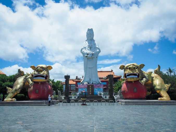
This short and easy wander takes you up into hills and alleyways above Keelung Port.
MOUNT HONGDAN (紅淡山)
This trail makes for a serviceable half-day trip from Taipei with interesting temples, one of Taiwan’s 100 Minor Peaks, views, and the promise of dinner from one of Keelung’s many eateries.
LIGHTHOUSES, BAIMIWENG FORT and XIANDONG ZUISHENG CAVE TEMPLE (基隆走走:基隆燈塔/球子山燈塔/白米甕砲臺/仙洞巖最勝寺)
 This trail in Keelung’s Zhongshan District isn’t the prettiest walk I’ve ever done, but it certainly packs in a lot of interesting spots into its short length. There are two lighthouses, port views, a fort, and a subterranean temple.
LOVERS’ LAKE ROUND-MOUNTAIN TRAIL (情人湖環山步道)
 Lovers’ Lake is a natural lake in the hills to the north of Keelung. It is encircled by two trails—a shorter and easier one that sticks close to the lakeshore called the Round Lake Trail, and a longer one that takes in more ocean views called the Round Mountain Trail. This post covers the second of those two options.
MOUNT DAWULUN (大武崙山)
 This short trail in Keelung’s Zhongshan District has a little bit of lots of things. It’s a historic trail. It takes you through an old fort. It includes one of Taiwan’s Xiao Bai Yue. And in the right weather, it can end with a dip in the sea and snacks by the beach.
HEPING ISLAND PARK (和平島公園)
 Heping Island Park is a small pocket of land on an island that shelters the mouth of Keelung Harbour. People come here to walk the short coastal trail year-round, and in the summer, you’ll find the ocean-fed pools full of swimmers.
ALABAO BAY GUIDED WALK (阿拉寶灣)
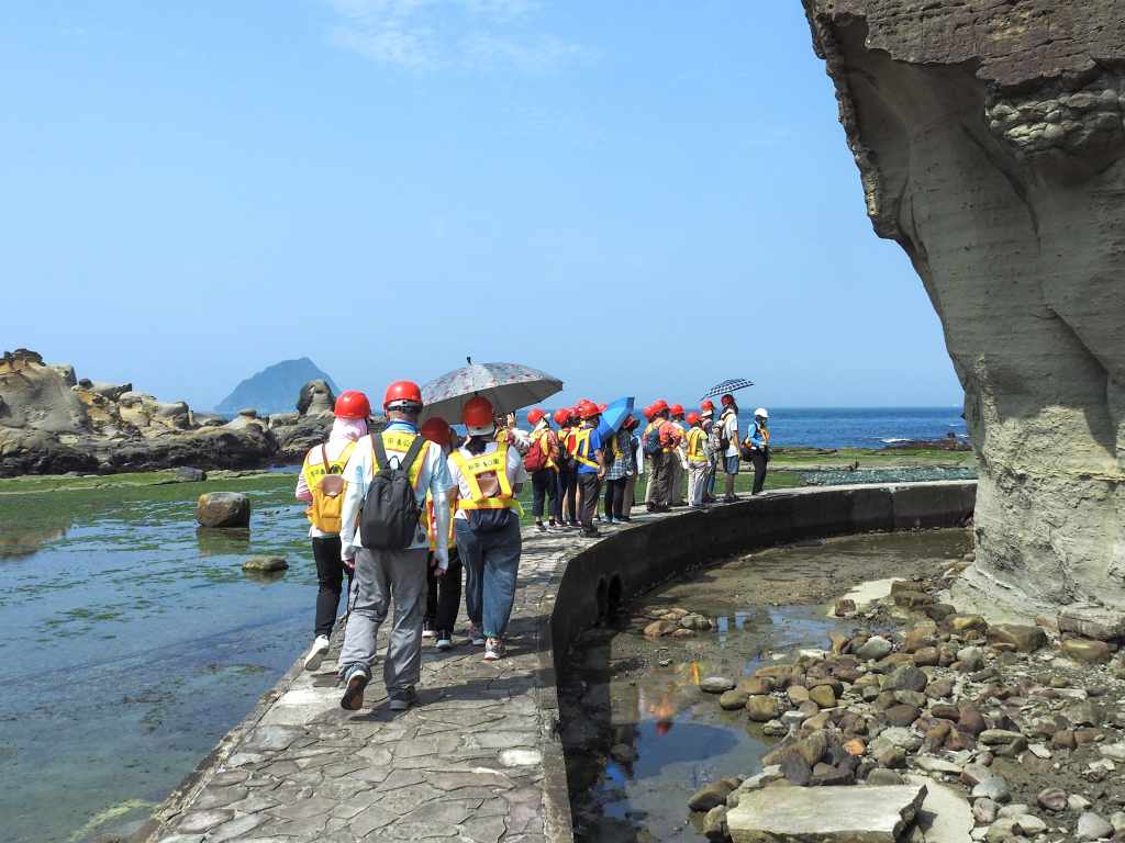
Only open for several months every year, Alabao Bay is a short stretch of coastline accessible from within Keelung’s Heping Island Park. The coastal trail offers interesting rock formations, views of Keelung Islet, and traces left behind by several waves of inhabitants.
RONGXUAN TRAIL (容軒步道)
 Rongxuan Trail is a short and easy loop walk right next to Taiwan’s northernmost train station.
CROUCHING TIGER HILL (臥虎山)
 A brief loop with an interesting temple and some exploration of a lesser known peak in Keelung.
KEELUNG ISLET (基隆嶼)
 Keelung Islet is a small rocky mound just a few kilometres off the coast of northern Taiwan. It is also a great choice for a day trip from the city.
WANGYOU VALLEY TRAIL ( 望幽谷步道)
 Located on just south of Keelung, the scenic Wangyou Valley Trail is one of the best-known walks on Taiwan’s northeast coast.
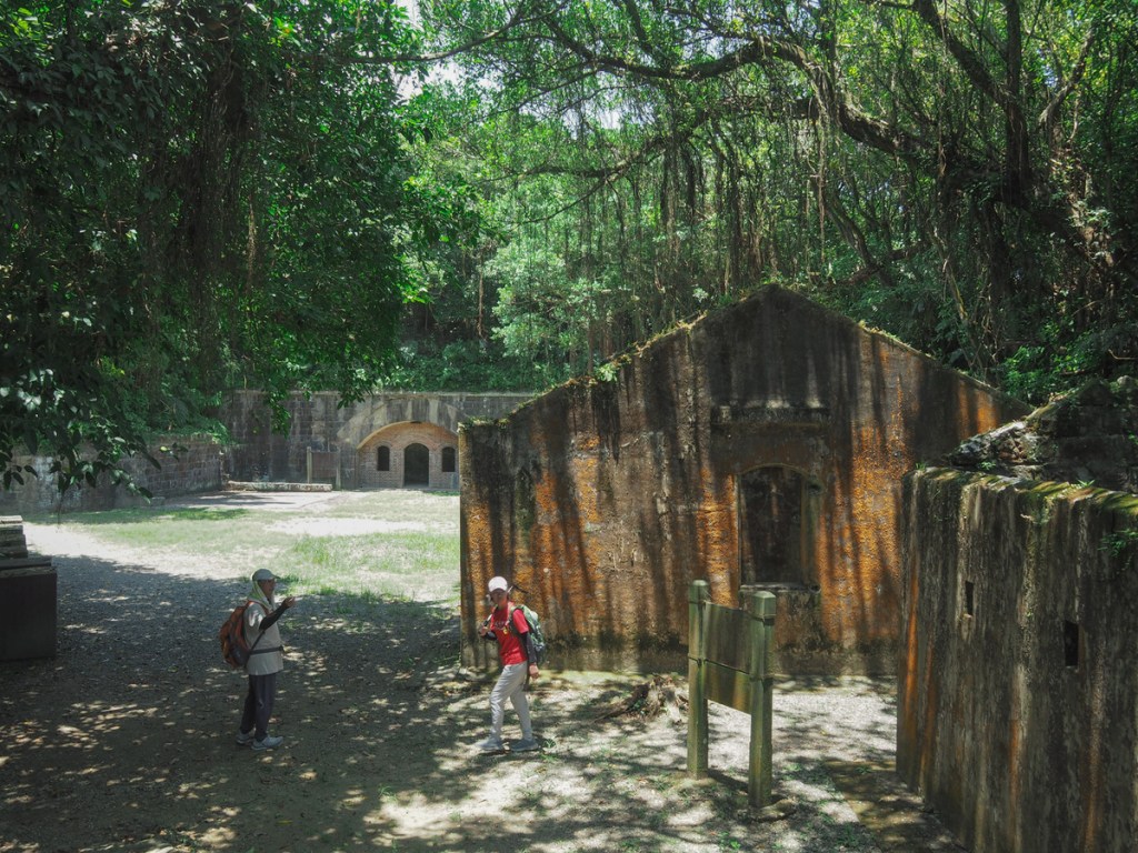
MOUNT GONGZILIAO and GONGZILIAO FORT (槓子寮山/槓子寮砲臺)
 The hills around Keelung are home to numerous old defensive structures left over from various periods in Taiwan’s history. The remains found here at Gongziliao Fort are the most extensive and well preserved out there.
TAIPEI SKYLINE TRAIL: SECTION 5A
 This section of the Taipei Skyline Trail takes you close to the coast as you explore some of the sights of Keelung.
TAIPEI SKYLINE TRAIL SECTION 4 (Short Version)
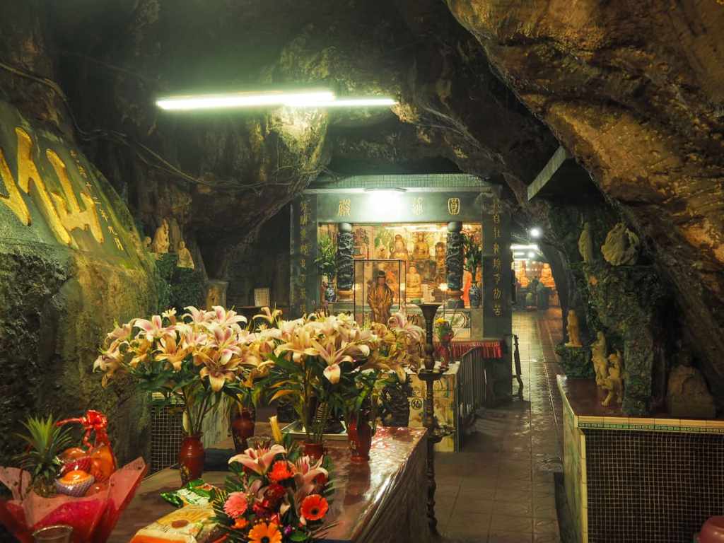
 The highlight of this section of the Taipei Skyline Trail is unquestionably the exceedingly cool temple cave close to Mount Hongdan. That aside, it involves some pleasant wandering over less-travelled paths, and passes plenty of historic spots.
XIANDONGHU SHAN and YUEMEI CAVE (仙洞湖山/月眉洞)
 You can find all sorts of oddities tucked into the hills of Taiwan, and Keelung’s unique brand of oddity seems to be caves with temples in them. This walk includes one such cave temple, as well as a scrappy climb to a peak with distant views of Taipei 101.
MALING PEAK (瑪陵尖)
 While the hills south of Keelung River are well known for their wealth of hiking trails, the peaks to the north are far less developed. This walk to Maling Peak is a short scramble through some of the area’s less frequently traversed trails.
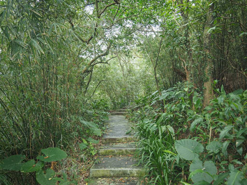
NUANDONG VALLEY LOOP (暖東峽谷O型)
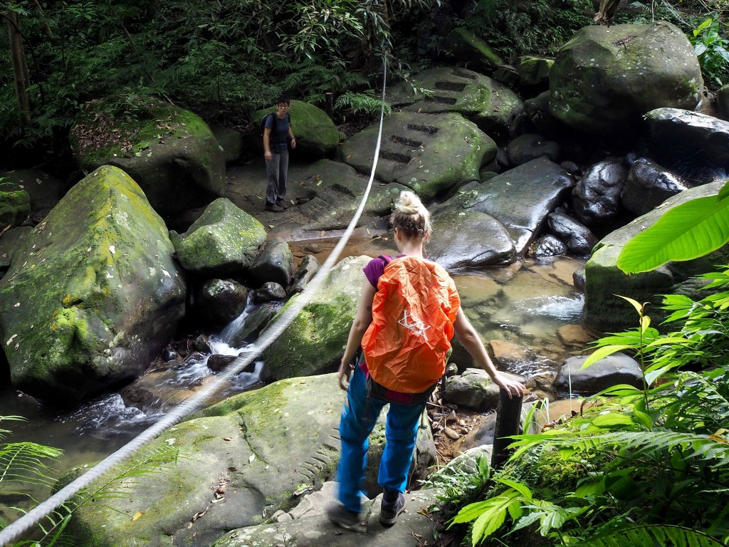
This short and sweet loop in Keelung’s overlooked Nuannuan District makes a great half day exploration. The trail tracks through quiet woodland and boasts beautiful views of water-sculpted rocks, as well as a couple of stream crossings and a photogenic land god temple thrown in for good measure.
