 Lingbo Temple Trail is a tiny little walk in Xizhi that's probably only visited by a handful of locals. It takes you up to a temple with a view over the area, then heads back down along a fishing pond and past a cute little temple in a cave.
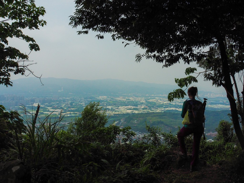
TAIPEI PUBLIC TRANSPORT HIKES
SANDIAOLING TUNNEL BIKEWAY
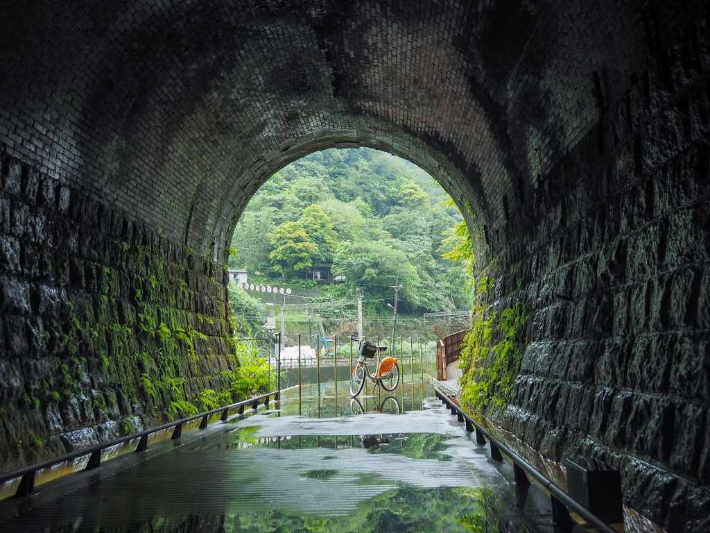 Since it reopened in 2022, Sandiaoling Tunnel has become a top spot for people wanting a short half-day adventure from Taipei.
RONGXUAN TRAIL (容軒步道)
 Rongxuan Trail is a short and easy loop walk right next to Taiwan's northernmost train station.
CROUCHING TIGER HILL (臥虎山)
 A brief loop with an interesting temple and some exploration of a lesser known peak in Keelung.
SHEN’AO RAIL BIKE (深奧鐵道自行車)
 A gentle ride along one of Keelung’s historic mining routes.
MOUNT DONGYAN (東眼山)
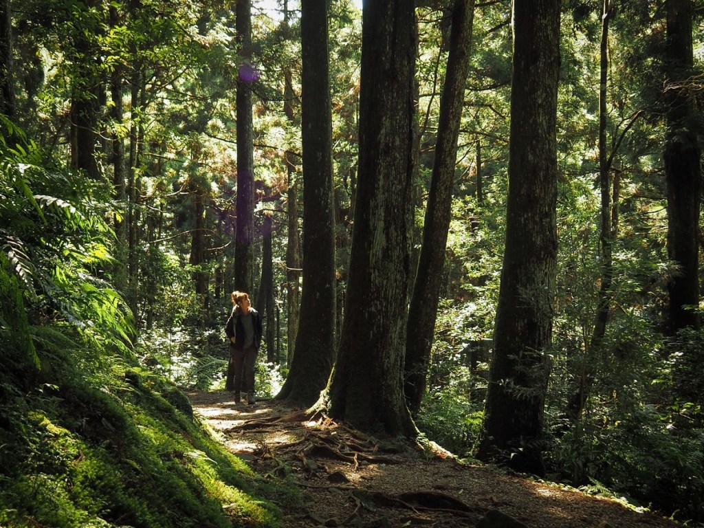 This beautiful trail in Taoyuan's Fuxing District takes you up to the summit of Mount Dongyan via some incredibly pretty forest footpaths.
KEELUNG ISLET (基隆嶼)
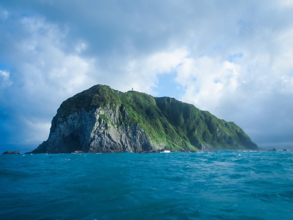 Keelung Islet is a small rocky mound just a few kilometres off the coast of northern Taiwan. It is also a great choice for a day trip from the city.
CARP HILL NIGHT HIKE (鯉魚山夜爬)
 Carp Hill Trail is a lovely walk whatever time of day you go, but I hope this post emboldens you to pay it an after-dark visit. Not only is it home to a wonderfully diverse range of nocturnal critters, but it also has a prettily sparkling night view to enjoy all by yourself.
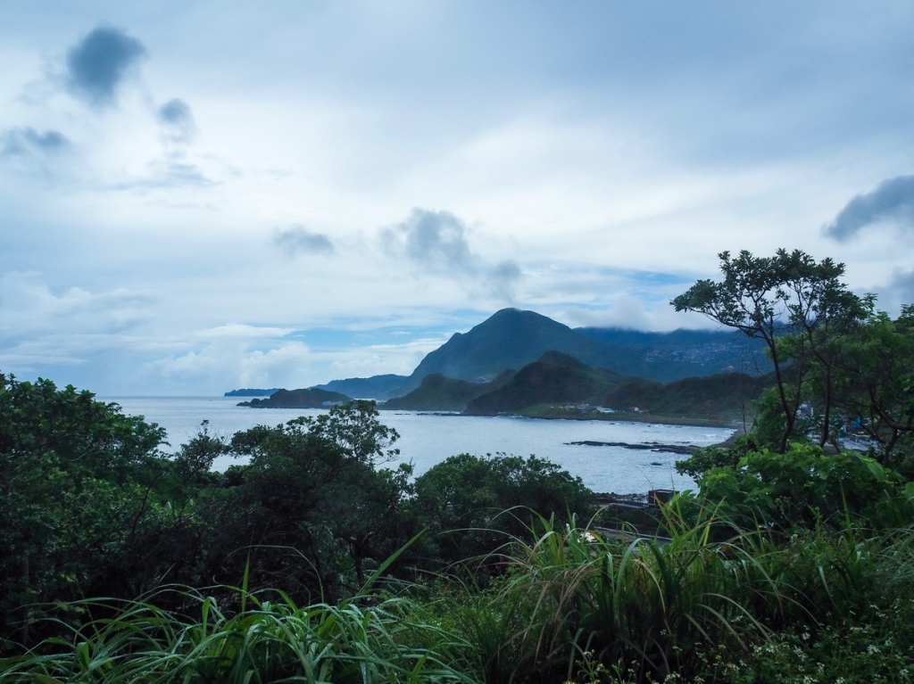
WANGYOU VALLEY TRAIL ( 望幽谷步道)
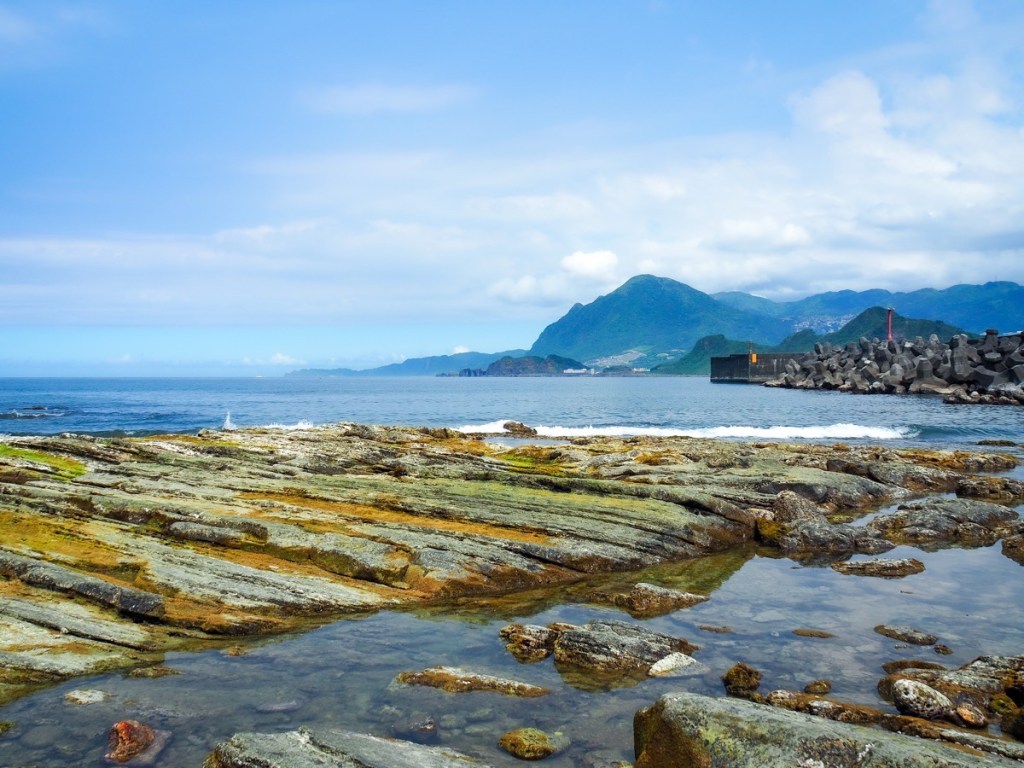 Located on just south of Keelung, the scenic Wangyou Valley Trail is one of the best-known walks on Taiwan's northeast coast.
MOUNT GONGZILIAO and GONGZILIAO FORT (槓子寮山/槓子寮砲臺)
 The hills around Keelung are home to numerous old defensive structures left over from various periods in Taiwan's history. The remains found here at Gongziliao Fort are the most extensive and well preserved out there.
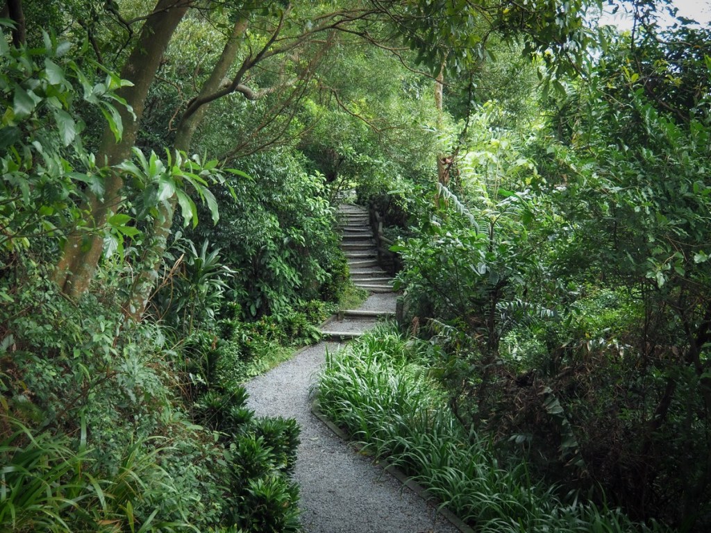
FIREFLY SPOTTING at YUANJUE WATERFALL (圓覺瀑布螢火蟲)
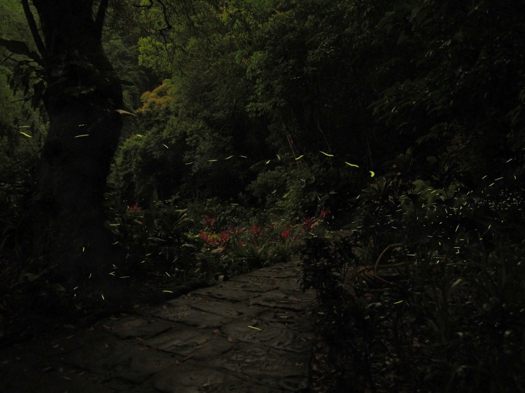 If you check online for the best places to see fireflies in Taipei, then one of the locations that appears in many of the lists is Dagouxi Waterfront Park. In fact, this is a little misleading since - while the walk does start there - you need to head a little further into the dark to spot any fireflies.
FIREFLIES at JINTONG COAL MEMORIAL PARK (菁桐煤礦紀念公園螢火蟲)
 The ruins of the old Jingtong Coal Mine make for a unique backdrop to Taiwan's April firefly viewing season.
TAIPEI SKYLINE TRAIL: SECTION 10B
 This section of the Taipei Skyline Trail packs a lot of interesting spots into its not-quite-14km length. There are not one, but two Xiao Bai Yue, and one of Taipei's most impressive land god temples.
TAIPEI SKYLINE TRAIL: SECTION 10A
 Leading from Sanxia District and on towards Tucheng, this section of the Taipei Skyline Trail was an unexpected pleasure. Gently taxing and quiet ridge line trails offer a wonderful escape from the city.
TAIPEI SKYLINE TRAIL: SECTION 9B
 Much of the Taipei Skyline Trail stitches together popular routes on the edge of the city. Not so this section, which looks like it doesn't get many visitors.
