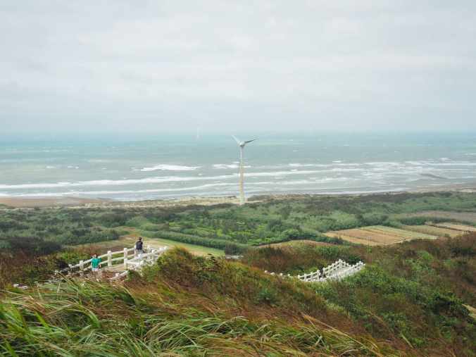
 This short almost coastal walk in Miaoli's Houlong Township has Instagram-famous views, towering turbines, and a converted railway tunnel to keep you entertained. At just under 3km, it's also a great little way to stretch your legs and/or catch the sunset if you're passing through on a long drive between the north and the south.
Author: taiwantrailsandtales
台灣山毛櫸國家步道
 位於太平山國家森林遊樂區最深處,台灣山毛櫸國家步道是一條美麗的森林步道,帶領健行者穿越據信可追溯至末次冰河時期的古老山毛櫸林。
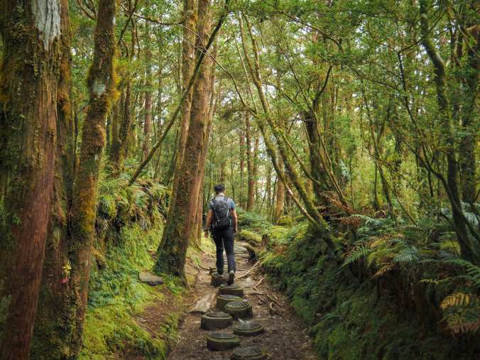
TAIWAN BEECH NATIONAL TRAIL (台灣山毛櫸國家步道)
Tucked snuggly into the innermost reaches of Taipingshan National Forest Recreation Area, Taiwan Beech National Trail is a pretty forested walk which takes hikers through an ancient stand of beech trees that is thought to date back to the last Ice Age.
大山母山步道
 大山母山是台灣最南端的小百岳,是一條短程而優美的健行路線,可眺望海岸風光。
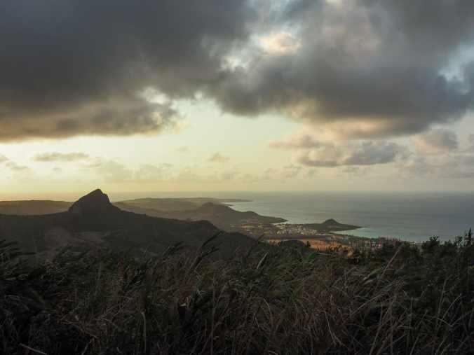
MOUNT DASHANMU (大山母山)
Mount Dashanmu, Taiwan's southernmost Xiao Bai Yue, is a short and sweet hike with views overlooking the coast.
獨立山國家步道
 獨立山國家步道從樟腦寮車站一路攀升至獨立山車站,途中多次與阿里山林業鐵路交會,還可以繞道前往一座寺廟裡的大型登山客廚房。
MOUNT DULI (獨立山)
Mount Duli National Trail takes hikers up from Zhangnaoliao Station to Dulishan Station, crossing paths with Alishan Forestry Railway at several points, with a possible detour to a huge hikers’ kitchen in a temple.
觀音山步道
 觀音山從新北市八里和五股區的淡水河岸拔地而起。它的綽號是硬漢嶺,因為攀爬此山以前被用作軍警人員的強化訓練活動,對於不熟悉台灣陡峭階梯的人來說,很容易理解原因。
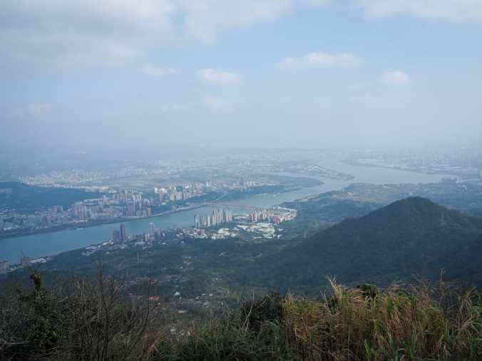
GUANYIN MOUNTAIN (觀音山)
Guanyin Mountain rises from the banks of Tamsui River in New Taipei’s Bali and Wugu Districts. Its nickname is tough guy peak on account of the fact that climbing it was previously used as an entoughenmemt activity for military police officers, and for those unacquainted with Taiwan’s steep, steep steps, it’s clear to see why.
DAGUI WATERFALL RIVER TRACE (大鬼瀑布溯溪)
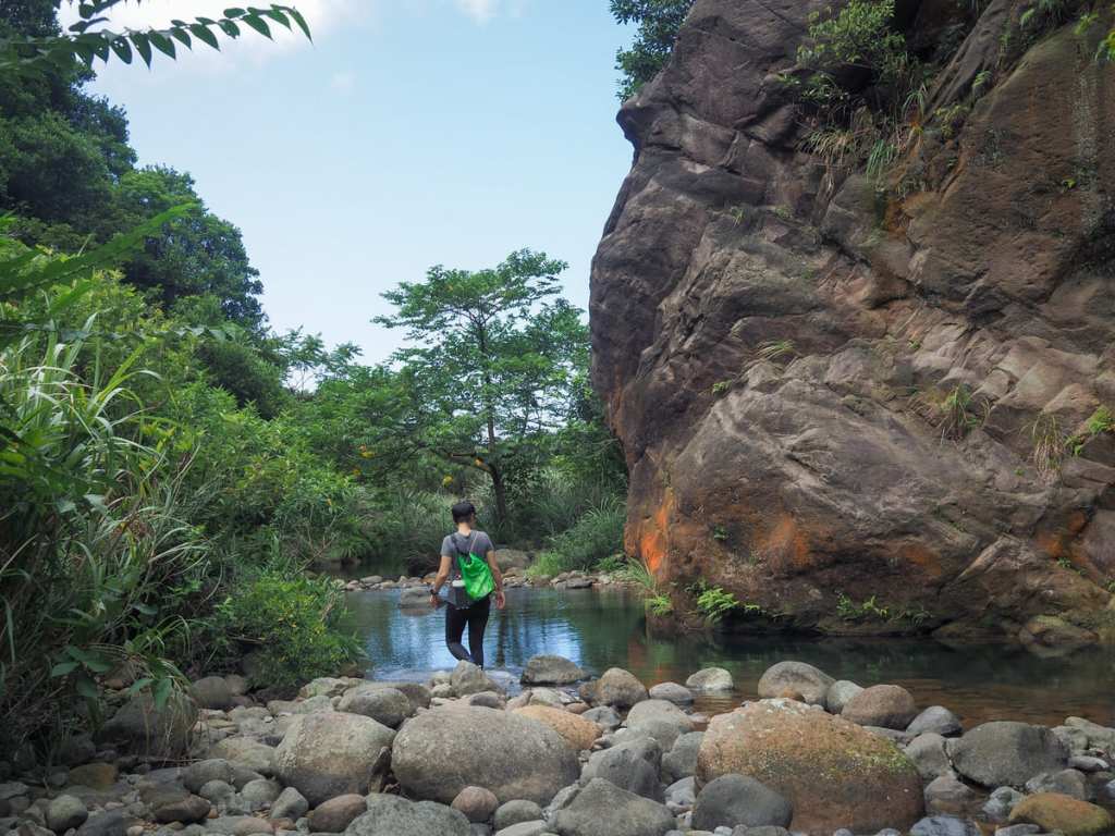 With Taiwan's summers dragging on for a seemingly infinite length of time, there's nothing more appealing than immersing yourself in the nearest body of water and this easy river trace in New Taipei's Ruifang District is a top spot to stop off on a hot day.
SHUANGQI AMBUPING TRAIL (雙崎埋伏坪步道)
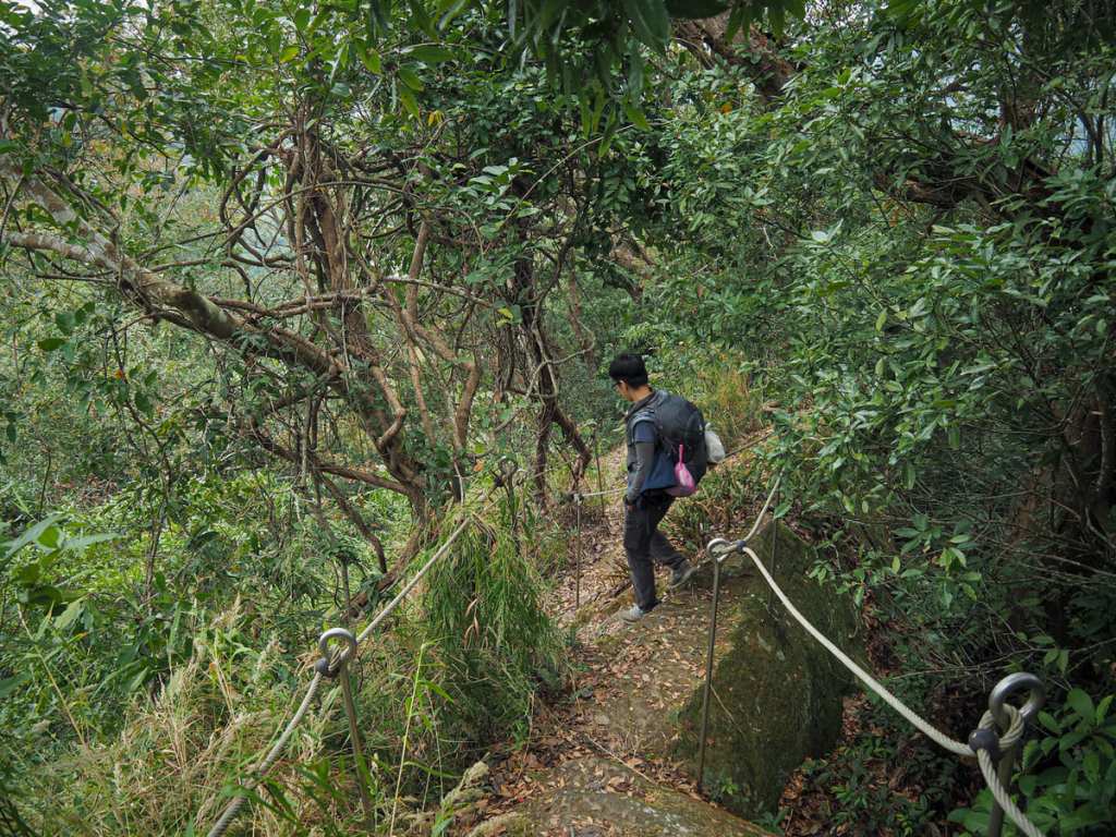 Ambuping Hiking Trail is a short loop in the lower elevation part of Taichung's Heping District. The trail encircles the Tayal tribal village of Shuangqi and takes in one peak, a section of ridgeline, and the remains of an old irrigation canal.
LALASHAN SACRED TREE TRAIL (拉拉山神木群歩道)
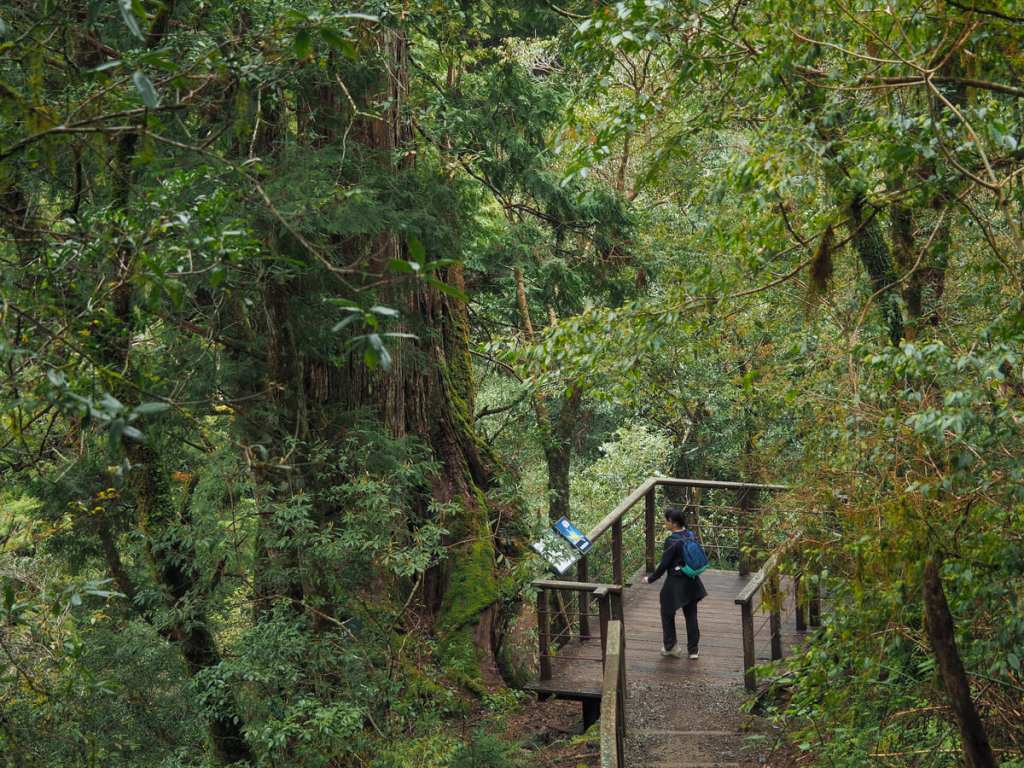 Lalashan — R'ra in the local Tayal language — is one of 19 such designated national forest recreation areas in Taiwan. It occupies an area of land that sits 1,500 to 2,130 metres above sea level in Taoyuan's Fuxing District up a winding road dotted with Tayal villages. The forest is home to many ancient trees, some of them centuries old, and a pleasantly shady trail takes hikers on a meandering loop to greet these sacred giants.
NEIDONG FOREST RECREATION AREA TRAILS (內洞森林遊樂區步道)
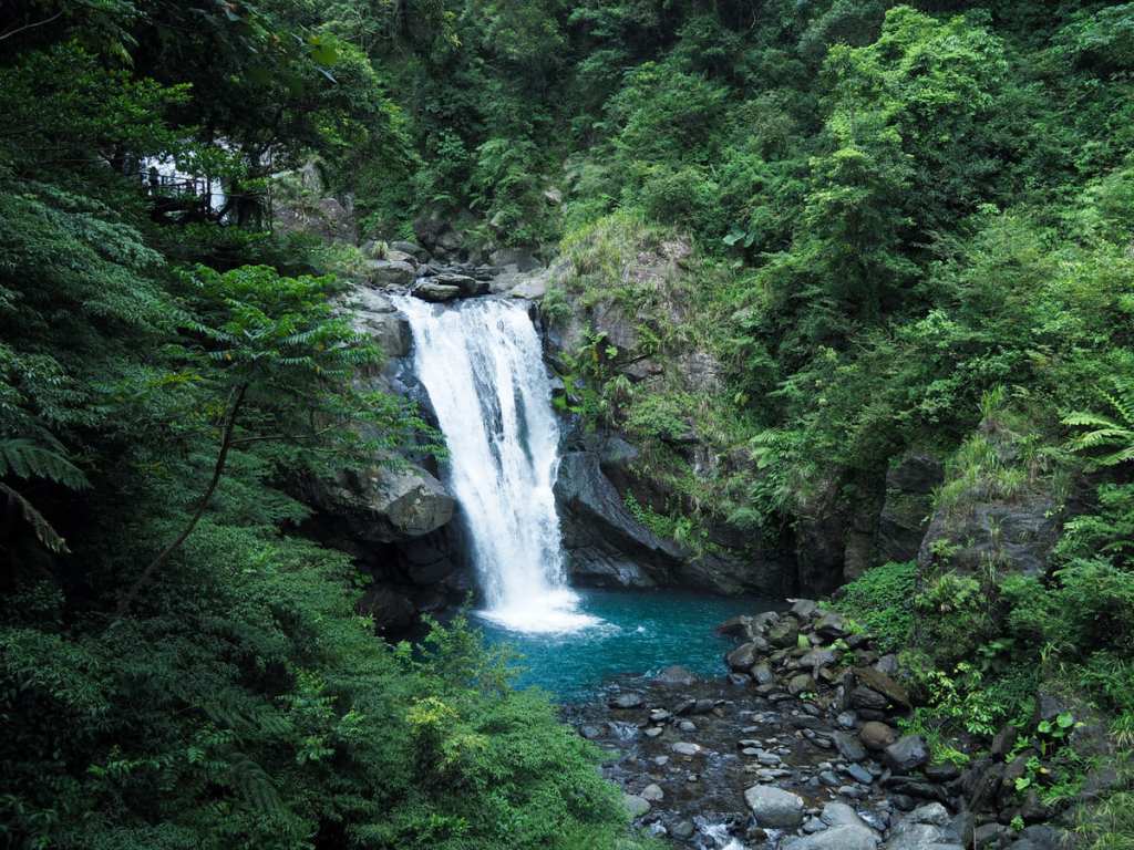 Situated on the banks of Nanshi Creek and far away from the busy city, Neidong National Forest Recreation Area is a peaceful and pretty natural haven. The park has a total of three trails — the Scenic Trail, the Forest Bathing Trail and the Waterfall Trail — which can be woven together into a single loop, allowing you to see all that the park has to offer.
MOUNTAINS to SEA GREENWAY DAY 11 (山海圳國家級綠道D11)
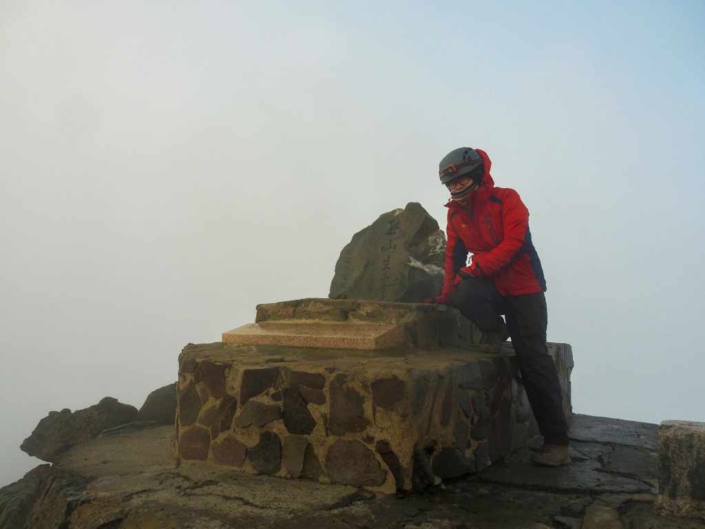 The final day of the Mountains to Sea Greenway saw us climb the last couple of kilometres to reach the highest point of Taiwan—the 3,952-metre summit of Jade Mountain.
MOUNTAINS to SEA GREENWAY DAY 10 (山海圳國家級綠道D10)
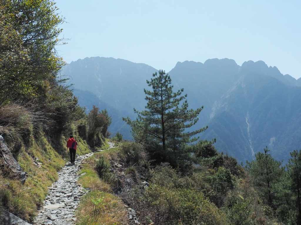 On the penultimate day of the MSTW, we made our way onwards and upwards to the summit of Jade Mountain. The morning's weather was perfect and the trail stretched out in front of us with beautiful scenery all around.
