
Hiking the Famous Wooden Trails in Dakeng
I have wanted to visit these log trails for literally the longest time, but well, it’s never seemed like the most opportune moment. If we’re driving this far south for a longer walk, we wouldn’t choose one this short. But on this trip, we stayed in Taichung after doing a full day’s walking in Daxueshan National Forest Recreation Area, and so it seemed like the perfect walk to do before heading back home. I’m glad we did, and hope that someday in the not-too-distant future we will get back down to explore the rest of the trails up in this part of the Dakeng Trail network.
DISTANCE: About 4km.
TIME: 2½-3 hours – We were right at the slow end of that (we were overtaken by everyone and his dog… literally).
TOTAL ASCENT: A little over 400 metres.
DIFFICULTY (REGULAR TAIWAN HIKERS): 3-4/10 – The harder end of easy. It may have something to do with the almost 1000m in elevation that we climbed the day before doing this, but I found this walk a little tiring. More than anything, it’s mentally taxing. You cannot stop thinking about where you’re putting your feet, not even for a second.
DIFFICULTY (NEW HIKERS): 4-6/10 – I’d say this is on the easier end of moderate. It involves quite a lot of climbing, but the route is very easy to follow, and as long as you keep putting one foot in front of the other, you’ll be fine. (We saw plenty of kids walking this, most of them enthusiastically.)
SIGNAGE: Very clear.
FOOD AND WATER: I drank about 0.7L on a sunny but cool winter day.
SHADE: Many sections are totally exposed, and where there is shade, it’s patchy.
MOBILE NETWORK: Phone coverage was weirdly spotty given how close to the city this walk is.
ENJOYMENT: This is a really unique trail with some great views. It’s definitely worth your time, just don’t expect to have it to yourself.
SOLO HIKE-ABILITY: As long as you’re relatively fit and know how you react to heights, then this would be fine to walk on your own.
OTHER: It might be wise to bring gloves. You’ll be grabbing onto a lot of ropes (don’t bring a hiking stick though–that would be more of a hinderance than a help. Also, if you’re not good with heights, this might not be the best walk for you. There aren’t any places where you could fall down a long way, but it often feels quite exposed. We passed one preteen kid who was soldiering on very bravely, despite being a little scared and it didn’t look like he was having fun.
TAIWAN 100 MINOR PEAKS: No. 41 – Mount Touke
ROUTE TYPE: Loop.
PERMIT: None needed.
Jump to the bottom of this post for a trail map and GPX file.
DIRECTIONS:

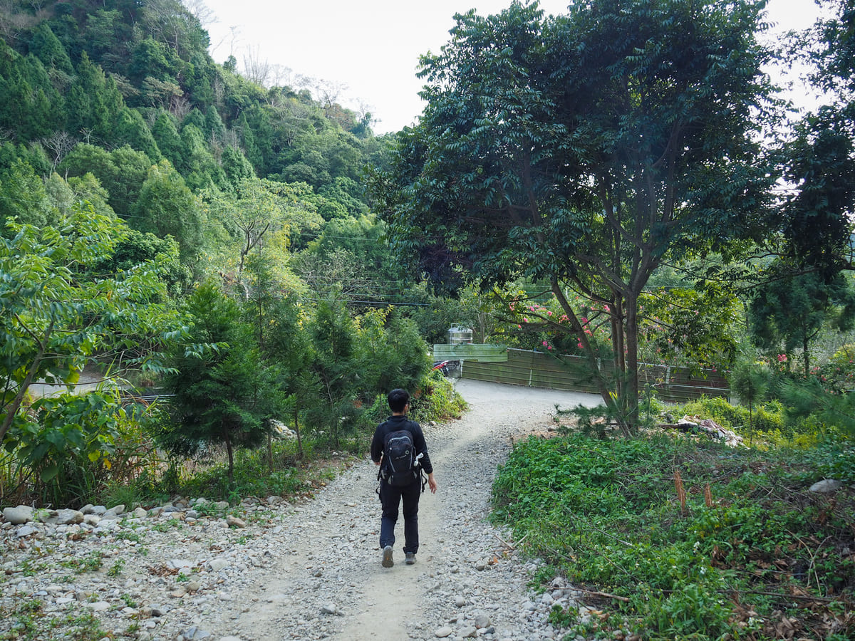
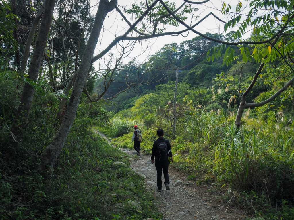
We drove up past Zhongzheng Campsite and found a space in one of the carparks close to Uncle Guo’s Macaque Ecological Park. To get started on the walk, cross over the bridge and head left up to the topmost end of the carpark.
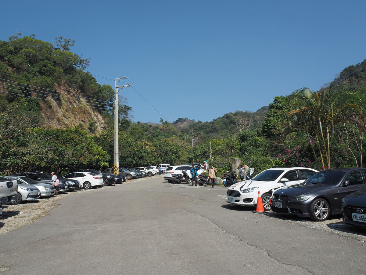
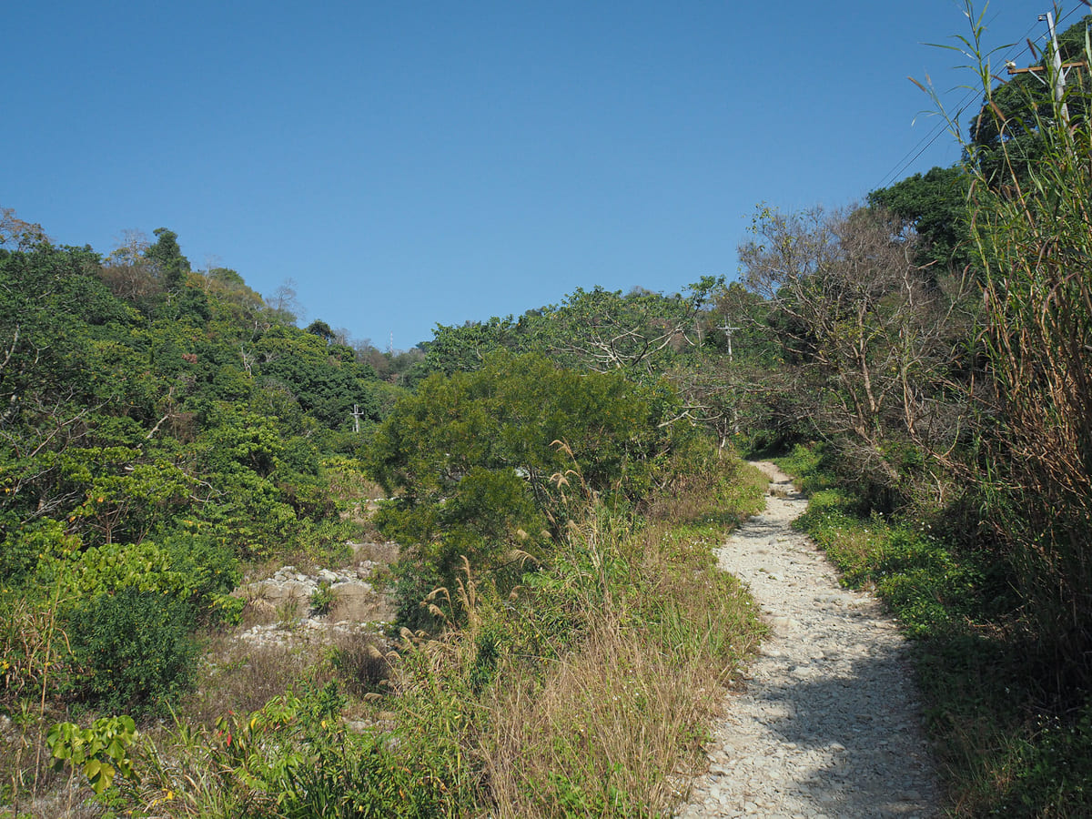
You’ll pass the entrance to the monkey park on your right. If you’re planning to pay it a visit, it is worth checking the time first (the monkeys are fed and a talk is given at 11 am, 2 pm and 4 pm). I have mixed-to-negative views on this type of place, but we both needed to use the bathrooms before we set off, so we paid to go in. The women at the ticket booth insisted on stamping our hands so that we could return later for the 4 o’clock feeding session without having to pay again. Once we were ready to set off properly, we walked all the way to the top of the carpark and started up the gravel trail.
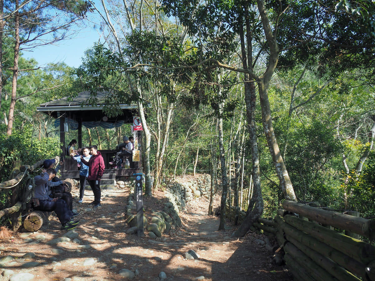
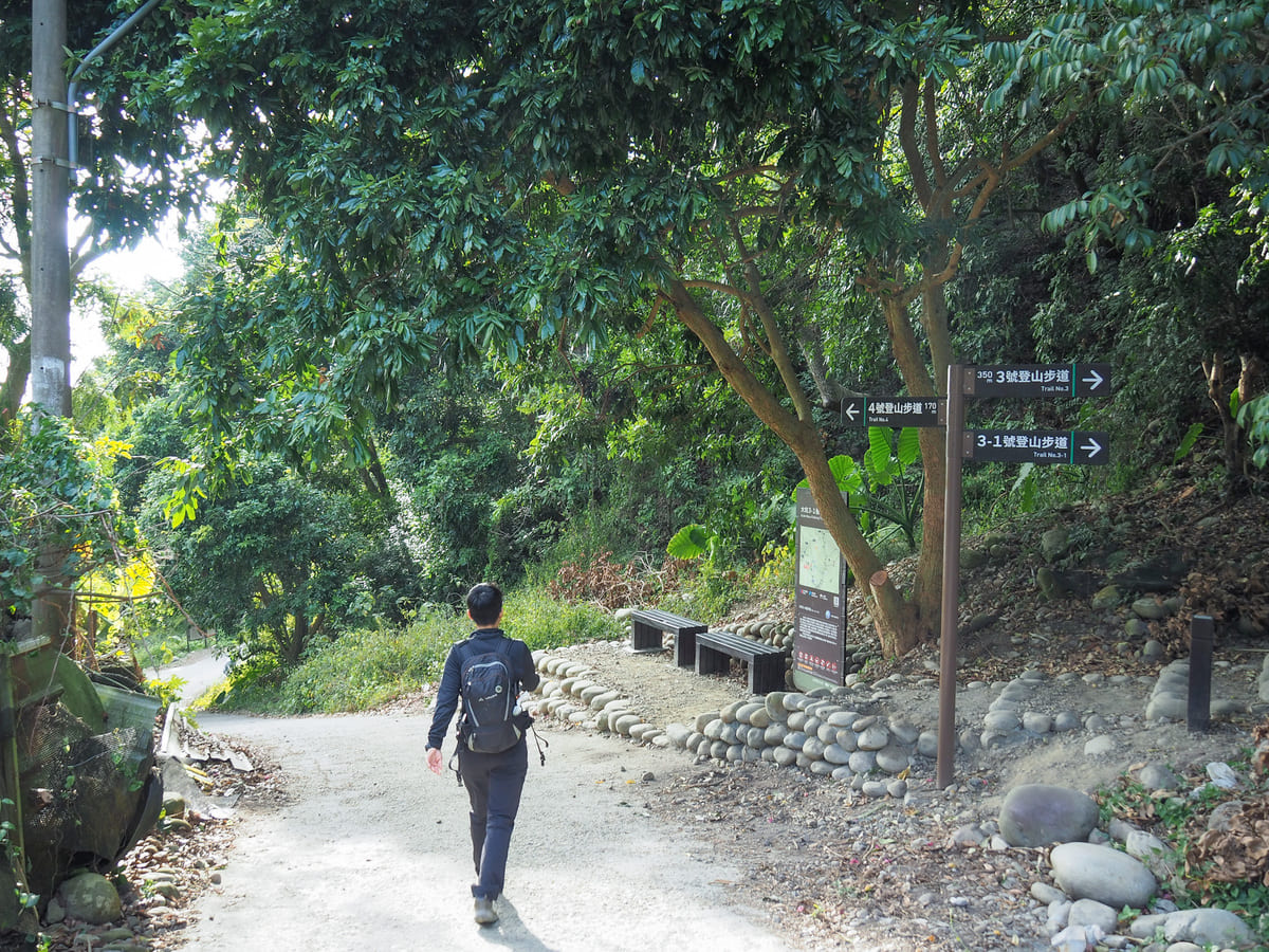
Soon, the trail connects to the main network. This is the junction between Dakeng No. 4 and Dakeng No. 3-1. We had planned to walk up via trail No. 4, so we headed up to the right past a shelter full of people taking a rest.

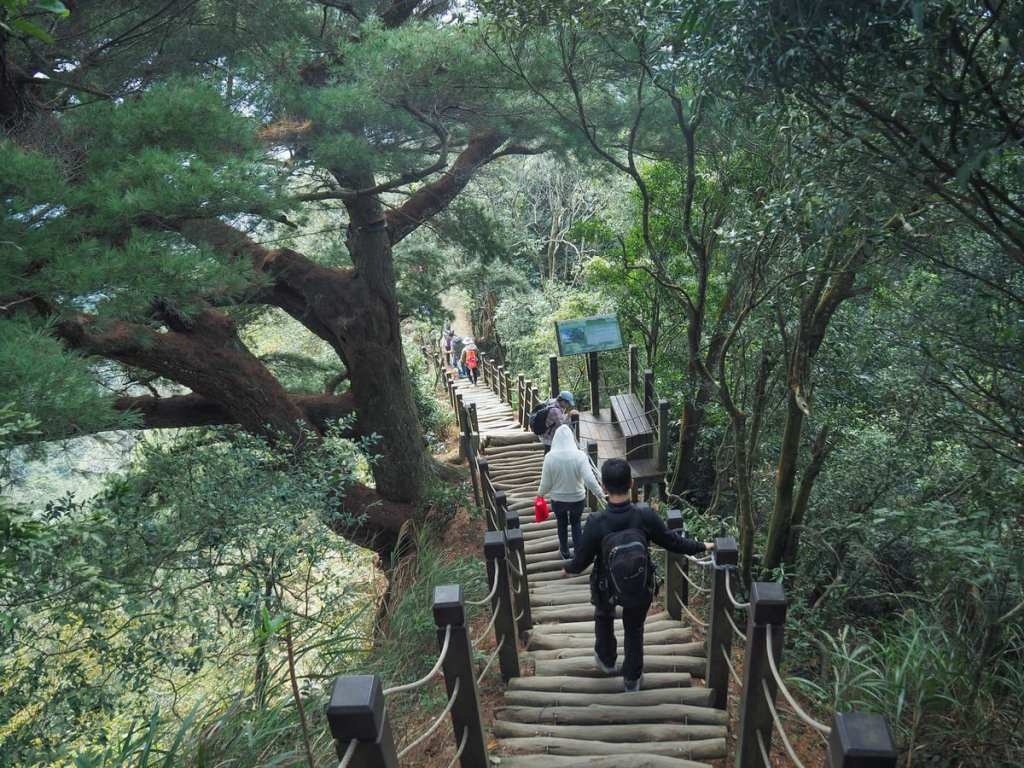
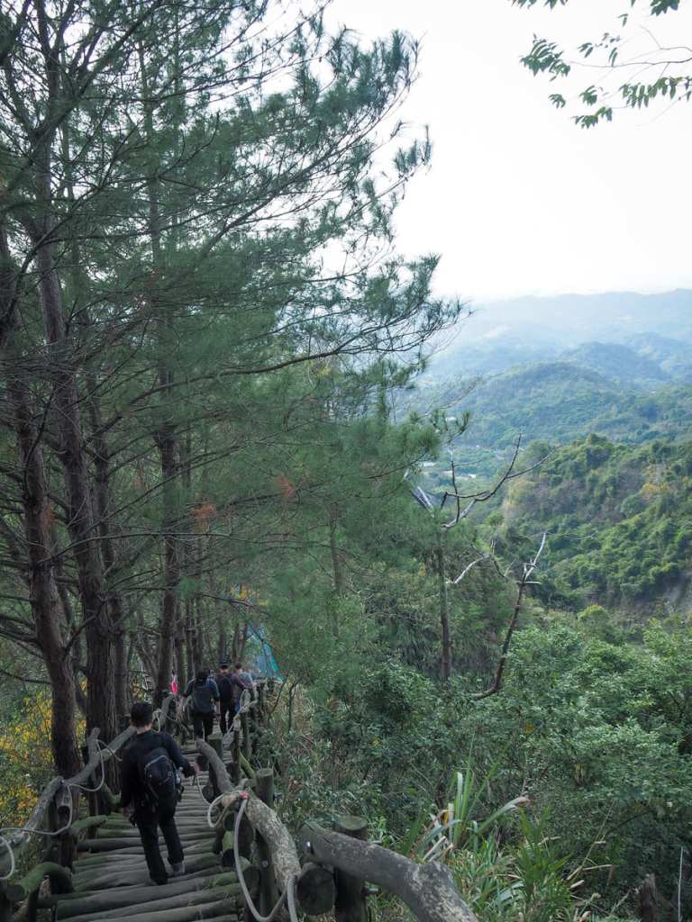
Right from the start, the trail lets you know what it’s about. If you get a hundred metres up and don’t like it, then you’re not going to enjoy this walk.
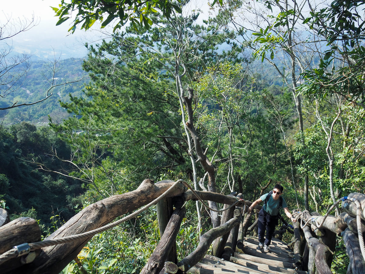
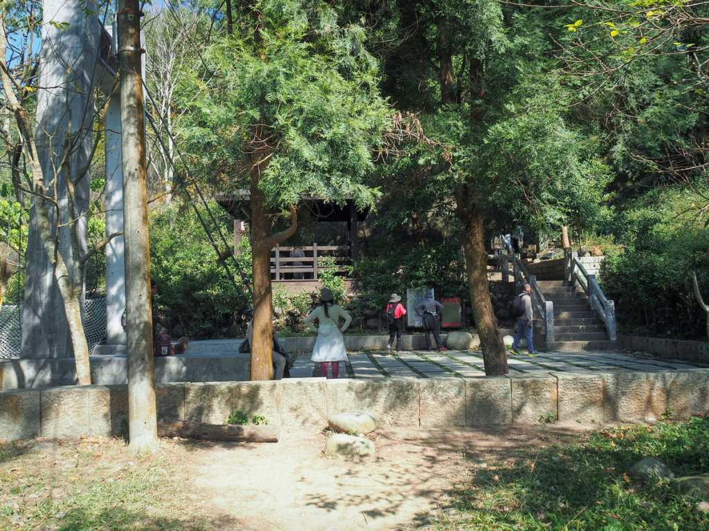
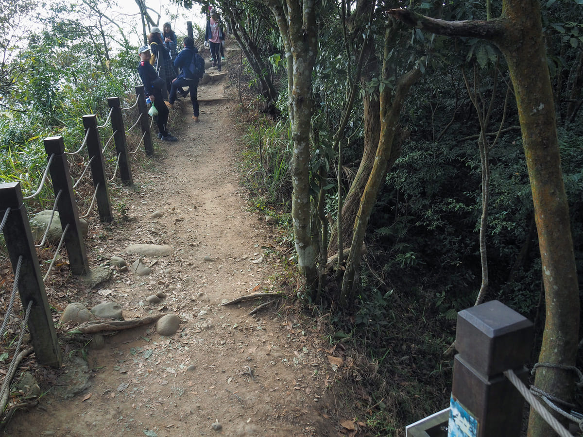
However, even if you think you hate it, I’d advise you to at the very least go as far as this next shelter (it took us a little under 20 minutes to get here). If you make it up this far, you’ll at least have enjoyed a couple of views.
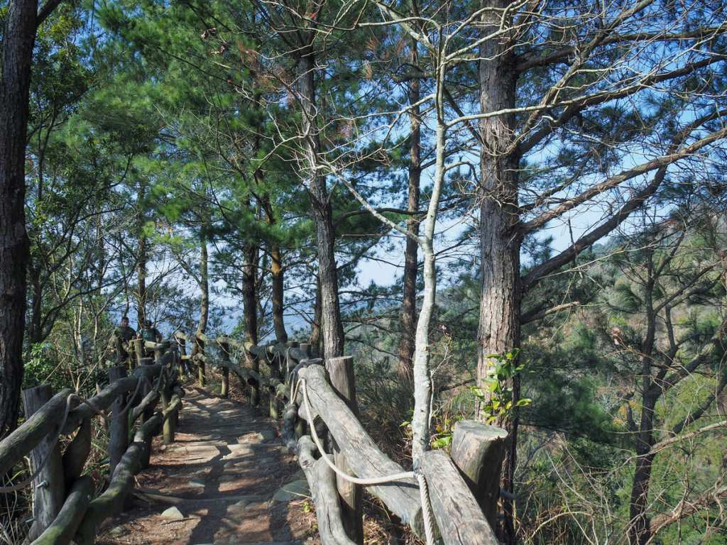
Unsurprisingly, I was not second-guessing my choice. Instead, I was thoroughly enjoying the bizarre hiking experience.
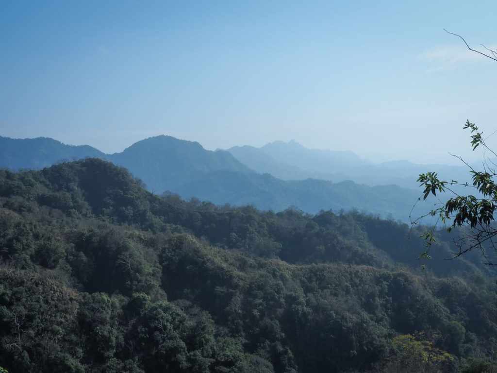
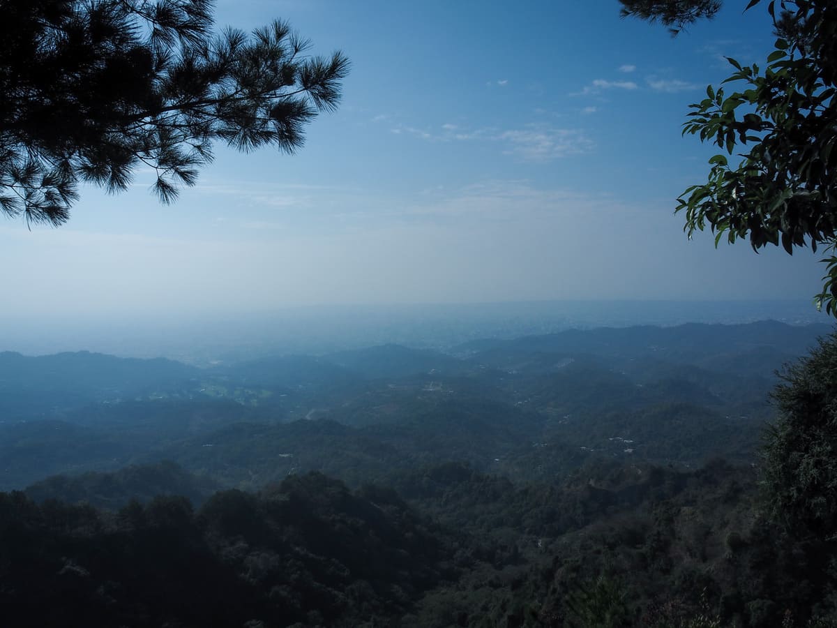
At a couple of places, the trees on the right opened and we could see over the mountains to the south. That most prominent hump in the middle row of mountains at about a third of the way in from the left is Mount Anying (another Xiao Bai Yue that I haven’t yet climbed), and further south in the back row of hills the sharp peak just right of the centre is Mount Dahengping (which we walked a few months back). Apparently, it’s also possible to see Mount Junda and Yu Shan, but I wasn’t sure with all of the haze.
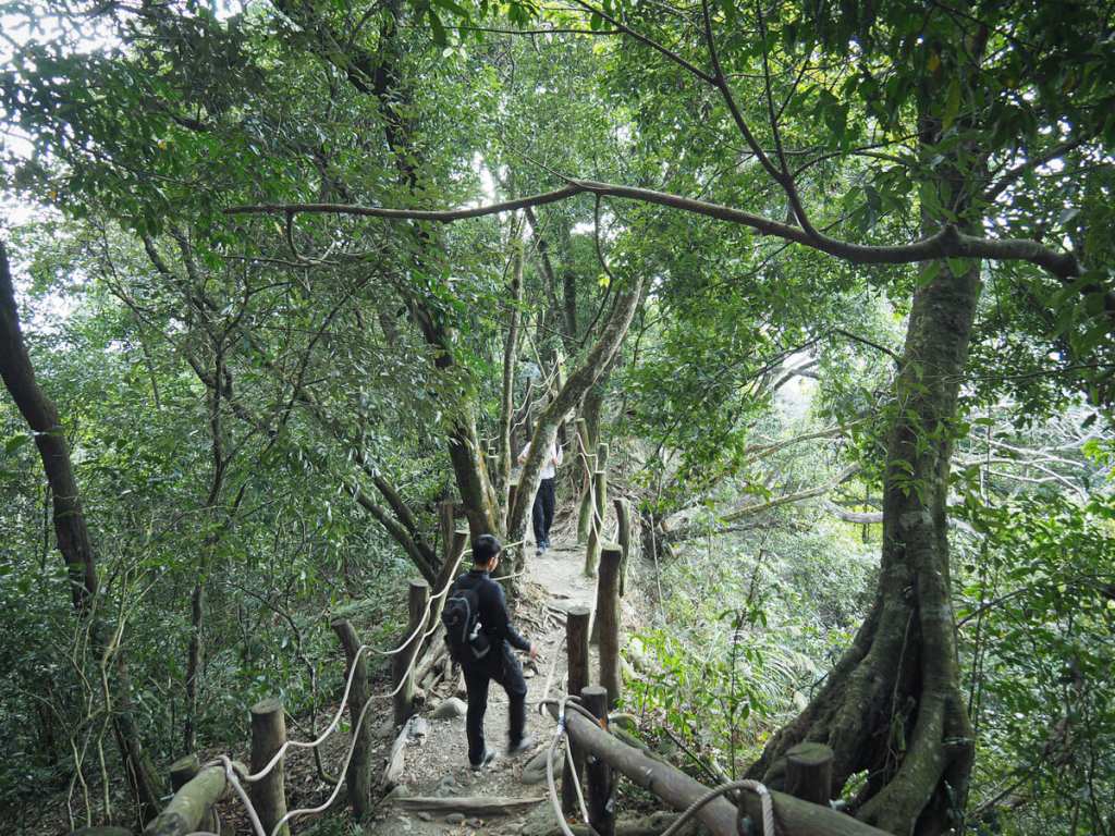
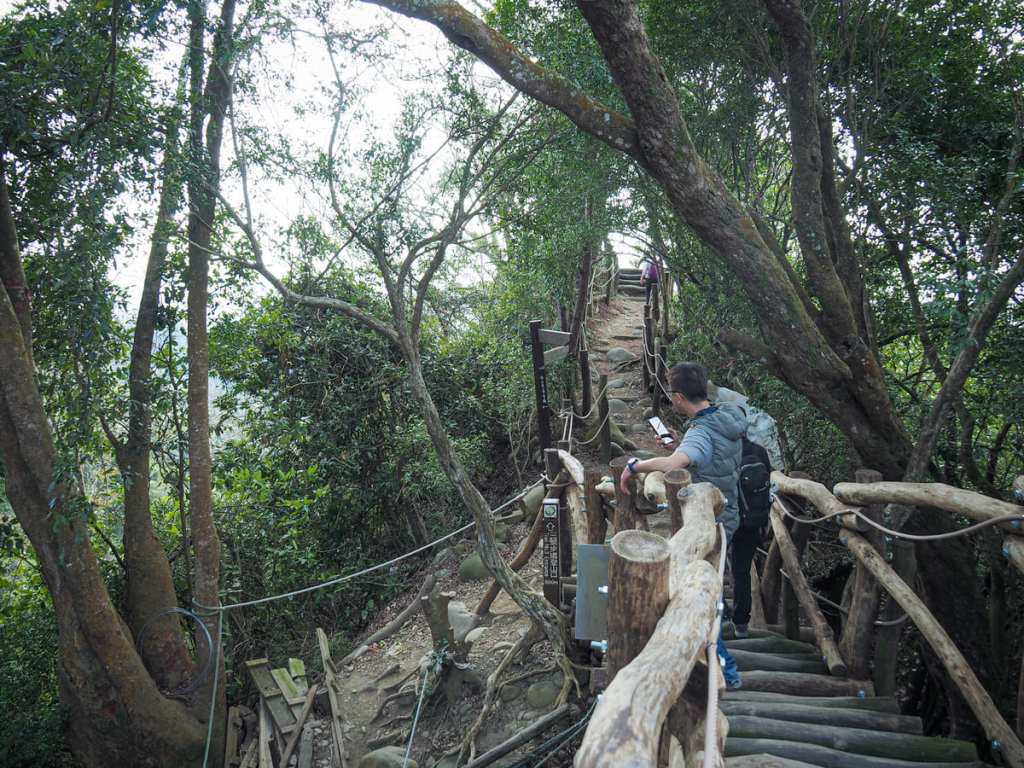
Once the trail joins the ridge line running north-south, it starts to become a series of short dips and climbs. At a saddle, we passed the first of several ridge shelters.
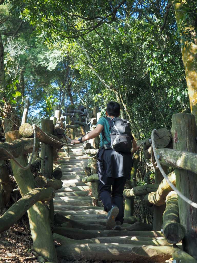
You can’t see it from this angle, but there’s space enough to fit more or less your whole leg in between each of these steps.
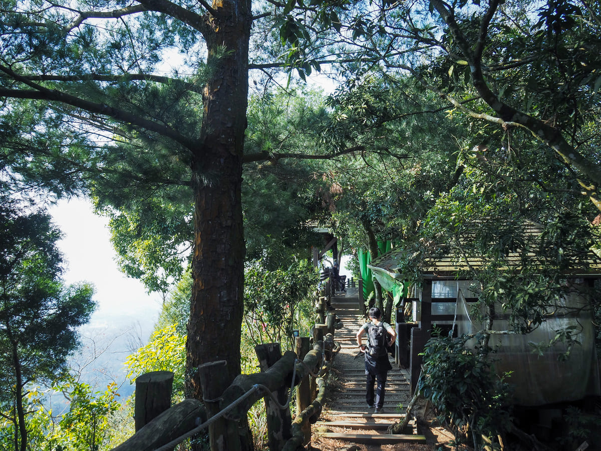
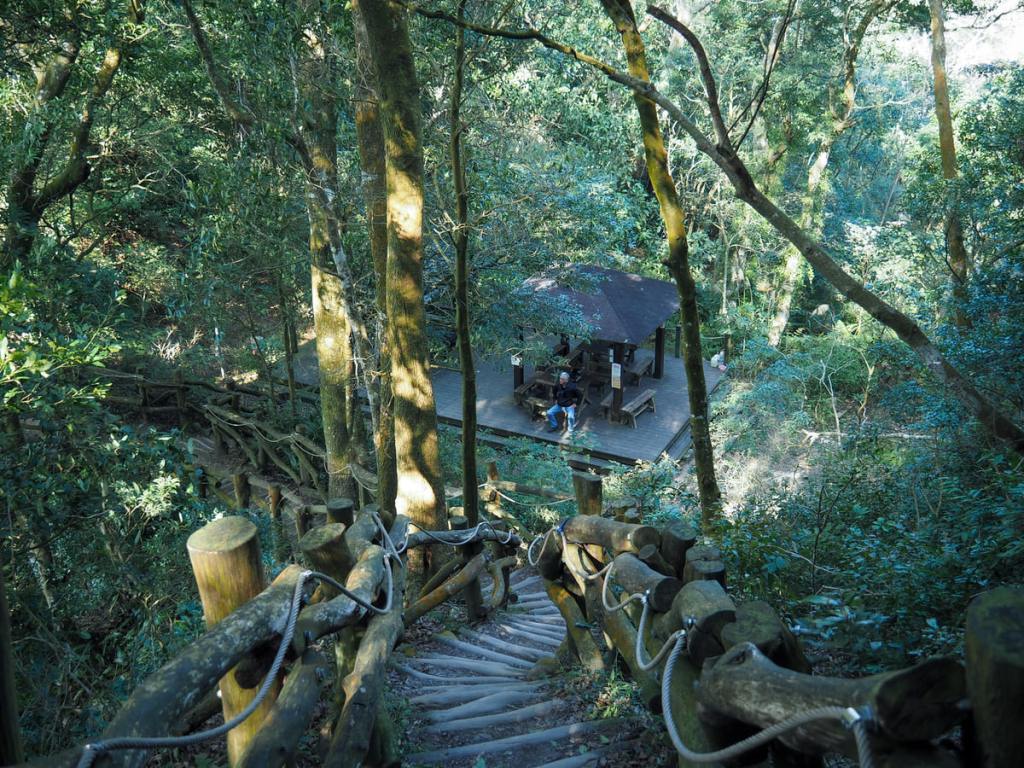
On top of the next peak, we found Qingjing Pavilion (清涼亭). Like a couple of others along trail four, this rest area has recently been renovated. In fact, this is a stupendous mountaintop rest area. Many small sections of seating are spread around so that groups can split off into their own areas. It’s a great use of the available space. We took a short break here before setting off again.
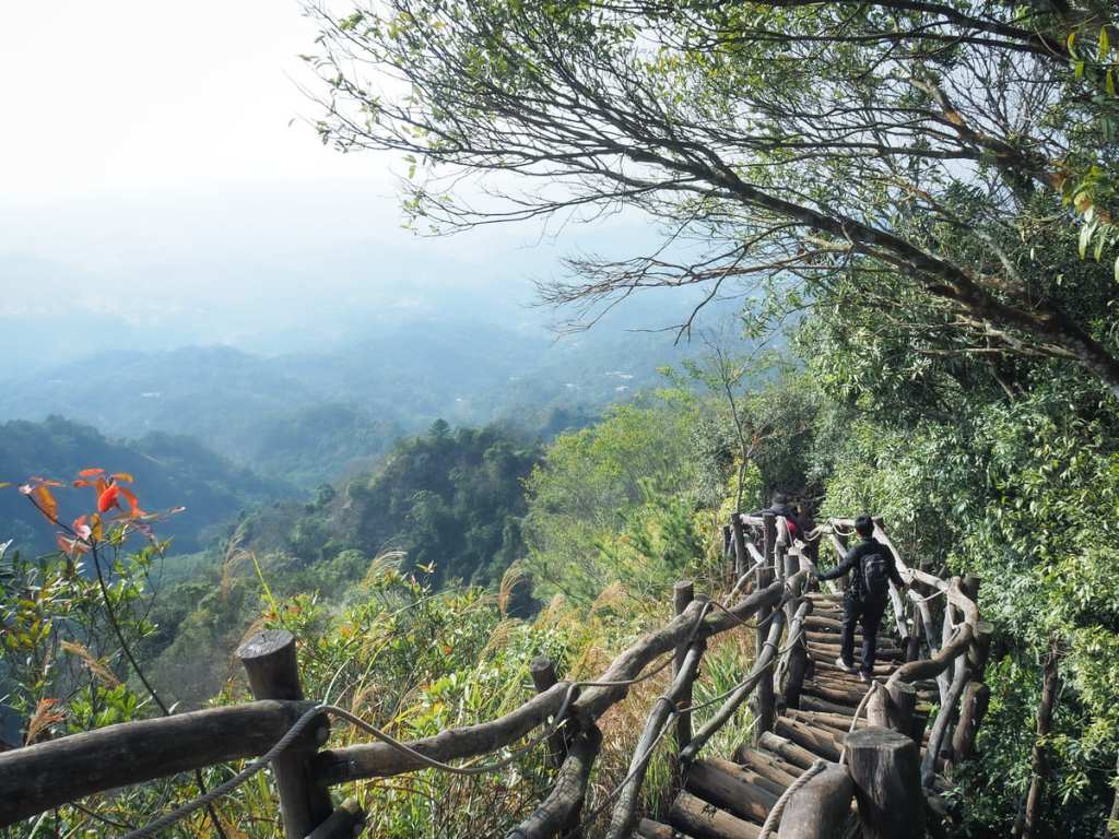
Not much further on, we passed the much smaller Guanri Pavilion (觀日亭). In clear weather, it must have a great view of the sunset, but you’d want to be especially careful walking this route in the dark. This ridge section between Guanri Pavilion and Touke Shan is probably the part with the very best views. How can you not be impressed by this?!

It’s not so much a case of steps, steps, steps as logs, logs, logs.

The pavilion complex on top of Mount Touke was still being fixed when we were there, but the triangulation stone and colourful metres-above-sea-level measurement were unaffected by the work. There were too many people milling around in the small space, so we headed onwards without stopping.
Dakeng Trail Number 4 finishes at the top of Mount Touke, and for about 200m, we picked up Dakeng Trail Number 5.
Ignore this first trail on the right, then at the next junction, follow the arrow pointing left onto Dakeng Trail Number 3.
Heading down is more of the same, although by this point, I could feel my brain getting quite tired with having to focus so intently on my feet.
On the way down, we were still being our slow-poke selves and even managed to get overtaken by a couple of dogs. I’m not sure why I’m shocked that dogs would be better at this than us, but they very obviously were.
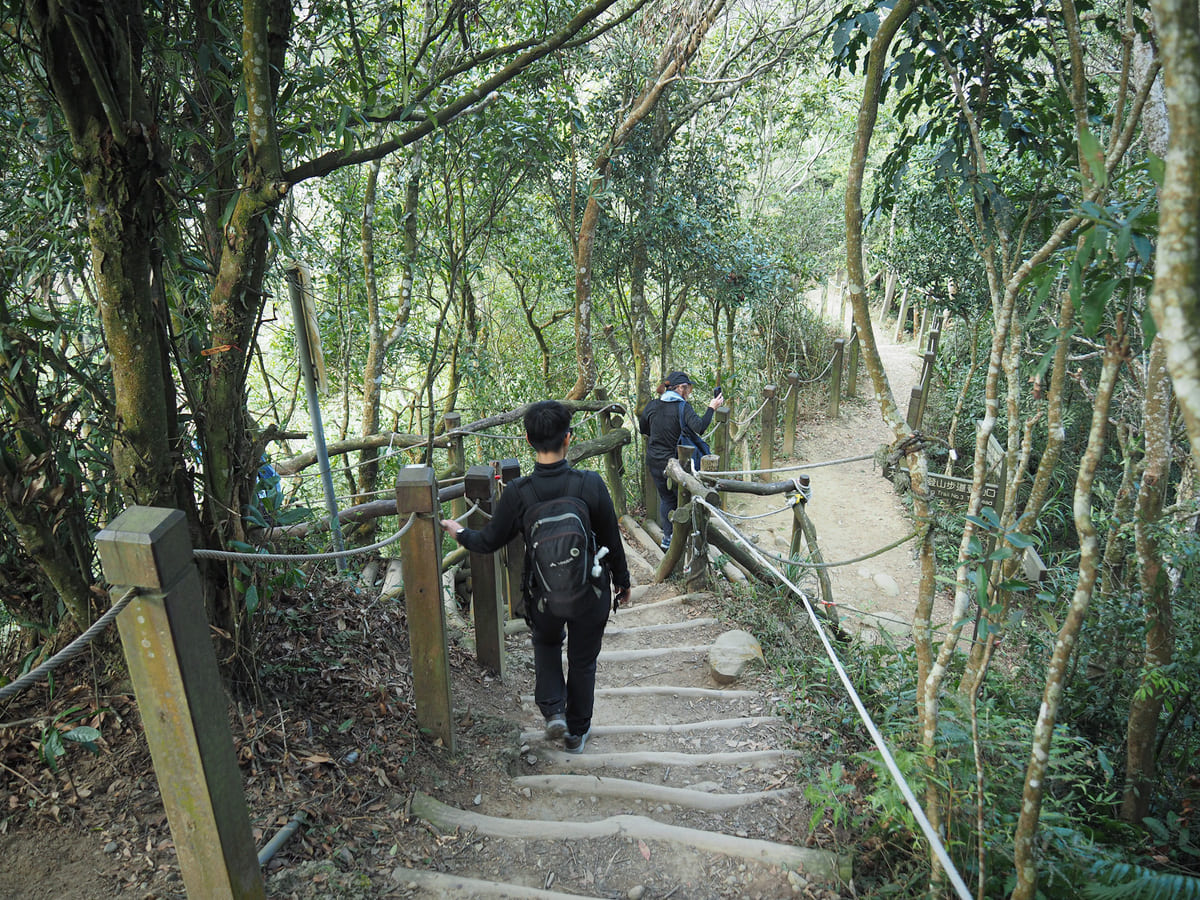
We were following our GPX route and digital maps, so we turned left down here following the sign to the bridge where we’d started our walk. However, I do not recommend you do this. I suggest you head straight on, then take the next left turn down trail 3-1. Route 3-1 is newly built and obviously very sturdy. The route we took… well, let’s just say it has seen better days.
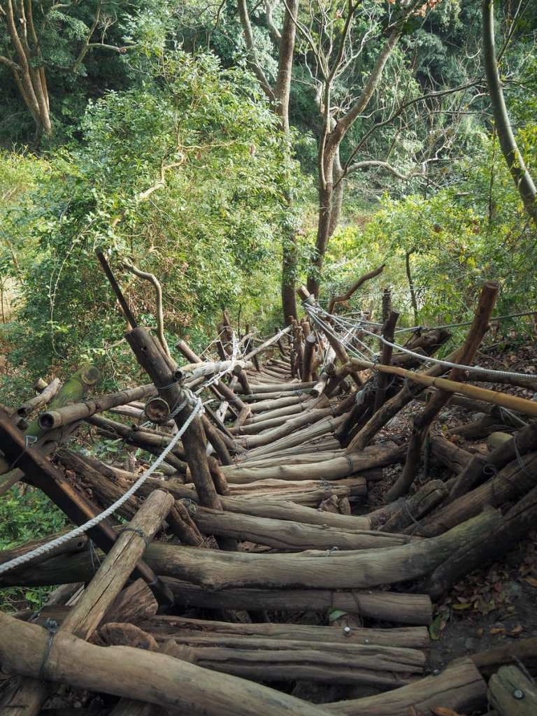
This section is extremely rickety. Multiple layers of steps had been placed on top of each other, and the steps creak as you walk.
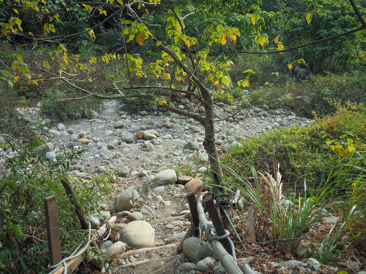
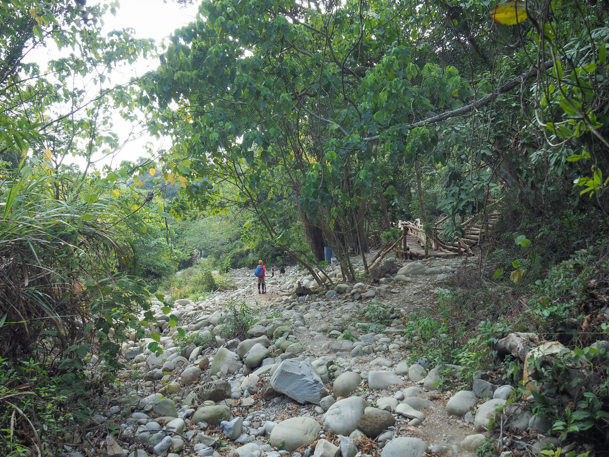
Thankfully though, the descent was over in a few minutes, and we found ourselves turning right to follow the riverbed downhill. Very soon, we spotted the new route 3-1 coming down to join us on the right. (This trail is so new that it hadn’t been added to all of the maps yet.)
If you keep heading downhill, you’ll quickly join up with the bottom entrance of trail 3-1 (where you would come out if you follow my advice from several photos ago).
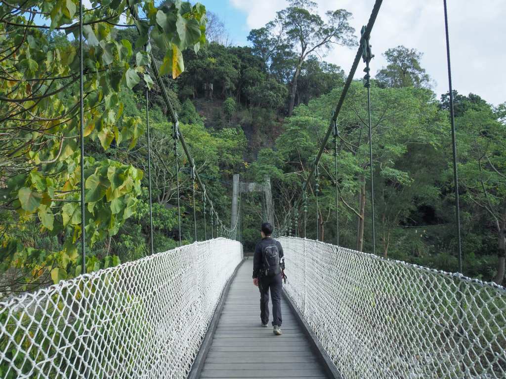
Keep heading downhill until reaching the suspension bridge. Once you cross over, you’ll find yourself back at the start of the loop.
From here, we turned right to follow the trail back towards the carpark and monkey park.
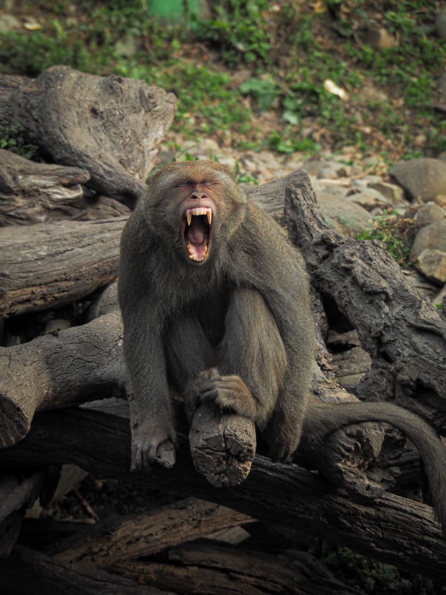
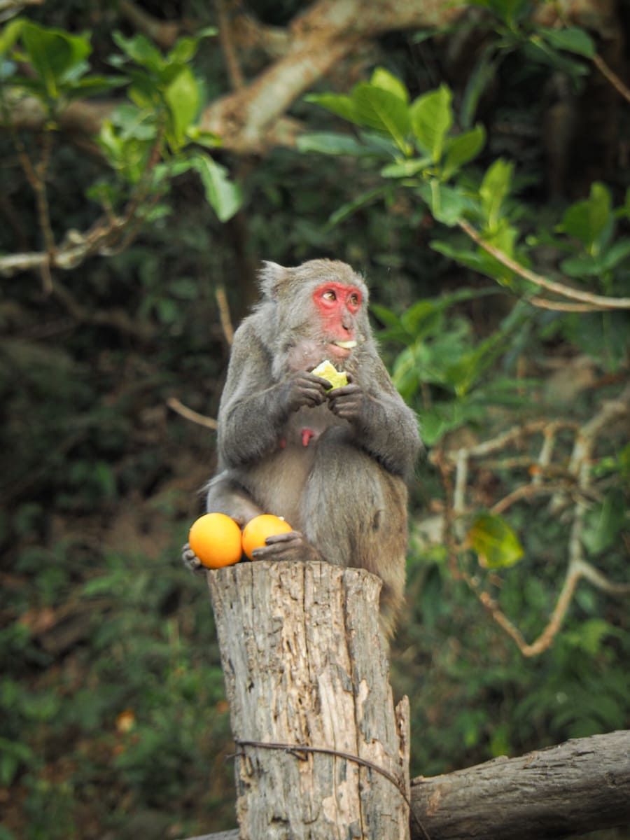


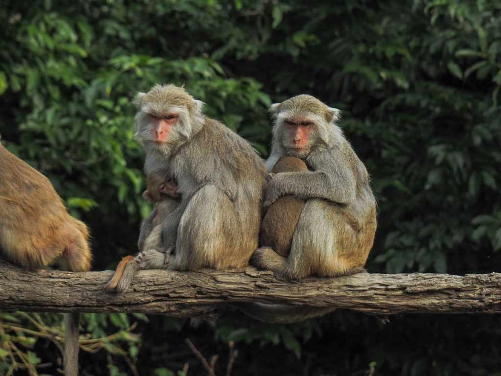
The woman at the ticket booth was shocked that it had taken us so long to climb, but told us that we’d arrived at the perfect time. We headed over to listen to the uncle with the loudspeaker laying the ground rules for the audience. The monkeys here are semi-wild. They belong to two separate troupes and come and go as they please, spending most of their time roaming the hills up where we’d just been walking. In the past, tourists in the area would come and feed the monkeys, and obviously, that is not a good idea. As you’ll know if you’ve visited other places where tourists feed the monkeys, this escalates the risk for both sides. With every session, management at this park includes an educational talk that instructs visitors on what to do or not do when they encounter wild monkeys. So, while I’m still not sure how I feel about this place, it is obvious that it’s run by people who are well-intentioned and who are trying to ensure harmony between Taiwan’s two species of primates.
HOW TO GET TO DAKENG TRAIL 4
Google Maps address: There’s parking near the trailhead by Uncle Guo’s Macaque Ecological Park.
GPS location: N24 10.400 E120 47.350
Public transport: Google Maps suggests several ways of arriving at the trailhead from Taichung TRA station by bus, all of which involve taking at least two buses, with the second one being one of the 66 services. The closest bus stop is Zhongzheng Camp.
Nearby Trails:
DAKENG TRAIL 4 TRAIL MAP
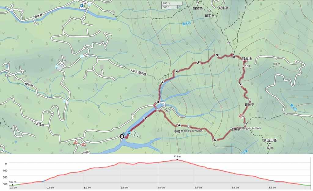
GPX file available here on Outdoor Active. (Account needed, but the free one works just fine.)
