Chiayi is truly a magical place for foreign hikers hoping to experience something distinctly different from Europe or the Americas. Mountain villages accessed by historic railways, forests made of towering bamboo and slopes clad in precision-clipped rows of tea — on this walk, it’s tick, tick, tick to all of the above, plus there’s the added thrill of potentially having to hitchhike.
Distance: 7.2 kilometres one-way. If you decide to walk back the same way, it’ll be double that.
Time: 3½ hours one-way, or at least double if you walk it both ways.
Difficulty (regular Taiwan hiker): 4/10 – This is on the harder end of easy or easier end of moderate for someone used to hiking in Taiwan—and by difficult, what I really mean is tiring.
Difficulty (new Taiwan hiker): 6-7/10 – If you’re not used to hiking in Taiwan, this is on the harder end of moderate. It’s very steep in sections, quiet (I went on a weekday and saw no one until the final kilometre), and it’s also a logistical challenge.
Total ascent: From Fenqihu to the Ruili trailhead, there is 430 metres of ascent and 740 metres of descent. If you want to do a there-and-back walk, those numbers would be more like 1,170 metres of both ascent and descent.
Water: I took about 1 litre on a warm November day. There are stores in Fenqihu where you can stock up on supplies, and there’s a store selling tea at the bottom trail head where you could probably get some water if you’re in need.
Shade: Most of the trail is very shady, but if you end up walking back along the road, you’ll be pretty exposed.
Mobile network: Mostly OK, but weak in some patches.
Enjoyment: This is a hard one for me. This is a popular trail and I can see why. It is a historic route that connects two mountain settlements. There are beautiful bamboo forestscapes, there’s a mountain railway at the start, and tea field at the end. There’s a lot of prettiness here. But, if I’m honest, I preferred other similar trails in the area like Yun-Chia Five Park Trail and the Mount Jinganshu/Wangyou Forest Trail.
Other: Lots of mosquitoes, and biting cat (read on for a visual).
Bathroom facilities: There are toilets in Fenqihu.
Route type: There-and-back or point-to-point (see transportation info for more on this).
Permit: None needed, but depending on how you plan to arrive, you might need to book bus/train tickets in advance.
Jump to the bottom of this post for a trail map and GPX file.
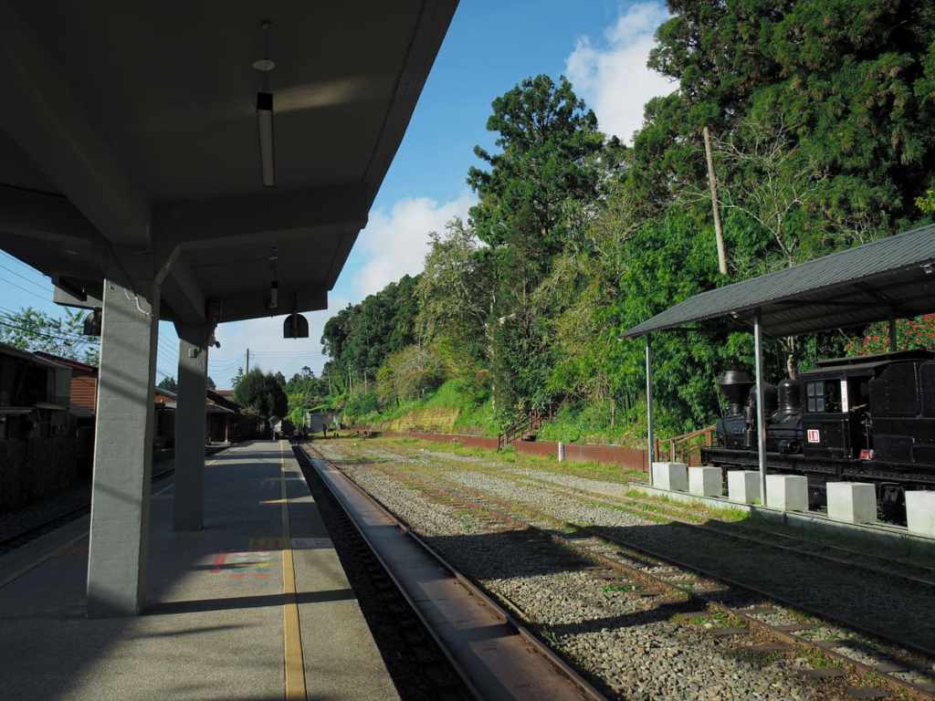
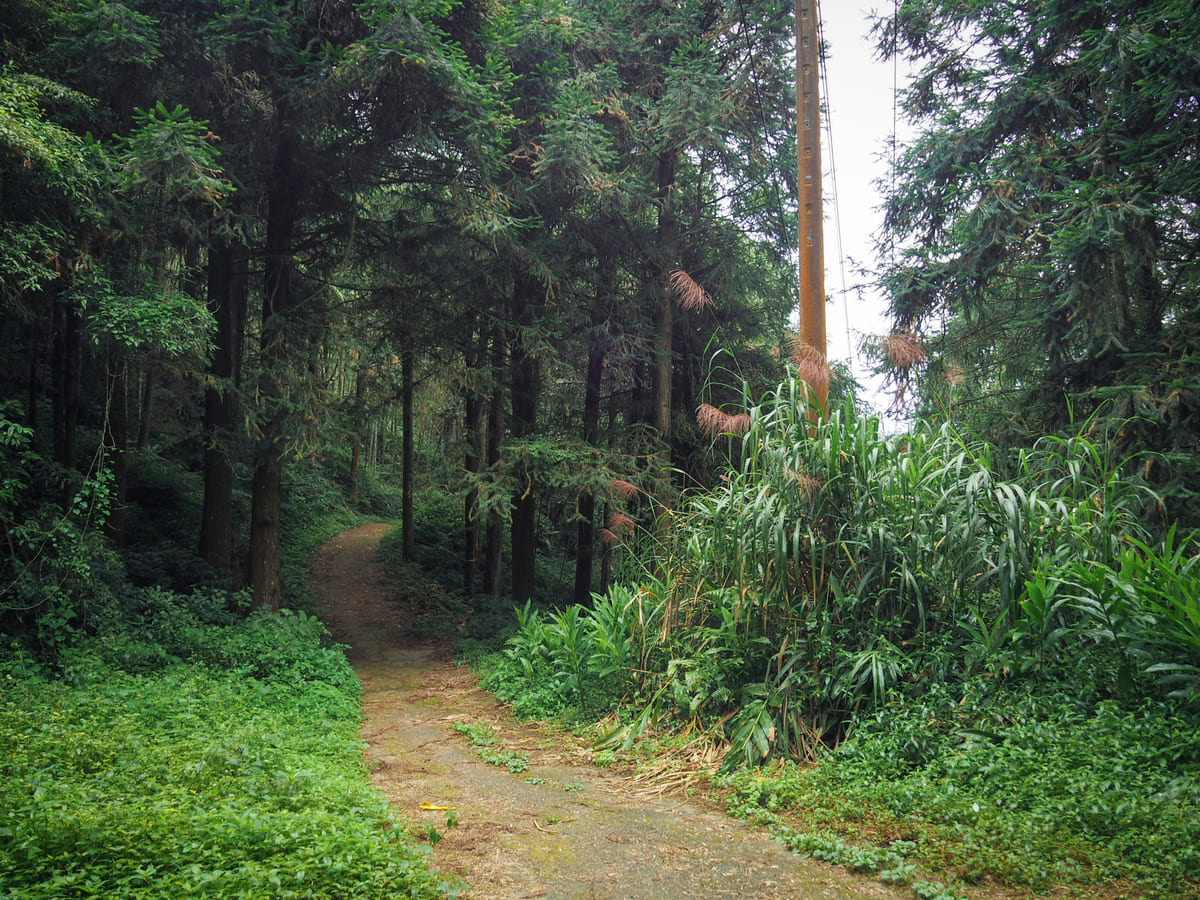
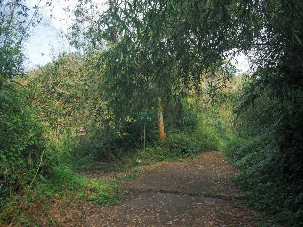
When I started my walk, it was still far too early for Fenqihu Station to be buzzing with tourists, but a small number of them had been milling around the village’s 7-Eleven when I got my coffee. To get to the start of Fenrui Historic Trail, cross over the tracks and head up the second flight of steps beyond the shiny black steam train.
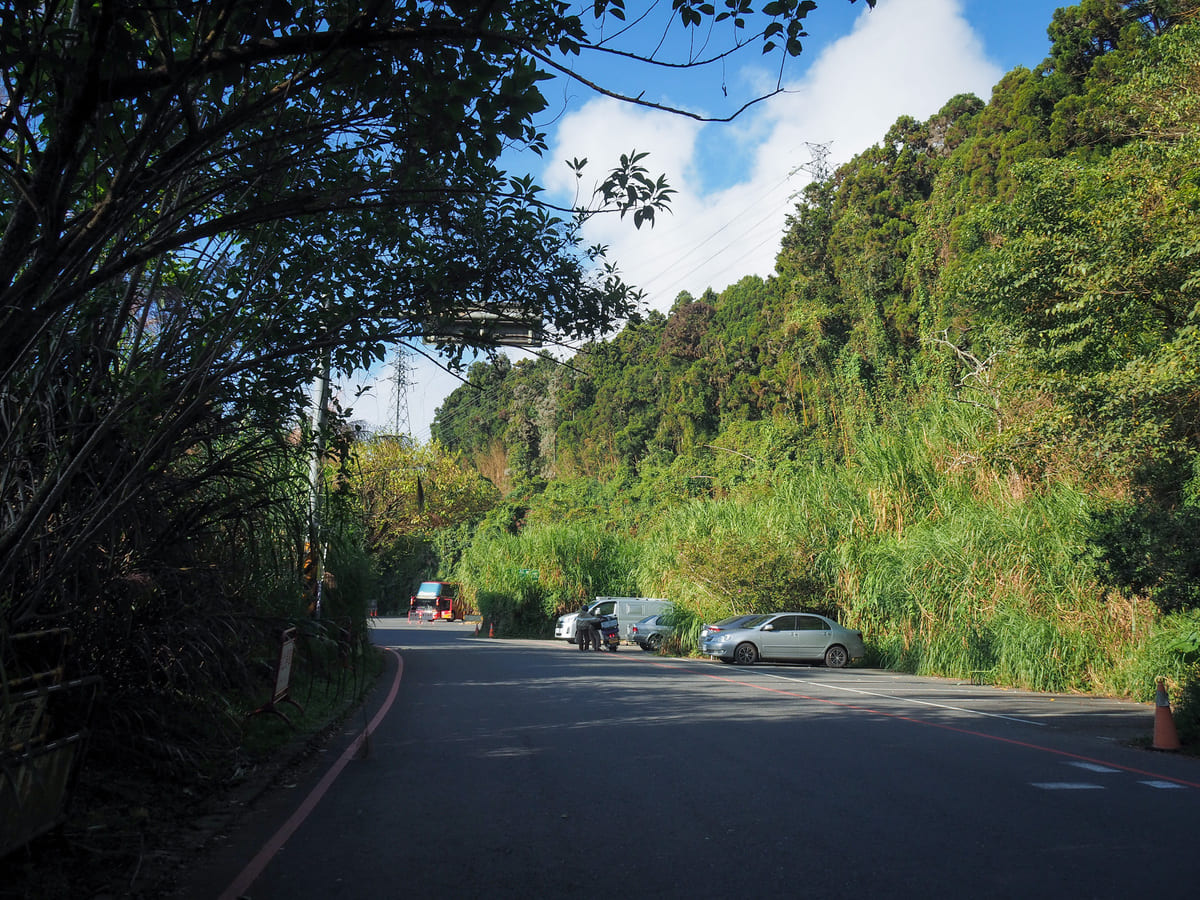
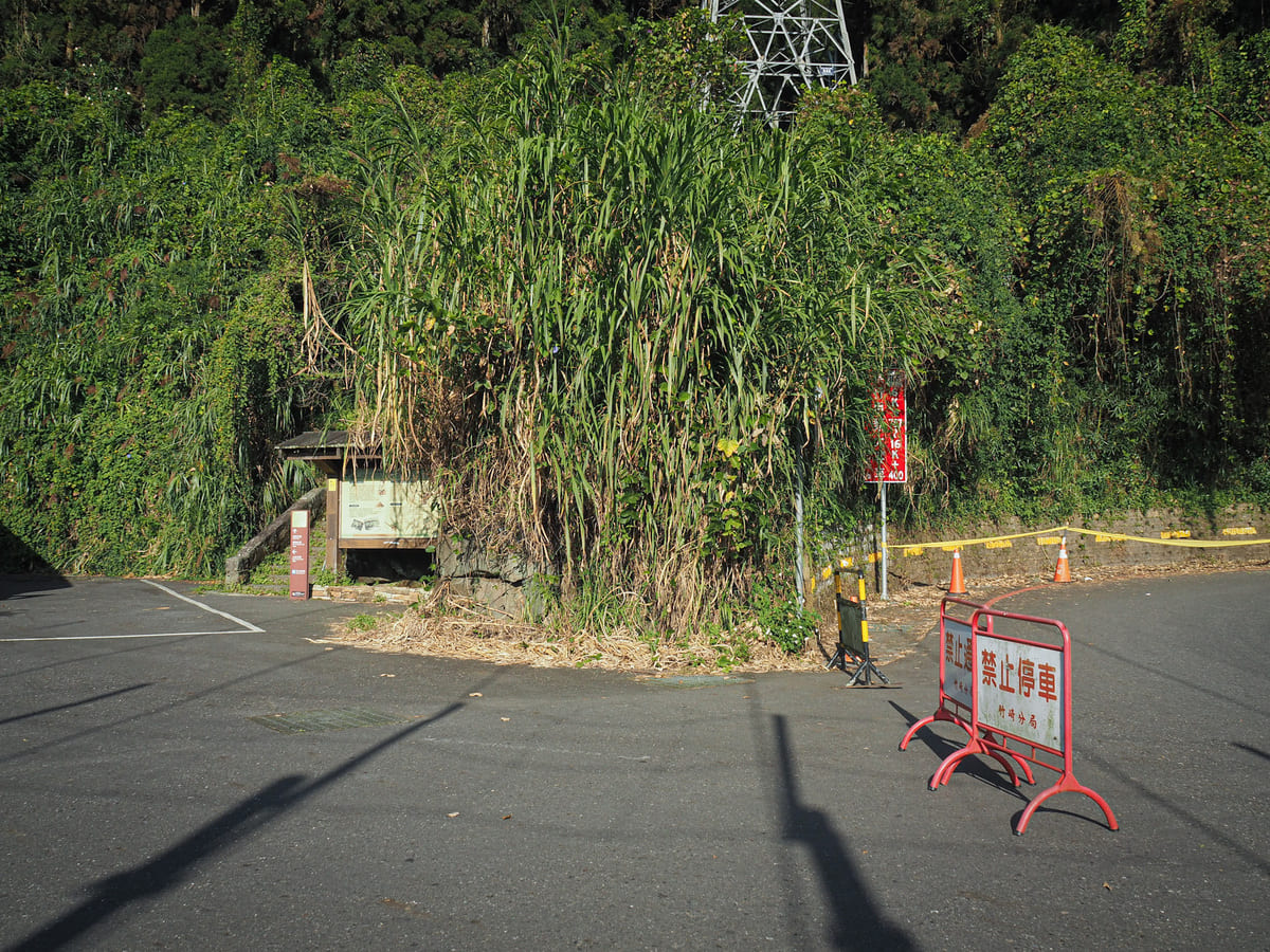
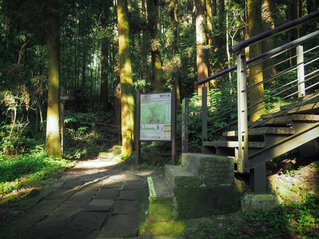
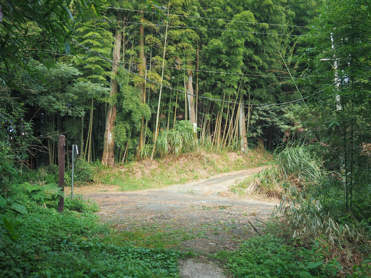
The steps emerge a little further up on Chiayi District Road 169. Turn left onto the road and follow it up to the tour bus parking lot. It’s from this auspicious location that Fenrui Historic Trail disappears into the trees. There’s a map and an information board giving an overview of the trail’s historical significance, the types of animals and birds you might encounter along the way, and a detailed map with an elevation profile and expected timings of how long each section will take. First up: a fifty-minute uphill slog.
Within a few steps, the forest seemingly embraced me into its vibrant world. Birdsong was all around and I enjoyed watching this flock of Taiwan barwings hop their way up and down the trees.
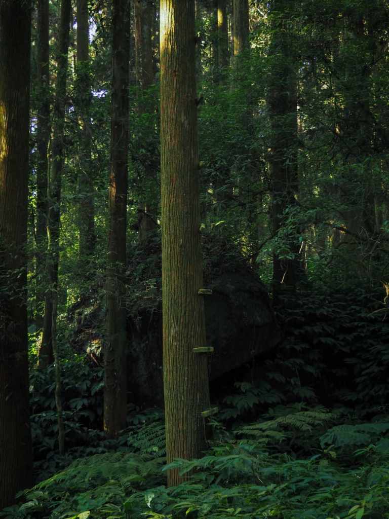
A tree trunk to the left side of the trail bore the signs of someone, sometime in the past having climbed it. I’ve no idea why, but these nailed-in bars can only have been used as a rudimentary ladder.
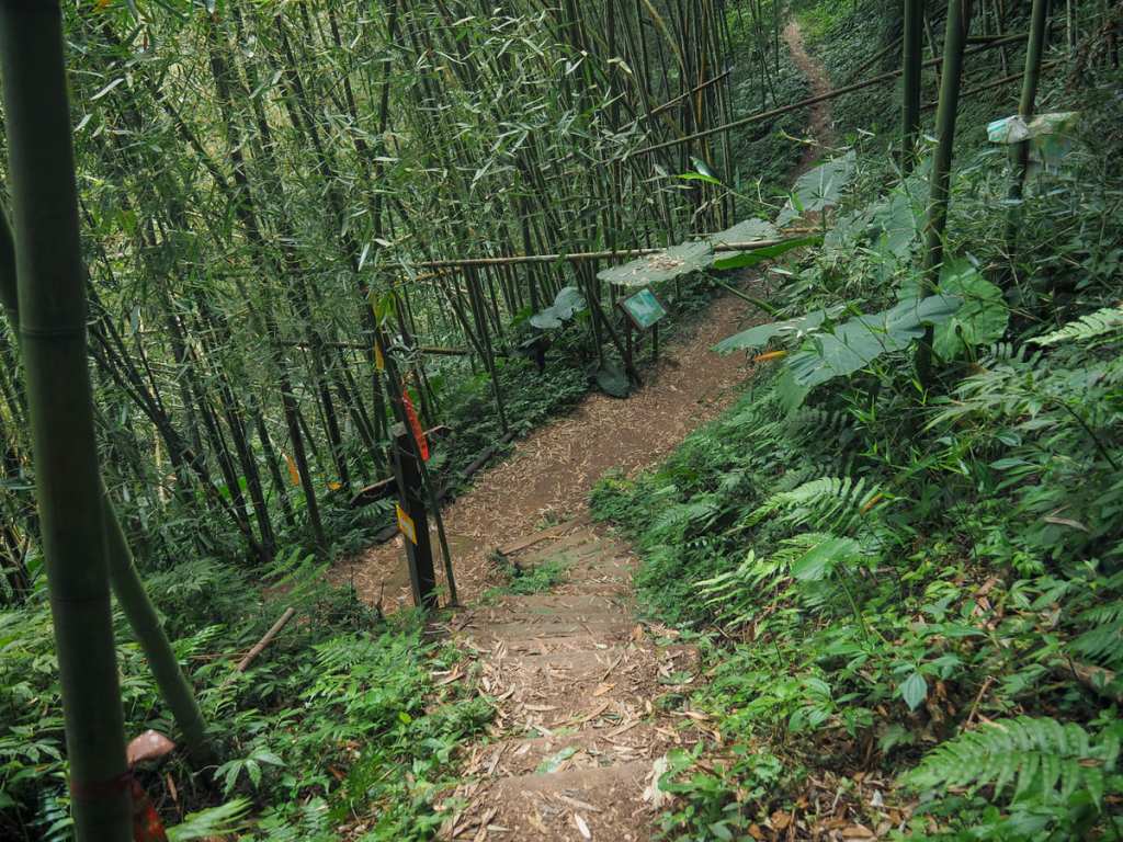
After a few minutes, the boardwalk steps of Fenqihu Trail divert off on the right. From here, the Fenrui Historic Trail starts its steep upwards climb.
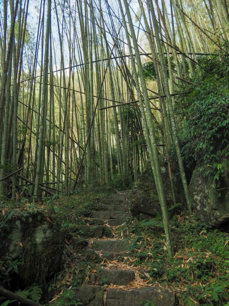
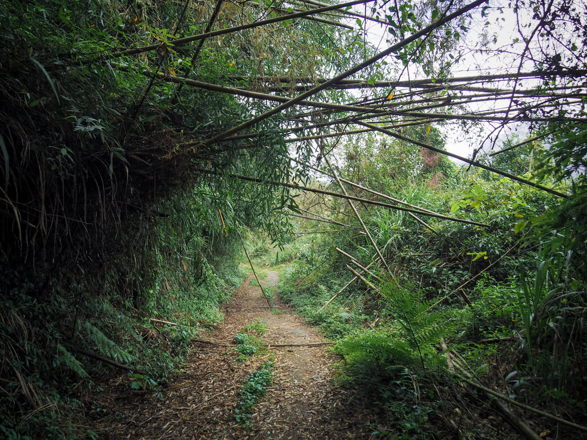
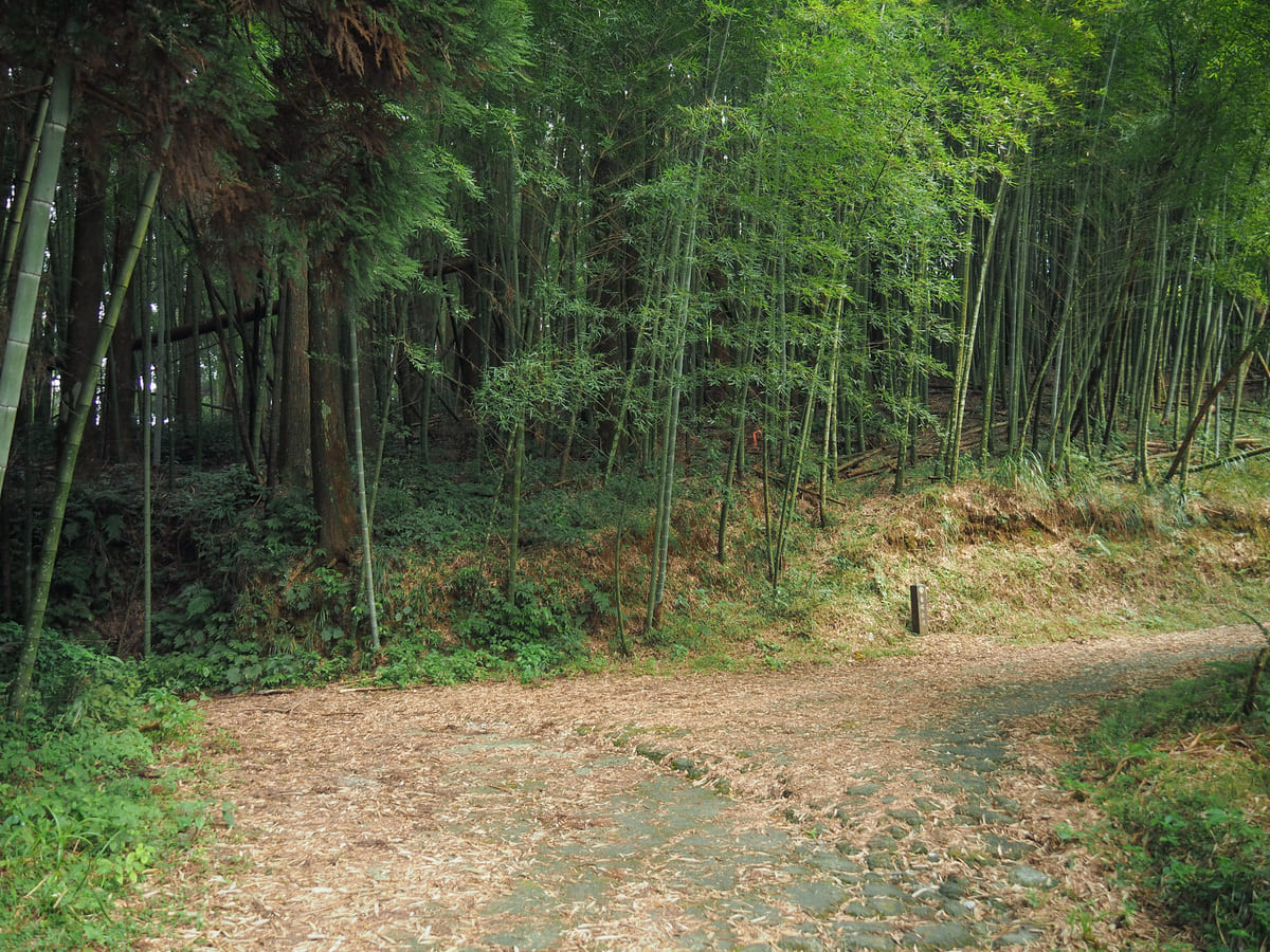
The steepest section of the climb is all through messy bamboo forests. I’m not certain, but I think a lot of the bamboo in this area might have recently been through the flowering and dying stage of its life cycle, because many of the groves were devoid of leaves.
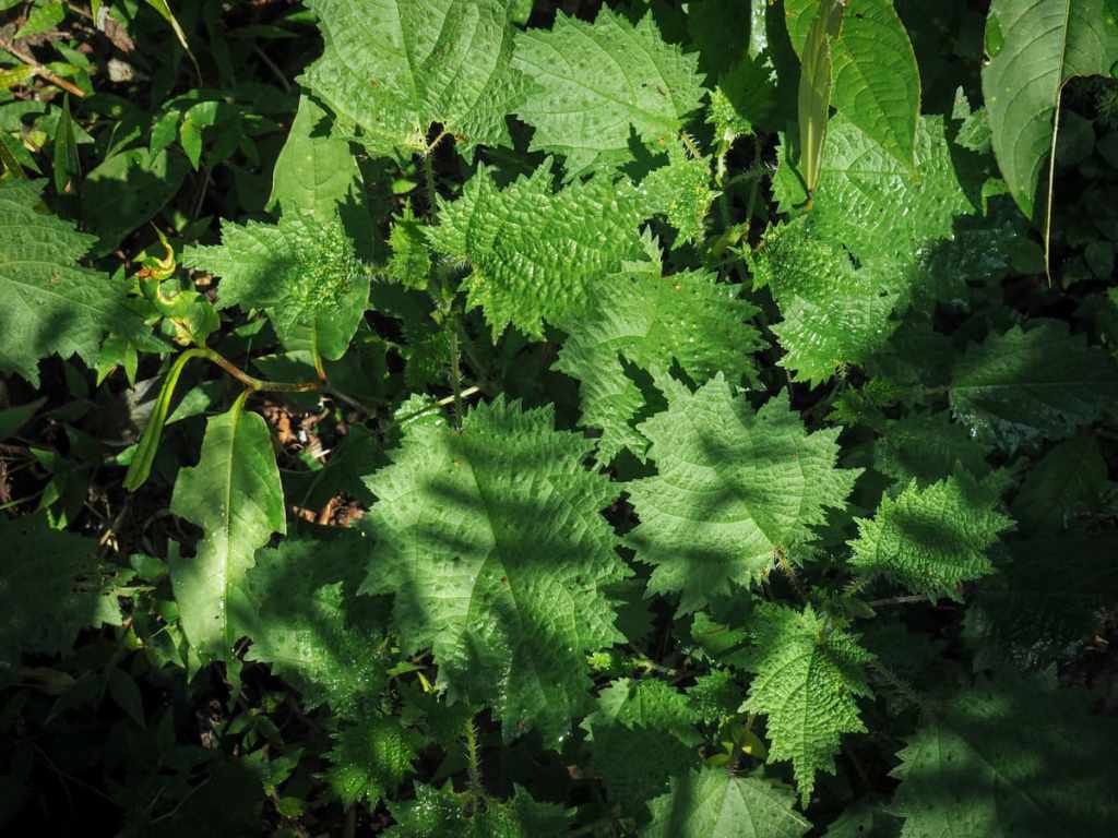
Keep an eye out for this plant at ankle-to-knee height. This is biting cat—a type of stinging nettle—and you do not want to know how it feels to get stung.
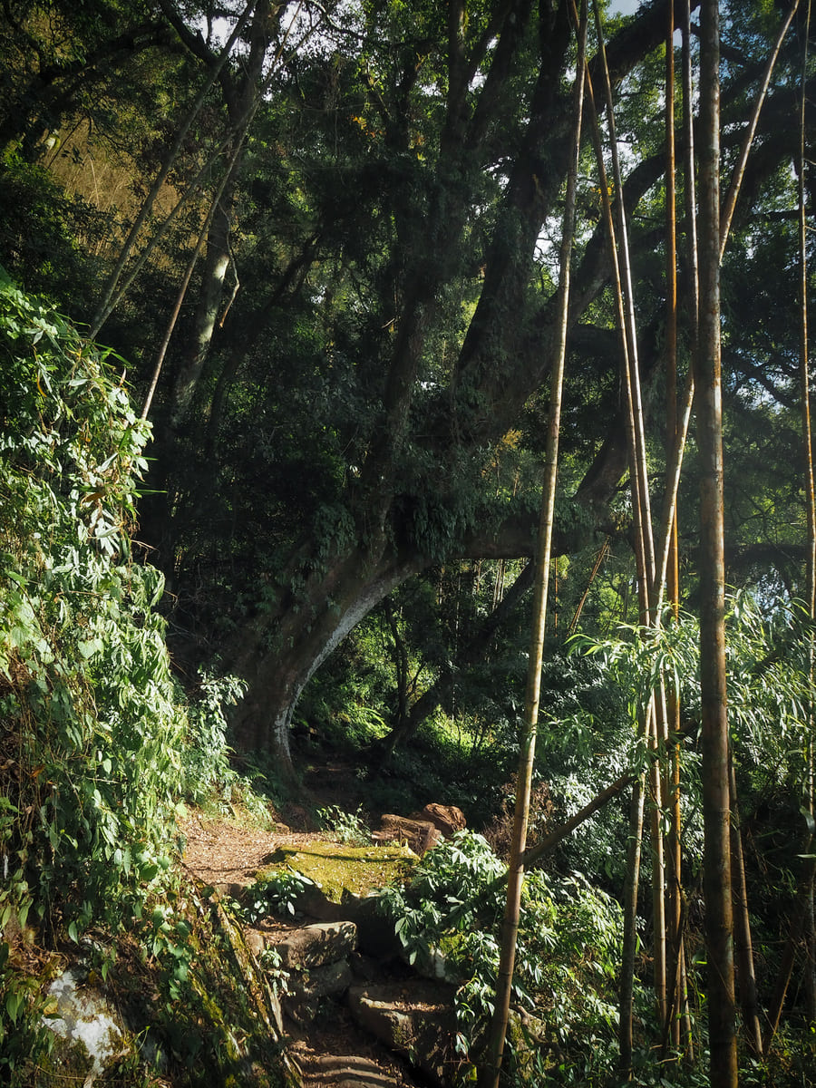
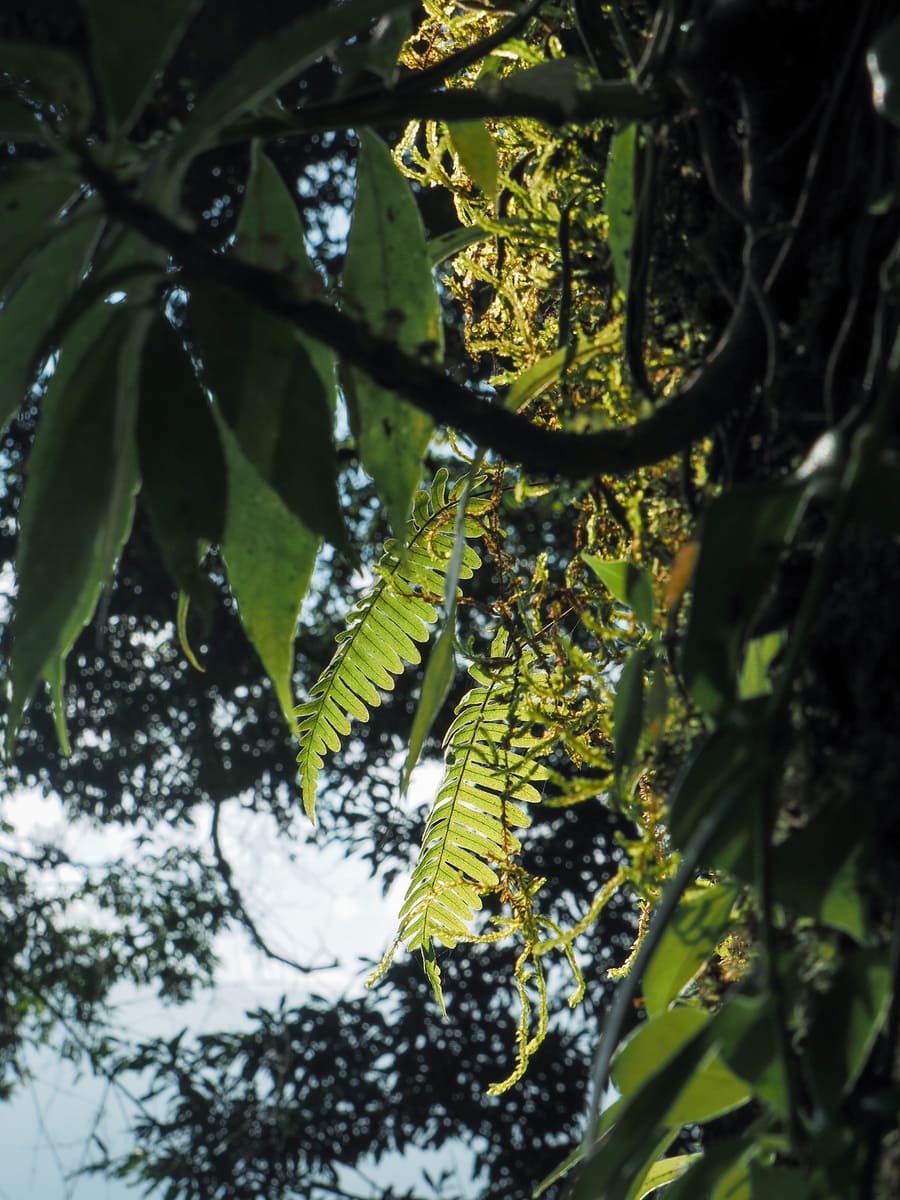
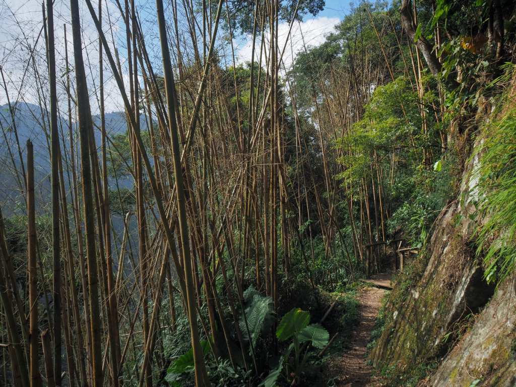
After about 30 or 40 minutes, the path becomes a little less steep and the bamboo monoculture gives way to a more mixed forest dotted with lots of gorgeous old camphor trees. These are the ones that stand far taller and sturdier than the other trees and they’re always draped with all kinds of mosses and ferns. They remind me of stately old ladies who won’t go out without donning their finest accessories.

A gap in the trees shows you just how far you’ve come already. That little collection of houses nestled in the hazy-morning shadow of the mountain is Fenqihu.
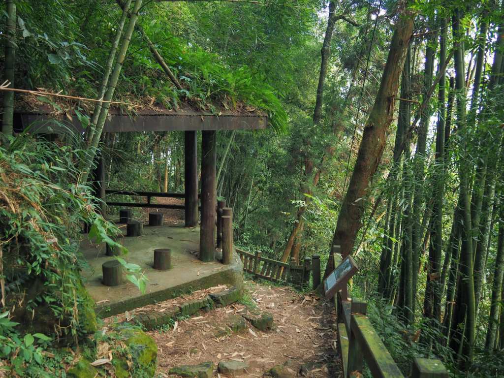
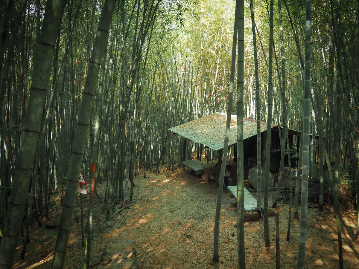
Shortly before you reach the first shelter along the trail, there is a side trail on the left leading up to Mount Guanglun (光崙山) and Motian Ridge (摩天嶺). I would strongly advise against adding this to your walk unless you are prepared for muddy, steep, and overgrown (see this post for some idea of what I mean).
In fact, the trail up to Mount Guanglun is not the only other trail leading away from this spot. On the right, there is a section of historic trail called the Cake Thief Trail (糕仔崁古道) on account of the fact that it was repaired by a gambling-loving farmer as penance for stealing some cakes. Don’t take that trail. Also, don’t take the narrow trail leading up behind the shelter. Instead, look out for the Fenrui Trail signage directing you down a wide track.
I wasn’t really expecting to find this kind of track on this trail. Most of the English language blogs detailing the trail seem to focus almost exclusively on the more picturesque bamboo sections. Nevertheless, I can’t say I felt sad to have a bit of easy walking after the steep climb of earlier.
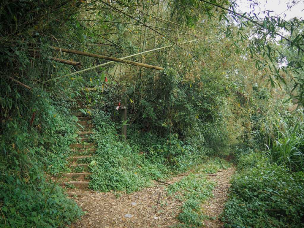
After following the track for about 5-10 minutes, the trail diverts off to the left and up some steps.
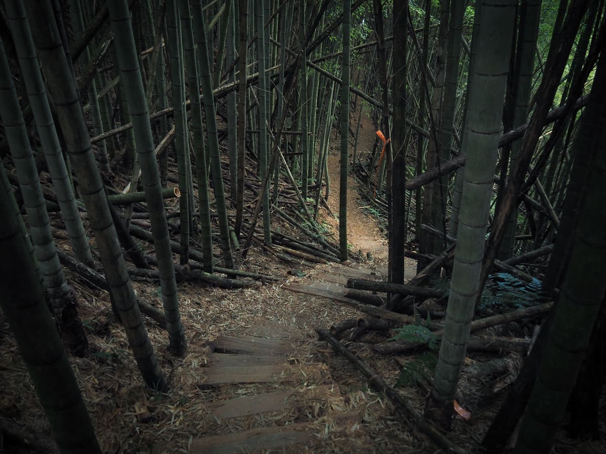
This section is chaotic. Bamboo stems have fallen across the trail like a giant’s discarded game of jenga. Around this point, I encountered what I think was probably a troop of monkeys just a little off-trail. There was movement from ground level to up high and some grunting sounds that were definitely monkey-ish in tone. I didn’t see anything except for a few black-necklaced scimitar babblers though.
After a while of ducking under and stepping over fallen bamboo, the trail emerges onto another farm track. Cross straight over, then at the second junction just a minute later, take the right fork.
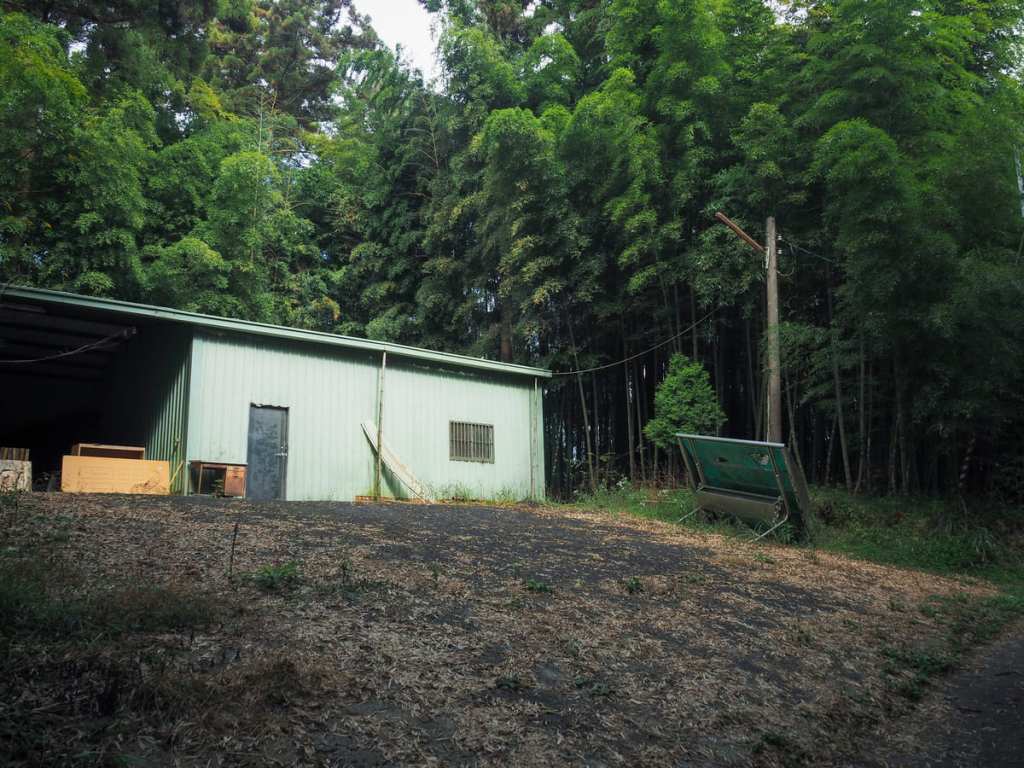
I passed a shut-up farm building. I’m guessing it’s probably used by people harvesting bamboo shoots—there’s pretty much nothing else up here.
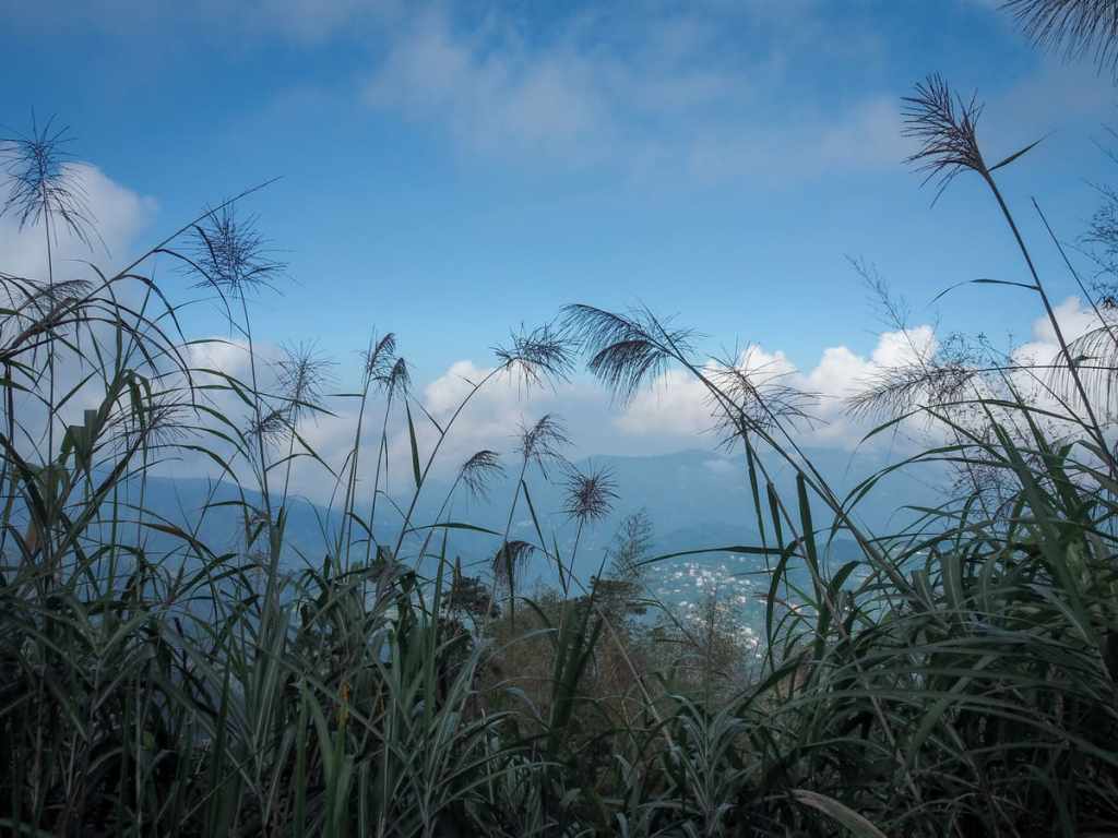
A lying sign says that this is the midpoint between Ruili and Fenqihu. It’s not. I think it’s about a third of the way if you’re coming from Fenqihu. It’s hard to see from the photo, but beyond the silvergrass, you can see tea farms spreading out over the distant hills.
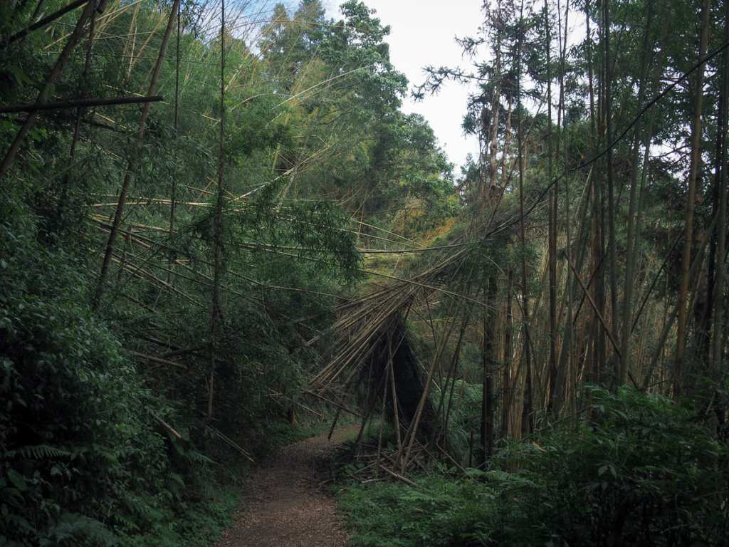
There’s more chaotic bamboo here. This fallen section looks to have been half cut away, judging by the pile of stacked stems on the right. It feels like it might collapse at any moment.
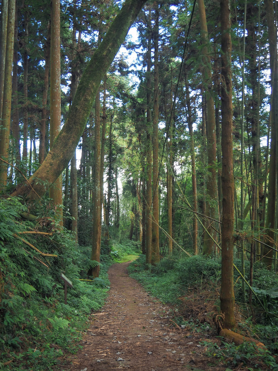
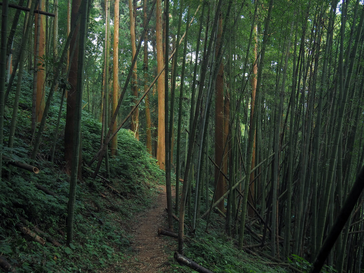
It was interesting to find patches of Japanese cedar interspersed among the bamboo groves—actually, I kind of liked the fact that I could enjoy both types of scenery.
The trail opens up a little onto a clearing beside another junction. Fenrui Historic Trail curves around to the left here, while a flight of steps leads up to Mount Yunzai (雲載山). From the map, it looks like the summit is just 200 metres off the main trail, but my legs were already tired from the past couple of days, so I didn’t check it out.
I had barely gone another 10 metres away from this junction when I was startled by grunting and some jerking, dashing movements through the trees on the downhill slope to my left. I stopped suddenly, and the sounds stopped too, but then, in response to me clapping my hands, the dark form of a wild boar went hurtling off through the bamboo, making a hell of a racket as it trampled the dry leaves. It’s not the first time I’ve come close to one of these while hiking, but it was the first time I was alone when I saw one. Even thinking about it now, I can feel the hairs prickle on my scalp in an animal fear response.
With the adrenaline draining from my muscles, I continued along the track until I reached the next junction. Here, the Fenrui Historic Trail takes a left turn and begins the start of the long descent.
This is probably the narrowest section of the whole walk, and there was a short stretch where I had to really focus my thoughts on where I was putting my feet because the path was both slippery and narrow, and there was a steep drop-off to the left.
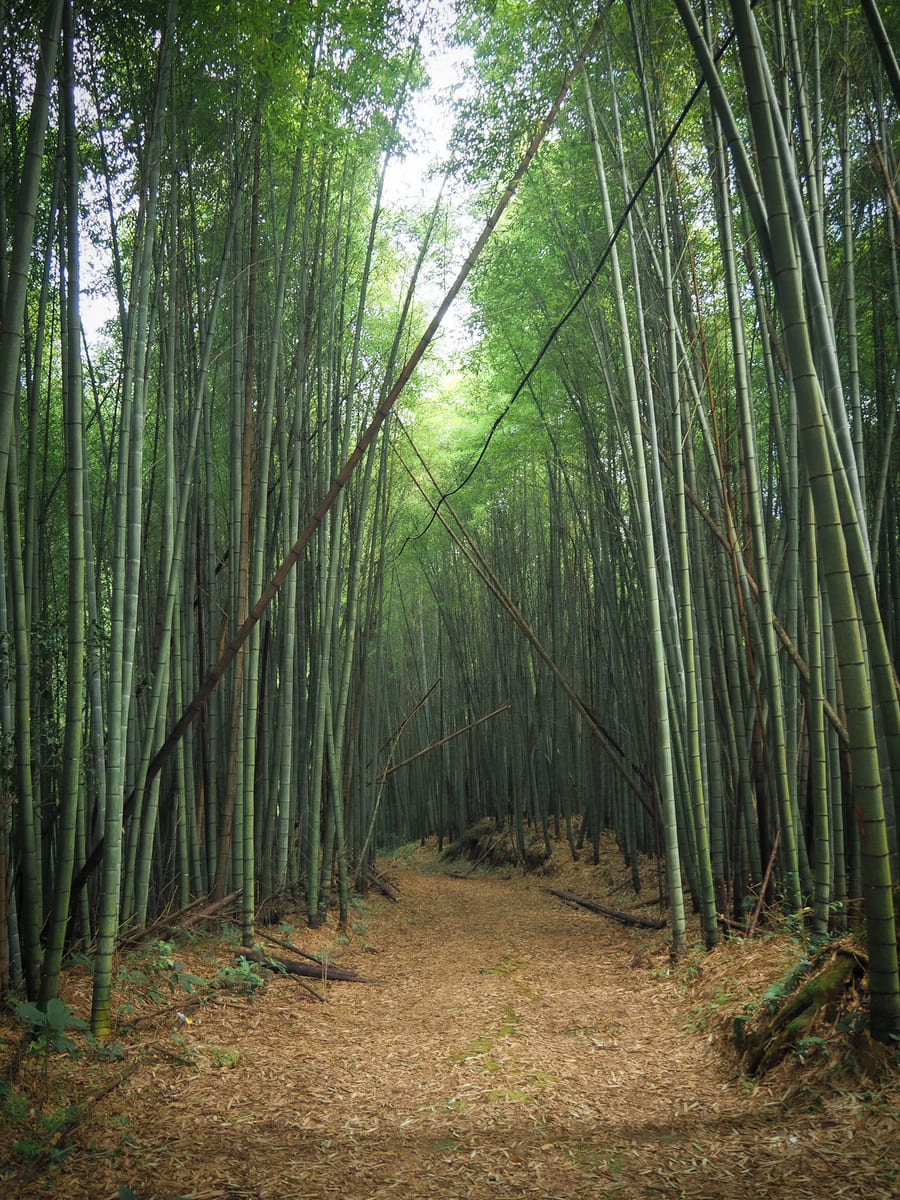
The further you descend, the darker and more dominated by bamboo the forest becomes. I think this must also have been in a crook of the hill which hadn’t yet been touched by the morning’s sun, because there were other stretches of bamboo forest that weren’t nearly this dark.
Here, Fenrui Historic Trail joins up with Ruitai Historic (瑞太古道)—both of these trails take their names take their names from the first characters of the places they join. Fenqihu (奮起湖) and Ruili (瑞里) in the case of Fenrui Historic Trail; Ruili (瑞里) and Taihe (太和) in the case of Ruitai Historic Trail. Turn left here and keep heading downhill.
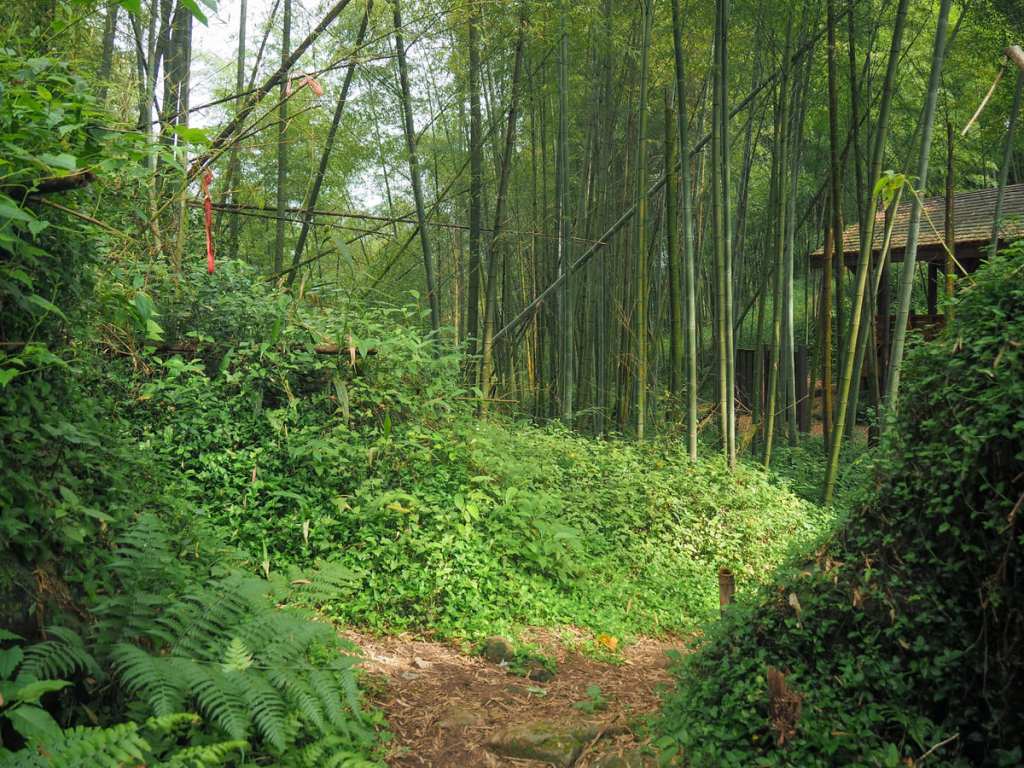
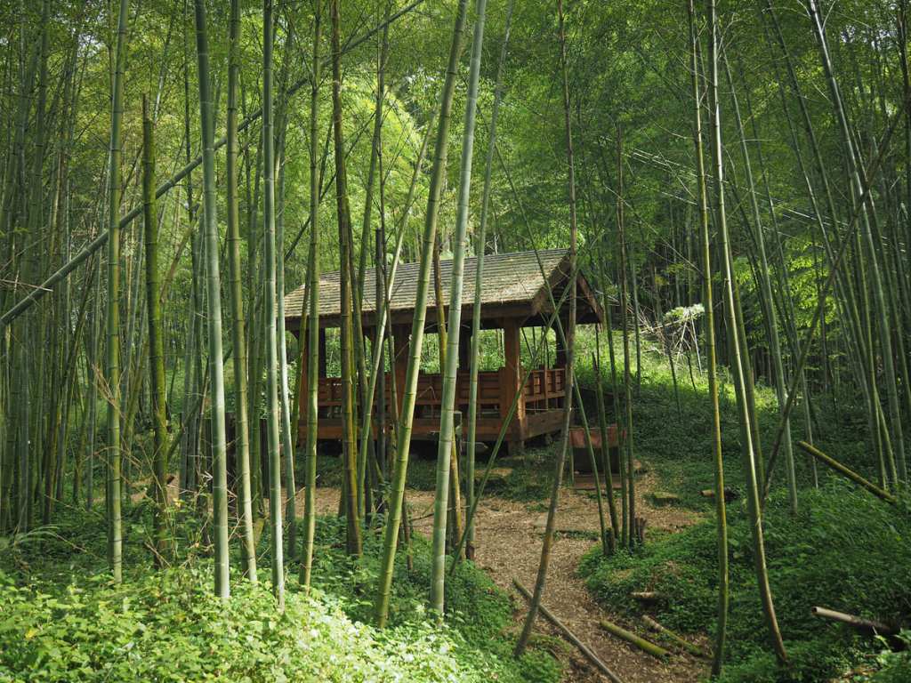
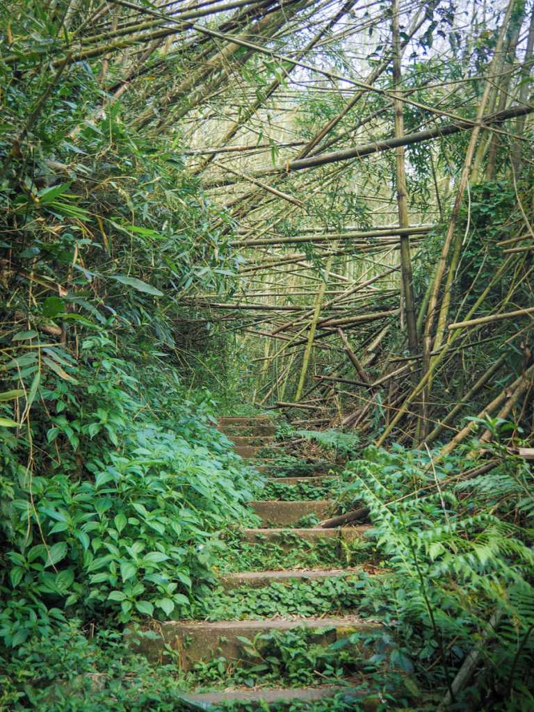
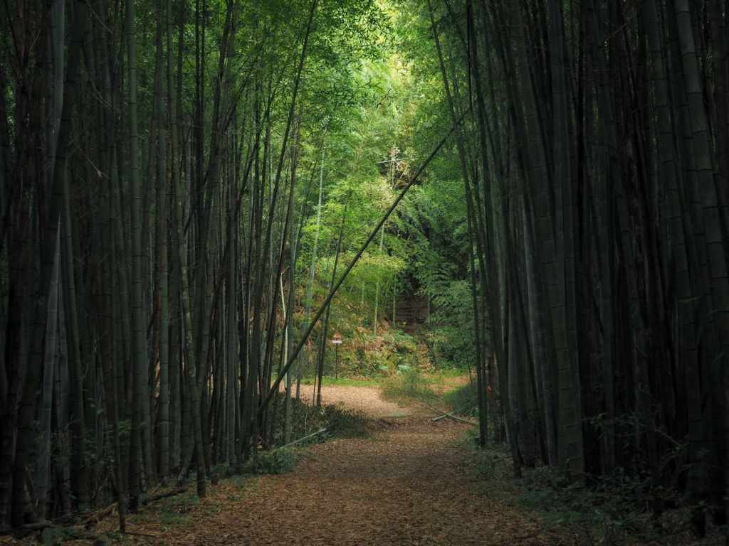
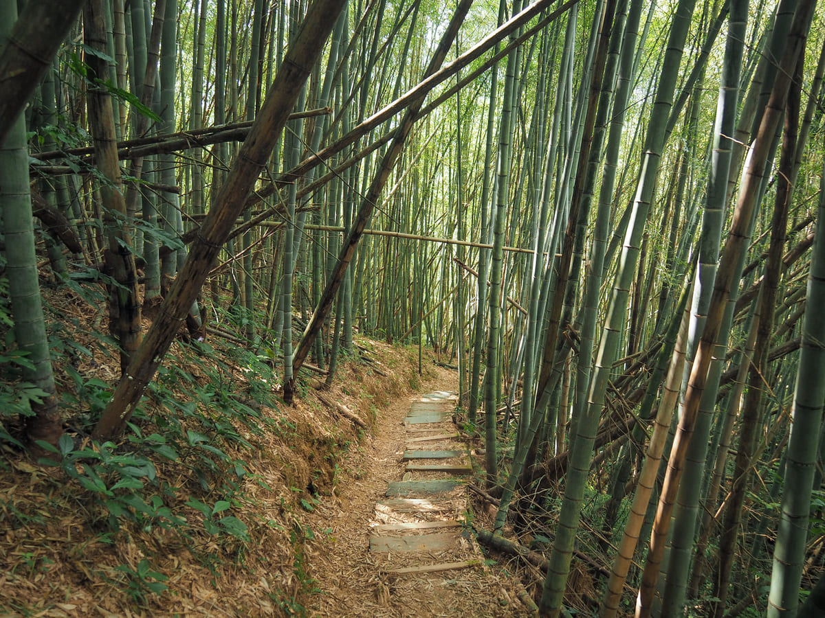
Another shelter sits close to the start of the portion of trail known as The Forest of Forgetting Sorrow (忘憂林).
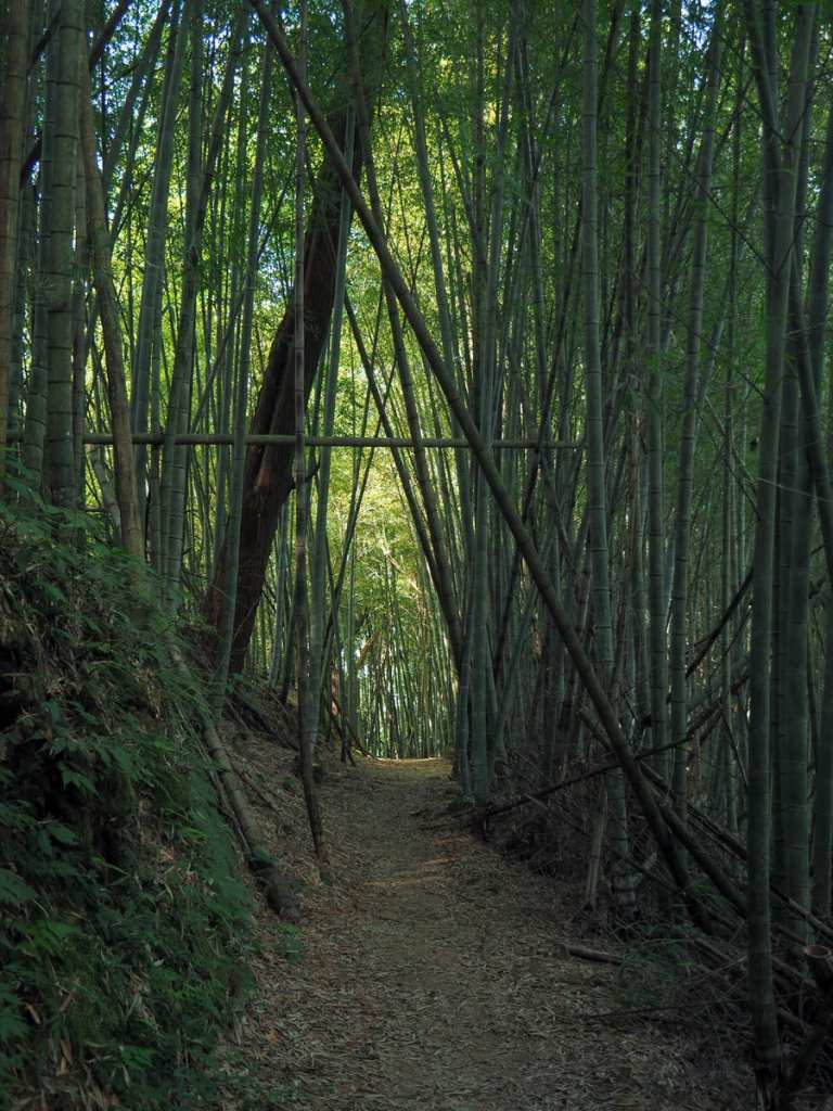
This is the section which features most prominently in other people’s write-ups of this trail. I can see why. It certainly is beautiful and dramatic, however, the lighting wasn’t great for photos at the time of my visit, and I think it looks even better if you have a person to show just how huge these towering bamboo stems are.

My patch of pretty light was right here on this specific bamboo stem. It was right around here—over two hours after setting off—that I ran into the first other hikers that I’d seen all day. The pair of them told me they were heading along Ruitai Historic Trail.
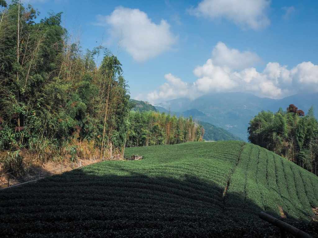
Just after I met them, the trail opened up briefly to cut along the edge of a tea farm.
Then, almost straight away, it was back into the bamboo for the final descent. I met another couple taking a rest here at the last shelter, and by this point, I could hear the cars rumbling away on the road below.
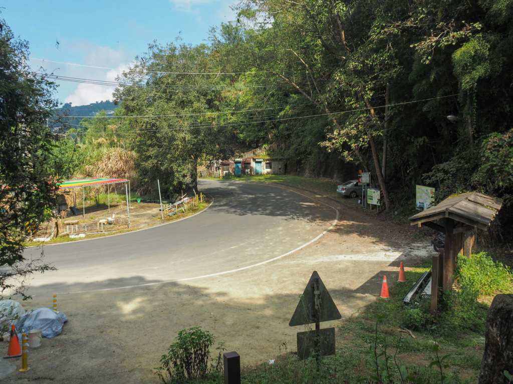
The trail ends at a pretty unimpressive spot here on Chiayi District Road 166. There is a bus stop (buses are few and far between), and there are a few grocery stores, but not much else. Before I set off on this walk, I knew my options for getting back to Fenqihu (where my scooter was) would be limited to either returning back the same way I’d come or else walking up a little and trying my luck at hitching a lift. After three previous days of hiking, I could not face that 2km climb, so I decided to turn right and head up a little further to Chiayi District Road 162 and go from there. I’ve accepted lifts in the past while walking in Taiwan, but I’d never actually intentionally hitchhiked before. Luckily for me, I struck gold on my very first attempt and was picked up by a 60-year-old farmer called Mr Huang, who removed a cauliflower and some aubergines from the passenger seat to let me in. It turned out that he was taking the vegetables from his mum’s farm a little further back to someone in Shizhao (石棹), which was the next village over from Fenqihu. He chatted happily away about his kids and how the area has changed since he was a kid, and I was back at my hotel within half an hour.
How to get to Fenrui Historic Trail
Google Maps address: The walk at Fenqihu Old Street and ends at a point on Chiayi District Road 166, somewhere around here.
GPS location:
- Fenqihu trailhead – N23 30.290 E120 41.585
- Ruili trailhead – N23 32.600 E120 41.000
Public transport: There’s no transport between the two trailheads, so that means you’re left with four options.
- Walk the trail in both directions — Given how long this will likely take, you’ll probably either need your own transport to the trailhead and/or to stay the night after you’ve completed your hike.
- Walk one way and hitchhike back — This was the option I went with. It wasn’t difficult to get a ride. In fact, the very first vehicle that past me gave me a lift.
- Plan your hike so that you stay in Ruili the day before and Fenqihu the day after (or vice versa).
- Parkbus sometimes runs this hike.
Either way, if you’re hoping to do this as a point-to-point trail relying on public transport, then you’re going to have to plan your visit carefully and almost certainly plan to spend a night in either Fenqihu or Ruili.
Fenqihu to Ruili Transport
Getting to Fenqihu — The 7302 bus departs from Chiayi Train Station at 7:06 am and 3:06 pm daily (Chiayi Station is not the first stop, Daya is, so you’ll need to get there earlier). The early bus arrives in Fenqihu around 8:50 am and the later one gets there around 4:50. (Note, if you arrive on the later one and stay the night, most places will be closed by the time you get there.)
Ruili to Fenqihu Transport
Getting back from Ruili — On weekends, the last 110 Taiwan Tourist Shuttle departs the Ruili-side bus stop at about 4:30pm (best arrive at least 15 minutes early on these rural routes). Mid-week, the latest bus to leave here passes through too early to be of use.
Getting to Ruili — On weekdays, the earliest bus to arrive at the Ruili trailhead is the 7315A, which arrives at 11:50 am after departing Chiayi Station at 9:24 am. On weekends, the earliest bus is the 110 Taiwan Tourist Shuttle, which leaves Chiayi Station at 7:47 am. In both cases, Chiayi Station is not the first stop (Daya is), so you’ll need to get there earlier.
Getting back from Fenqihu — The last bus back from Fenqihu is the 5 pm 7302 service bound for Chiayi.
Fenrui Historic Trail Map
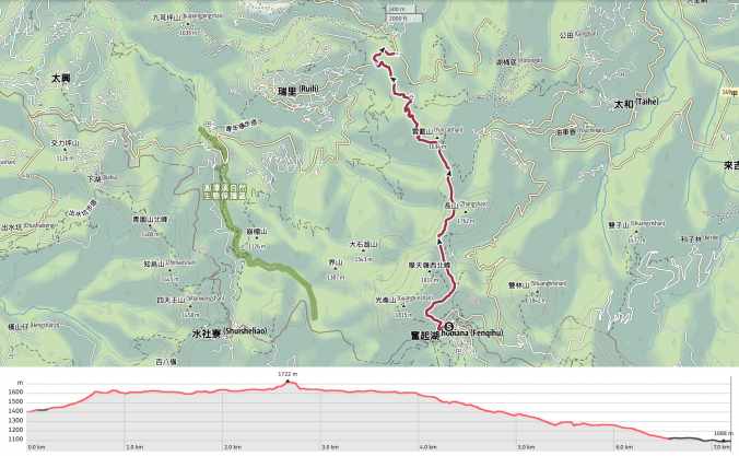
GPX file available here on Outdoor Active. (Account needed, but the free one works just fine.)
