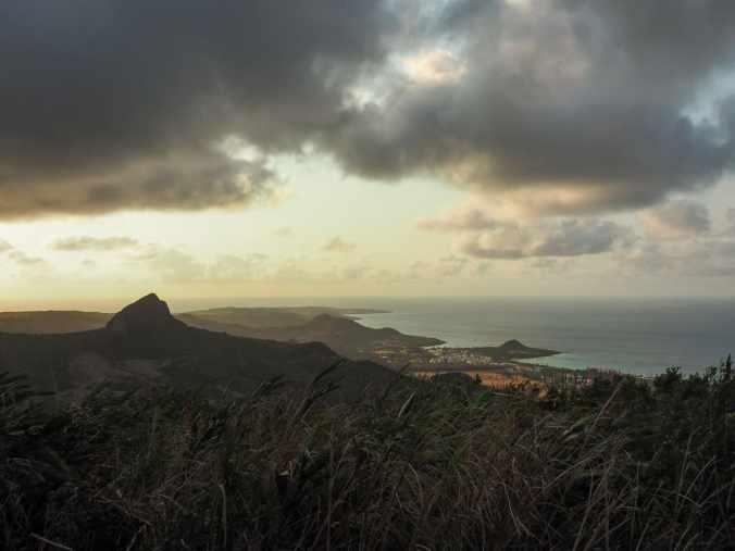
Mount Dashanmu, Taiwan’s southernmost Xiao Bai Yue, is a short and sweet hike with views overlooking the coast. I visited pre-breakfast one morning and enjoyed watching the sun add colours to the landscape.
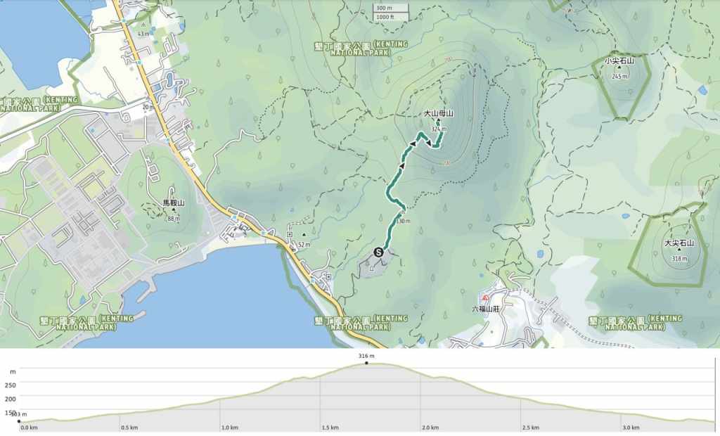
DISTANCE: About 3.5km.
TIME: 1½-2 hours – It took me about 45 minutes to climb, 30 minutes to descend, and a while to enjoy the views at the top.
TOTAL ASCENT: A little over 200 metres.
DIFFICULTY (REGULAR TAIWAN HIKERS): 2/10 – Watch out for the loose rocks and a couple of unclear turns. Those aside, this is a pretty easy walk.
DIFFICULTY (NEW HIKERS): 3-4/10 – The rough track, slight climb and lack of signage out this walk on the harder end of easy for new hikers.
SIGNAGE: There’s very little signage here at all.
FOOD AND WATER: I walked this before breakfast, so I just took a coffee and a jujube for a little mountaintop snack.
SHADE: Not much shade. I did this walk before the sun rose too high, but had I been walking a bit later, I would have wanted at least a sun hat.
MOBILE NETWORK: Clear throughout.
ENJOYMENT: This is a short and sweet walk with some enjoyable coastal views.
SOLO HIKE-ABILITY: This walk is safe and easy enough to do solo.
OTHER: It might be worth giving superstitious hiking mates a heads up that the starting point is a graveyard.
TAIWAN 100 MINOR PEAKS: Number 81
ROUTE TYPE: There and back. (The map shows a possible loop, but on the ground, the trail looks quite unclear.)
PERMIT: None needed.
Jump to the bottom of this post for a trail map and GPX file.
DIRECTIONS:
From the parking lot at the top end of a small graveyard, you can see the summit of Mount Dashanmu. It looks tantalisingly close, but it would take me about 45 minutes to make my way there.
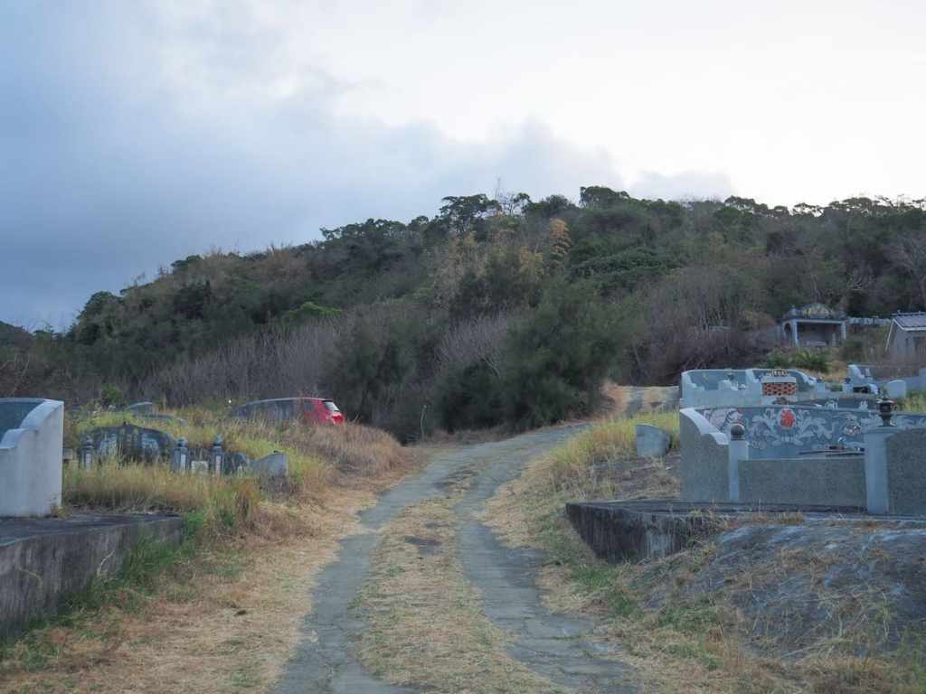
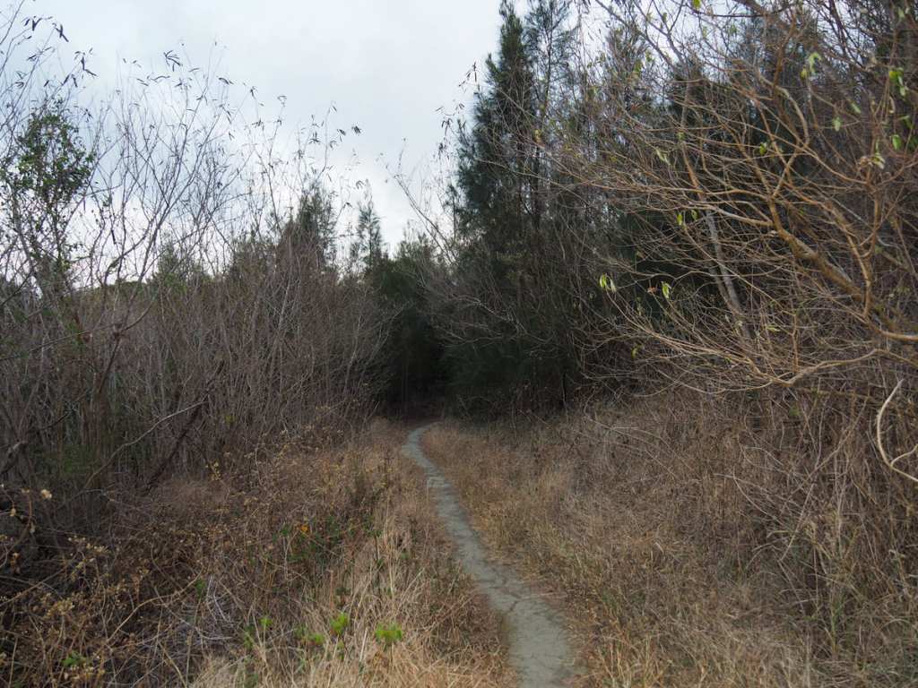
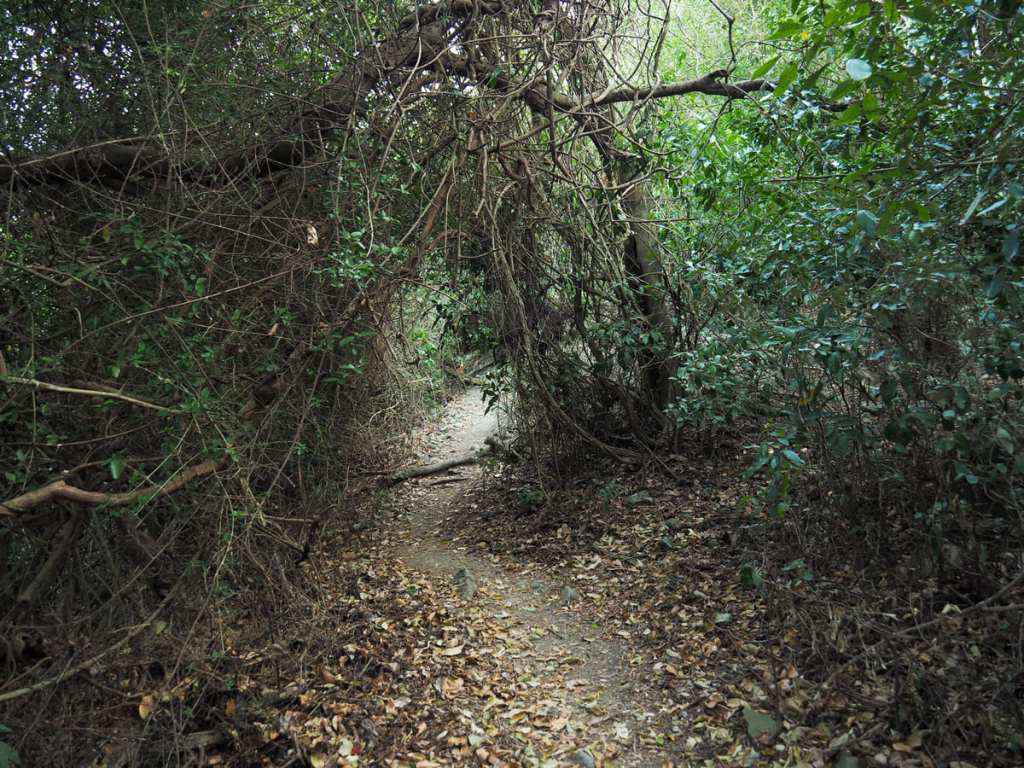
My scooter was the first vehicle in the carpark when I arrived at about ten past six, but as I was photographing the start of the walk, a couple pulled up in a little red car. The start of the trail is an almost missable opening at the back of the carpark (just to the right of the car in the first photo).
The landscape here is entirely unlikely anything I’m used to back up north. Everything is dusty and dry, although the fact that the area is currently experiencing a drought probably not doing the land any favours.
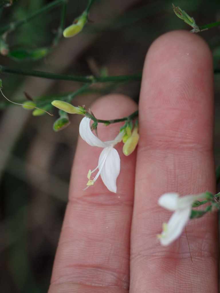
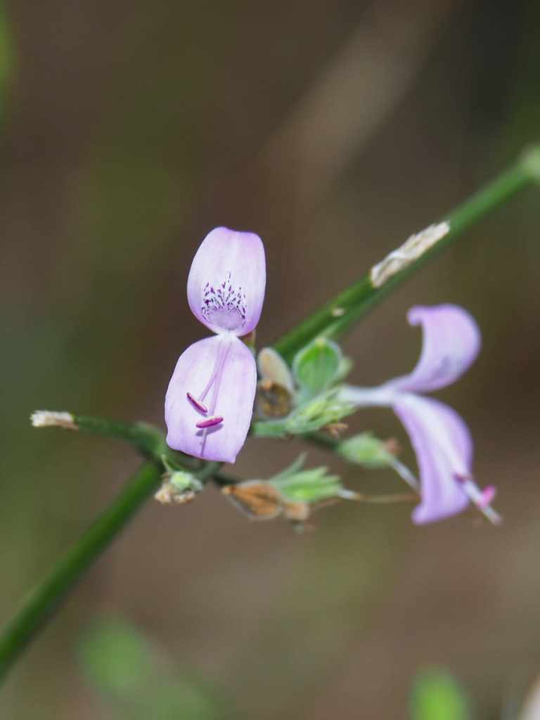
Pretty much the only flowers growing were these tiny Hypoestes cumingiana (槍刀菜). I think the white ones on the left are just an oddity. There was only one patch with white flowers, all the rest were purple.
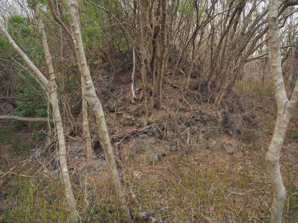
The rocks are mostly the same coral limestone that you can see all over Kenting National Forest Recreation Area. The rocks’ many nooks and crannies being the perfect place for seeds to take root and grow into trees.
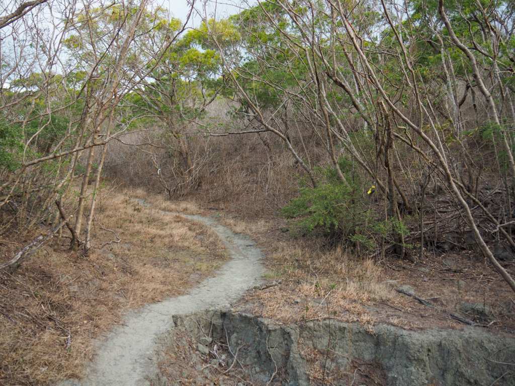
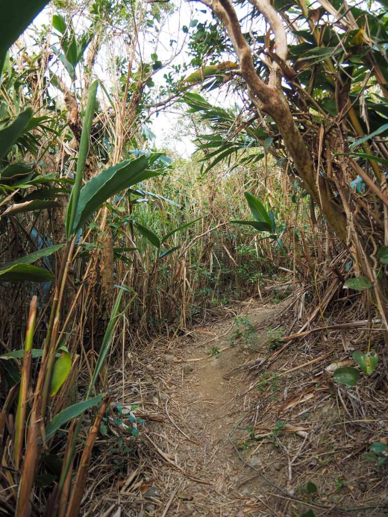
I passed a couple of turn-offs (to the right in the first photo, and left in the second). However, the main trail is by far the clearest, so for the most part, the side trails are easy to miss.
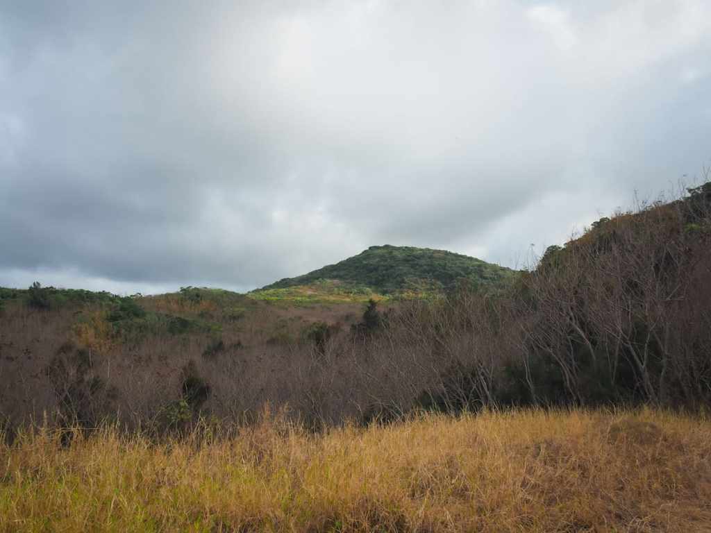
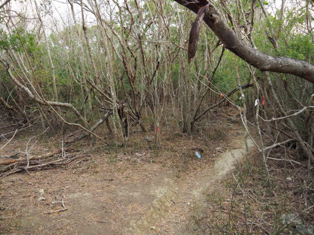
As the trail climbs higher, the vegetation goes through several changes. At times it’s dense…
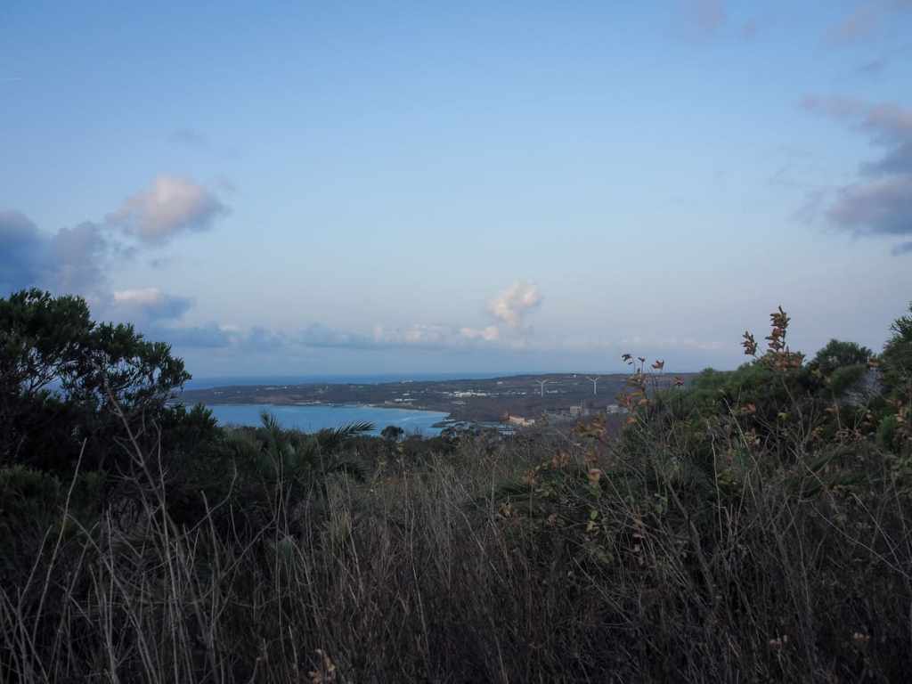
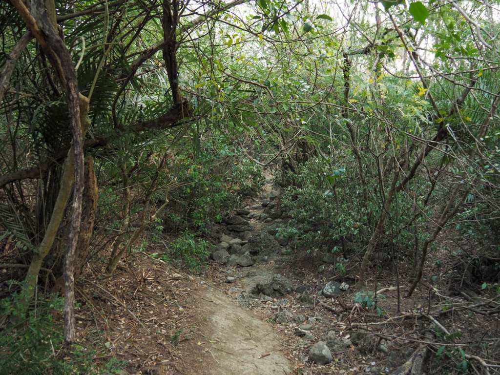
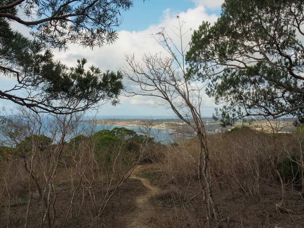
…and at times it becomes low and open. In a couple of spots it’s open enough to give you a view of the sea.
After climbing gently for the first half of the walk, the trail gets a little steeper for the second half.
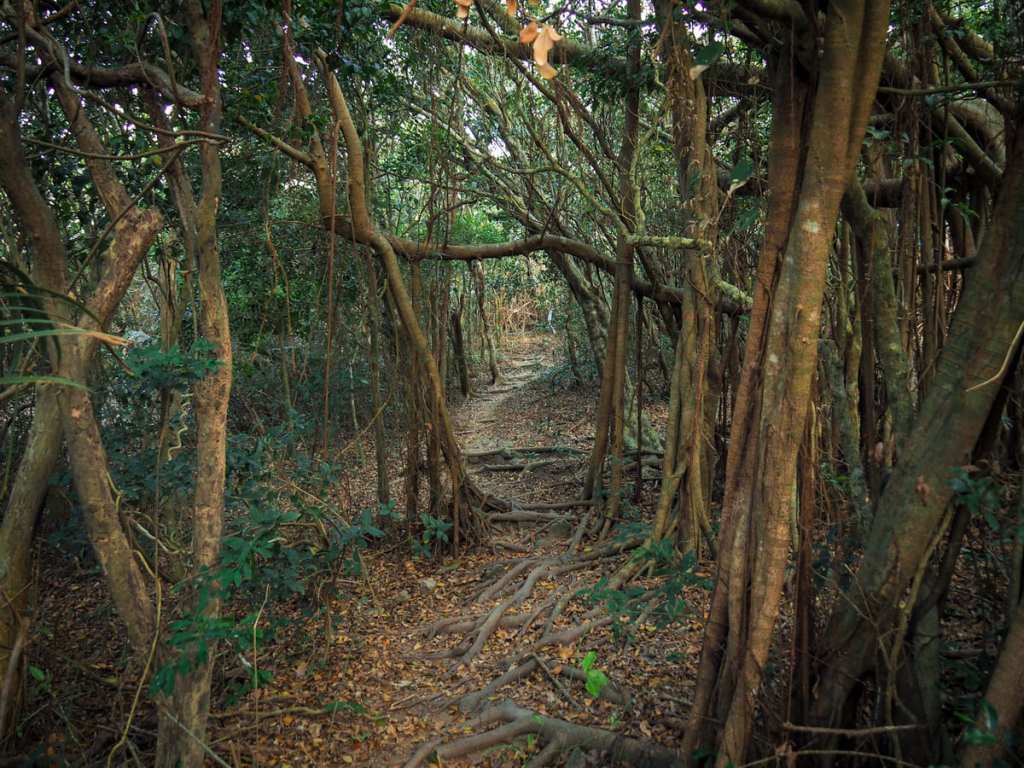
One particularly pretty section was a tangled mass of hanging fig roots.
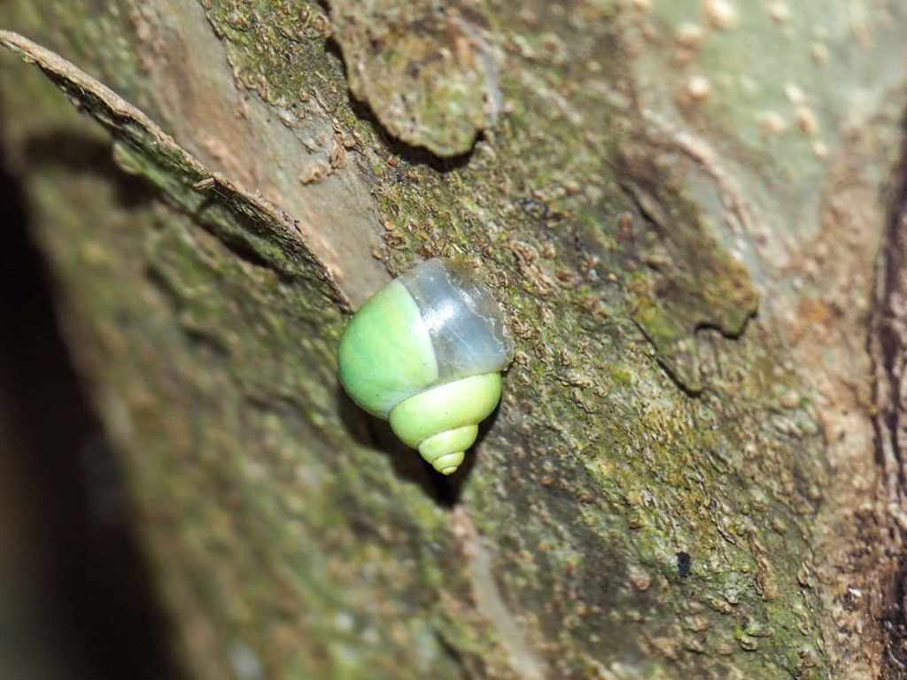
This bright green snail clinging to the side of the tree caught my attention. (I think it is Leptopoma perlucidum.)
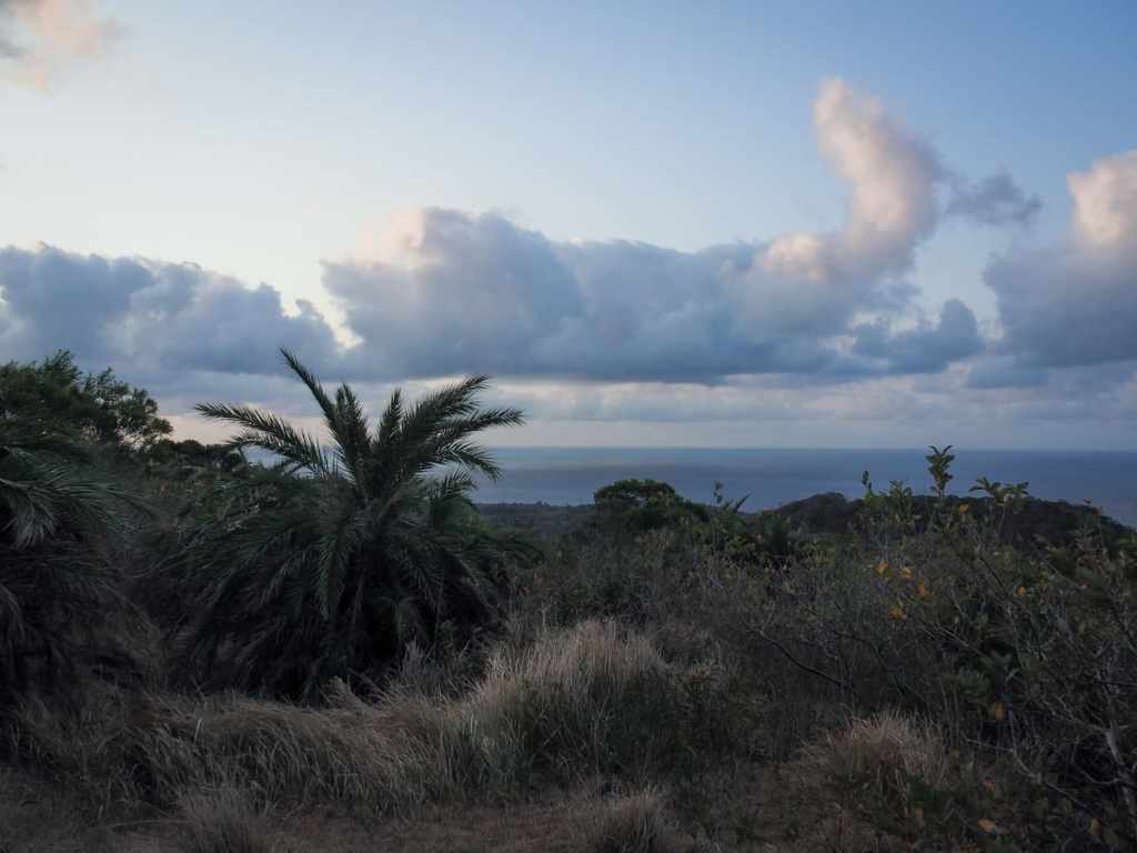
Right before I reached the summit, the greenery changed again. This time the trees were replaced by grasses so tall they grew above my head. There were lots of birds crashing around amongst them, as well as a couple of grumpy squirrels.
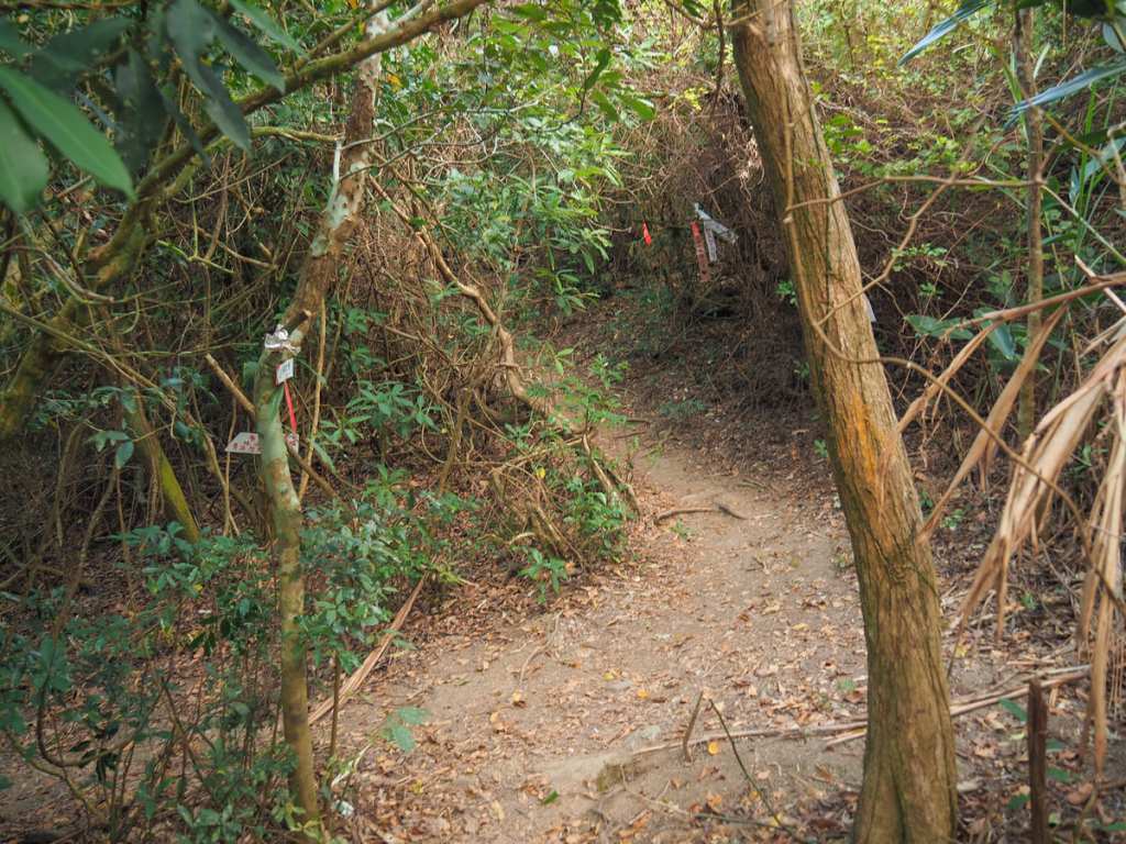
Close to the peak, there are two turn-offs on the left, both of which are signposted as leading towards Jinding Lane (金鼎巷). Ignore both of them and keep heading up.
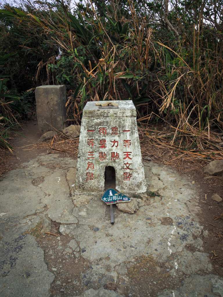
The triangulation marker for this summit is hidden inside a kind of protective turret casing. The summit is a mere 325 metres above sea level, but in such low surroundings, it still feels like a long way up.
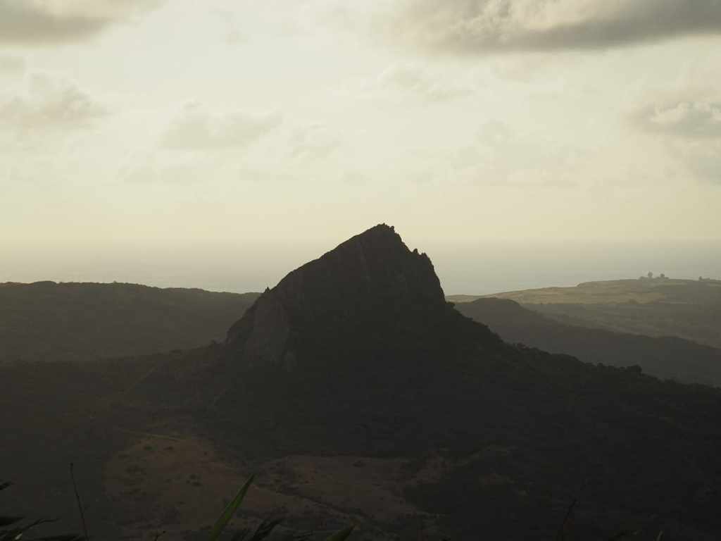
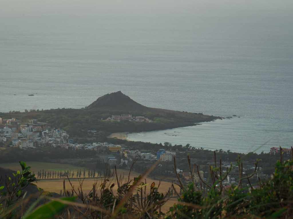
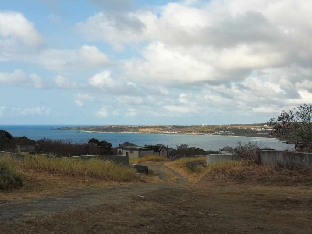
Other nearby peaks which stand out are the extremely steep Mount Dajian and the smaller Frog Rock squatting at the water’s edge.
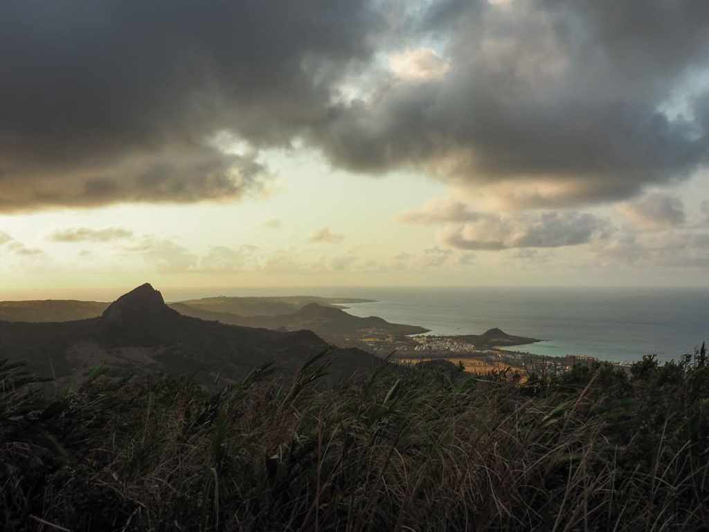
The overall view is rather lovely. And even more so for being mine to enjoy alone early in the morning. I stayed about ten minutes to finish my coffee and watch the clouds blow over. A few minutes into my descent, I passed the couple who’d parked just after me, and they asked me if they could take a photo with me. I agreed on the condition that they let me take one too (collecting these has enabled me not to feel so irritated by being asked).
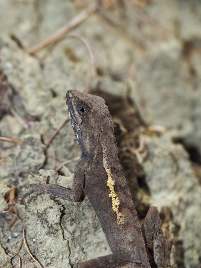
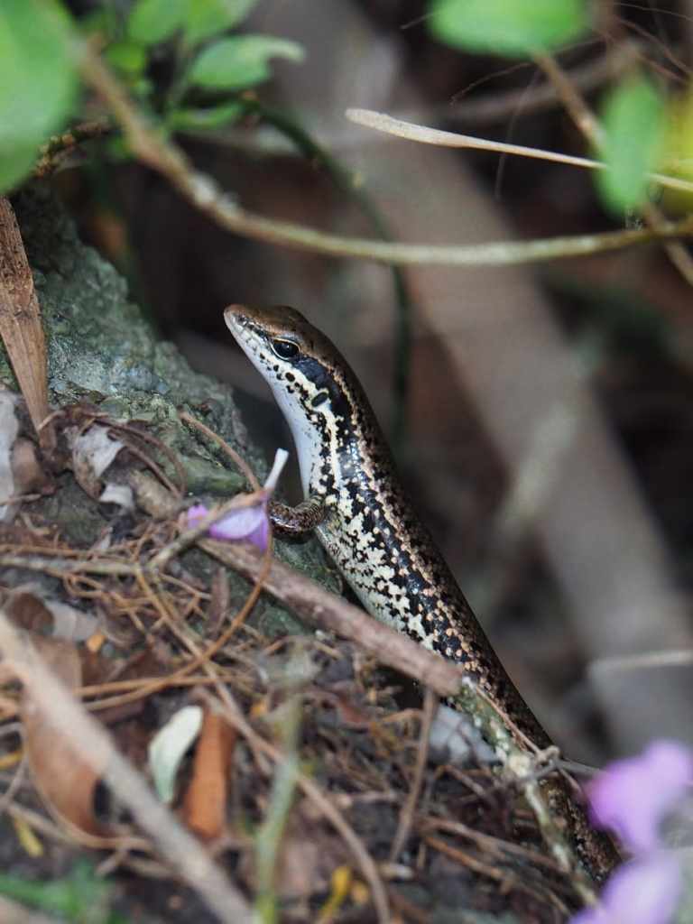
Lizards and skinks, it seems, are late risers, because although I’d seen none on the way up, on the way down I saw and heard loads of these critters. In the dry condition, each one sounded about the size of a dog.
The walk down was a bit quicker than the climb. I think it took me about thirty minutes before I made it back to my scooter and set off in search of breakfast.
HOW TO GET TO MOUNT DASHANMU
Google Maps address: The walk starts at the top end of a graveyard. There is parking space for a few cars and plenty of scooters here.
GPS location: N21 57.530 E120 46.470
Public transport: If you’re coming on public transport, you’ll add add another 1km (or 20 minutes) to your walk in each direction. If you’re staying in Hengchun, you can catch the 101 Kenting Shuttle, the 9117, or the 9188 from Hengchun Visitor Centre/Transfer Station and ride it as far as Tiaoshizi bus stop. If you’re coming from Kenting, you can catch pretty much the same buses, but heading in the opposite direction. Again, alight at Tiaoshizi bus stop and walk from there.
Nearby Trails:
- Checheng Turtle Hill
- Frog Rock Coastal Park
- Hengchun City Walls
MOUNT DASHANMU TRAIL MAP
GPX file available here on Outdoor Active. (Account needed, but the free one works just fine.)
