Update (May 2025): I have just heard that the section between Baimiweng Fort and Mount Qiuzi Lighthouse is currently closed. Anyone wishing to walk this route should make a slightly longer loop via the backroads.
Maritime city, Keelung, is an odd fish. It’s pretty terrible at promoting itself, so I always go with low expectations, but—as is the case in the walk covered here—often find myself pleasantly surprised. Not “I’m moving to Keelung right now” pleasantly surprised, but “why don’t I visit more often” surprised. The trail covered here isn’t the prettiest walk I’ve ever done (and nor would you expect it to be given its portside location), but it certainly packs in a lot of interesting spots into its short length.
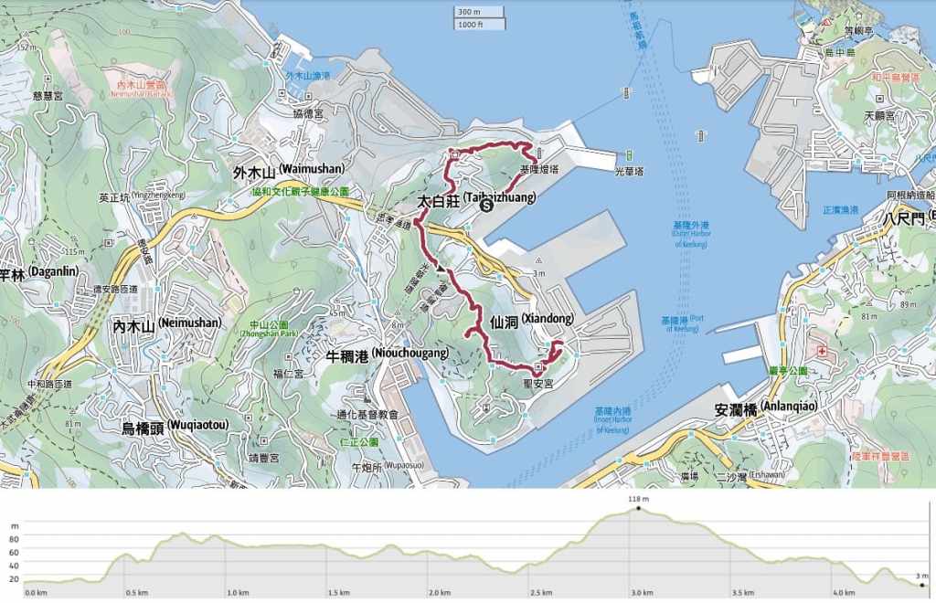
Distance: 4.5 kilometres give or take a bit.
Time: 2-3 hours depending on how long you spend at each spot (and how slow the heat makes you).
Total ascent: About 170 metres.
Difficulty (regular Taiwan hiker): 3/10 – There are some steep sections aided by roped railings.
Difficulty (new Taiwan hiker): 4-5/10 – Steep slopes and patchy signage would make this moderately challenging for someone new to Taiwan hiking trails.
Risks and dangers: Some slopes would be very slippery in wet weather. From September through to November, the hills around Keelung seem to have a greater number of hiker-hornet altercations than other places, so I’d be cautious of hiking here during those months.
Water: I took 0.8L and drank all of it on a hot July day. Water bottles can be topped up at the temple right of the end of the walk.
Shade: Shade is on and off. I use an umbrella for stretches of this walk.
Mobile network: Mostly OK with a couple of weak patches.
Enjoyment: This is a quintessential Keelung hike in that it underpromises and over-delivers. I wasn’t expecting to enjoy it that much, but I really did. There are sea and port views, a fort, two lighthouses, a couple of neat temples, and brief stretches of pleasant trail.
Other: There’s a lighthouse museum close to the start of the trail that’s worth a quick visit if it’s open when you arrive.
Bathroom facilities: You can find toilets at the Baimiweng Fort (there’s a clean toilet block behind the fort’s information centre), and close to Xiandong Zuisheng Temple.
Route type: Point to point (but almost a loop).
Permit: None needed.
Jump to the bottom of this post for a trail map and GPX file.
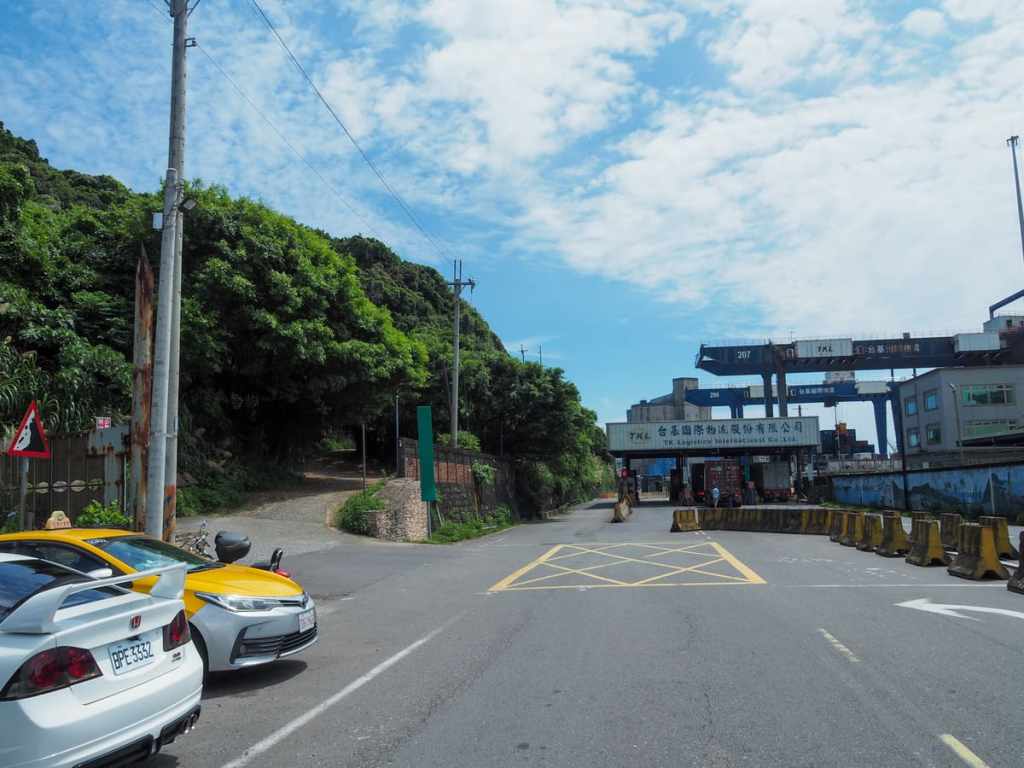
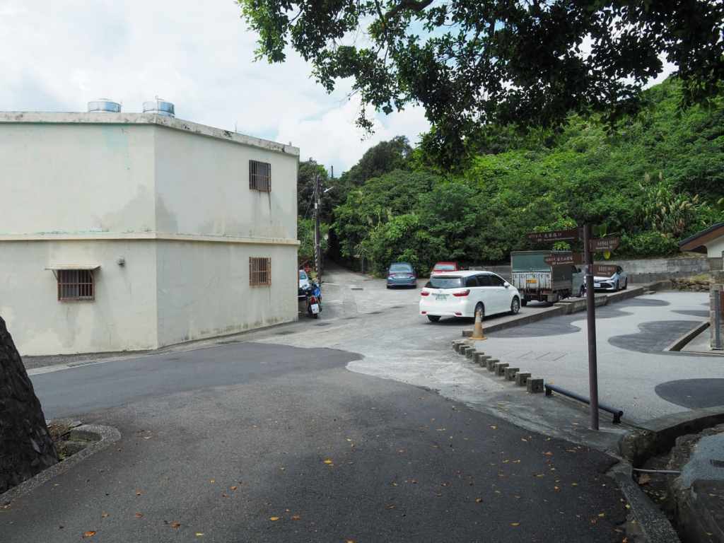
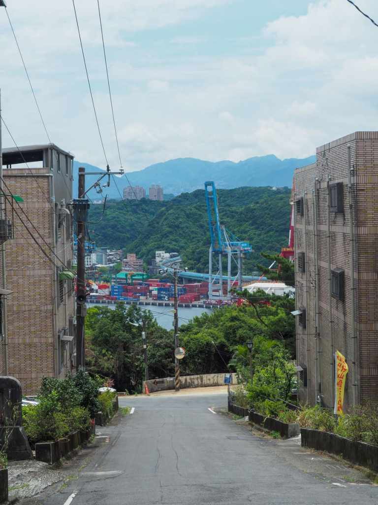
Alighting at the terminal bus stop of the 301 minibus, I carried on up the road almost as far as the entrance to a container yard. On the left just before you enter the yard, a track leads up, signposted as going towards Keelung Lighthouse.
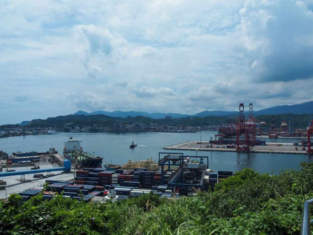
As you head up the track, there are views of the port below. I stood for a while, watching the cranes glide along their rails. The lighthouse was immediately behind me when I was taking this photo, but it’s somewhat obscured from the road by greenery.
The track terminates in a viewing deck which looks out to sea, and if you just keep heading forward, you’ll soon find yourself running out of track and left with just a narrow footpath cutting through the greenery.
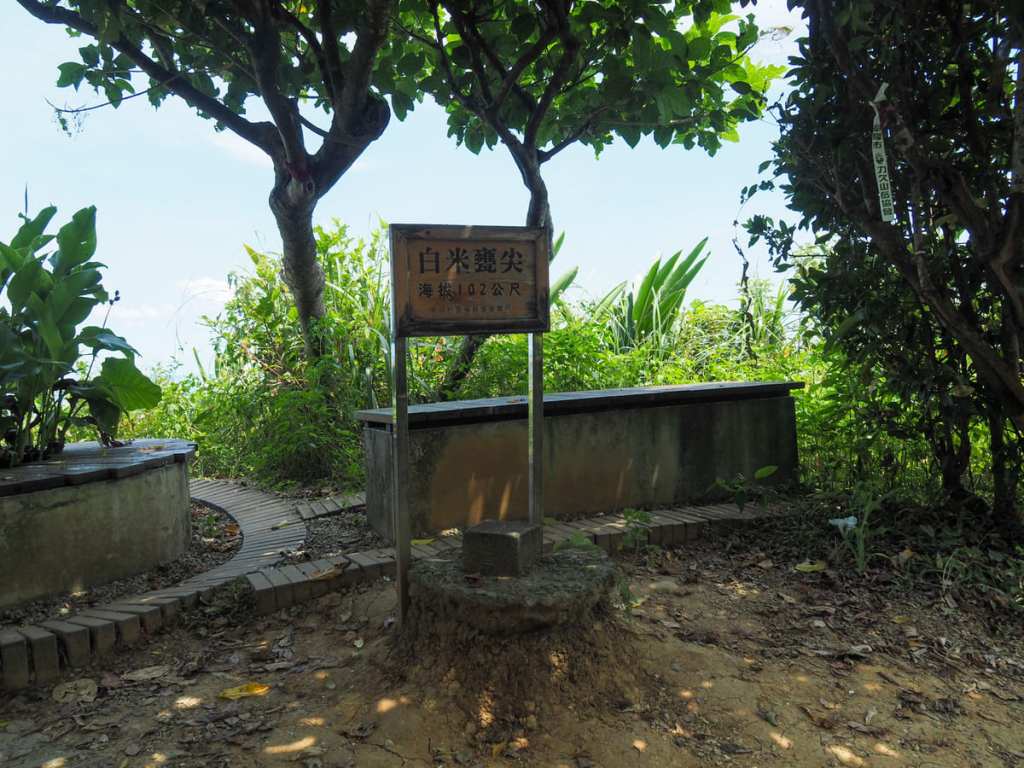
The trail quickly climbs to Baimiweng Peak (白米甕尖), which is marked by a couple of benches and a triangulation marker. “Baimiweng” means “white rice urn” and there’s an interesting local story behind the toponym. The tale holds that in Qing- and Japanese-era Taiwan, life was tough for the residents of Keelung, and white rice was a luxury that was hard to come by. But at a spot, somewhere around here, grains of rice were said to flow from a crevice—not much, but enough to satisfy hungry bellies. However, it seems that the inescapable human trait of greed reared its ugly head, and some people began digging into the rocks to get more rice. Their doing so irritated the gods so much that the rice tap was shut off and no more miraculous white rice flowed from the ground.

Up by the peak is where you get your first sighting of the Hseih-ho Power Plant’s trio of white towers.

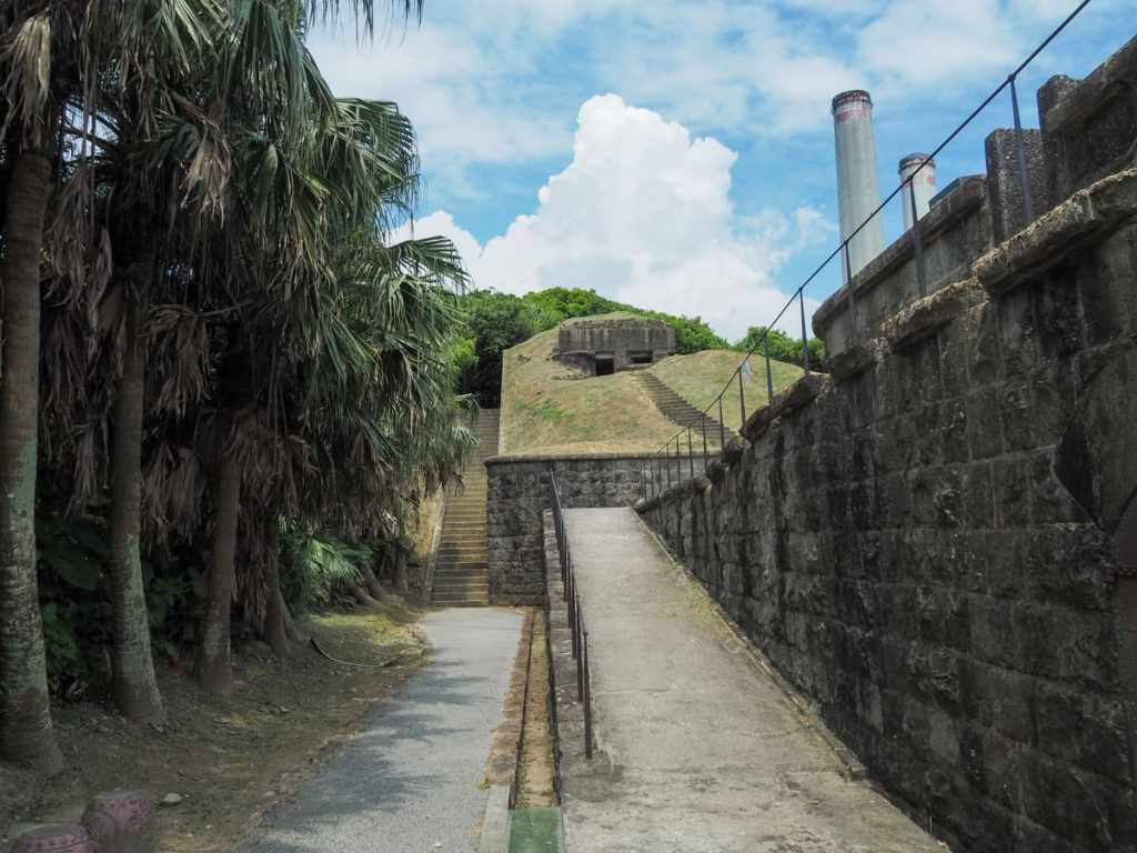
A steep flight of concrete steps cuts down from a military observation bunker towards Baimiweng Battery.
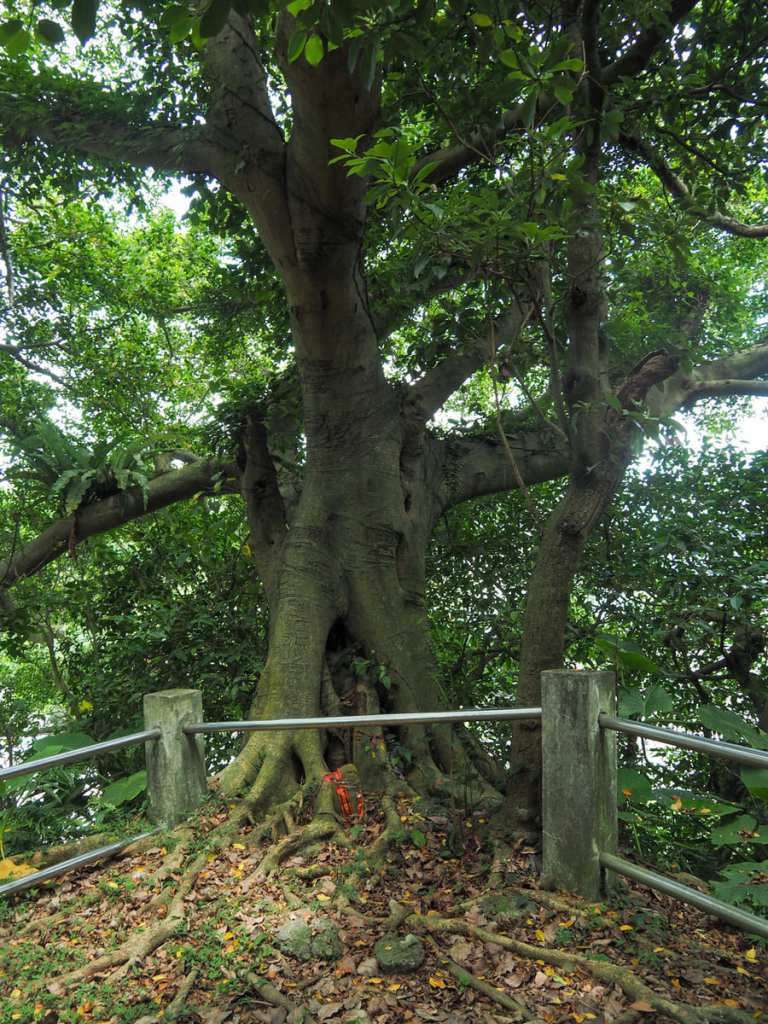
A small clearing beside the trail has been left so that hikers can pause and admire the tenacity of this banyan that’s somehow managed to grow bigger and stronger than most of the other trees on these seaward slopes.
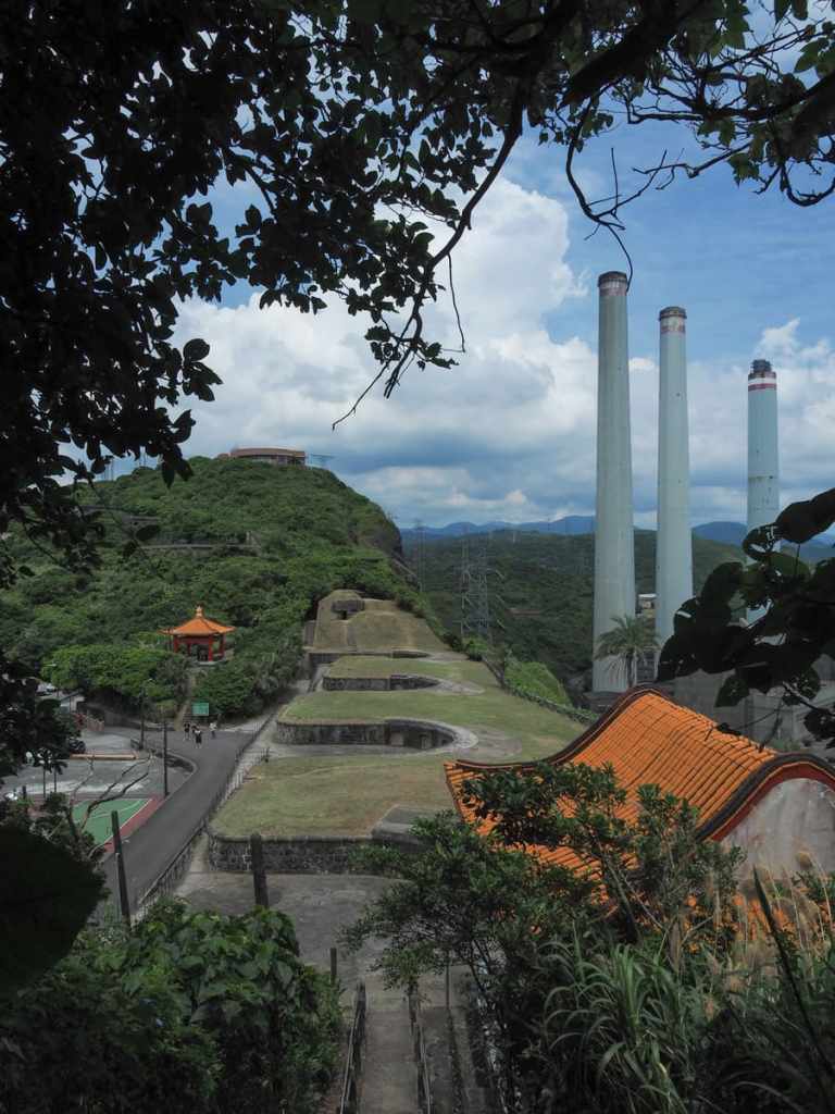
Just as you approach the bottom of the steps, you’ll find yourself approaching Baimiweng Fort (白米甕砲臺, also known as Baimiweng Battery and Holland Castle.
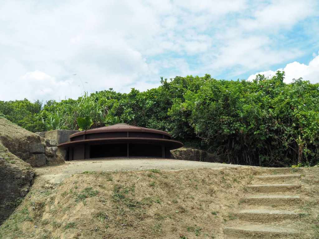
There are different opinions as to when it was built, with some claiming that there have been fortifications up here for over 300 years since Taiwan’s years of Dutch colonisation. It was claimed by French forces during the Sino-Frech War of 1884-1885, and was later rebuilt to its current configuration during the Japanese occupation era.
Four artillery mounts are lined up along the rectangular-shaped facility, all facing out to sea. And raised slightly above them on the fortification’s western edge is the command centre. It’s worth taking a little while to explore and enjoy the views before continuing your walk.
Heading down from the fort, pass an information centre (it has a 3D map of Keelung showing where all the known fortifications are, but sadly all the displays are in Chinese only) on your right, and follow the ambiguously oriented signs pointing to Mount Qiuzi Lighthouse (or Mount Ciouzi Lighthouse). This is straight ahead and in the centre of this photo.
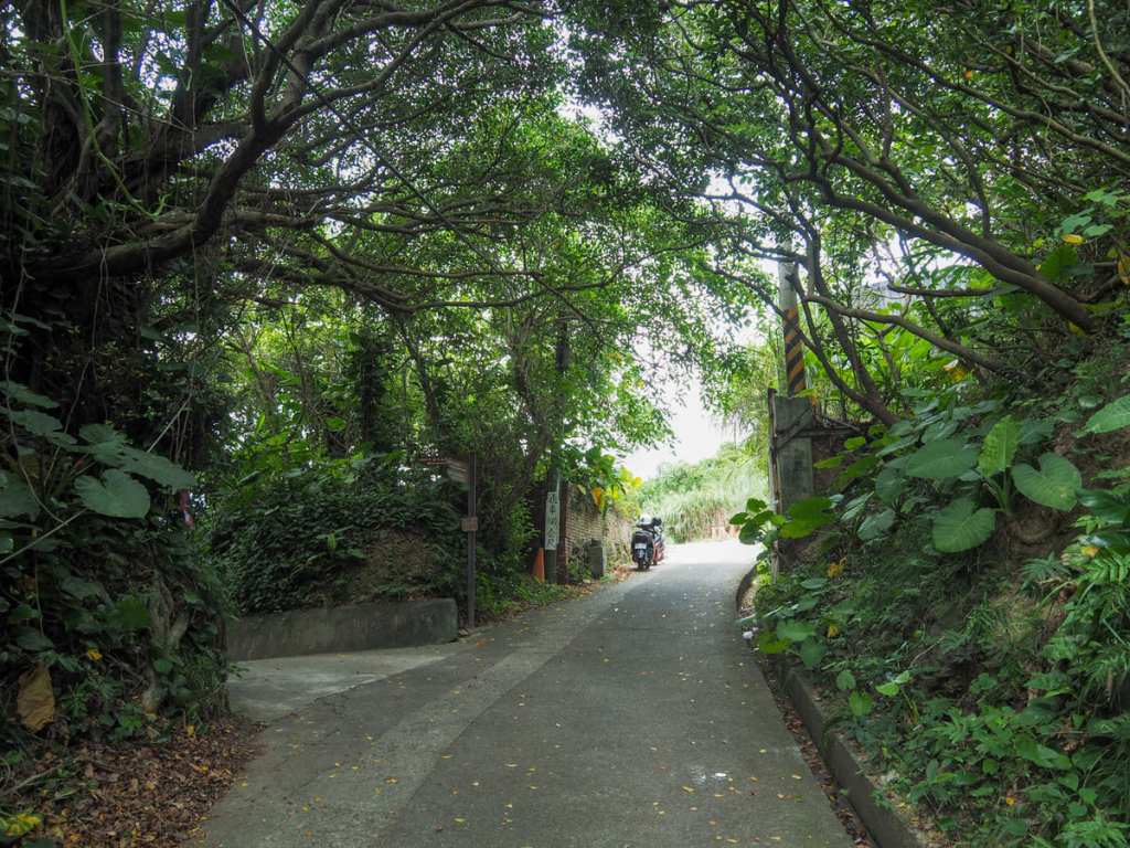
Almost as soon you walk under the shelter of the trees, take a left turn.

At every step of the way, finger-post markers direct you towards Mount Ciouzi Lighthouse. They were sometimes hard to spot, and sometimes seem to be leading me in an unlikely direction, but they turned out to be spot-on.
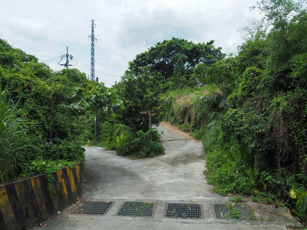
As you start to run out of road again, it felt like the path was leading me somewhere I might well find a body (seriously, one turned up in Keelung not too long back). Luckily, I encountered no unwanted surprises, just a few abandoned buildings.
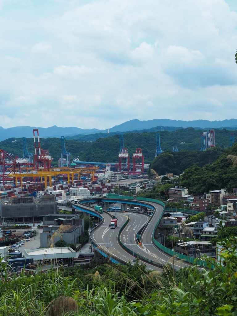
A break in the tree cover offers views over Provincial Highway 2F, a short spur road that allows lorries coming from Keelung Port to easily slip into Freeway No. 3.

A banyan tree stands in a quiet clearing.

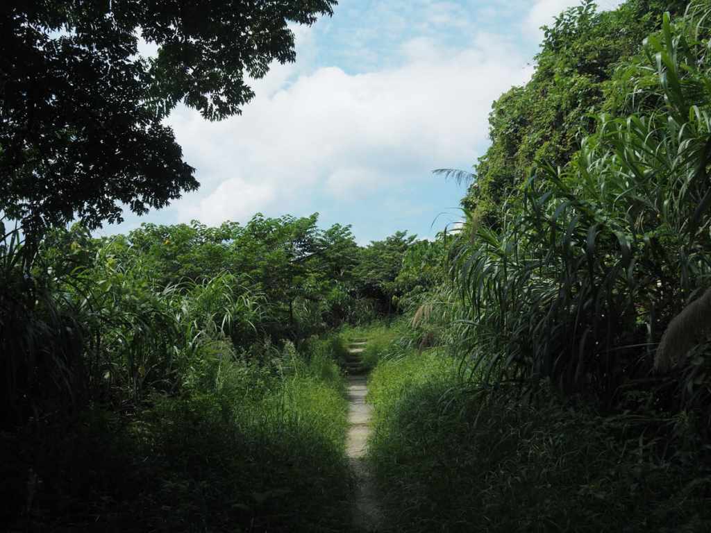
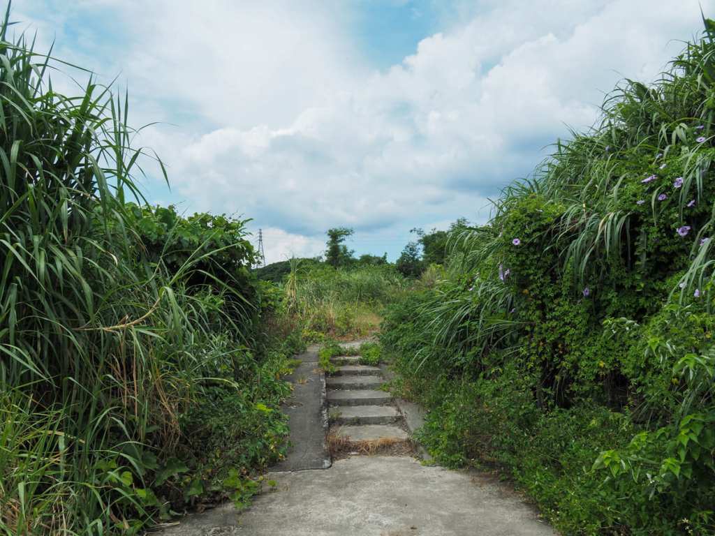
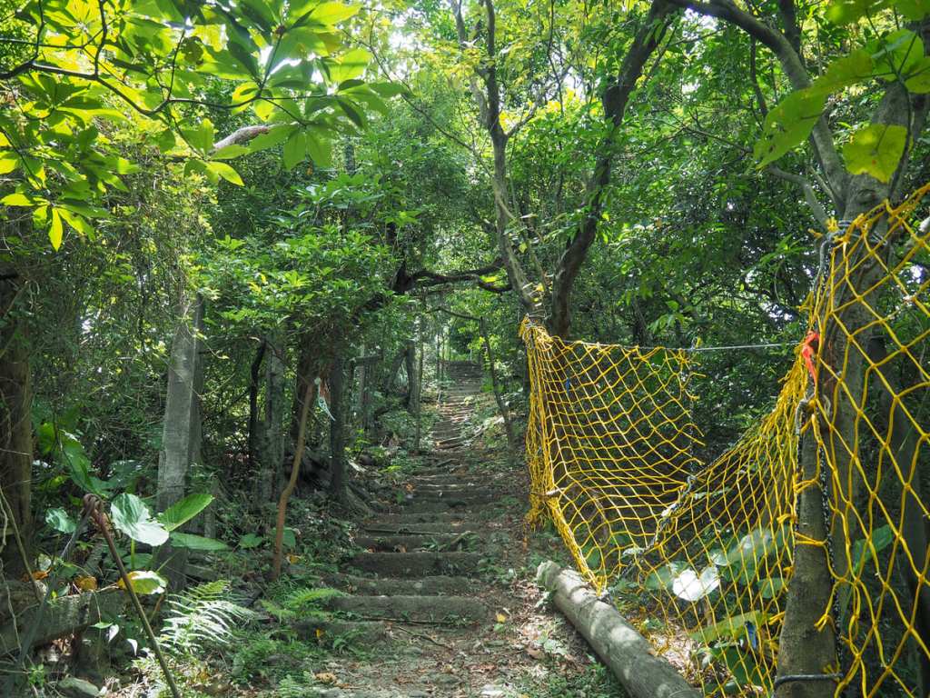
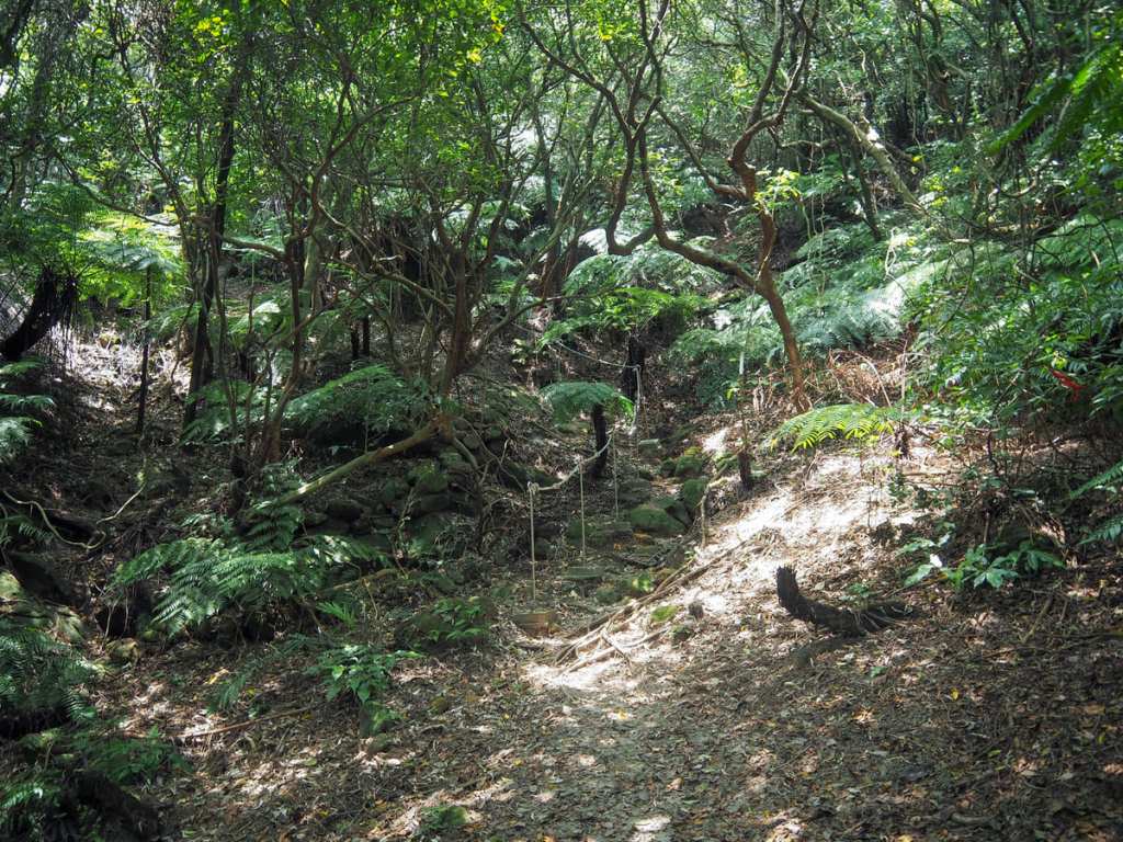
The trail here is generally quite pleasant and shady, although I imagine it wouldn’t take much rain to turn it into a soggy mess.


In some of the steeper sections, ropes or steps make the going a little easier, but unfortunately, there’s a crap ton of rubbish where the trail gets close to inhabited (or maybe formerly inhabited) areas.
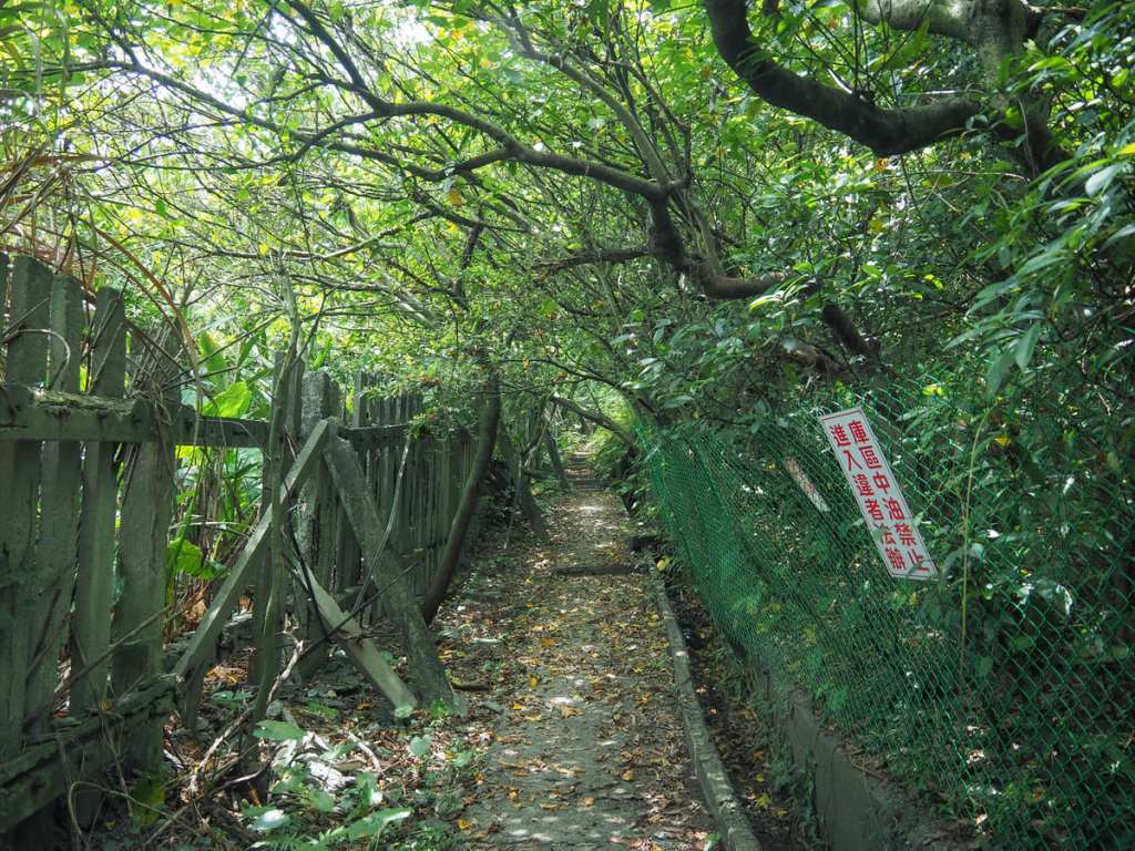
I say “maybe formerly inhabited” because the state of the fencing makes it seem like no one has been tending to these areas for a while.
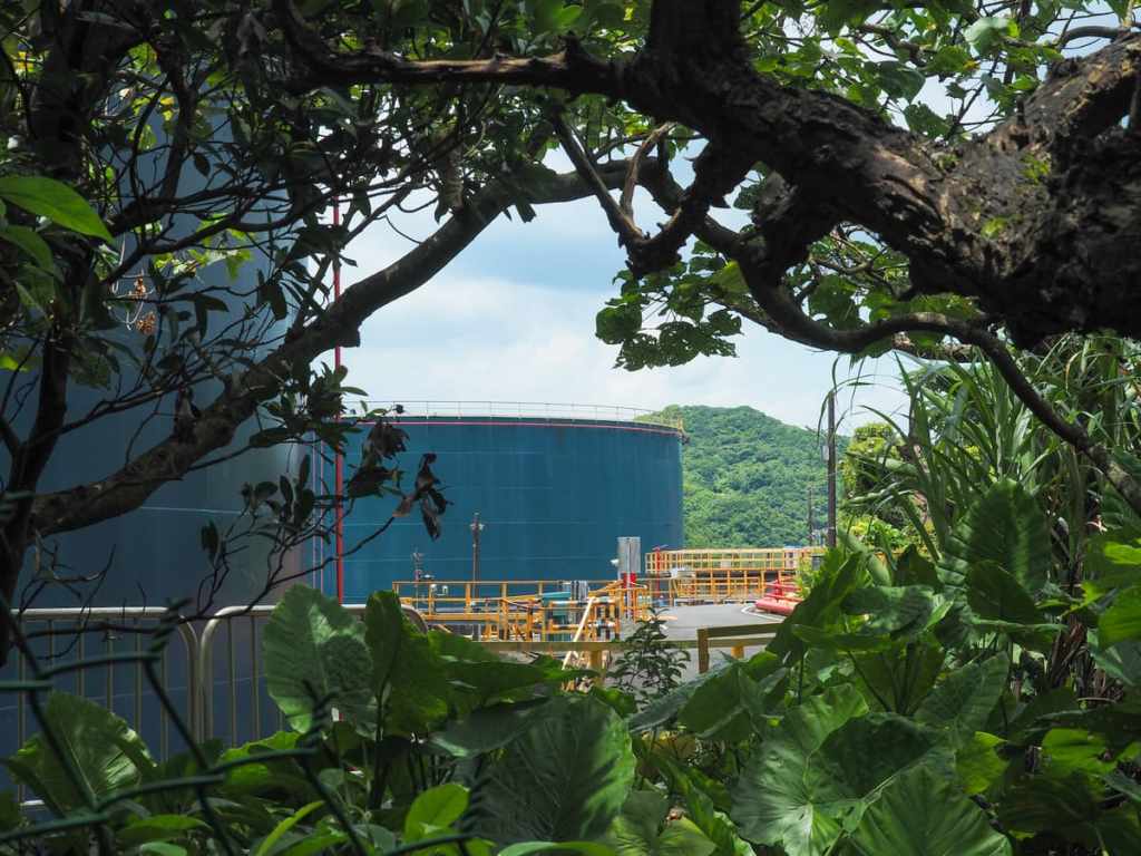
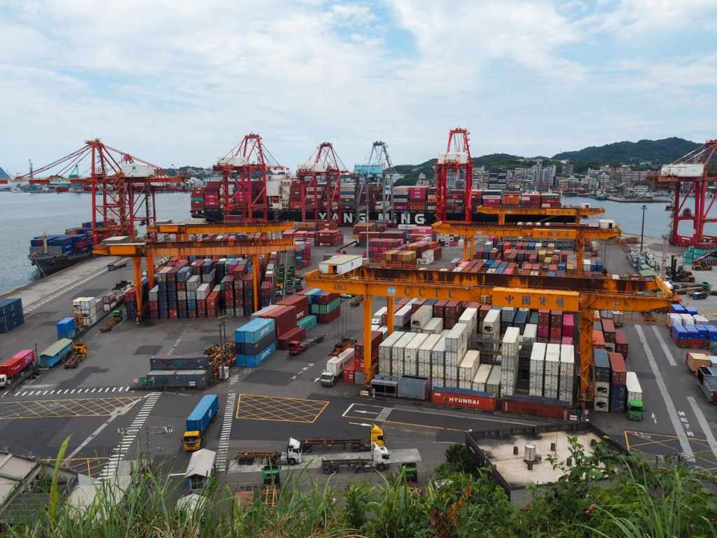
Through a mesh fence to the right, you can see some of the CPC Corporation’s storage tanks. From the trail, it feels like you’re surrounded by mountains, but in reality, this is just a couple of minutes away from the port by road.
Beyond the storage tanks, there is a little more climbing to be done, the final part of which is pretty steep.
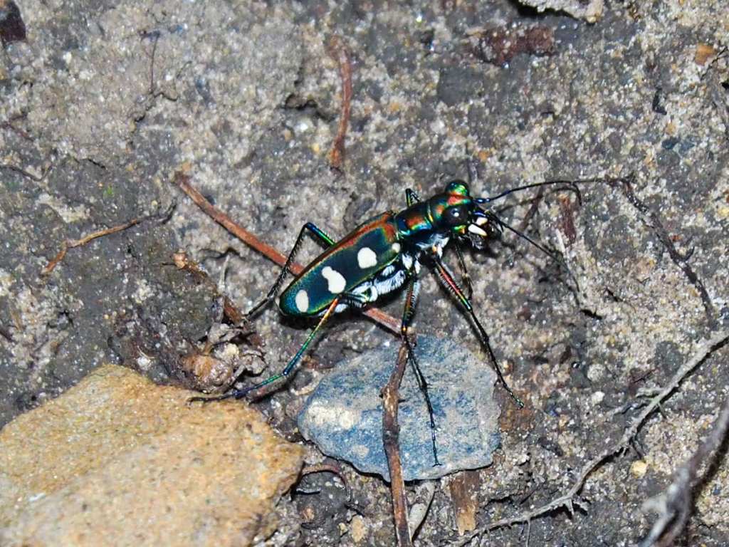
A Cosmodela batesi beetle. These gorgeous bugs are around 2cm in length and can often be found staking out specific sections of path in the summer months. With a decent camera and a modicum of patience, it’s usually possible to get a reasonable photo of their iridescent carapace.

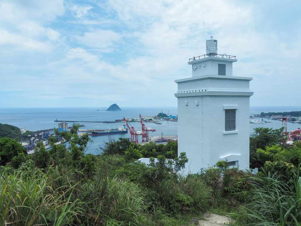
At the top of the steps, the trail takes a left turn to head down towards the coast again, but first, take a right and head up a few more metres to Mount Qiuzi Lighthouse.
The lighthouse has been in operation since 1956, although it hasn’t always been the spotless white that it is today—at one point it had a coat of camo paint and was part of a larger military base in the vicinity.
Just a short way beyond the lighthouse, you’ll come to the summit of Mount Qiuzi, and from here, you can enjoy views looking over the inner harbour towards the Martyr’s Shrine and Zhongzheng Park’s towering Guanyin statue.
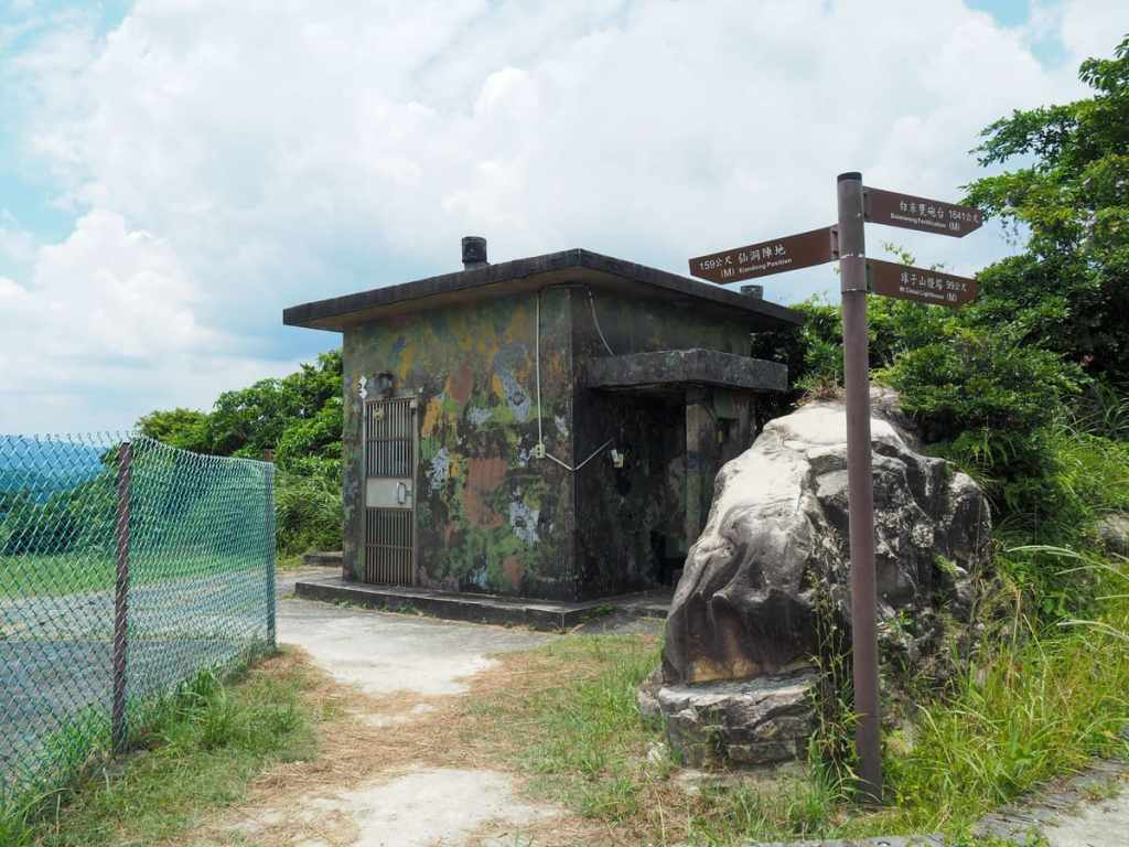
Heading down, I found myself passing some of the non-abandoned military structures that used to occupy the peak. If it weren’t for the signage indicating that this is part of a trail, I would question whether I was meant to be up here at all.

Where the track joins the road, cross over and head straight down Lane 103 towards distant harbour views.
At the bottom of the lane, follow the path as it veers to the left. (There is a smaller path on the left too, but I stayed with the road.)
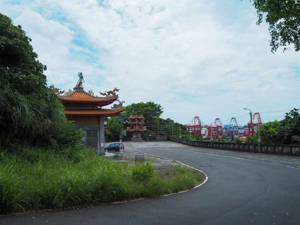
You’ll know you’re heading in the right direction when you find yourself approaching a temple carpark. This is Keelung Sheng’an Temple (基隆聖安宮).
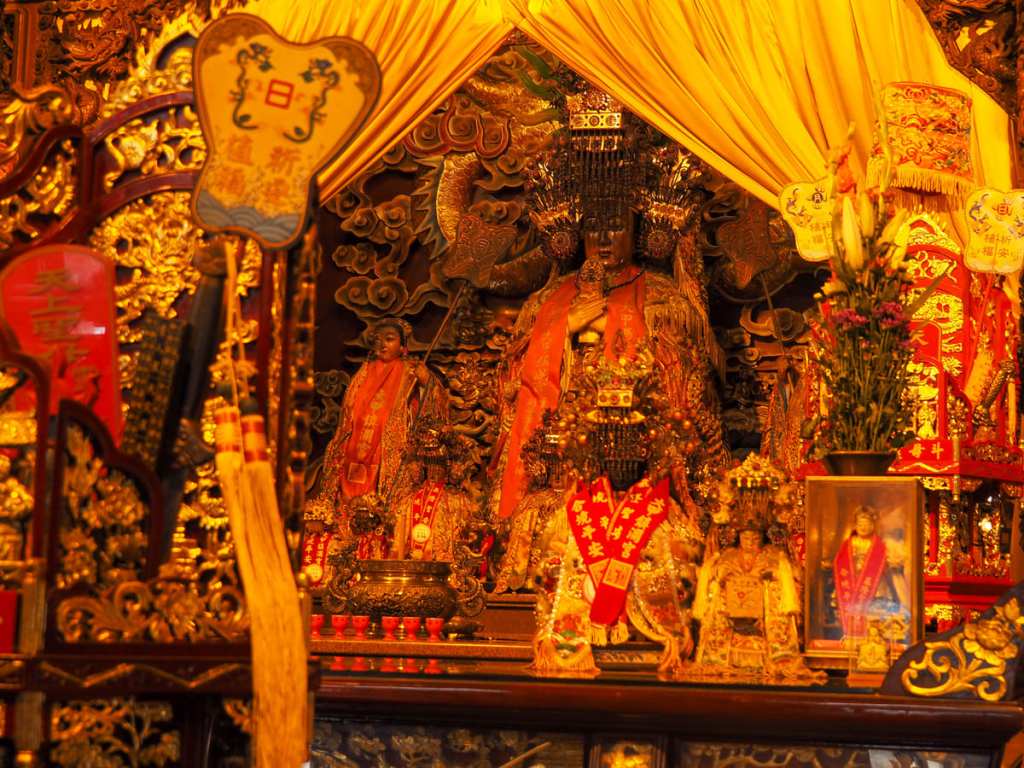
Inside, you’ll find several altars, but the central and grandest altar is dedicated to Mazu, goddess of the sea and patron saint of those who make their livings on the waves.
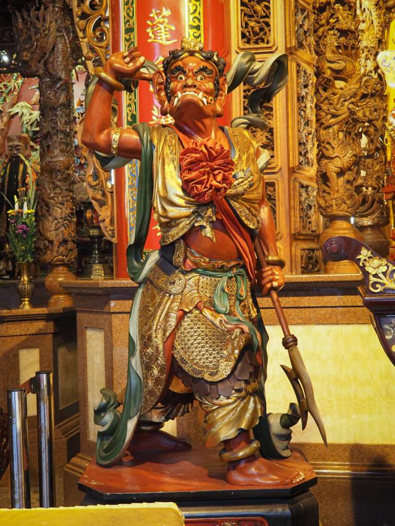
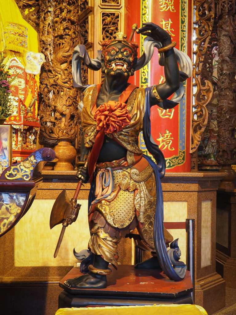
Mazu is, as ever, flanked by her two guardians, the All Seeing and All Hearing Generals.
Leaving the temple courtyard via a bath behind it’s spirit money incinerator, you’ll find yourself walking into Xiandong Park.
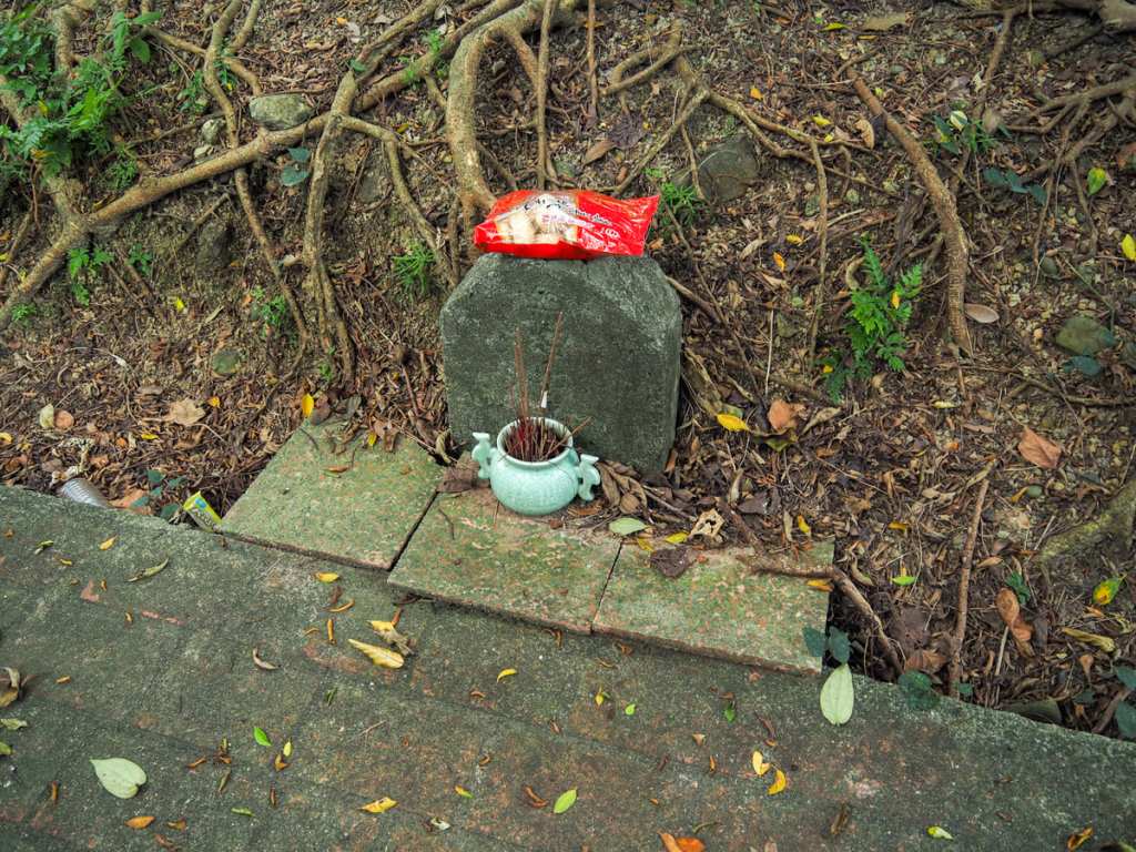
The park has a small gravestone that’s venerated with incense, cigarettes, and snacks, and it also has the closest view of the port that you’re going to get.
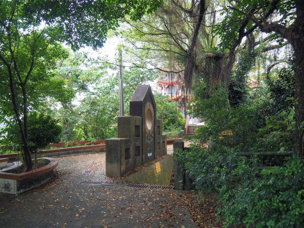
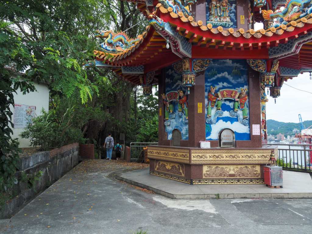
Once you’ve had your last view of the port, head down the steps towards Xiandong Temple.

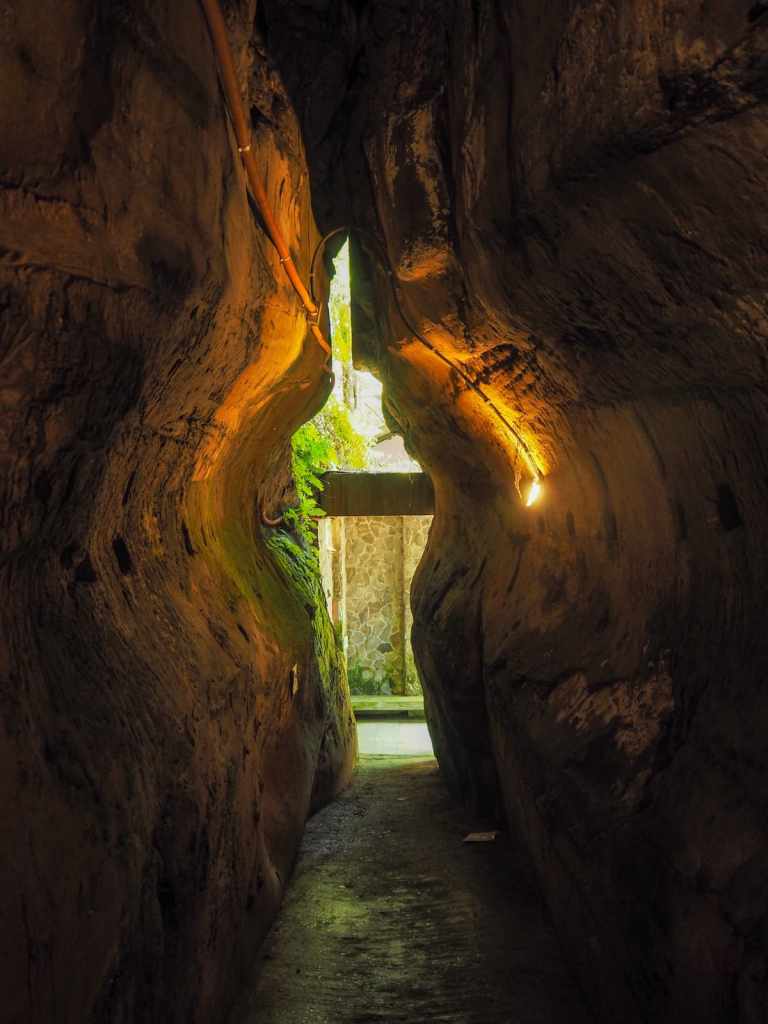
Steps cut down between two sheer rock faces, and a seated Buddha at the bottom of the flight marks the entrance to Xiandongyan Zuisheng Temple (仙洞巖最勝寺).

The temple is also sometimes known as the Fairy Cave Temple in English, because “仙” (or “Xian”), the first character of its Chinese name, can mean fairy. However, elsewhere, it’s stated that the cave received its name because, at some time in the distant past, a devout Buddhist achieved enlightenment by meditating in the cave and “仙“ is also used to refer to enlightened or immortal beings. Indeed, there are several other temples or cave features scattered around Taiwan with similar names, such as one in part of the temple complex at Xizhi’s Gongbei Temple, the Baxian Caves ancient archaeological site on Taiwan’s east coast, and one hidden behind Pingxi Old Street, although some of these are more associated with the Eight Immortals of Taoist and Buddhist lore.
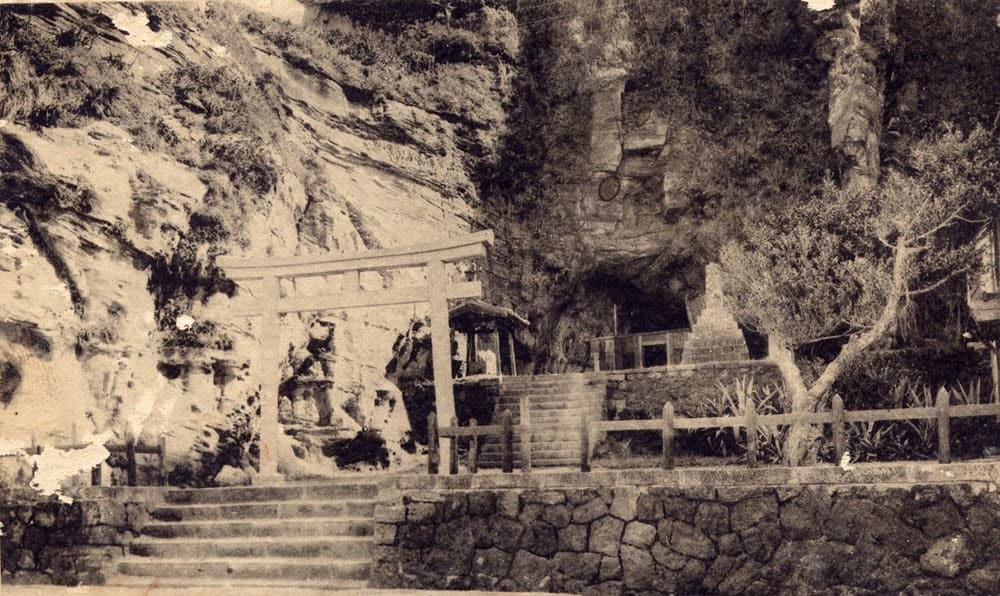
Above: Keelung Xiandong Biantian Temple. Source: Wang Lizhao (2004). Keelung Municipal Cultural Center. Keelung City.
The cave system itself, along with its neighbour, the Buddha’s Hand Cave, was formed by sea erosion, but these days, it’s about 300 metres from the nearest water and up some steps, so there’s little chance of them being flooded with seawater. Records suggest that the first temple to officially occupy the caves here was Daiming Temple (代明宮), a Buddhist establishment enshrining Guanyin and the Buddha ( Siddhartha Gautama), which was consecrated in 1872. During that period, the absence of modern industry meant the sounds of the nearby waves could be heard echoing throughout the cavernous chambers, making it an ideal spot for meditation and reflection.
Later, once the Japanese had taken control of Taiwan, they coopted the temple, booted out Guanyin and enshrined Benzaiten, Shinto goddess of all that flows—love, music, wealth, water, art and wisdom—as the main deity. Later still, these changes were rolled back. Guanyin was reinstated in the main cave and Benzaiten was moved next door.
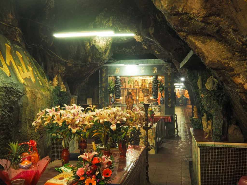
Stepping into the temple, you’re immediately greeted by Budai, the Laughing Buddha, and behind that, a second altar holds Guanyin. Visiting on an energy-sapping hot summer’s day, it was a relief to step into the cool, lily-scented air of the caves.

Deeper in, exquisite carvings of Buddhist figures line the walkway.
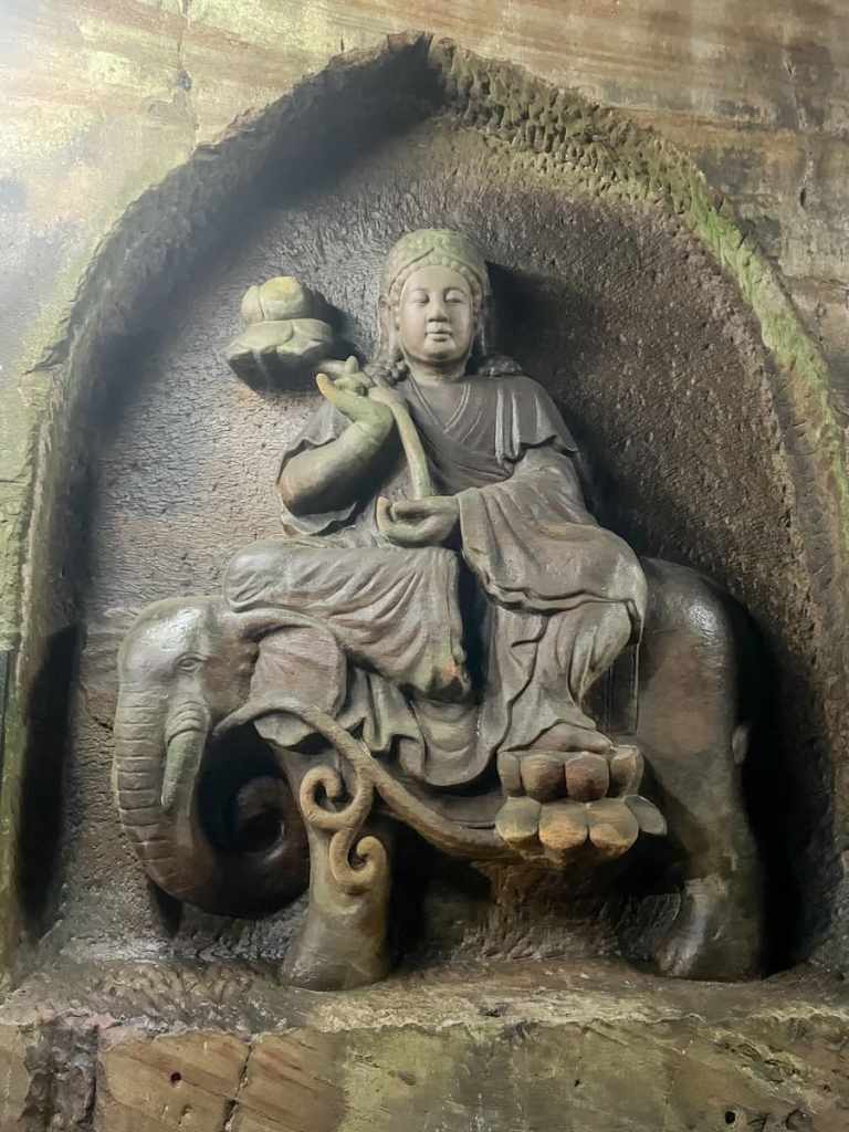

Puxian Pusa (or the Samantabhadra bodhisattva, a being associated with meditation and religious practise) rides his elephant steed. Beside him, Wenshu Pusa (the Manjushri bodhisattva, associated with wisdom and insight) rides a lion.
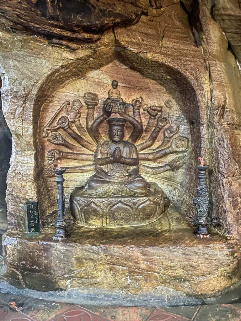
A many-armed bodhisattva deep in the cave’s rear altar hall.
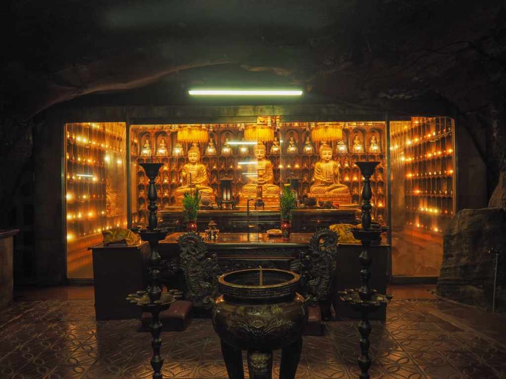
The main altar in the larger righthand hall holds a trio of Buddhas (三寶佛) seated in front of individual prayer lights. During my first visit, there was a tense back-and-forth going on between a family and the gods via a medium. It was clear front the urgency and intensity of the bargaining between the parties that the family was in the grips of some kind of misfortune and needed guidance.


Everywhere you look, nooks and crannies are filled with small altars dedicated to beings from Buddhist and/or Taoist teachings.
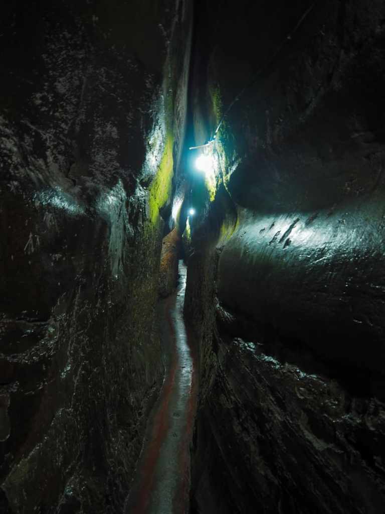
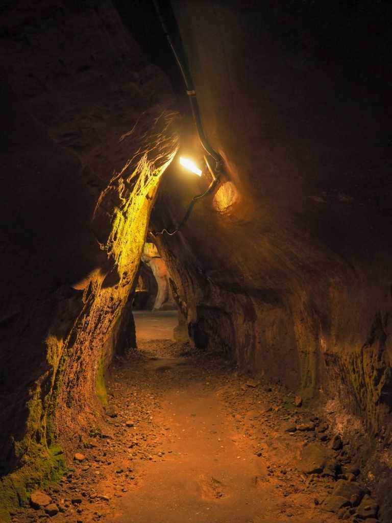
The most thrilling (or terrifying) part of Xiandongyan Zuisheng Temple is the narrow slot of a walkway hidden just to the left of Guanyin’s altar. Lit with discombobulating lights that trick you into imagining you’re walking into daylight, the walkway twists and turns, forcing you to crouch or walk crabways.
It took me two attempts to pluck up the courage to go all the way to the end, and even then, I almost gave up. If you’re prone to claustrophobia, you’ll definitely want to skip this part.

At the end of the walkway, the space opens up to a larger (but still not that large) chamber with another altar. Being uncomfortable in confined spaces, I hung around just long enough to calm myself down and mentally prepare for the return journey through the impossibly thin walkway, but horror of horrors, I encountered a couple coming in from the other direction (why they didn’t wait closer to the entrance when they saw me coming rather than forging on to one of the narrowest parts, I have no idea).
Out of one cave and into another, I popped next door (left if you’re standing with your back to the mouth of Xiandongyan) to find the Buddha’s Hand Cave. The regular entrance was blocked up for some reason, but if you walk around the houses, there’s a back way in. This cave is not as well-kept as its neighbour, and there were a few areas where the lighting had gone out. I checked around to see if I could spot the famous feature from which it gets its name, but I couldn’t see it, and I felt a little uncertain about exploring unlit corners by myself, so I decided to retreat and call it a day.

The ultimate reward for a morning spent braving the summer’s heat: mango and taro snow ice.
How to get there
Google Maps address: The walk starts just outside the entrance to TK Logistics, and finishes by Xiandongyan Zuisheng Temple.
GPS location:
- Starting trailhead – N25 09.200 E121 44.750
- Ending trailhead – N25 08.700 E121 44.900
Public transport: Take a bus or train to Keelung Transit Station and from there, board the 301 minibus. The bus leaves from the first waiting zone on the roadside bus stop outside the transit station. Ride it to Taibai Village (the last stop before it turns around to head back to the city).
To return, catch the 301 heading in the opposite direction from Xiandongyan bus stop or the 302, which takes a more circuitous route back to the town.
Further reading: This post contains some more information and photos about some of the sites visited on this walk. And for more info on the cave temples, check here.
Nearby trails:
- Alabao Bay
- Crouching Tiger Hill
- Heping Island Park
- Keelung Big Buddha
- Keelung Islet
- Mount Gongziliao
- Rongxuan Trail
- Wangyou Valley Trail
Trail Map
GPX file available here on Outdoor Active. (Account needed, but the free one works just fine.)
