Taipingshan’s Highest Peak
The Mount Sanxing Trail is a steep and pretty walk through varied forest landscapes to the highest summit within the boundaries of Taiping National Forest Recreation Area. Despite being one of Taiwan’s Minor 100 Peaks, this trail is quite a lot quieter than other trails in the park, making it a good choice for anyone who wants to escape the crowds for a couple of hours.
DISTANCE: 3km
TIME: 2-3 hours – We spent 2.5 hours walking this at an unhurried and easy pace.
TOTAL ASCENT: About 350 metres. The elevation profile seems to show a steady ascent, but from walking, it feels like it gets fractionally less steep as you near the summit.
DIFFICULTY (REGULAR TAIWAN HIKERS): 3/10 – Getting here is the first challenge—that winding road can be rough if you’re not a good traveller. Once you’re on the trail, things are pretty straightforward. It’s a steep up-and-down but can mostly be done without needing to use your hands.
DIFFICULTY (NEW HIKERS): 4-5/10 – This would be on the upper end of easy or lower end of moderate for someone new to Taiwan’s trails for the same reasons mentioned above. If you’re new to hiking here, you may also need to be a little extra careful about wayfinding. There is only one path, but occasionally, there are animal tracks and forestry workers’ tracks that might be confusing.
SIGNAGE: There are no signs along this route, only hiking tags tied to trees.
FOOD AND WATER: We took 0.5L each but didn’t drink much because it was so cool. We also didn’t need any of our snacks, but you should probably take some just in case.
SHADE: This is a pretty well-shaded walk.
MOBILE NETWORK: My mobile coverage kept wobbling in and out.
ENJOYMENT: As with all of Taipingshan’s trails, this one boasts spectacular forest scenery. Whether you walk it in sunny or cloudy weather will greatly impact the overall feeling, but either will be impressive. However, if you’re looking for views, you might want to choose another walk (perhaps Mount Wangyang).
SOLO HIKE-ABILITY: As long as you have a map, there should be little risk to anyone attempting this alone. It’s not a challenging walk, and there aren’t any dangerous sections. That said, it is not unheard of for people to get lost up here.
OTHER: A hiking stick might aid in comfort and balance, especially on the descent.
TAIWAN 100 MINOR PEAKS: Number 85 – Mount Sanxing.
ROUTE TYPE: There and back.
PERMIT: None needed, but you do need to pay to enter the park. More information about park tickets and accommodation can be found on the Taipingshan page.
Jump to the bottom of this post for a trail map and GPX file.
DIRECTIONS:

This is not one of the more popular walks within Taipingshan National Forest Recreation Area, and as such, it doesn’t have signage, a built trail, or carpark facilities like the others do. Instead, it starts from a nondescript point partway along the road to Cueifeng Lake. There’s little to mark the starting point, save for a small pile of stone to help you climb up the retaining wall.

However, once you have found the start, the trail is pretty well-defined and very easy to follow.

There are no living giant trees on this hike, but there are plenty of skeletons that tower above you even as stumps.

The forest scenery changes somewhat after the first third of the walk and everything starts to feel brighter and a little more open.

It was so hard to photograph just how pretty the light was in the trees.


This walk has few signs of the logging industry that is responsible for shaping the park as it is today, but we did spot this metal rope wound around a log.

It looks like there is a pretty extensive afforestation effort going on in a couple of patches along this trail, with many red-topped bamboo stakes supporting metre-high saplings.

A little over halfway up, we passed over a forestry track. If you look closely at the stones here, it’s easy to spot lots of sparkling white quartz, a stone I’m really not used to seeing on my walks. We also came across this on a couple of other walks along the trail.


The higher up you go, the more epiphytic moss you’ll find draped over the branches.

A pair of heart-shaped leaves. I earned myself an eye-roll from my beloved from pointing out their romantic nature.


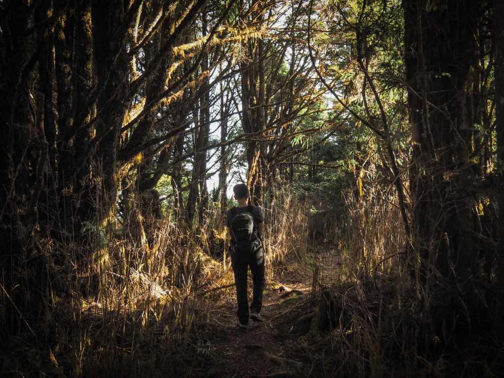
The plant life beside the trail gets a little denser again as we neared the top.

But even with the darker denser forest, the sunlight still found a way in. By this time, it was already about quarter past three, beyond the time at which the whole of Taipingshan National Forest Recreation Area typically is shrouded in thick which clouds. Somehow we really lucked out and got the best possible weather.

I can never get enough of the moss and sunlight in this part of the world.

We reached the summit after about an hour and ten minutes of climbing. At 2,352 metres above sea level, Mount Sanxing is the highest peak within the boundaries of Taipingshan National Forest Recreation Area. That aside, it is not an especially interesting summit. The clearing containing the triangulation marker is surrounded by tall grasses so there’s no view.

We didn’t wait long before turning back and retracing our steps through the still-sunny forest.


When we reached the open area, we could see clouds rolling in a little further away.

The low, late-afternoon sunlight slanted through the trees, creating a halo effect by shining through the trees’ mossy coats.

We were the last ones on the trail that day, and it was a real treat to walk through such a large, peaceful forest.


The sun had all but dipped below the crest of the hill by the time the road came back into view and that meant I could cast a larger-than-life show on the trees.

We made it back to the road another hour and ten minutes after leaving the peak, and from here we drove back to Taipingshan Villa for dinner and bed.
How to get to Mount Sanxing
Google Maps address: The Mount Sanxing trail starts here, about two-thirds of the way along Pingyuan Forestry Road (the road to Cueifeng Lake). There’s no carpark, so you’ll just have to pull up in one of the wider spots at the side of the road (it’s very easy to figure out where cars usually park).
GPS location: N24 29.940 E121 33.950
Public transport: There’s no public transport that will take you to this trailhead. The only options are to drive yourself there or to hire a driver to take you.
Other trails in Taipingshan National Forest Recreation Area:
- Cueifeng Lake Circluar Trail
- Cypress Trail
- Jancing Historic Trail
- Jiuzhize Nature Trail
- Maosing Loop Trail
- Maosing Main Trail
- Taiwan Beech National Trail
- Taiwan Hemlock Trail
- Mount Wangyang Trail
MOUNT SANXING TRAIL MAP

GPX file available here on Outdoor Active. (Account needed, but the free one works just fine.)
