Blue Skies, Green Hills and Dramatic Coastal Scenery in Taitung County
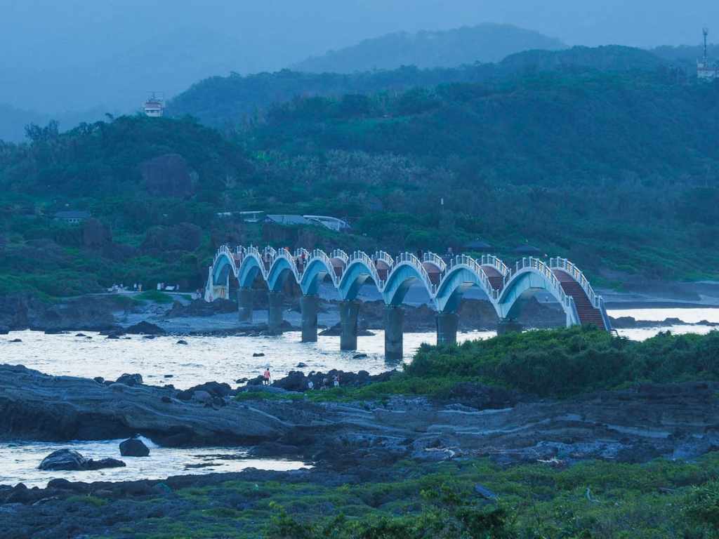
Sanxiantai is a former isthmus — now islet — located on Taiwan’s southeast coast, just north of Changbin. Formerly grazing land for the local Indigenous folks’ livestock, the islet is now one of the most popular sightseeing spots in the region (the other being Baxian Cave — a significant site of prehistoric habitation). People are drawn here to admire the arresting sight of the eight-arched bridge that connects the coast to the islet, and most never go much further than the mainland-side end of the bridge. However, if you push on a little further, the islet has much to explore, including sea caves, snakes, and fossilised corals.
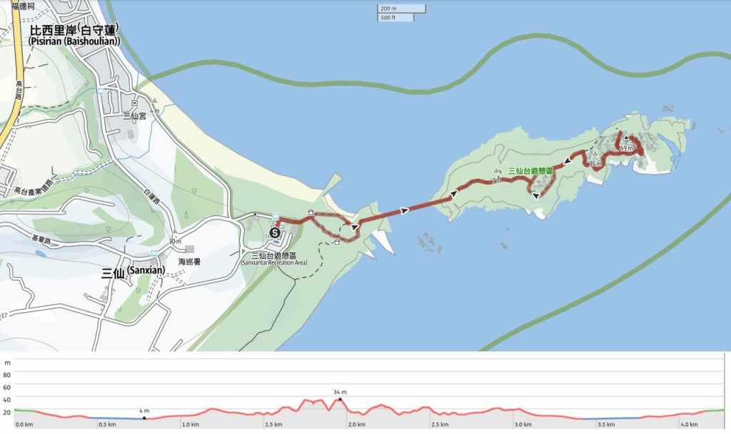
DISTANCE: About 4.3 kilometres if you explore the whole route, but most people just go over the bridge and back again which is around 2 kilometres.
TIME: 1½-2 hours. I spent a leisurely 2 hours there and it felt like a good amount of time to wander, explore and have a look in the rock pools.
TOTAL ASCENT: About 80 metres.
DIFFICULTY (REGULAR TAIWAN HIKERS): 2-3/10 – There’s some rock hopping, some steps, but otherwise it’s easy.
DIFFICULTY (NEW HIKERS): 4/10 – For anyone new to hiking in Taiwan, this walk is still pretty easy, but there are a couple of places where the lack of clear signage could make it feel a little more adventurous than your average stroll in the park.
SIGNAGE: Signage is generally OK, except for when it comes to the last stretch of the walk towards Hehuan Cave and the lighthouse.
FOOD AND WATER: 0.5L was not quite enough for me on a hot August afternoon, but there are stores at the trailhead.
SHADE: There’s almost no shade on this trail, so cover up if your skin is sun-shy. I went on a calm, wind-free day, so I made use of a UV umbrella.
MOBILE NETWORK: There’s clear network coverage along the whole route.
ENJOYMENT: This is an excellent walk that shouldn’t be missed if you’re in the area. The natural scenery is especially pretty, and there is the chance of spotting some neat coastal wildlife.
SOLO HIKE-ABILITY: As long as you don’t stray too close to the water (and it’s easy not to), there’s no reason why you shouldn’t do this walk by yourself.
OTHER: Sunrise or mid-late afternoon are the two best times to visit for good lighting. And speaking of lighting, if you’re nervous about dark places, you might want to bring a light to illuminate your passage through the cave, but I made do without.
ROUTE TYPE: There and back with a couple of small loops in the middle.
PERMIT: None needed.
Jump to the bottom of this post for a trail map, GPX file and transportation information.
DIRECTIONS:
Numbers by photos refer to the GPS coordinates at the end of the post.
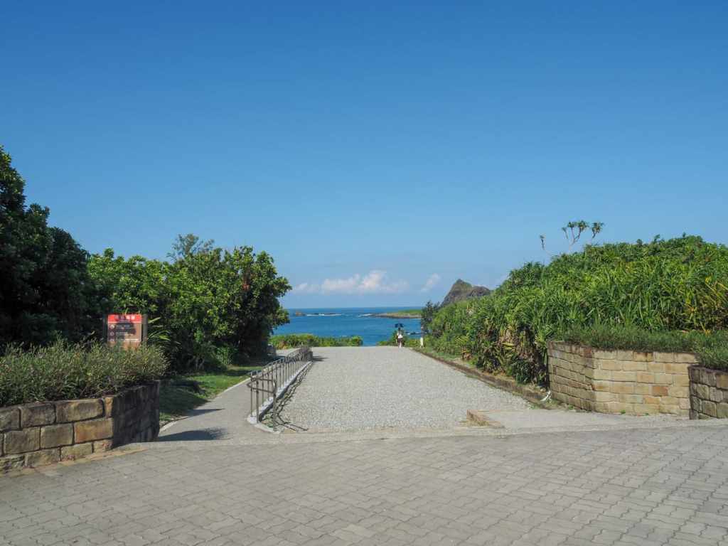
Once you’ve escaped the collection of tourist tat shops by the carpark, a path leads down towards the sea and the start of the trail.
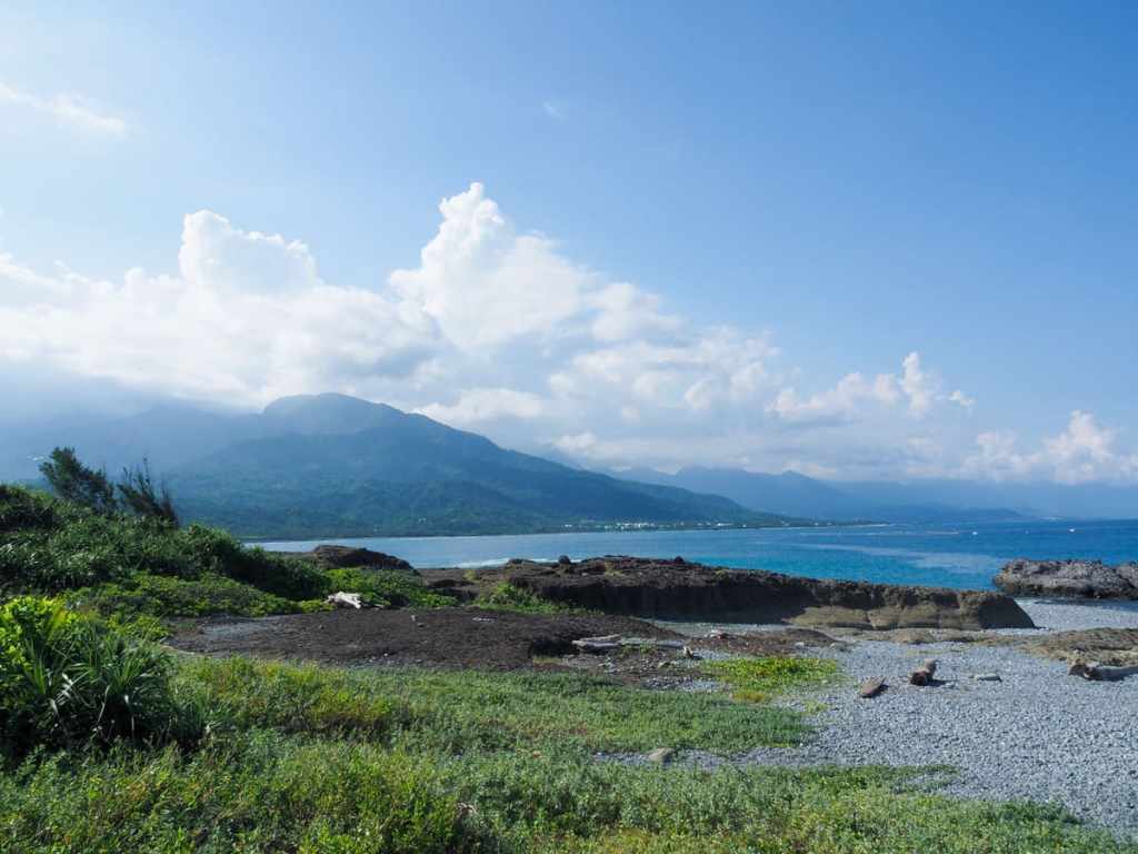
We had arrived at about half past three in the after noon, so the sun was just about getting ready to start its descent into the clouds that had gathered above the coastal hills.
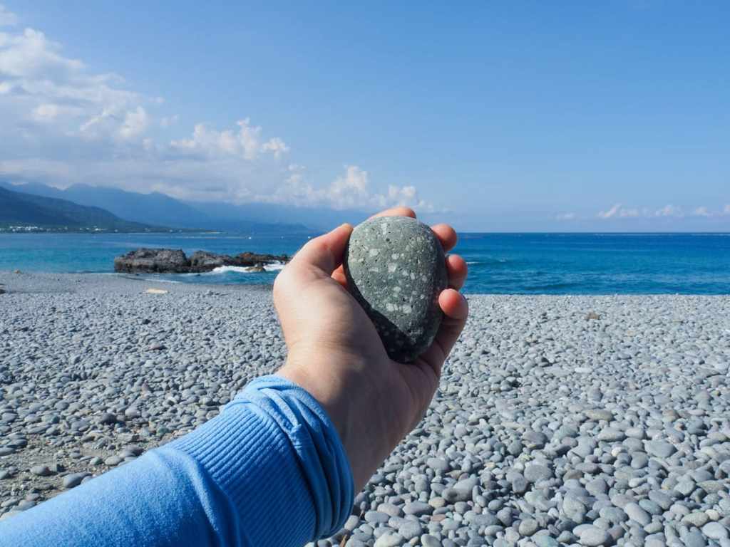
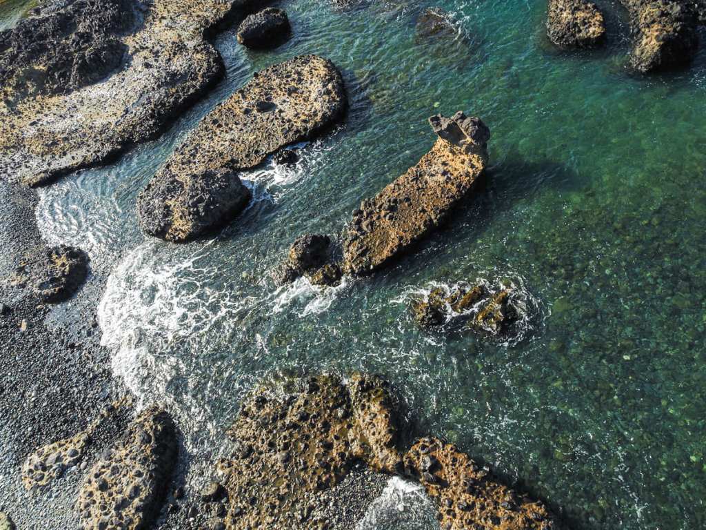
There is a mini maze of paths, but they all head towards the bridge, so I opted for the one that would take me down to the rocky beach. Most of the beach was covered in sea-smoothed volcanic pebbles like this one, light grey, speckled with white, and hot to the hand after an afternoon in the sun.
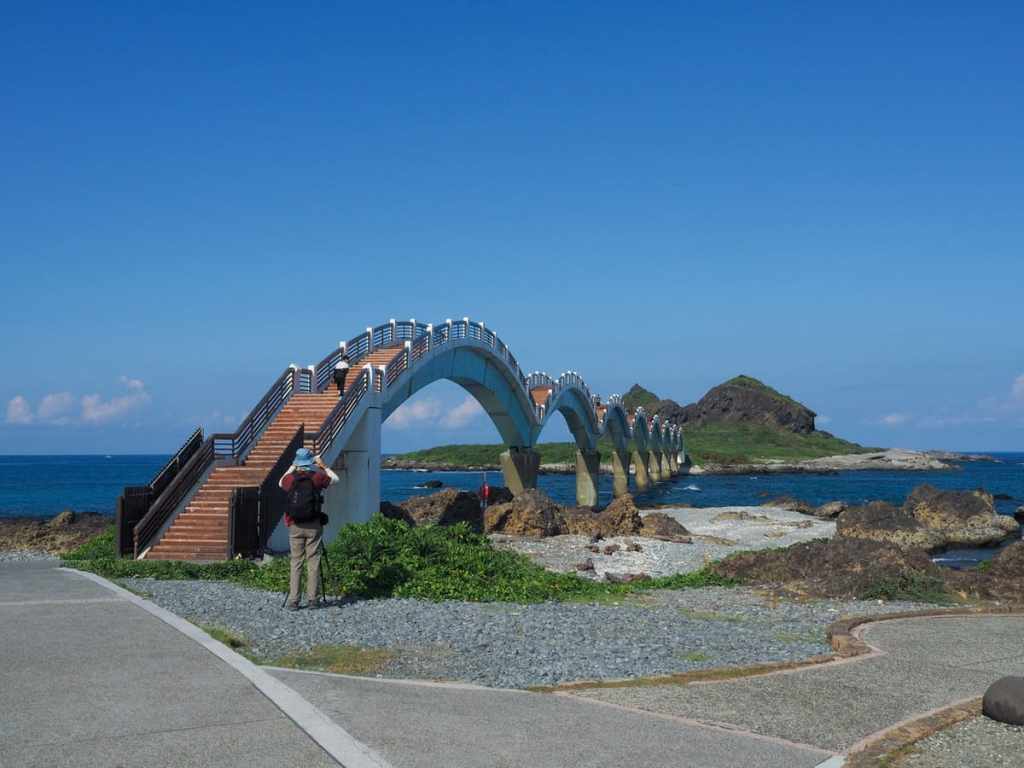
The eight arches of Sanxiantai Bridge span the gap between the islet and the mainland. It was built in 1987 to make crossings easier, although at some time in the past, was connected by a land bridge.
Gazing down the bridge, I could see fishermen poised on the rocks and gentle waves sweeping around them.
Walking over the bridge, the dipping and rising of the path hides and reveals people as they walk, meaning that the number of people ahead of you seems to change each time you pop up.
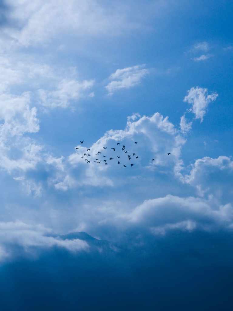
This flock of egrets circled above me for a while, alternating between appearing as black shadows against white clouds or white flashes against distant mountains as their wings twisted to catch the sun.
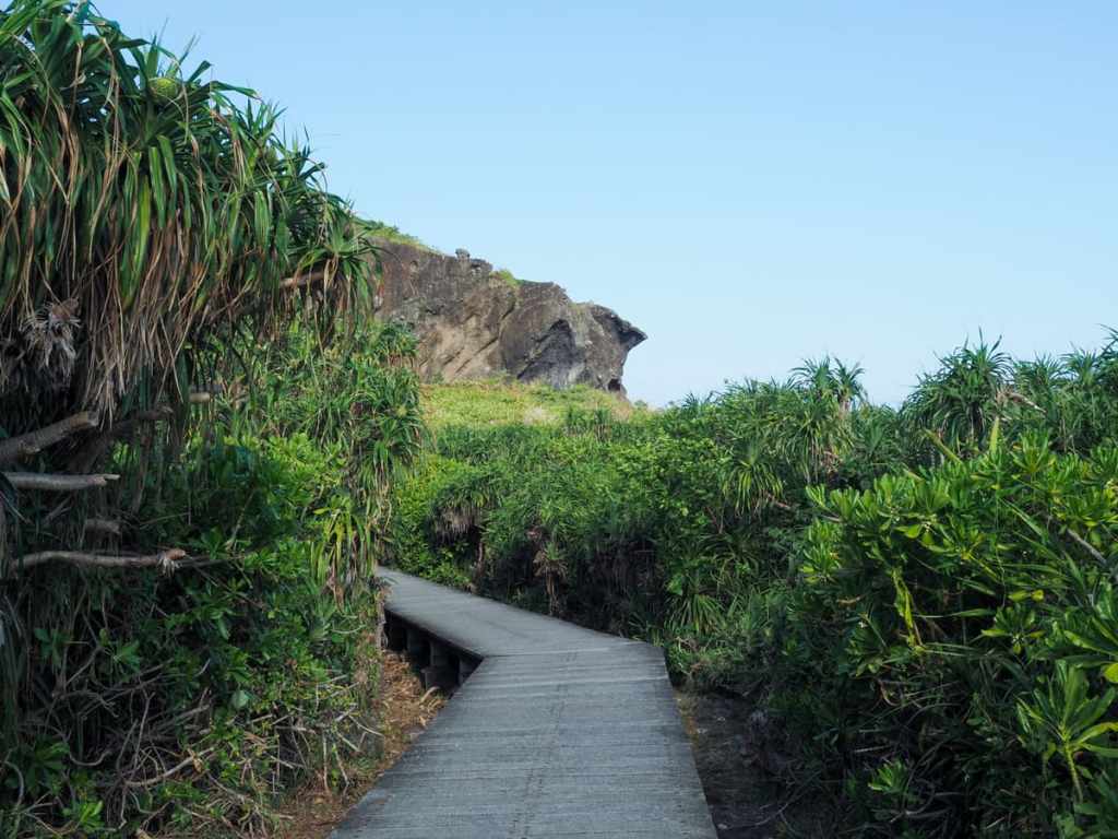
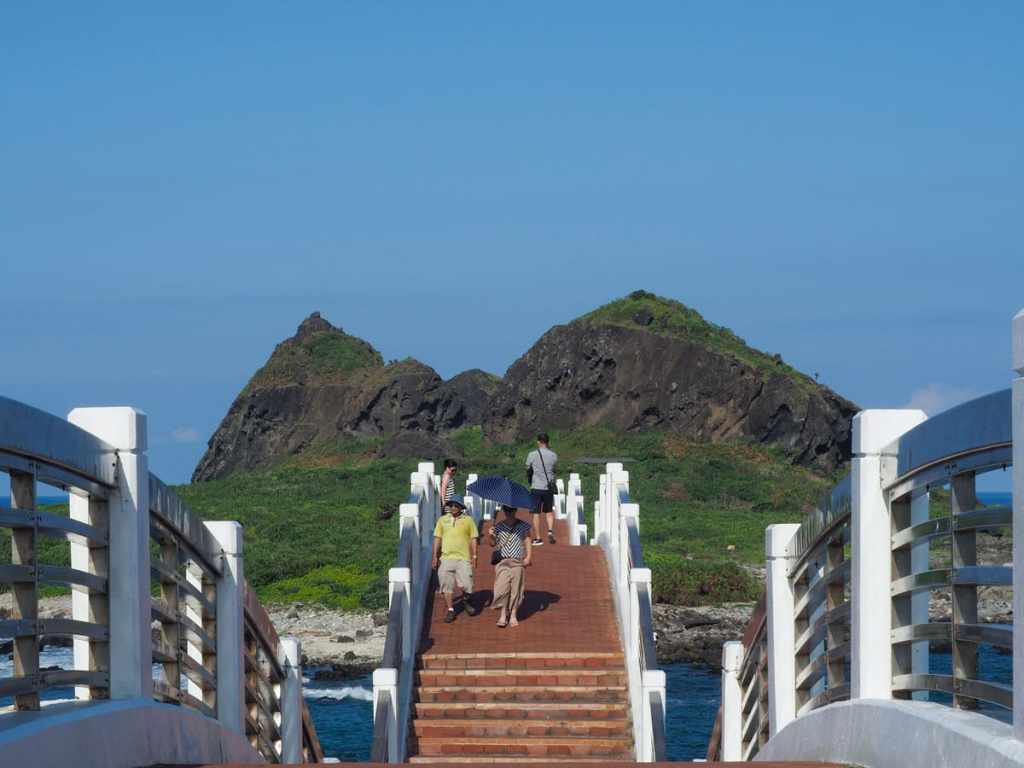
At the far side of the bridge, a raised boardwalk cuts through the foliage. The spiky, point ones are screw pine, and the trees with more rounded leaves are beach cabbage.
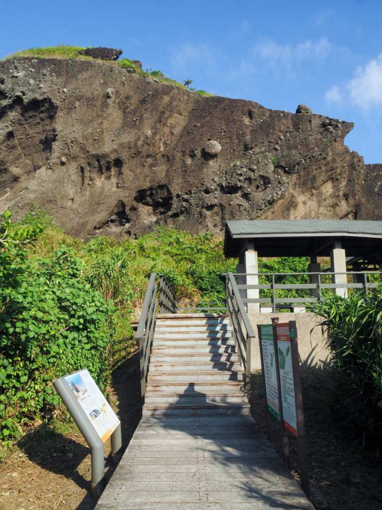
The boardwalk leads to a sheltered rest area, and from here, the path splits in two to encourage the first of the three immortals, Li Tie-guai.
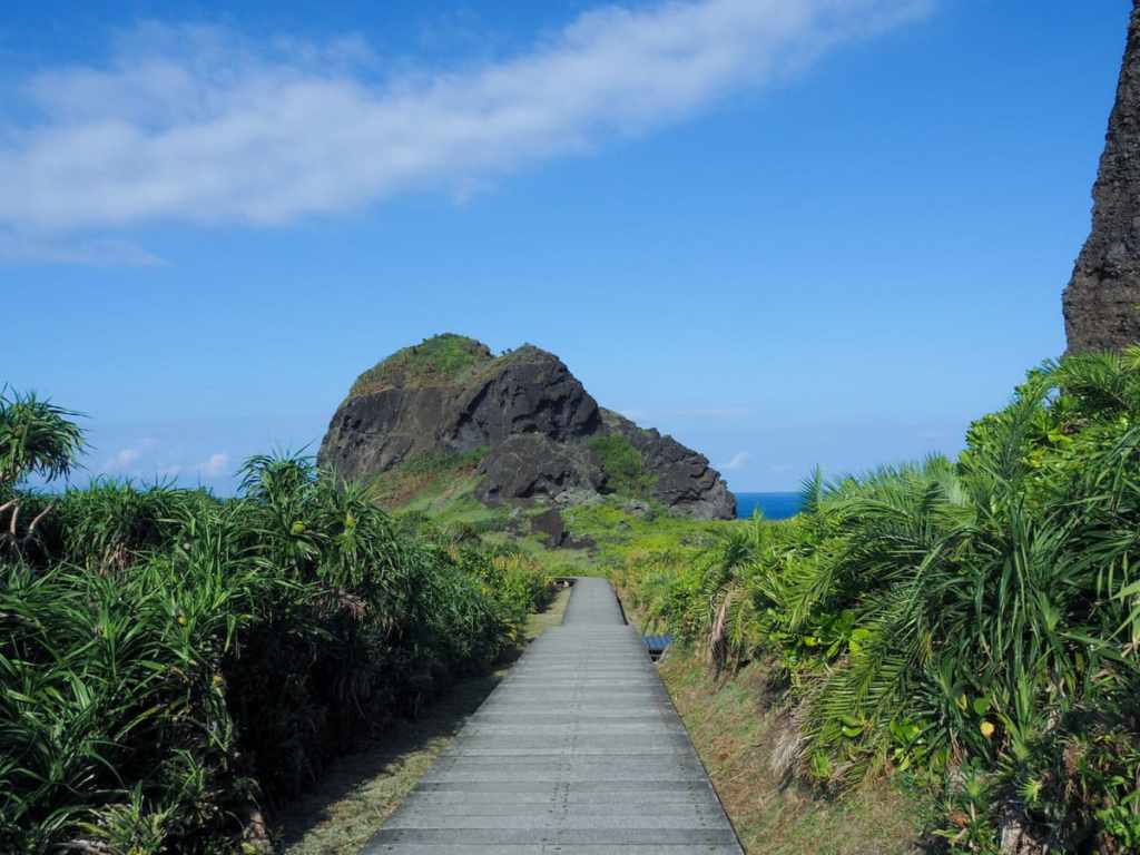
The trails rejoin at the far side and from here, you can see the rocky mass of the islet’s other two peaks. This pair is meant to be Lü Dong-bin and He Xian-gu. Why are three of the Eight Immortals rendered in stone here? Apparently, Lü (known for his lascivious tendencies) and He (the only female among the modern immortals) once snuck off to one of the islet’s caves to indulge in a spot of something that required privacy. They were followed by nosy Li, but his peeping was spotted by the Guardian of the Southern Heavenly Gate who sent a lightning bolt down to smite him. Unfortunately, though, the divine aim was off and the bolt ended up splitting the coursing couple, hence the existence of Fairy Sword Gorge, a rocky channel between the two furthest peaks. In fact, the smiting went so disastrously wrong that all three were turned to stone.
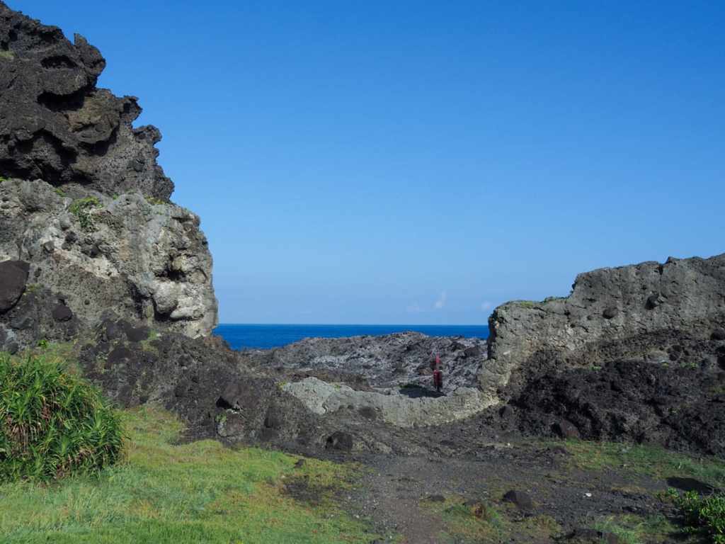
Where the boardwalk comes to an end, there appear to be three smaller trails snaking their way further out along the headland. The one to the left is (I think) a fisherman’s trail, the central one heads up steeply to a cave, while the third one on the right will take you to Sanxiantai’s lighthouse. I took the righthand trail and followed it as it picked its way down towards the shoreline.
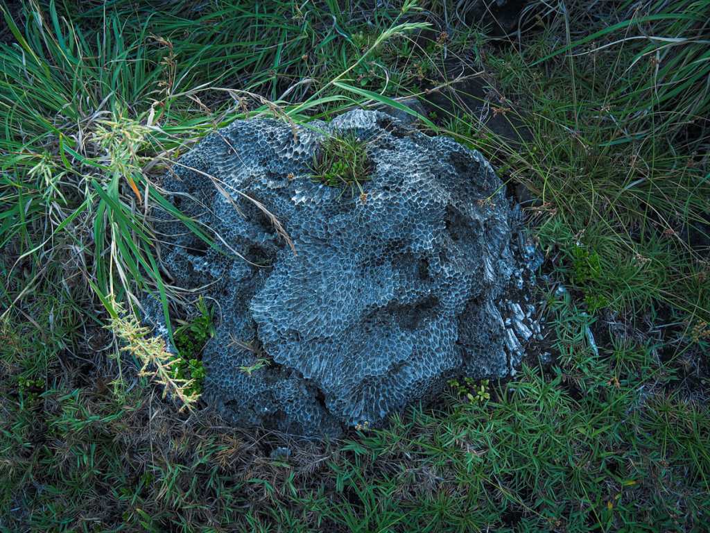
Here, I could get up close enough to some of the rocks to see that many of them were fossilised coral limestone — beautiful but vicious if you happen to bump into it.
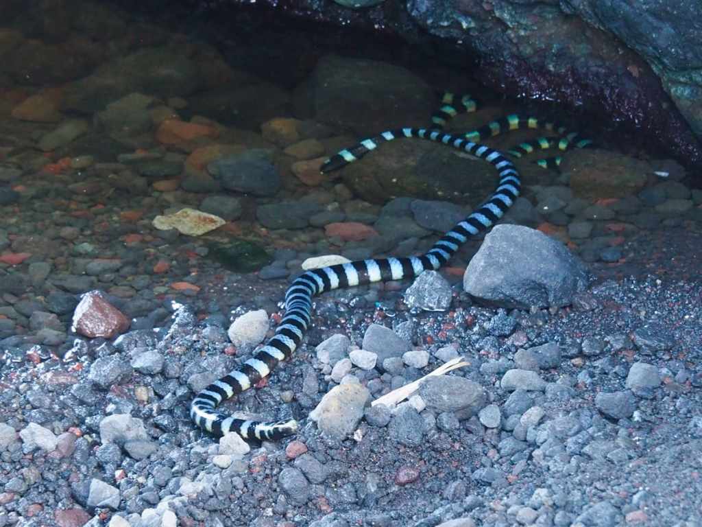
The first sea cave you come to is little more than a narrow passageway between two rocks. I passed it by because there was a couple taking photos in it, but my hiking mate for the day called me back because he’d spotted a snake. As it turned out, there were actually three snakes in the pool, all sea kraits, marked with bands of black and a pale, iridescent blue. These aquatic snakes are highly venomous but generally quite docile, and according to a guy who turned up while we were looking at them, they can often be found in this exact spot.
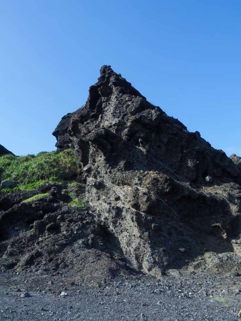
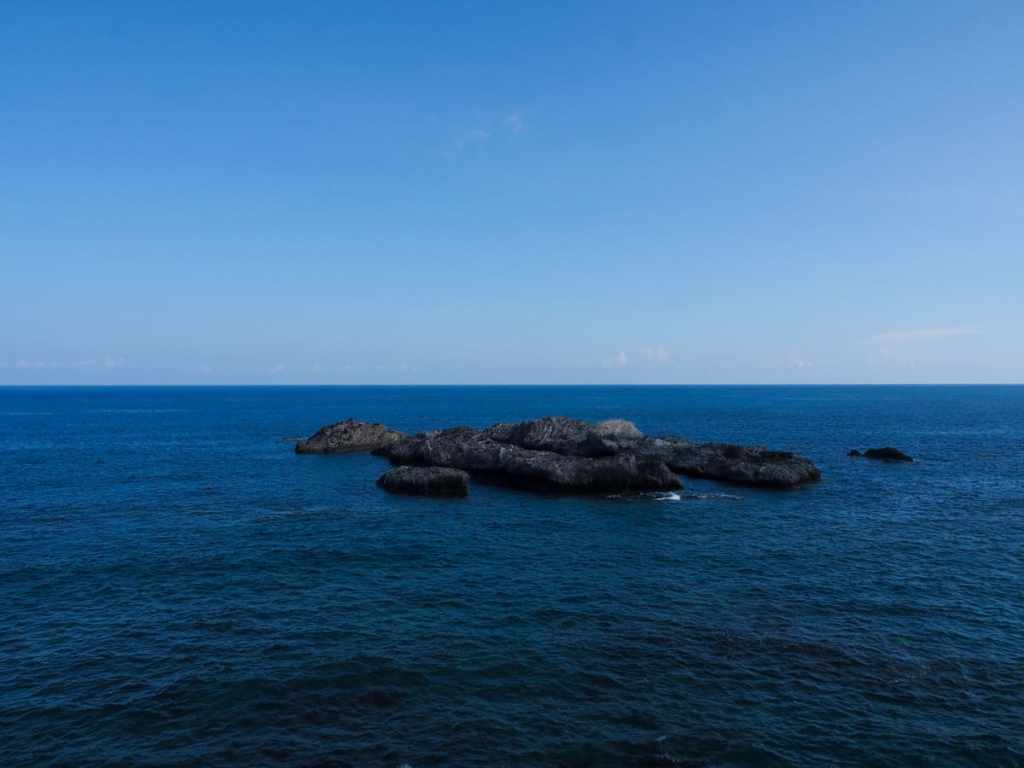
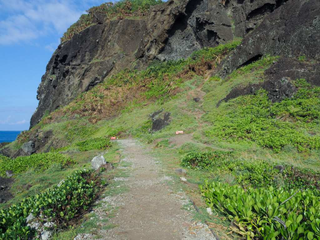
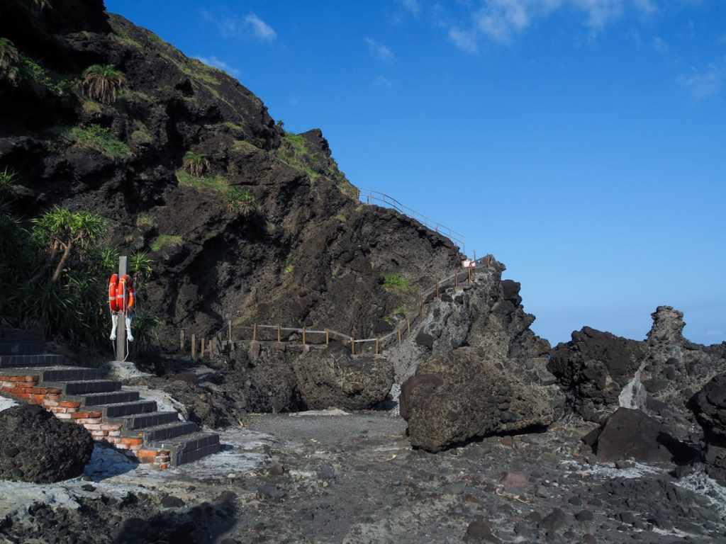
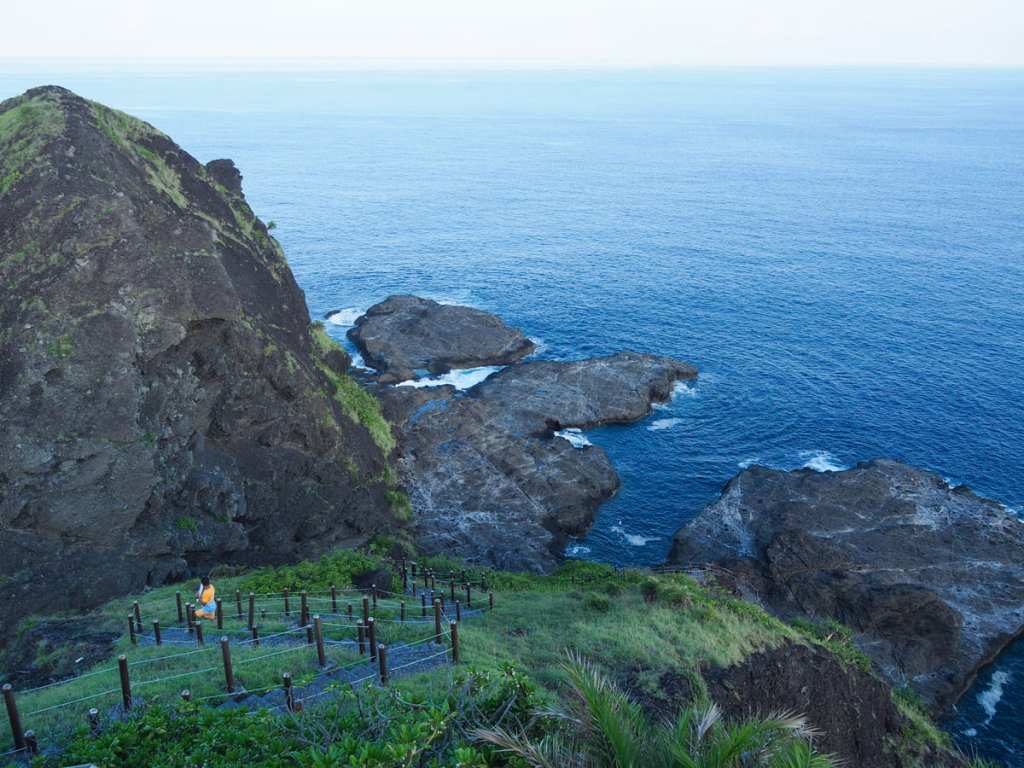
A craggy spire of volcanic agglomerate rising from the rocky beach. The trail heads around the southern edge of the islet’s small peaks, just far enough away from the rock face to keep the risk of being hit by loose rocks to a minimum.
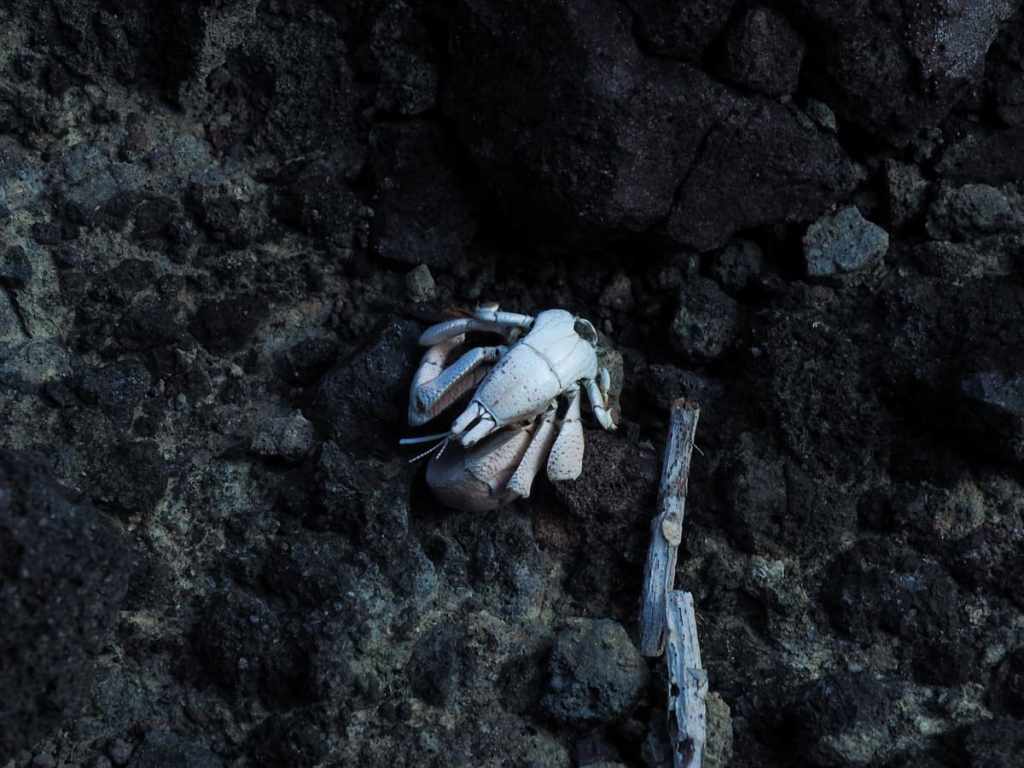
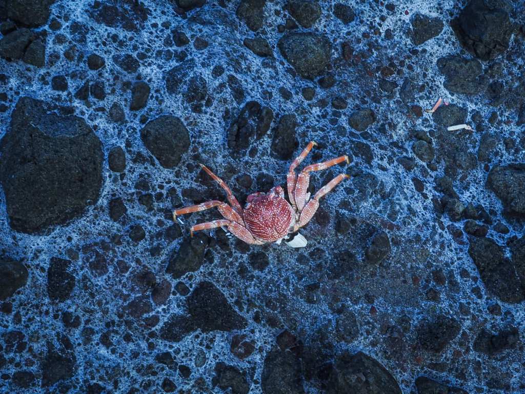
In the tidal pools, I saw tiny fish with blue spots on their heads and several species of crab darted away as I approached. While on the rocks, I saw the carcasses of many a crab that had most likely become a heron’s dinner.
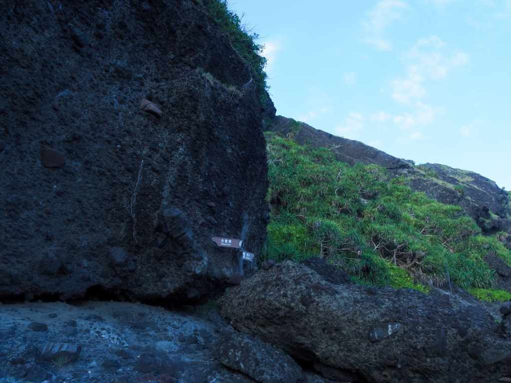
If you keep heading away from the mainland, you’ll come to this signpost. Before you head straight over towards the lighthouse, be sure to make a quick detour to Hehuan Cave.
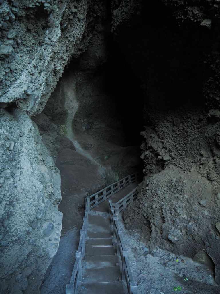
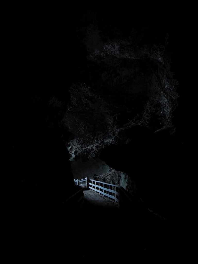
After a brief climb, steps descend into a dark passageway. The tunnel actually cuts all the way through to the far side of the islet, but there are kinks in the walkway at either end, so the centre is plunged into total darkness. I used my phone torch to light the way (and make sure I didn’t step on any snakes), but even so, the dark seemed to swallow up any light I cast into it.
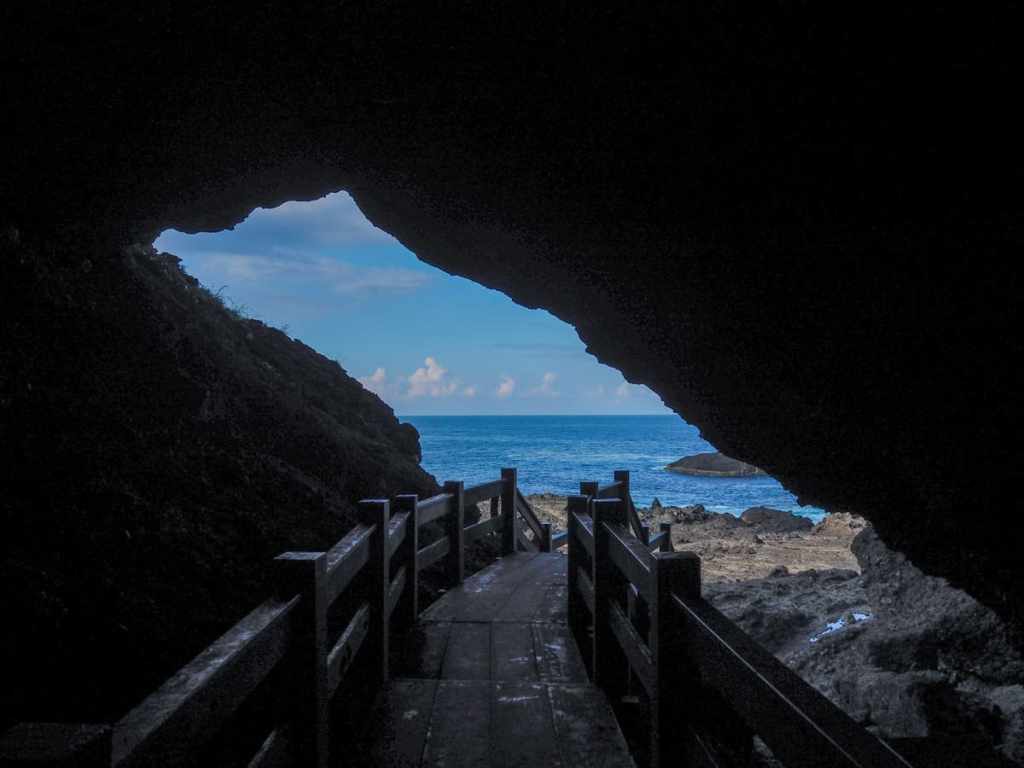
At the far side, steps lead down to the foreshore, and here, I watched what seemed to be some kind of magic trick. Amidst the churning waters, there were several protruding rocks and from just one of them, a constant cascade of water spilled forth like an impossible waterfall.
Heading back through the cave, I returned to the path I’d been on and continued to follow it towards the lighthouse.
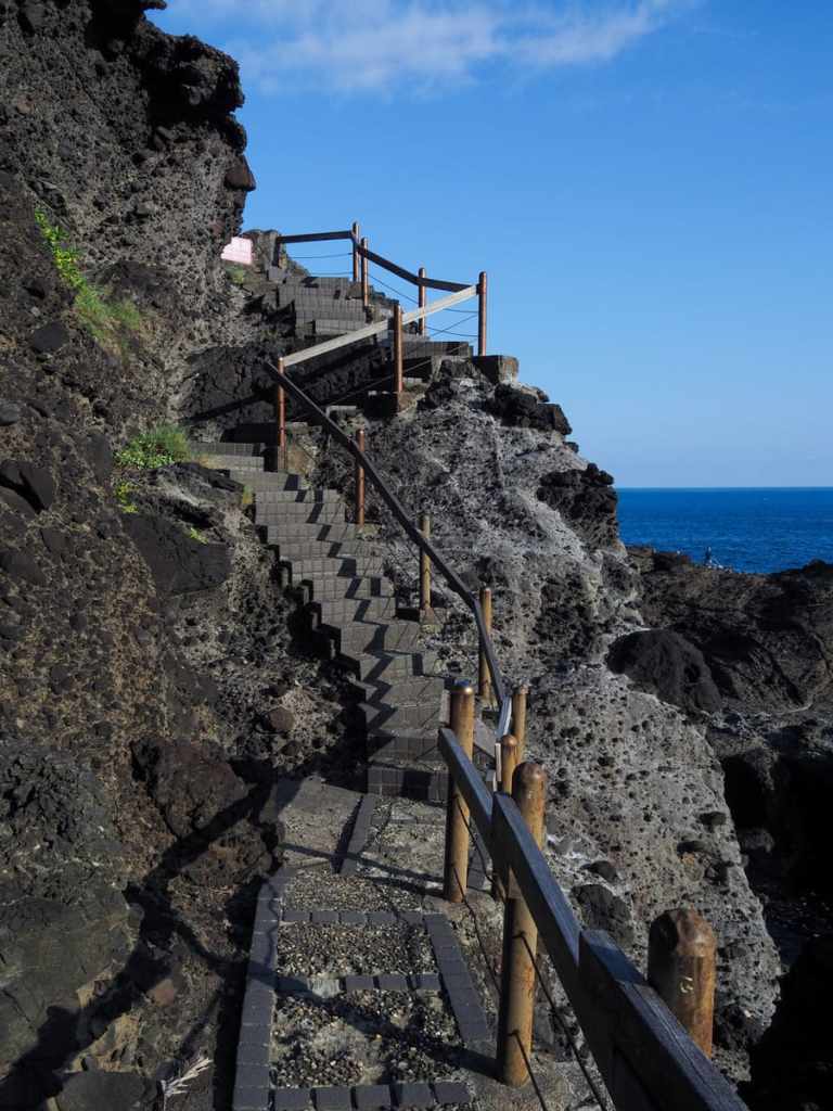
Unlike the rest of the walk which had been bumpy, but mostly on the flat, here, steps began climbing steeply — tiring under the glare of the late afternoon sun.
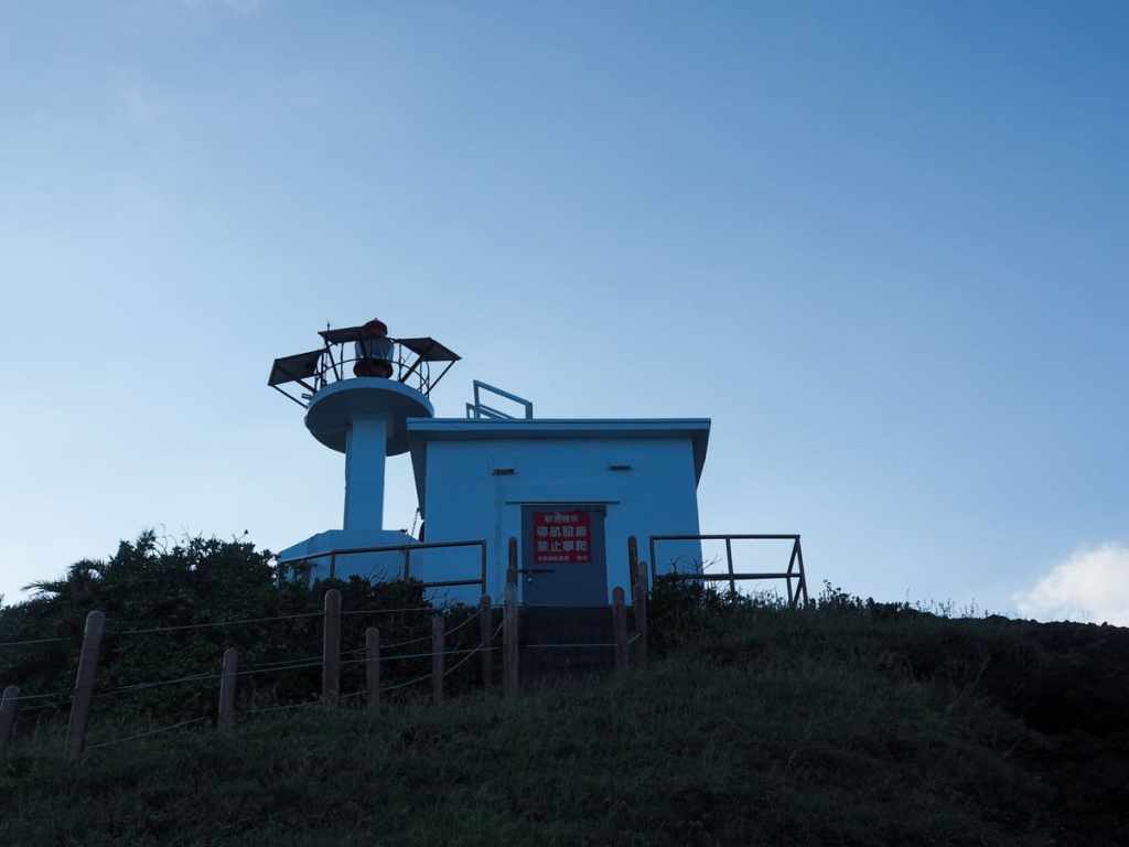
It took about five minutes to reach the old Japanese-built lighthouse. When it was constructed in 1915, it was the first such structure on Taiwan’s east coast.
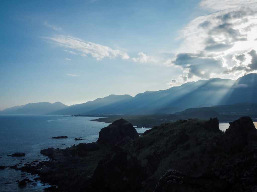
From up at the top, there are sweeping views along the mainland coastline both to the north and the south (pictured), and with the sun getting ready to dip below the top of the Hai’an Mountain Range, I enjoyed extra dramatic lighting.
Returning to the carpark is simply a case of retracing your steps down from the lighthouse, back along the shore, and over the bridge.
HOW TO GET TO SANXIANTAI
Google Maps address: The walk starts and finishes close to the Sanxiantai Tourist Information Centre. There is ample (paid) parking here.
GPS location: N23 07.390 E121 24.505
Public transport: The 8101 and 8101A Taiwan Tourist Shuttle to and from Taitung Bus Station stops here several times a day. Buses leave Taitung Bus Station at 7:40, 8:30, 12:20 and 17:30 and the journey takes about 2.5 hours. Heading back, the buses leave Sanxiantai at approximately 9:50, 10:50, 13:45, 15:55 and 17:35. However, since Sanxiantai isn’t the first stop, it’s important to be waiting at the bus stop early.
Further reading: There are a lot of posts out there about this subject. This one from Josh Ellis’s site covers it nicely and there’s a lot of info on the Taiwan Gods website too.
SANXIANTAI TRAIL MAP
GPX file available here on Outdoor Active. (Account needed, but the free one works just fine.)
